Sedalia is an unincorporated town, a post office, and a census-designated place (CDP) located in and governed by Douglas County, Colorado, United States. The CDP is a part of the Denver–Aurora–Lakewood, CO Metropolitan Statistical Area. The Sedalia post office has the ZIP Code 80135. At the United States Census 2020, the population of the Sedalia CDP was 177.

The Pinery is an unincorporated community and a census-designated place (CDP) located in and governed by Douglas County, Colorado, United States. The CDP is a part of the Denver–Aurora–Lakewood, CO Metropolitan Statistical Area. The population of The Pinery CDP was 10,517 at the United States Census 2010. Douglas County governs the unincorporated community. The Parker post office serves the area.

The Air Force Academy is a census-designated place (CDP) located in El Paso County, Colorado, United States. The CDP includes the developed portion of the United States Air Force Academy, including the cadet housing facilities. The CDP is a part of the Colorado Springs, CO Metropolitan Statistical Area. The USAF Academy post office (ZIP Codes 80840 and 80841 serves the area. At the United States Census 2020, the population of the Air Force Academy CDP was 6,680.

Black Forest is an unincorporated community and a census-designated place (CDP) located in and governed by El Paso County, Colorado, United States. The CDP is a part of the Colorado Springs, CO Metropolitan Statistical Area. The population of the Black Forest CDP was 15,097 at the United States Census 2020. Both the Colorado Springs post office and the Elbert post office serve the area.

Cascade-Chipita Park is a census-designated place (CDP) comprising the unincorporated communities of Cascade and Chipita Park located in and governed by El Paso County, Colorado, United States. The CDP is a part of the Colorado Springs, CO Metropolitan Statistical Area. The population of the Cascade-Chipita Park CDP was 1,628 at the United States Census 2020. The Cascade post office serves the area.

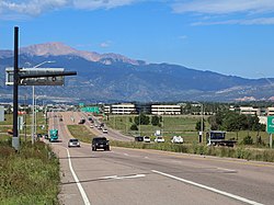
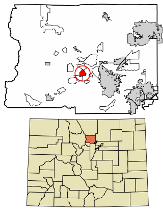
Gleneagle is an unincorporated community and a census-designated place (CDP) located in and governed by El Paso County, Colorado, United States. The CDP is a part of the Colorado Springs, CO Metropolitan Statistical Area. The population of the Gleneagle CDP was 6,649 at the United States Census 2020. The Colorado Springs post office serves the area.

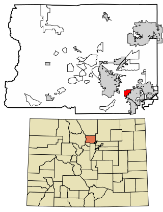
Stratmoor is an unincorporated community and a census-designated place (CDP) located in and governed by El Paso County, Colorado, United States. The CDP is a part of the Colorado Springs, CO Metropolitan Statistical Area. The population of the Stratmoor CDP was 6,518 at the United States Census 2020. The Colorado Springs post office serves the area.

Woodmoor is an unincorporated community and a census-designated place (CDP) located in and governed by El Paso County, Colorado, United States. The CDP is a part of the Colorado Springs, CO Metropolitan Statistical Area. The population of the Woodmoor CDP was 9,536 at the United States Census 2020. The Monument post office serves the area.

Security-Widefield is a census-designated place (CDP) comprising the unincorporated communities of Security and Widefield located in and governed by El Paso County, Colorado, United States. The CDP is a part of the Colorado Springs, CO Metropolitan Statistical Area. The population of the Security-Widefield CDP was 38,639 at the United States Census 2020. El Paso County governs the unincorporated communities. Both the Colorado Springs post office and the Fountain post office serve the area.

Peyton is an unincorporated town, a post office, and a census-designated place (CDP) located in and governed by El Paso County, Colorado, United States. The CDP is a part of the Colorado Springs, CO Metropolitan Statistical Area. The Peyton post office has the ZIP Code 80831. At the United States Census 2020, the population of the Peyton CDP was 214.

Wolcott is an unincorporated town, a post office, and a census-designated place (CDP) located in and governed by Eagle County, Colorado, United States. The CDP is a part of the Edwards, CO Micropolitan Statistical Area. The Wolcott post office has the ZIP Code 81655. At the United States Census 2020, the population of the Wolcott CDP was 20.

Ellicott is an unincorporated community and a census-designated place (CDP) located in and governed by El Paso County, Colorado, United States. The CDP is a part of the Colorado Springs, CO Metropolitan Statistical Area. The population of the Ellicott CDP was 1,248 at the United States Census 2020. The Calhan post office serves the area.
Crisman is an unincorporated community and a census-designated place (CDP) located in and governed by Boulder County, Colorado, United States. The CDP is a part of the Boulder, CO Metropolitan Statistical Area. The population of the Crisman CDP was 186 at the United States Census 2010. The Boulder post office serves the area.

Glendale is an unincorporated community and a census-designated place (CDP) located in and governed by Boulder County, Colorado, United States. The CDP is a part of the Boulder, CO Metropolitan Statistical Area. The population of the Glendale CDP was 69 at the United States Census 2010. The Jamestown post office serves the area.

Hidden Lake is an unincorporated community and a census-designated place (CDP) located in and governed by Boulder County, Colorado, United States. The CDP is a part of the Boulder, CO Metropolitan Statistical Area. The population of the Hidden Lake CDP was 31 at the United States Census 2010. The Ward post office serves the area.

Leyner is an unincorporated community and a census-designated place (CDP) located in and governed by Boulder County, Colorado, United States. The CDP is a part of the Boulder, CO Metropolitan Statistical Area. The population of the Leyner CDP was 29 at the United States Census 2010. The Lafayette post office serves the area.
Paragon Estates is an unincorporated community and a census-designated place (CDP) located in and governed by Boulder County, Colorado, United States. The CDP is a part of the Boulder, CO Metropolitan Statistical Area. The population of the Paragon Estates CDP was 928 at the United States Census 2010. The Boulder post office serves the area.

St. Ann Highlands is an unincorporated community and a census-designated place (CDP) located in and governed by Boulder County, Colorado, United States. The CDP is a part of the Boulder, CO Metropolitan Statistical Area. The population of the St. Ann Highlands CDP was 288 at the United States Census 2010. The Nederland post office serves the area.

Tall Timber is an unincorporated community and a census-designated place (CDP) located in and governed by Boulder County, Colorado, United States. The CDP is a part of the Boulder, CO Metropolitan Statistical Area. The population of the Tall Timber CDP was 208 at the United States Census 2010. The Boulder post office serves the area.

Rock Creek Park is an unincorporated community and a census-designated place (CDP) located in and governed by El Paso County, Colorado, United States. The CDP is a part of the Colorado Springs, CO Metropolitan Statistical Area. The population of the Rock Creek Park CDP was 68 at the United States Census 2020. The Colorado Springs post office serves the area.