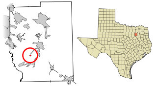
Kaufman County is a county in the northeastern area of the U.S. state of Texas. As of the 2020 census, its population was 145,310. Its county seat is Kaufman. Both the county, established in 1848, and the city were named for David S. Kaufman, a U.S. Representative and diplomat from Texas. Kaufman County is part of the Dallas-Fort Worth-Arlington metropolitan statistical area.
Moultrie is the county seat and largest city of Colquitt County, Georgia, United States. It is the third largest city in Southwest Georgia, behind Thomasville and Albany. As of the 2020 census, Moultrie's population was 14,638. It was originally known as Ochlockoney until it was incorporated by the Georgia General Assembly in 1859. Moultrie is an agricultural community set in the Southern Rivers part of Georgia.
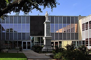
Kaufman is a city in and the county seat of Kaufman County, Texas, United States. Its population was 6,797 at the 2020 census.

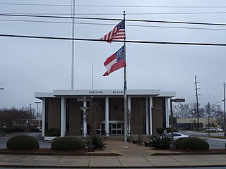
Kemp is a city in Kaufman County, Texas, United States. The population was 1,129 in 2020.

Seagoville is a city in Dallas County, Texas, United States, and a suburb of Dallas. A small portion of Seagoville extends into Kaufman County. The population was 18,446 at the 2020 census. The city is located along U.S. Highway 175, 10 miles (16 km) from downtown Mesquite.
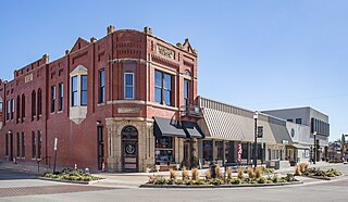
Scurry is a town in Kaufman County, Texas, United States. It was incorporated in 2003. As of the 2010 census, it had a population of 681.
Ables Springs is an unincorporated community in Kaufman County, Texas, United States.
Poetry is a town in Kaufman and Hunt counties, Texas, United States. It is located at the intersection of Farm to Market Roads 986 and 1565, approximately six miles north of Terrell. The population, as of 2020, is estimated to be 2,069.
Abner is an unincorporated community in Kaufman County, located in the U.S. state of Texas. It is located within the Dallas/Fort Worth Metroplex.
Cobb is an unincorporated community in Kaufman County, located in the U.S. state of Texas. It is located within the Dallas/Fort Worth Metroplex.
Frog is an unincorporated community in Kaufman County, located in the U.S. state of Texas. It is located within the Dallas/Fort Worth Metroplex.
Gastonia is an unincorporated community in Kaufman County, located in the U.S. state of Texas. According to the Handbook of Texas, the community had a population of 30 in 2000. It is located within the Dallas/Fort Worth Metroplex.
Hiram is an unincorporated community in Kaufman County, located in the U.S. state of Texas. According to the Handbook of Texas, the community had a population of 34 in 2000. It is located within the Dallas/Fort Worth Metroplex.
Lawrence is an unincorporated community in Kaufman County, located in the U.S. state of Texas. According to the Handbook of Texas, the community had a population of 279 in 2000. It is located within the Dallas/Fort Worth Metroplex.
McCoy is an unincorporated community in Kaufman County, located in the U.S. state of Texas. It is located within the Dallas/Fort Worth Metroplex.
Ola is an unincorporated community in Kaufman County, located in the U.S. state of Texas. According to the Handbook of Texas, the community had a population of 50 in 2000. It is located within the Dallas/Fort Worth Metroplex.
Prairieville is an unincorporated rural small village in Kaufman County, Texas, United States. There is a grocery store at Prairieville, a church, and several homes. According to the Handbook of Texas, the community had a population of 50 in 2000. It is located within the Dallas-Fort Worth metropolitan area.
Tolosa is an unincorporated community in Kaufman County, located in the U.S. state of Texas. According to the Handbook of Texas, the community had a population of 58 from 1988 through 2000. It is located within the Dallas-Fort Worth metropolitan area.
Warsaw is an unincorporated community in Kaufman County, located in the U.S. state of Texas. According to the Handbook of Texas, the community had a population of 58 in 2000. It is located within the Dallas/Fort Worth Metroplex.
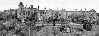
Terrell State Hospital is a public psychiatric hospital located in Terrell, Texas, United States. Opened in 1885, it was originally known as the North Texas Lunatic Asylum. The original hospital building was built according to the Kirkbride Plan.


