Related Research Articles

The Everglades is a natural region of flooded grasslands in the southern portion of the U.S. state of Florida, comprising the southern half of a large drainage basin within the Neotropical realm. The system begins near Orlando with the Kissimmee River, which discharges into the vast but shallow Lake Okeechobee. Water leaving the lake in the wet season forms a slow-moving river 60 miles (97 km) wide and over 100 miles (160 km) long, flowing southward across a limestone shelf to Florida Bay at the southern end of the state. The Everglades experiences a wide range of weather patterns, from frequent flooding in the wet season to drought in the dry season. Throughout the 20th century, the Everglades suffered significant loss of habitat and environmental degradation.

Everglades National Park is an American national park that protects the southern twenty percent of the original Everglades in Florida. The park is the largest tropical wilderness in the United States and the largest wilderness of any kind east of the Mississippi River. An average of one million people visit the park each year. Everglades is the third-largest national park in the contiguous United States after Death Valley and Yellowstone. UNESCO declared the Everglades & Dry Tortugas Biosphere Reserve in 1976 and listed the park as a World Heritage Site in 1979, and the Ramsar Convention included the park on its list of Wetlands of International Importance in 1987. Everglades is one of only three locations in the world to appear on all three lists.

Florida Bay is the bay located between the southern end of the Florida mainland and the Florida Keys in the United States. It is a large, shallow estuary that while connected to the Gulf of Mexico, has limited exchange of water due to various shallow mudbanks covered with seagrass. The banks separate the bay into basins, each with its own unique physical characteristics.

The Kissimmee River is a river in south-central Florida, United States that forms the north part of the Everglades wetlands area. The river begins at East Lake Tohopekaliga south of Orlando, flowing south through Lake Kissimmee into the large, shallow Lake Okeechobee. Hurricane-related floods in 1947 prompted channelization of the meandering lower stretch, completed by 1970. The straightened course reduced wetland habitat and worsened pollution. In response, efforts since the 1990s have partially restored the river's original state and revitalized the ecosystem, as part of the broader restoration of the Everglades.
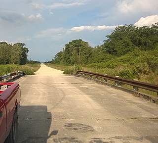
Picayune Strand State Forest is one of 37 state forests in Florida managed by the Florida Forest Service. The 78,000-acre forest consists primarily of cypress swamps, wet pine flatwoods and wet prairies. It also features a grid of closed roads over part of it, left over from previous land development schemes.
Earth systems engineering and management (ESEM) is a discipline used to analyze, design, engineer and manage complex environmental systems. It entails a wide range of subject areas including anthropology, engineering, environmental science, ethics and philosophy. At its core, ESEM looks to "rationally design and manage coupled human–natural systems in a highly integrated and ethical fashion". ESEM is a newly emerging area of study that has taken root at the University of Virginia, Cornell and other universities throughout the United States, and at the Centre for Earth Systems Engineering Research (CESER) at Newcastle University in the United Kingdom. Founders of the discipline are Braden Allenby and Michael Gorman.

The St. Lucie River is a 35-mile-long (56 km) estuary linked to a coastal river system in St. Lucie and Martin counties in the U.S. state of Florida. The St. Lucie River and St. Lucie Estuary are an "ecological jewel" of the Treasure Coast, central to the health and well-being of the surrounding communities. The river is part of the larger Indian River Lagoon system, the most diverse estuarine environment in North America with more than 4,000 plant and animal species, including manatees, oysters, dolphins, sea turtles and seahorses.

The environment of Florida in the United States yields an array of land and marine life in a mild subtropical climate. This environment has drawn millions of people to settle in the once rural state over the last hundred years. Florida's population increases by about 1,000 residents each day. Land development and water use have transformed the state, primarily through drainage and infill of the wetlands that once covered most of the peninsula.
The South Florida Water Management District (SFWMD) is a regional governmental district that oversees water resources from Orlando to the Florida Keys. The mission of the SFWMD is to manage and protect water resources by balancing and improving water quality, flood control, natural systems, and water supply, covering 16 counties in Central and Southern Florida. It is the largest water management district in the state, managing water needs for 7.7 million residents. A key initiative is the restoration of America's Everglades – the largest environmental restoration project in the nation's history. The District is also working to improve the Kissimmee River and its floodplain, Lake Okeechobee and South Florida's coastal estuaries.
The Water Resources Development Act of 1996 is part of Pub. L. 104–303 (text)(PDF), was enacted by Congress of the United States on October 12, 1996. Most of the provisions of WRDA 1996 are administered by the United States Army Corps of Engineers.
Water Resources Development Act of 1988, Pub. L. 100–676, is a public law passed by Congress on November 17, 1988 concerning water resources in the United States in the areas of flood control, navigation, dredging, environment, recreation, water supply, beach nourishment and erosion.

A national push for expansion and progress toward the latter part of the 19th century stimulated interest in draining the Everglades, a region of tropical wetlands in southern Florida, for agricultural use. According to historians, "From the middle of the nineteenth century to the middle of the twentieth century, the United States went through a period in which wetland removal was not questioned. Indeed, it was considered the proper thing to do."

An ongoing effort to remedy damage inflicted during the 20th century on the Everglades, a region of tropical wetlands in southern Florida, is the most expensive and comprehensive environmental repair attempt in history. The degradation of the Everglades became an issue in the United States in the early 1970s after a proposal to construct an airport in the Big Cypress Swamp. Studies indicated the airport would have destroyed the ecosystem in South Florida and Everglades National Park. After decades of destructive practices, both state and federal agencies are looking for ways to balance the needs of the natural environment in South Florida with urban and agricultural centers that have recently and rapidly grown in and near the Everglades.
The Water Resources Development Act of 1999, Pub. L. 106–53 (text)(PDF), was enacted by Congress of the United States on August 17, 1999. Most of the provisions of WRDA 1999 are administered by the United States Army Corps of Engineers.
The Water Resources Development Act of 2000, Pub. L. 106–541 (text)(PDF), was enacted by Congress of the United States on December 11, 2000. Most of the provisions of WRDA 2000 are administered by the United States Army Corps of Engineers.

Wetland conservation is aimed at protecting and preserving areas of land including marshes, swamps, bogs, and fens that are covered by water seasonally or permanently due to a variety of threats from both natural and anthropogenic hazards. Some examples of these hazards include habitat loss, pollution, and invasive species. Wetland vary widely in their salinity levels, climate zones, and surrounding geography and play a crucial role in maintaining biodiversity, ecosystem services, and support human communities. Wetlands cover at least six percent of the Earth and have become a focal issue for conservation due to the ecosystem services they provide. More than three billion people, around half the world's population, obtain their basic water needs from inland freshwater wetlands. They provide essential habitats for fish and various wildlife species, playing a vital role in purifying polluted waters and mitigating the damaging effects of floods and storms. Furthermore, they offer a diverse range of recreational activities, including fishing, hunting, photography, and wildlife observation.
Aquifer storage and recovery (ASR) is the direct injection of surface water supplies such as potable water, reclaimed water, or river water into an aquifer for later recovery and use. The injection and extraction is often done by means of a well. In areas where the rainwater cannot percolate the soil or where it is not capable of percolating it fast enough and where the rainwater is thus diverted to rivers, rainwater ASR could help to keep the rainwater within an area. ASR is used for municipal, industrial and agricultural purposes.
The Everglades Foundation was formed by a group of outdoor enthusiasts, environmentalists and residents of Florida who were concerned over the decline of the Everglades and the resulting damage in the nearby natural and protected areas such as Florida Bay. The original founding members, the late George Barley, a wealthy Orlando developer, and billionaire Paul Tudor Jones II, spearheaded the organization's growth, and shared the same concern over the steady decline of the environmental balance in this unique and delicate ecosystem due to poor water management and pollution.

The South Florida rocklands ecoregion, in the tropical and subtropical moist broadleaf forests biome, occurs in southern Florida and the Florida Keys in the United States, where they would naturally cover an area of 2,100 km2 (810 sq mi). These forests form on limestone outcrops with very thin soil; the higher elevation separating them from other habitats such as coastal marshes and marl prairies. On mainland Florida, rocklands exist primarily on the Miami Rock Ridge, which extends from the Miami River south to Everglades National Park. South Florida rocklands are further divided into pine rocklands and rockland hammocks.

The Everglades Agricultural Area Environmental Protection District, better known as simply the Everglades Agricultural Area (EAA), is an area extending south from Lake Okeechobee to the northern levee of Water Conservation Area 3A, from its eastern boundary at the L-8 canal to the western boundary along the L-1, L-2, and L-3 levees. The EAA incorporates almost 3,000 square kilometers of highly productive agricultural land. The EAA was established by the State Legislature as a special district representing landowners within the EAA Basin for the purposes of ensuring environmental protection. Means include conducting scientific research on environmental matters related to air and water and land management practices and implementing the financing, construction, and operation of works and facilities designed to prevent, control, abate or correct environmental problems and improve the environmental quality of air and water resources.
References
- ↑ "Congressional Research Service: Everglades Restoration: Federal Funding and Implementation Progress -- Nov. 18 2014" (PDF).
- ↑ About CERP: a Brief Overview Archived 2015-02-25 at the Wayback Machine
- ↑ Development of the Central & South Florida (C&SF) Project Archived 2015-02-25 at the Wayback Machine
- ↑ Grunwald, Michael (2006). The Swamp (First paperback ed.). New York, NY: Simon & Schuster Paperbacks. p. 316. ISBN 978-0-7432-5105-1.
- ↑ National Research Council Report-in-Brief,Progress Toward Restoring the Everglades: The Fourth Biennial Review, 2012, http://dels.nas.edu/Report/Progress-Toward-Restoring-Everglades/13422 Archived 2012-09-28 at the Wayback Machine
- ↑ National Research Council Report,Progress Toward Restoring the Everglades: The Fourth Biennial Review, 2012, http://dels.nas.edu/Report/Progress-Toward-Restoring-Everglades/13422 Archived 2012-09-28 at the Wayback Machine
- ↑ National Research Council Report-in-Brief,Progress Toward Restoring the Everglades: The Fourth Biennial Review, 2012,http://dels.nas.edu/Materials/Report-In-Brief/4296-Everglades