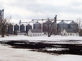
Dorothy was initially established as a railroad station in 1916–17, after the Northern Pacific Railway extended its line from Tilden Junction to Winnipeg and built a spur through Red Lake Falls. The new town sucked away what was left of the historic river crossing town, Huot, and for a time sputtered toward prosperity, boasting a grain elevator, a Catholic church, a school and several houses.
The post office in Dorothy was first established February 11, 1898, with Joseph H. Mathews as postmaster. It was finally discontinued in 1945.[2]
The Federal Writers' Project reported in 1938 that the town had a population of 25, and "a beautiful church with stained-glass windows". In 1973, the railroad was abandoned and the grain elevator closed, and with it, the town's reason for existence was gone. By 2007, the church had been abandoned and appeared to be in use as a residence.
On October 24, 2014, the old church caught fire and burned to the ground in a conflagration that apparently started after embers from a pile of leaves a property owner was burning nearby blew towards the building, igniting the structure, which was a total loss.
Red Lake County is a county in the Northwestern part of the U.S. state of Minnesota. As of the 2010 United States Census, the population was 4,089, making it the third-least populous county in Minnesota. Its county seat is Red Lake Falls.
Lake Crystal is a city in Blue Earth County, Minnesota, United States. Established in May 1869. The population was 2,549 at the 2010 census. It is part of the Mankato–North Mankato Metropolitan Statistical Area.
Badger Township is a township in Polk County, Minnesota, United States. It is part of the Grand Forks-ND-MN Metropolitan Statistical Area. Under the United States Public Land Survey System it is a survey township identified as Township 149 North, Range 42 West, Fifth Principal Meridian. The population was 166 at the 2000 census.
Erskine is a city in Polk County, Minnesota, United States. The population was 503 at the 2010 census. It is part of the Grand Forks N.D. – Minn. Metropolitan Statistical Area.
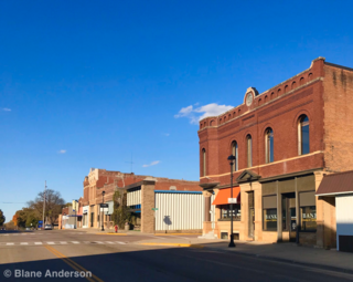
Red Lake Falls is a city in Red Lake County, Minnesota, United States. The population was 1,427 at the 2010 census. It is the county seat of Red Lake County. The city lies in the middle of Red Lake Falls Township, from which it was separated when incorporated as a village in 1881. Its status was raised to that of a city in 1898.
Tenney is an unincorporated community and former city in section 28 of Campbell Township, Wilkin County, Minnesota, United States. A post office was established there in 1887, and Tenney was incorporated as a city on November 30, 1901. The population was 5 at the 2010 census, tying Tenney with Funkley as Minnesota's least populous community. It is part of the Wahpeton, ND–MN Micropolitan Statistical Area. Tenney's main economic feature is a grain elevator near its southern border.
Hastings is a city in Dakota and Washington counties, in the U.S. state of Minnesota, near the confluence of the Mississippi, Vermillion, and St. Croix Rivers. Its population was 22,172 at the 2010 census. It is the county seat of Dakota County, which contains most of it; a small part extends into Washington County along the Mississippi River's north bank. It is named for the first elected governor of Minnesota, Henry Hastings Sibley.
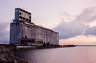
A grain elevator is an agrarian facility complex designed to stockpile or store grain. In grain trade, the term "grain elevator" also describes a tower containing a bucket elevator or a pneumatic conveyor, which scoops up grain from a lower level and deposits it in a silo or other storage facility.
Annelly is a ghost town in Richland Township 9 miles southeast of Newton in Harvey County, Kansas, United States. The community was located along the Missouri Pacific Railroad line between Newton and Whitewater, but the track was abandoned in 2003. As of September 2019, the land is privately owned farmland.
Cisco is a place name for the remnants of a former unincorporated community located along the Soo Line Railroad and US 59 in the northwestern quarter of Section 11 of Badger Township, 149 North, Range 42 West, in Polk County, Minnesota, United States, approximately four miles north of the city of Erskine, and about the same distance south of the city of Brooks.
Huot is an unincorporated community in Louisville Township, Red Lake County, Minnesota, United States. The name of the community evokes the French-Canadian and Métis history of the Red River Trails and the Pembina settlements of Assiniboia.
Boyd was a town in Wasco County, Oregon, United States, disincorporated in 1955, and now vacant except for a few abandoned homes, weathered outbuildings, and a derelict wooden grain elevator surrounded by the wheat fields, which still produce the grain that used to fill it. The site was recently bought and turned into farmland. The site of the former settlement is 9.5 miles (15.3 km) southeast of The Dalles, on the east side of U.S. Route 197 from which it is visible at a distance.
Codell is an unincorporated community in Rooks County, Kansas, United States.
Preston, also known as Preston Bend, is an unincorporated community and census-designated place located on the Red River in Grayson County, Texas, United States. It grew in the 19th century at the intersection of several military and trade roads and was an important crossing on the Shawnee cattle trail. Preston lost prominence after the MK&T railroad bypassed the town to the east, leading to a decline in traveler and cattle drive traffic. Much of its former town site is submerged beneath the waters of Lake Texoma. Its population was 2,096 as of the 2010 census.
Blackstone is an unincorporated community in section 7 of Sunbury Township, Livingston County, Illinois, United States. Blackstone is 10 miles (16 km) southeast of Streator and 13 miles (21 km) west of Dwight, Illinois. Blackstone has a post office with ZIP code 61313. It is part of the geographic region known as Streatorland.
Org is an unincorporated community in Nobles County, Minnesota, United States.
Reading is an unincorporated community in Nobles County, Minnesota, United States.
Horizon, located on the south side of Channel Lake, is a hamlet in Bengough Rural Municipality No. 40, Saskatchewan, Canada. It previously held the status of a village until December 31, 1973. The hamlet is located 60 km (37 mi) east of the Town of Assiniboia on highway 13.
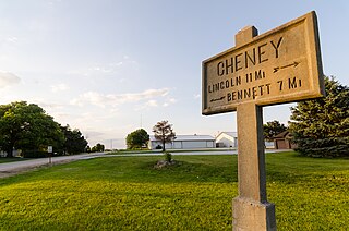
Cheney is an unincorporated community in Lancaster County, Nebraska, United States.
Gorman is an unincorporated community in Potter County, in the U.S. state of South Dakota.
This page is based on this Wikipedia article Text is available under the CC BY-SA 4.0 license; additional terms may apply. Images, videos and audio are available under their respective licenses.