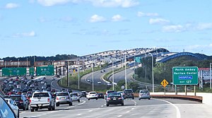
The New Jersey Turnpike (NJTP) is a system of controlled-access highways in the U.S. state of New Jersey. The turnpike is maintained by the New Jersey Turnpike Authority (NJTA). The 117.20-mile (188.62 km) mainline's southern terminus is at a complex interchange with Interstate 295 (I-295), U.S. Route 40 (US 40), US 130, and Route 49 near the border of Pennsville and Carneys Point townships in Salem County, one mile (1.6 km) east of the Delaware Memorial Bridge. Its northern terminus is at an interchange with I-80 and US 46 in Ridgefield Park. Construction of the mainline from concept to completion took 22 months, from 1950 to 1951. It was opened to traffic on November 5, 1951, between its southern terminus and exit 10.

The Atlantic City Expressway, officially numbered, but unsigned, as Route 446 and abbreviated A.C. Expressway, ACE, or ACX, and known locally as the Expressway, is a 44.19-mile (71.12 km) controlled-access toll road in the U.S. state of New Jersey, managed and operated by the South Jersey Transportation Authority (SJTA). It serves as an extension of the freeway part of Route 42 from Turnersville southeast to Atlantic City. The Atlantic City Expressway is signed as east-west, though the mileage and exits decrease as if one is travelling north-south. It connects Philadelphia and the surrounding Delaware Valley metropolitan area with Atlantic City and other Jersey Shore resorts, and also serves other South Jersey communities, including Hammonton and Mays Landing. The expressway intersects many major roads, including Route 73 in Winslow Township, Route 54 in Hammonton, Route 50 in Hamilton Township, the Garden State Parkway in Egg Harbor Township, U.S. Route 9 (US 9) in Pleasantville, and the Atlantic City–Brigantine Connector near the eastern terminus in Atlantic City.

The Garden State Parkway (GSP) is a controlled-access toll road that stretches the north–south length of eastern New Jersey from the state's southernmost tip near Cape May north to the New York state line at Montvale. Its name refers to New Jersey's nickname, the "Garden State". The parkway has an unsigned reference number of Route 444 by the New Jersey Department of Transportation (NJDOT). At its north end, the road becomes the Garden State Parkway Connector, a component of the New York State Thruway system that connects to the Thruway mainline in Ramapo.
E-ZPass is an electronic toll collection system used on toll roads, toll bridges, and toll tunnels in the Eastern United States, Midwestern United States, and Southern United States. The E-ZPass Interagency Group (IAG) consists of member agencies in several states, which use the same technology and allow travelers to use the same transponder on toll roads throughout the network.
The New York State Thruway is a system of controlled-access toll roads spanning 569.83 miles (917.05 km) within the U.S. state of New York. It is operated by the New York State Thruway Authority (NYSTA), a New York State public-benefit corporation. The 496.00-mile (798.23 km) mainline is a freeway that extends from the New York City line at Yonkers to the Pennsylvania state line at Ripley by way of I-87 and I-90 through Albany, Syracuse, and Buffalo. According to the International Bridge, Tunnel and Turnpike Association, the Thruway is the fifth-busiest toll road in the United States. The toll road is also a major route for long distance travelers linking the cities of Toronto and Buffalo with Boston and New York City.
Florida's Turnpike, designated as unsigned State Road 91, is a controlled-access toll road in the U.S. state of Florida, maintained by Florida's Turnpike Enterprise (FTE). Spanning approximately 309 miles (497 km) along a northwest–southeast axis, the turnpike is in two sections. The SR 91 mainline runs roughly 265 miles (426 km), from its southern terminus at an interchange with Interstate 95 (I-95) in Miami Gardens to an interchange with I-75 in Wildwood at its northern terminus. The Homestead Extension of Florida's Turnpike continues from the southern end of the mainline for another 48 miles (77 km) to US Highway 1 in Florida City. The slogan for the road is "The Less Stressway". The mainline opened in stages between 1957 and 1964, while the extension was completed in 1974. The turnpike runs through Miami, Fort Lauderdale, and West Palm Beach, where it parallels I-95, and through Orlando, where it crosses I-4.

The Delaware Memorial Bridge is a dual-span suspension bridge crossing the Delaware River. The toll bridges carry Interstate 295 and U.S. Route 40 and is also the link between Delaware and New Jersey. The bridge was designed by the firm of Howard, Needles, Tammen & Bergendoff with consulting help from engineer Othmar Ammann, whose other designs include the George Washington Bridge and the Verrazzano-Narrows Bridge.
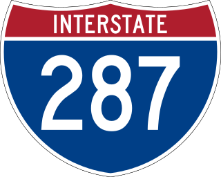
Interstate 287 (I-287) is an auxiliary Interstate Highway in the US states of New Jersey and New York. It is a partial beltway around New York City, serving northern New Jersey and the counties of Rockland and Westchester in New York. I-287, which is signed north–south in New Jersey and east–west in New York, follows a roughly horseshoe-shaped route from the New Jersey Turnpike (I-95) in Edison, New Jersey, clockwise to the New England Thruway (I-95) in Rye, New York, for 98.72 miles (158.87 km). Through New Jersey, I-287 runs west from its southern terminus in Edison through suburban areas. In Bridgewater Township, the freeway takes a more northeasterly course, paralleled by US Route 202 (US 202). The northernmost part of I-287 in New Jersey passes through mountainous surroundings. After crossing into New York at Suffern, I-287 turns east on the New York State Thruway (I-87) and runs through Rockland County. After crossing the Hudson River on the Tappan Zee Bridge, I-287 splits from I-87 near Tarrytown and continues east through Westchester County on the Cross-Westchester Expressway until it reaches the New England Thruway. Within New Jersey, I-287 is maintained by the New Jersey Department of Transportation (NJDOT), and, within New York, it is maintained by the New York State Thruway Authority (NYSTA).

Interstate 295 (I-295) in Delaware, New Jersey, and Pennsylvania is an auxiliary Interstate Highway, designated as a bypass around Philadelphia, Pennsylvania, and a partial beltway of Trenton, New Jersey.
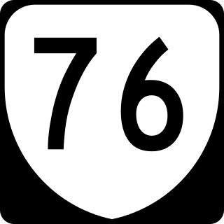
State Route 76 is a controlled-access toll road in the U.S. state of Virginia. Known as the Powhite Parkway, the state highway runs 13.04 miles (20.99 km) from SR 652 near Midlothian north to Interstate 195 (I-195) in Richmond. SR 76 connects SR 288, U.S. Route 60, and SR 150 in Chesterfield County with I-195 and SR 195 west of Downtown Richmond. The highway includes a pair of mainline barrier toll plazas and ramp toll plazas at most interchanges, all of which accept E-ZPass. SR 76 is maintained by the Virginia Department of Transportation (VDOT) in Chesterfield County and the Richmond Metropolitan Authority in the city of Richmond. The Richmond section of the freeway was constructed in the early 1970s; the highway was extended to its current terminus in Chesterfield County in the late 1980s.
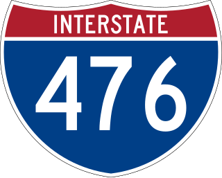
Interstate 476 (I-476) is a 132.1-mile (212.6 km) auxiliary Interstate Highway of I-76 in the U.S. state of Pennsylvania. The highway runs from I-95 near Chester north to I-81 near Scranton, serving as the primary north–south Interstate corridor through eastern Pennsylvania. It consists of both the 20-mile (32 km) Mid-County Expressway, locally referred to as the "Blue Route", through Delaware and Montgomery counties in the suburban Philadelphia area, and the tolled, 110.6-mile (178.0 km) Northeast Extension of the Pennsylvania Turnpike, which connects the Delaware Valley with the Lehigh Valley, the Pocono Mountains, and the Wyoming Valley to the north.
The Connecticut Turnpike is a freeway and former toll road in the U.S. state of Connecticut; it is maintained by the Connecticut Department of Transportation (ConnDOT). Spanning approximately 128 miles (206 km) along a generally west–east axis, its roadbed is shared with Interstate 95 (I-95) for 88 miles (142 km) from the New York state border in Greenwich to East Lyme; I-395 for 36 miles (58 km) from East Lyme to Plainfield; and SR 695 for four miles (6.4 km) from Plainfield to the Rhode Island state line at U.S. Route 6 (US 6) in Killingly. The turnpike briefly runs concurrently with US 1 from Old Saybrook to Old Lyme and Route 2A from Montville to Norwich.

Interstate 78 (I-78) is an east–west route stretching from Union Township, Lebanon County, Pennsylvania, to New York City. In New Jersey, I-78 is called the Phillipsburg–Newark Expressway and the Newark Bay–Hudson County Extension of the New Jersey Turnpike. The highway runs for 67.83 miles (109.16 km) in the northern part of the state of New Jersey from the I-78 Toll Bridge over the Delaware River at the Pennsylvania state line in Phillipsburg, Warren County, east to the Holland Tunnel under the Hudson River at the New York state line in Jersey City, Hudson County. The Phillipsburg–Newark Expressway portion of I-78, formally called the Lightning Division Memorial Highway, runs from the Phillipsburg area east across rural areas of western New Jersey before entering suburban areas in Somerset County. The road crosses the Watchung Mountains, widening into a local–express lane configuration at Route 24 as it continues through urban areas to Newark. Here, I-78 intersects the mainline of the New Jersey Turnpike (I-95) and becomes the Newark Bay Extension, crossing the Newark Bay Bridge and continuing to Jersey City. The route, along with Route 139, follows a one-way pair of surface streets to the Holland Tunnel.

The Edison Bridge and the Vieser bridge are a pair of bridges that carry U.S. Route 9 in the state of New Jersey, spanning the Raritan River near its mouth in Raritan Bay. The bridge, which connects Woodbridge on the north with Sayreville on the south, was opened to weekend traffic starting on October 11, 1940, and was opened permanently on November 15, 1940. As of 2003, the bridge carries more than 82,000 vehicles daily and is owned and operated by the New Jersey Department of Transportation. It also runs directly parallel to the Driscoll Bridge, which carries the Garden State Parkway.

The Pennsylvania Turnpike/Interstate 95 Interchange Project is a road construction project that built an interchange between Interstate 95 (I-95) and the Pennsylvania Turnpike in Bristol Township, Bucks County, Pennsylvania, in the United States. The $553 million first stage is complete: a pair of flyover ramps–one connecting I-95 northbound with the eastbound turnpike and the other connecting the westbound turnpike with I-95 southbound—that opened in 2018, with some cleanups to connecting roads completed in 2021. Construction of the remaining ramps is expected to begin when funding is available.

The Delaware River–Turnpike Toll Bridge is a four-lane, steel through arch bridge crossing the Delaware River between Burlington Township, Burlington County, New Jersey and Bristol Township, Bucks County, Pennsylvania. As a part of Interstate 95 (I-95), it is a major highway link between Philadelphia and New York City. The bridge also connects the Pennsylvania Turnpike's east-west mainline with the main trunk of the New Jersey Turnpike, via the Pearl Harbor Memorial Turnpike Extension. Tolls are collected only in the west/southbound direction via electronic toll collection.

Interstate 95 (I-95) is an Interstate Highway running along the East Coast of the United States from Miami, Florida, north to the Canada–United States border at Houlton, Maine. In Maryland, the route is a major highway that runs 110.01 miles (177.04 km) diagonally from southwest to northeast, entering from the District of Columbia and Virginia at the Woodrow Wilson Bridge over the Potomac River, northeast to Maryland's border with Delaware near Elkton. It is the longest Interstate Highway within Maryland and is one of the most traveled Interstate Highways in the state, especially between Baltimore and Washington, D.C., despite alternate routes along the corridor, such as the Baltimore–Washington Parkway, U.S. Route 1 (US 1), and US 29. I-95 also has eight auxiliary routes in the state, the most of any state along the I-95 corridor. Portions of the highway, including the Fort McHenry Tunnel and the Millard E. Tydings Memorial Bridge, are tolled.

The Great Egg Harbor Bridge is a series of four bridges along the Garden State Parkway in New Jersey, with tolls collected in the southbound direction. It crosses the Great Egg Harbor Bay, connecting Upper Township, in Cape May County to Somers Point in Atlantic County. The bridge crosses over a section of Egg Harbor Township, and Drag Island. It has carried a portion of U.S. Route 9 since 2013.

U.S. Route 9 (US 9) is a United States Numbered Highway in the Mid-Atlantic region of the United States, running from Laurel, Delaware, to Champlain, New York. In New Jersey, the route runs 166.80 miles (268.44 km) from the Cape May–Lewes Ferry terminal in North Cape May, Cape May County, where the ferry carries US 9 across the Delaware Bay to Lewes, Delaware, north to the George Washington Bridge in Fort Lee, Bergen County, where the route along with Interstate 95 (I-95) and US 1 continue into New York City. US 9 is the longest U.S. Highway in the state.

Interstate 77 (I-77) in the US state of West Virginia is a major north–south Interstate Highway. It extends for 187.21 miles (301.29 km) between Bluefield at the Virginia state line and Williamstown at the Ohio state line.