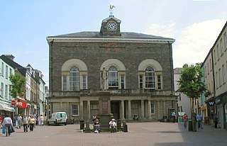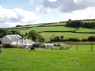
Carmarthenshire is a county in the south-west of Wales. The three largest towns are Llanelli, Carmarthen and Ammanford. Carmarthen is the county town and administrative centre. The county is known as the "Garden of Wales" and is also home to the National Botanic Garden of Wales.

Llanwrda is a village and community in Carmarthenshire, Wales, 4 miles (6.4 km) southwest of Llandovery. It lies on the River Towy. The population in 2011 was 514.

Carmarthen East and Dinefwr is a constituency of the House of Commons of the Parliament of the United Kingdom represented since 2010 by Jonathan Edwards of Plaid Cymru. It elects one Member of Parliament (MP) by the first past the post system of election. It was created in 1997, mostly from the former seat of Carmarthen.

Llanelli is a constituency of the House of Commons of the Parliament of the United Kingdom. From 1918 to 1970 the official spelling of the constituency name was Llanelly. It elects one Member of Parliament (MP) by the first past the post system of election. Since 2005, it is currently represented by Nia Griffith of the Labour Party.
Cwmamman is a community in Carmarthenshire, about 12 miles north of Swansea in southwest Wales. Literally meaning "Amman valley", it takes its name from the River Amman which runs through the area.

Dinefwr was one of six local government districts of the county of Dyfed, Wales from 1974 to 1996. It was named after Dinefwr Castle which in the middle ages had been the court of the House of Dinefwr and one of the three principal royal courts of Wales with Aberffraw and Shrewsbury.
Llwchwr is a community and electoral ward in the central western part of the City and County of Swansea, Wales, UK. It lies 9 km west-north-west of Swansea city centre and is bounded by the communities of Gorseinon to the north, Penllergaer to the east, and Gowerton to the south, as well as by the estuary of the River Loughor to the west, on the far side of which lies Bynea in Carmarthenshire, connected to Llwchwr by road and rail bridges.
Coleg Sir Gâr is a further education college in Carmarthenshire, Wales, with five campuses across the county.

Llannon is a small village, community and electoral ward in the county of Carmarthenshire, Wales. It is located on the A476 road 11 mi (18 km) south east of the county town, Carmarthen, between Tumble and Swiss Valley.

St Ishmael is a hamlet and community in Carmarthenshire, Wales. The community population taken at the 2011 census was 1,370. It comprises the villages of Ferryside and Llansaint and the surrounding rural areas. The community is bordered by the communities of: Llandyfaelog; Kidwelly; Pembrey and Burry Port Town; and Llansteffan, all being in Carmarthenshire. It is named for the 6th-century Breton prince and Welsh saint Isfael.
Llanarthney is a village and community in Carmarthenshire, south-west Wales. Situated on the B4300 road 12 km east of Carmarthen and 10 km west of Llandeilo, the community had a population at the 2001 census of 738, of whom 61 per cent were Welsh-speaking. At the 2011 Census the population had increased slightly to 765.

Llanfihangel Aberbythych is a community in Carmarthenshire, Wales. The population recorded at the 2011 census was 1,344. It is bordered by Llangathen, Llandeilo, Dyffryn Cennen, Llandybie, Gorslas and Llanarthney, all of which are in Carmarthenshire. There is no village of Llanfihangel Aberbythych – the name is taken from St Michael's Church, which dates from 1849, at Golden Grove, about 3 miles (5 km) south-west of Llandeilo. It now belongs to the Church in Wales parish of Catheiniog. Villages include Carmel and Maesybont.
Llanllawddog is a community located in Carmarthenshire, south-west Wales. The population of the community taken at the 2011 census was 703.
Manordeilo and Salem is a community located in Carmarthenshire, Wales. The population taken at the 2011 census was 1,754.
Newchurch and Merthyr is a community located in Carmarthenshire, Wales including the villages of Newchurch and Merthyr. The community population at the 2011 census was 676.
Quarter Bach is a community located in the east of Carmarthenshire, Wales.
Saron is a mining village near the town of Ammanford in Carmarthenshire, Wales. Saron is in the community of Llandybie.
Tyisha is an electoral ward for Llanelli Town Council and Carmarthenshire County Council in Llanelli, Wales.
Llandeilo is the name of an electoral ward for Carmarthenshire County Council, which includes the communities of Llandeilo and Dyffryn Cennen, in Carmarthenshire, Wales. It is represented by one county councillor.
Pontamman was the name of an electoral ward for Carmarthenshire County Council, which included parts of the town and community of Ammanford, Carmarthenshire, Wales. It was represented by one county councillor.


