Fairfax Avenue

Last updated
The Academy Museum of Motion Pictures and the May Company on Fairfax Avenue Highsmithmaycompanywilshire.jpg
The Academy Museum of Motion Pictures and the May Company on Fairfax Avenue
Canter's Deli on Fairfax Avenue Canter's Deli on Fairfax.jpg
Canter's Deli on Fairfax Avenue

Fairfax Avenue is a street in the north central area of the city of Los Angeles, California, United States. It runs from La Cienega Boulevard in Culver City at its southern end to Hollywood Boulevard in Hollywood on its northern end. From La Cienega Boulevard (between Culver City and Mid-City) to Sunset Boulevard between West Hollywood and Hollywood, Fairfax Avenue separates the Westside from the central part of the city along with Venice Boulevard, La Cienega Boulevard, Hauser Boulevard, San Vicente Boulevard, South Cochran Avenue, Wilshire Boulevard, 6th Street, Cochran Avenue, 4th Street, La Brea Avenue, Fountain Avenue and Sunset Boulevard.

Fairfax Avenue forms the western boundary of Hancock Park as well as Park La Brea, a 160-acre (60 ha), 4,222-unit apartment complex with over 10,000 residents. [1]

Since World War II, the Fairfax District has been a heavily Jewish neighborhood in Mid-City West. Fairfax High School, on the corner of Fairfax and Melrose Avenue, was known as the alma mater of many entertainment industry personalities. Canter's Deli has been a late night hangout in Los Angeles since the 1940s. CBS's Television City is located on the corner of Fairfax and Beverly Boulevard, where thousands camp out to wait for a chance to watch The Price Is Right , and the former site of Gilmore Stadium, where the minor league baseball team, the Hollywood Stars, used to play prior to the Dodgers moving from Brooklyn. World-famous recording studio, Cherokee Studios, home to over 250 gold and platinum records, is just above Melrose Avenue.

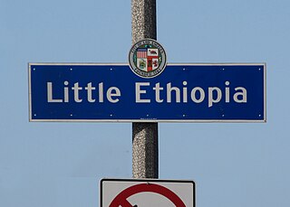
The Grove is off 3rd Street and Fairfax. Due to the high density of attractions, Fairfax is one of the most congested streets in Los Angeles. Little Ethiopia is further south by Olympic Blvd and north by Pico Boulevard between the Carthay Square and Wilshire Vista neighborhoods in West Los Angeles. South of Olympic, Fairfax narrows to two lanes, Pico Boulevard between the Crestview, Picfair Village, Wilshire Vista and Carthay Square neighborhoods in West Los Angeles and Venice Boulevard between the Crestview and Picfair Village neighborhoods in West Los Angeles and the Lafayette Square neighborhood in Mid-City.

At the northeast corner of Wilshire Boulevard and Fairfax is the former May Company department store building, which was converted to the Los Angeles County Museum of Art and will be the future home of the Academy Museum of Motion Pictures. The Petersen Automotive Museum is located on the southeast corner of Wilshire/Fairfax.

Metro Local line 217 serves Fairfax Avenue. An underground station for the Metro D Line at Wilshire Boulevard is currently under construction and is due to open in 2023.

Notable landmarks

Related Research Articles

<span class="mw-page-title-main">Fairfax District, Los Angeles</span> Neighborhood of Los Angeles

The Fairfax District is a neighborhood in the Central region of Los Angeles, California.

West Los Angeles is an area within the city of Los Angeles, California, United States. The residential and commercial neighborhood is divided by the Interstate 405 freeway, and each side is sometimes treated as a distinct neighborhood, mapped differently by different sources. Each lies within the larger Westside region of Los Angeles County.

<span class="mw-page-title-main">Park La Brea, Los Angeles</span> Neighborhood of Los Angeles in California, United States

Park La Brea is an apartment community in the Miracle Mile District of Los Angeles, California. With 4,255 units located in eighteen 13-story towers and thirty-one two-story buildings, it is among the largest apartment complexes in the continental United States. It sits on 160 acres (0.65 km2) of land.

<span class="mw-page-title-main">Little Ethiopia, Los Angeles</span> Neighborhood of Los Angeles in California, United States of America

Little Ethiopia is a neighborhood in the central region of Los Angeles. It is known for its collection of Ethiopian restaurants, coffee shops, boutiques and thrift stores.

<span class="mw-page-title-main">La Cienega Boulevard</span> Highway in California

La Cienega Boulevard is a major north–south arterial road in the Los Angeles metropolitan area that runs from El Segundo Boulevard in Hawthorne to the Sunset Strip in West Hollywood to the north. It was named for Rancho Las Cienegas, literally "The Ranch Of The Swamps," an area of marshland south of Rancho La Brea.

Carthay is a half-square-mile neighborhood in Central Los Angeles, California. It contains Carthay Circle, Carthay Square and South Carthay. There are three Los Angeles Historic Preservation Overlay Zones in Carthay.

<span class="mw-page-title-main">Wilshire Boulevard</span> Major thoroughfare in the metropolitan Los Angeles area, United States

Wilshire Boulevard (['wɪɫ.ʃɚ]) is a prominent 15.83 mi (25.48 km) boulevard in the Los Angeles area of Southern California, extending from Ocean Avenue in the city of Santa Monica east to Grand Avenue in the Financial District of downtown Los Angeles. One of the principal east–west arterial roads of Los Angeles, it is also one of the major city streets through the city of Beverly Hills. Wilshire Boulevard runs roughly parallel to Santa Monica Boulevard from Santa Monica to the west boundary of Beverly Hills. From the east boundary, it runs a block south of Sixth Street to its terminus.

Mid-Wilshire is a neighborhood in the central region of Los Angeles, California. It is known for the Los Angeles County Museum of Art, the Petersen Automotive Museum, and the Miracle Mile shopping district.

<span class="mw-page-title-main">Faircrest Heights, Los Angeles</span> Neighborhood of Los Angeles

Faircrest Heights is a neighborhood in Mid-City, Los Angeles, California.

<span class="mw-page-title-main">San Vicente Boulevard</span> Street in Western Los Angeles running southeast of Beverly Hills, United States

San Vicente Boulevard is a major northwest-southeast thoroughfare located in the western portion of the metropolitan area of Los Angeles, CA.

Pico Boulevard is a major Los Angeles street that runs from the Pacific Ocean at Appian Way in Santa Monica to Central Avenue in Downtown Los Angeles, California, United States. It is named after Pío Pico, the last Mexican governor of Alta California.

<span class="mw-page-title-main">Beverly Boulevard</span> Thoroughfare in Los Angeles, United States

Beverly Boulevard is one of the main east–west thoroughfares in Los Angeles, in the U.S. state of California. It begins off Santa Monica Boulevard in Beverly Hills and ends on the Lucas Avenue overpass near downtown Los Angeles to become 1st Street. A separate Beverly Boulevard begins off 3rd Street and Pomona Boulevard in East Los Angeles, runs through Montebello and Pico Rivera, and becomes Turnbull Canyon Road in Whittier near Rose Hills Memorial Park.

<span class="mw-page-title-main">Highland Avenue (Los Angeles)</span> Road in Los Angeles, California, United States

Highland Avenue is a north–south road in Los Angeles. It is a major thoroughfare that runs from Cahuenga Boulevard and the US 101 Freeway in Hollywood from the north end to Olympic Boulevard in Mid-City Los Angeles on the south end. Highland then is a small residential street from Olympic Boulevard south to Adams Boulevard. For through access, Highland swerves west into Edgewood Place which accesses La Brea Avenue.

<span class="mw-page-title-main">Venice Boulevard</span> Thoroughfare in Los Angeles

Venice Boulevard is a major east–west thoroughfare in Los Angeles, running from the ocean in the Venice district, past the I-10 intersection, into downtown Los Angeles. It was originally known as West 16th Street under the Los Angeles numbered street system.

<span class="mw-page-title-main">Robertson Boulevard</span> Street in Los Angeles

Robertson Boulevard is a street in Los Angeles, in the U.S. state of California, that also passes through the incorporated cities of West Hollywood, Beverly Hills, and Culver City.

<span class="mw-page-title-main">La Brea Avenue</span> Thoroughfare in Los Angeles, USA

La Brea Avenue is a prominent north-south thoroughfare in the City of Los Angeles and in Los Angeles County, California.

<span class="mw-page-title-main">Mid-City West, Los Angeles</span> Los Angeles neighborhood in Central LA

Mid-City West is an area in the western part of Central Los Angeles that is served by the Mid City West Neighborhood Council. It contains the neighborhoods of Beverly–Fairfax, Beverly Grove, Burton Way, Carthay Circle, Melrose, Miracle Mile and Park La Brea.

<span class="mw-page-title-main">Los Angeles's 5th City Council district</span> American legislative district

Los Angeles's 5th City Council district is one of the fifteen districts in the Los Angeles City Council. It is currently represented by Democrat Katy Young Yaroslavsky since 2022 after winning an election to succeed Paul Koretz, who termed out.

<span class="mw-page-title-main">Beverly Grove, Los Angeles</span> District and neighborhood of Los Angeles, California, US

Beverly Grove is an area within the Beverly–Fairfax neighborhood in the Mid-City West region of Los Angeles, California.

References

  1. Maggie Barnett (May 23, 2004). "Freshly hip, Park La Brea is an urban oasis". Los Angeles Times. Retrieved August 9, 2012.

34°04′35″N118°21′41″W / 34.0763°N 118.3615°W / 34.0763; -118.3615