
Sullivan County is a county in the U.S. state of New York. As of the 2020 census, the population was 78,624. The county seat is Monticello. The county's name honors Major General John Sullivan, who was labeled at the time as a hero in the American Revolutionary War in part due to his successful campaign of genocide against the Iroquois.

Fallsburg is a town in Sullivan County, New York, United States. The town is in the eastern part of the county. The population was 12,870 at the 2010 census. It is not to be confused with the hamlet of Fallsburg which bears a similar name and is within the town of Fallsburg.

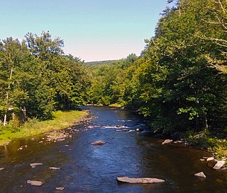
Neversink is a town in Sullivan County, New York, United States. The population was 3,557 at the 2010 census.
The Neversink River is a 55-mile-long (89 km) tributary of the Delaware River in southeastern New York in the United States. The name of the river comes from the corruption of an Algonquian language phrase meaning "mad river."

New York State Route 42 (NY 42) is a north–south, discontinuous state highway in the Catskill Mountains region of New York in the United States. The southernmost of the highway's two segments begins at an intersection with U.S. Route 6 (US 6) and US 209 in Port Jervis and ends at a junction with NY 55 near the Rondout Reservoir in Neversink. NY 42's northern segment runs from NY 28 in Shandaken to NY 23A in Lexington. The 41-mile (66 km) southern segment is located in Orange County and Sullivan County, while the 11-mile (18 km) northern segment is in Ulster County and Greene County.
Wingdale is a hamlet and census-designated place (CDP) in the town of Dover in Dutchess County, New York, United States. It was first listed as a CDP prior to the 2020 census.

Loch Sheldrake is a hamlet and census-designated place (CDP) in the Town of Fallsburg, New York, United States, in Sullivan County. The zip code for Loch Sheldrake is 12759.
Bliss is the largest hamlet and a census-designated place (CDP) in the town of Eagle, Wyoming County, New York, United States. As of the 2010 census, it had a population of 527.
Woodbourne is a hamlet in the town of Fallsburg in Sullivan County, New York, United States.
North Pownal is an unincorporated community and census-designated place (CDP) in the town of Pownal, Bennington County, Vermont, United States. It was first listed as a CDP prior to the 2020 census.
Winthrop is a hamlet and census-designated place (CDP) in the town of Stockholm in St. Lawrence County, New York, United States. As of the 2010 census, it had a population of 510.
Alfred is a census-designated place (CDP) and the primary village in the town of Alfred, York County, Maine, United States. It is in central York County and the center of the town of Alfred, 4 miles (6 km) northeast of Sanford and 13 miles (21 km) west of Biddeford. U.S. Route 202 passes through the village, leading northeast 23 miles (37 km) to Gorham and southwest through Sanford 20 miles (32 km) to Rochester, New Hampshire. Maine State Route 4 leads south 13 miles (21 km) to North Berwick and leads north out of town with US 202. State Route 111 leads east from Alfred to Biddeford.
Madrid is the primary hamlet and a census-designated place (CDP) in the town of Madrid in St. Lawrence County, New York, United States. As of the 2010 census, it had a population of 757, out of 1,735 in the entire town of Madrid.
Groveland Station is a census-designated place (CDP) in Livingston County, New York, United States. The CDP consists of the hamlet of Groveland and nearby residential areas. The CDP population was 281 as of the 2010 census. New York State Route 63 passes through the community.
Wadsworth is a hamlet and census-designated place (CDP) in the town of York, Livingston County, New York, United States. Its population was 190 as of the 2010 census. New York State Route 36 passes through the community.
York is a hamlet and census-designated place (CDP) in the town of York, Livingston County, New York, United States. Its population was 544 as of the 2010 census. New York State Route 36 passes through the community.
Pamelia Center is a hamlet and census-designated place (CDP) in Jefferson County, New York, United States. Its population was 264 as of the 2010 census. The community is located at the junction of New York State Route 37 and New York State Route 342.
Crest View Heights is a neighborhood and census-designated place (CDP) in the town of Owego, Tioga County, New York, United States. It was first listed as a CDP prior to the 2020 census.
Castleton Four Corners is a census-designated place (CDP) in the town of Castleton, Rutland County, Vermont, United States. It consists of the unincorporated villages of Castleton Corners and Hydeville. As of the 2020 census, the CDP had a population of 699, out of 4,458 in the entire town.
Middletown Springs is the primary village and a census-designated place (CDP) in the town of Middletown Springs, Rutland County, Vermont, United States. As of the 2020 census, it had a population of 194, out of 794 in the entire town.


