
The Sava is a river in Central and Southeastern Europe, a right tributary of the Danube. It flows through Slovenia, Croatia, along the northern border of Bosnia and Herzegovina, and through Serbia, discharging into the Danube in Belgrade. Its central part is a natural border of Bosnia-Herzegovina and Croatia. The Sava forms the northern border of the Balkan Peninsula, and the southern edge of the Pannonian Plain.

The Vrbas is a major river with a length of 250 kilometres (160 mi), in western Bosnia and Herzegovina. It is a right tributary of the Sava river. The city of Banja Luka is located on the river banks.

The Krka is a river in southeastern Slovenia, a right tributary of the Sava. With a length of 94.6 km (58.8 mi), it is the second-longest river flowing in its entirety in Slovenia, following the Savinja.

The Sava Dolinka is a headwater of the Sava River in northwestern Slovenia. The 45 kilometres (28 mi) long Sava Dolinka starts as Nadiža Creek in the Planica Valley under Mount Zadnja Ponca in the Julian Alps, at an elevation of 1222 m, close to the Italian border. The stream goes underground soon after its source and breaks out again after 5 km at an elevation of 842 m in Zelenci, near Kranjska Gora. The Sava Dolinka flows through Kranjska Gora, Gozd Martuljek, Jesenice, between Bled and Breg, and past the town of Lesce. The first in a series of hydroelectric power plants on the river, the Moste Hydro Power Plant, is located near Žirovnica. It merges with the second major headwater of the Sava, the Sava Bohinjka, at Radovljica. A notable tributary of the Sava Dolinka is the Radovna, which flows through the Vintgar Gorge near Bled.
The Lim is a river flowing through Montenegro, Albania, Serbia and Bosnia and Herzegovina. 220 km (137 mi) long, it is the right and the longest tributary of the Drina.

The Bosut is a river in eastern Croatia and northwestern Serbia, a 186 km long left tributary of the Sava river. Its name from the Indo-European root *bhogj, meaning "to flow". The same root is seen in hydronym "Bosna".

The Ćehotina, also Ćeotina, Ćotina or Čehotina, is a 125 kilometres (78 mi) long river in Montenegro and Bosnia and Herzegovina, it is a right bank tributary of the Drina river.

The Kolubara, is a 87 km (54 mi) long river in western Serbia; it is an eastern, right tributary to the Sava river.
The Jerez is a river in western Serbia, a 56 km-long right tributary to the Sava river.

The Studva is a river in eastern Croatia and northern Serbia, a 37 km-long right tributary to the Bosut river. It flows entirely within the Syrmia region of both Croatia and Serbia (Vojvodina).

Sana is a river in the north-western part of Bosnia and Herzegovina. It is a tributary of the Una, into which it flows near Novi Grad. It is the longest of the nine rivers that flow through Sanski Most, and is 142 km long. It is not a navigable waterway.
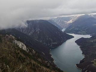
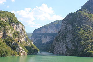
The Drina is a 346 km (215 mi) long international river, which forms a large portion of the border between Bosnia and Herzegovina and Serbia. It is the longest tributary of the Sava River and the longest karst river in the Dinaric Alps which belongs to the Danube river watershed. Its name is derived from the Latin name of the river which in turn is derived from Greek.
Bilogora is a low mountainous range in central Croatia. It consists of a series of hills and small plains some 80 kilometres in length stretching in the direction northwest-southeast, along the southwest part of the Podravina region. The highest peak is called Rajčevica, located in the north of the mountain.
Lonja is a river in central Croatia, a left tributary of the Sava. It is 49 kilometres (30 mi) long and its basin covers an area of 4,259 square kilometres (1,644 sq mi).

Glina is a river in central Croatia and Bosnia and Herzegovina, a right tributary of Kupa. It is 112 kilometres (70 mi) long and its basin covers an area of 1,427 square kilometres (551 sq mi).

Orljava is a river in Slavonia, eastern Croatia, a left tributary of Sava. It is 87.6 kilometres (54.4 mi) long and its basin covers an area of 1,618 square kilometres (625 sq mi).

Sunja is a river in central Croatia, a right tributary of Sava. It is 69 kilometres (43 mi) long and its basin covers an area of 462 square kilometres (178 sq mi).

Ilova is a river in central Croatia, a left tributary of the Sava. It is 104.6 kilometres (65.0 mi) long and its basin covers an area of 1,796 square kilometres (693 sq mi).
The Tinja is a river of northeastern Bosnia and Herzegovina. It is a right tributary of the Sava, into which it flows near Brčko. It is 99.4 kilometres (61.8 mi) long and its drainage basin covers an area of 904 square kilometres (349 sq mi).


