
Longdendale is a valley in the Peak District of England, north of Glossop and southwest of Holmfirth. The name means "long wooded valley" and the valley is mostly in the counties of Derbyshire and Greater Manchester.

The Metropolitan Borough of Tameside is a metropolitan borough of Greater Manchester in North West England. It is named after the River Tame, which flows through the borough, and includes the towns of Ashton-under-Lyne, Audenshaw, Denton, Droylsden, Dukinfield, Hyde, Mossley and Stalybridge. Its western border is approximately 4 miles (6.4 km) east of Manchester city centre. Tameside is bordered by the metropolitan boroughs of Stockport and Oldham to the south and north respectively, the city of Manchester to the west and the borough of High Peak in Derbyshire to the east across Longdendale. As of 2011 the overall population was 219,324.

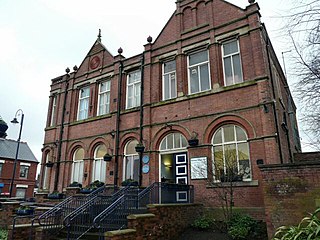
Stalybridge is a town in Tameside, Greater Manchester, England, with a population of 23,731 at the 2011 Census. Historically part of Cheshire, it is 8 miles (12.9 km) east of Manchester city centre and 6 miles (9.7 km) north-west of Glossop.

Mottram in Longdendale is a village in Tameside, Greater Manchester, England. At the 2011 census, the population for the ward of Longdendale, which includes Mottram and the surrounding area, was 9,950.
Denton is a town in Tameside, Greater Manchester, England, five miles (8 km) east of Manchester city centre. Historically part of Lancashire, it had a population of 36,591 at the 2011 Census.

Ashton-under-Lyne is a market town in Tameside, Greater Manchester, England. The population was 45,198 at the 2011 census. Historically in Lancashire, it is on the north bank of the River Tame, in the foothills of the Pennines, 6.2 miles (10.0 km) east of Manchester.

Dukinfield is a town in Tameside, Greater Manchester, England, on the south bank of the River Tame opposite Ashton-under-Lyne, 6.3 miles (10.1 km) east of Manchester. At the 2011 Census, it had a population of 19,306.
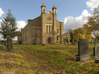
Hyde is a town in Tameside, Greater Manchester, England, which had a population of 34,003 in 2011.

Audenshaw is a market town in Tameside, Greater Manchester, England, 4.9 miles (7.9 km) east of Manchester. Historically part of Lancashire, in 2011 it had a population of 11,419.
Mossley (/ˈmɒzli/) is a town and civil parish in Tameside, Greater Manchester, England, in the upper Tame Valley and the foothills of the Pennines, 3 miles (4.8 km) southeast of Oldham and 8.9 miles (14.3 km) east of Manchester.

Droylsden is a suburban town in Tameside, Greater Manchester, England, 4.1 miles (6.6 km) east of Manchester city centre and 2.2 miles (3.5 km) west of Ashton-under-Lyne, with a population at the 2011 Census of 22,689.
Hale is a suburb and electoral ward within the Metropolitan Borough of Trafford, in Greater Manchester, England. The population of the village taken at the 2011 Census was 15,315. It is contiguous with the southeast of Altrincham, about 9 mi (14 km) southwest of the city of Manchester.
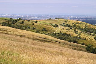
Werneth Low is a hill in Greater Manchester, England, and a part of the Pennines. It is located on the borders of Stockport and Tameside, rising to a height of 279 metres (915 ft). The villages of Woodley, Greave, Gee Cross, Mottram and Romiley lie on the sides of the low.

Ashton upon Mersey is an area of the Metropolitan Borough of Trafford, Greater Manchester, England, with a population of 9,693 at the 2011 census. It lies on the south bank of the River Mersey, 5 miles (8.0 km) south of Manchester city centre.

Godley railway station serves the Godley area of Hyde, Tameside, Greater Manchester, England. It is 8+1⁄2 miles (13.7 km) east of Manchester Piccadilly on the Manchester-Glossop Line.
Park Bridge is an area of Ashton-under-Lyne, in the Metropolitan Borough of Tameside, in Greater Manchester, England. It is situated in the Medlock Valley, by Ashton-under-Lyne's border with Oldham. Park Bridge anciently lay within medieval manor of Ashton, however there is no record of Park Bridge until the 17th century. The name is probably a reference to the medieval Lyme Park, in the north west of the manor of Ashton. For nearly two hundred years from the 18th to the 20th centuries it was the site of the Park Bridge Ironworks.

Nico Ditch is a six-mile (9.7 km) long linear earthwork between Ashton-under-Lyne and Stretford in Greater Manchester, England. It was dug as a defensive fortification, or possibly a boundary marker, between the 5th and 11th century.
Newton is an area of Hyde, Greater Manchester, England, which occupies a narrow strip of land from the River Tame near Newton Hall to Matley, between Hyde and Dukinfield.
There is evidence of activity around Reddish – a settlement in Greater Manchester, England – before the Norman conquest in the presence of Nico Ditch and some Saxon coins. The recorded history of Reddish begins at the turn of the 13th century when it was documented as "Redich". Reddish remained a predominantly rural settlement throughout the medieval period, but expanded to become a mixed industrial and residential area during the 19th century. It developed rapidly during the Industrial Revolution, and still retains landmarks from that period, such as Houldsworth Mill.

There are 48 Grade I listed buildings in Greater Manchester, England. In the United Kingdom, the term listed building refers to a building or other structure officially designated as being of special architectural, historical or cultural significance; Grade I structures are those considered to be "buildings of exceptional interest". In England, the authority for listing under the Planning Act 1990 rests with Historic England, a non-departmental public body sponsored by the Department for Culture, Media and Sport.

