
Greater Manchester is a ceremonial county in North West England. It borders Lancashire to the north, Derbyshire and West Yorkshire to the east, Cheshire to the south, and Merseyside to the west. Its largest settlement is the city of Manchester.

The Leeds and Liverpool Canal is a canal in Northern England, linking the cities of Leeds and Liverpool.

The Manchester Bolton & Bury Canal is a disused canal in Greater Manchester, England, built to link Bolton and Bury with Manchester. The canal, when fully opened, was 15 miles 1 furlong (24 km) long. It was accessed via a junction with the River Irwell in Salford. Seventeen locks were required to climb to the summit as it passed through Pendleton, heading northwest to Prestolee before it split northwest to Bolton and northeast to Bury. Between Bolton and Bury the canal was level and required no locks. Six aqueducts were built to allow the canal to cross the rivers Irwell and Tonge and several minor roads.

The River Etherow is a river in northern England, and a tributary of the River Goyt. Although now passing through South Yorkshire, Derbyshire and Greater Manchester, it historically formed the ancient county boundary between Cheshire and Derbyshire. The upper valley is known as Longdendale. The river has a watershed of approximately 30 square miles (78 km2), and the area an annual rainfall of 52.5 inches (1,330 mm).

The River Tame flows through Greater Manchester, England. It rises on Denshaw Moor and flows to Stockport where it joins the River Goyt to form the River Mersey.

Rochdale is a town in Greater Manchester, England, and the administrative centre of the Metropolitan Borough of Rochdale. In the 2021 census the town had a population of 111,261, compared to 223,773 for the wider borough. Rochdale is in the foothills of the South Pennines and lies in the dale (valley) of the River Roch, 5 miles (8 km) northwest of Oldham, and 10 miles (16 km) northeast of Manchester.

The West Pennine Moors is an area of the Pennines covering approximately 90 square miles (230 km2) of moorland and reservoirs in Lancashire and Greater Manchester, England. It is a Site of Special Scientific Interest.
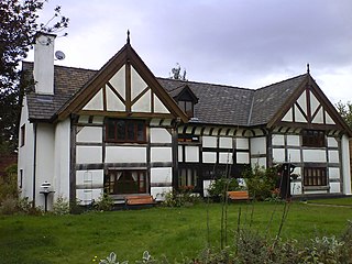
Kersal is a suburb and district of Salford in Greater Manchester, England, 3 miles (4.8 km) northwest of Manchester and is part of the historic county of Lancashire.

The transport infrastructure of Greater Manchester is built up of numerous transport modes and forms an integral part of the structure of Greater Manchester and North West England – the most populated region outside of South East England which had approximately 301 million annual passenger journeys using either buses, planes, trains or trams in 2014. Its position as a national city of commerce, education and cultural importance means the city has one of the largest and most thorough transport infrastructures which is heavily relied upon by its 2.8 million inhabitants in the Greater Manchester conurbation and further afield in the North West region. Public transport comes under the jurisdiction of Transport for Greater Manchester.

The Manchester and Salford Junction Canal was a canal in the city of Manchester. It was originally built to provide a direct waterway between the Mersey and Irwell Navigation and the Rochdale Canal. The canal opened in 1839 and was abandoned in 1922.

The geography of Greater Manchester is dominated by one of the United Kingdom's largest metropolitan areas, and in this capacity the landlocked metropolitan county constitutes one of the most urbanised and densely populated areas of the country. There is a mix of high density urban areas, suburbs, semi-rural and rural locations in Greater Manchester, but overwhelmingly the land use in the county is urban.
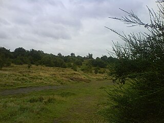
Kersal Moor is a recreation area in Kersal, Greater Manchester, England which consists of eight hectares of moorland bounded by Moor Lane, Heathlands Road, St. Paul's Churchyard and Singleton Brook.

Drinkwater Park is situated in the Irwell Valley on the western border of Prestwich, near Manchester, bounded by the River Irwell to the west, Agecroft Road and Rainsough Brow (A6044) to the south, Butterstile Lane and Carr Clough estate to the east and Bunkers Hill to the north. The park is administered by Forestry England and is part of Prestwich Forest Park, which also incorporates Philips Park, Mere Clough, Prestwich Clough, Forest Bank Park in Pendlebury and Waterdale Meadow.

The Haslingden Canal was a proposed canal link between the Bury arm of the Manchester Bolton & Bury Canal in Greater Manchester, England, and the Leeds and Liverpool Canal in Accrington, England, passing through Haslingden. 53°42′N2°18′W Authorised by an Act of Parliament in 1794, the canal was not built.

Between 1901 and 1949 Manchester Corporation Tramways was the municipal operator of electric tram services in Manchester, England. At its peak in 1928, the organisation carried 328 million passengers on 953 trams, via 46 routes, along 292 miles (470 km) of track.

The Hulme Locks Branch Canal is a canal in the city of Manchester. It is 200m in length and was built to provide a direct waterway between the Mersey and Irwell Navigation and the Bridgewater Canal. The canal opened in 1838 and was superseded in 1995 by a new lock at Pomona Dock 3. As both of its locks remain closed, the canal is now overgrown.


