List of castles in Greater Manchester

Last updated

Map of Greater Manchester with the locations of castles:
.mw-parser-output .div-col{margin-top:0.3em;column-width:30em}.mw-parser-output .div-col-small{font-size:90%}.mw-parser-output .div-col-rules{column-rule:1px solid #aaa}.mw-parser-output .div-col dl,.mw-parser-output .div-col ol,.mw-parser-output .div-col ul{margin-top:0}.mw-parser-output .div-col li,.mw-parser-output .div-col dd{page-break-inside:avoid;break-inside:avoid-column}
Buckton Castle
Bury Castle
Dunham Castle
Manchester Castle
Radcliffe Tower
Rochdale Castle
Stockport Castle
Ullerwood Castle
Watch Hill Castle Castles in Greater Manchester.jpg
Map of Greater Manchester with the locations of castles:
Radcliffe Tower is one of three fortified manor houses in Greater Manchester. Radcliffe tower hdr.jpg
Radcliffe Tower is one of three fortified manor houses in Greater Manchester.

There are nine castles in Greater Manchester, a metropolitan county in North West England. They consist of four motte-and-bailey castles, three fortified manor houses, an enclosure castle, and a possible shell keep. A motte-and-bailey castle is characterised by two elements: the motte is an artificial mound with a wooden stockade and stronghold on top, usually a stone keep or tower, [1] while the bailey is a defended enclosure adjacent to the motte, typically enclosed by a ditch and a bank topped by a timber palisade or stone wall. [2] Motte-and-bailey castles were the most common type of castle in England following the Norman Conquest. [3] A shell keep was a motte with a stone wall rather than a wooden stockade on top; there would have been no tower within the walls. [4] Four of Greater Manchester's castles are scheduled monuments: Buckton, Bury, Radcliffe Tower, and Watch Hill. A scheduled monument is a "nationally important" archaeological site or historic building, given protection against unauthorised change. [5]

Contents

The purpose of a castle was not simply militaristic, but was also considered to be a stamp of authority over the population of an area and a status symbol. Some would have acted as centres of trade and administration for a manor. [6] The earliest castles in Greater Manchester are Dunham Castle and Watch Hill Castle in Trafford, Ullerwood Castle in Manchester, and Stockport Castle in Stockport. Dunham, Ullerwood, and Stockport castles were first recorded in 1173 as belonging to barons who had rebelled against Henry II, [7] and Watch Hill likely dates from this period; and at least three were motte-and-bailey castles, probably because of the speed and ease with which they could be erected. [8] Hamon de Massey, who owned the Trafford castles and Ullerwood, and Geoffrey de Constentyn, who owned Stockport Castle, were two of the three rebels from Cheshire; the other was the Earl of Chester, the owner of Chester Castle. [7]

Castles continued to be built in the area, although the last to be built in Greater Manchester were two fortified manor houses near Bury, built more for comfort than as utilitarian military structures. Bury Castle and Radcliffe Tower followed the national trend in the 13th century; they would most likely have acted as the centre of the manor they served. [9]

List of castles

See also

Related Research Articles

<span class="mw-page-title-main">Tameside</span> Borough in Greater Manchester, England

Tameside is a metropolitan borough of Greater Manchester, England, named after the River Tame, which flows through it, and includes the towns of Ashton-under-Lyne, Audenshaw, Denton, Droylsden, Dukinfield, Hyde, Mossley and Stalybridge. Tameside is bordered by the metropolitan boroughs of Stockport to the south, Oldham to the north and northeast, Manchester to the west, and to the east by the Borough of High Peak in Derbyshire. As of 2021, the population of Tameside was 231,199, making it the 8th-most populous borough of Greater Manchester by population.

<span class="mw-page-title-main">Stalybridge</span> Town in Greater Manchester, England

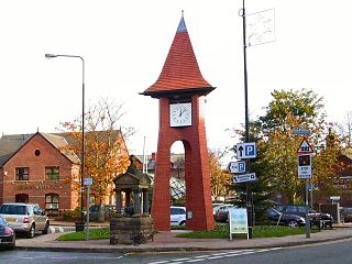
Stalybridge is a town in Tameside, Greater Manchester, England, with a population of 23,731 at the 2011 Census.

<span class="mw-page-title-main">Altrincham</span> Town in Greater Manchester, England

Altrincham is a market town in Trafford, Greater Manchester, England, south of the River Mersey. It is 8 miles (13 km) southwest of Manchester, 3 miles (5 km) southwest of Sale and 10 miles (16 km) east of Warrington. At the 2011 census, it had a population of 52,419.

<span class="mw-page-title-main">Trafford</span> Borough in Greater Manchester, England

Trafford is a metropolitan borough of Greater Manchester, England, with an estimated population of 235,546 in 2021. It covers 106 square kilometres (41 sq mi) and includes the area of Old Trafford and the towns of Altrincham, Stretford, Urmston, Partington and Sale. The borough was formed in 1974 as a merger of six former districts and part of a seventh. The River Mersey flows through the borough, separating North Trafford from South Trafford, and the historic counties of Lancashire and Cheshire. Trafford is the seventh-most populous district in Greater Manchester.

<span class="mw-page-title-main">Hale, Greater Manchester</span> Human settlement in England

Hale is a suburb and electoral ward within the Metropolitan Borough of Trafford, in Greater Manchester, England. The population of the village taken at the 2011 census was 15,315. It is contiguous with the southeast of Altrincham, about 9 mi (14 km) southwest of the city of Manchester.

<span class="mw-page-title-main">Warburton, Greater Manchester</span> Human settlement in England

Warburton is a village and civil parish within the Metropolitan Borough of Trafford in Greater Manchester, England. Historically in Cheshire, Warburton lies on the south bank of the River Mersey between the borough of Warrington and Greater Manchester. In the 21st century, the village remains predominantly rural. Altrincham is the nearest town. According to the 2001 census, the parish had a population of 286.

<span class="mw-page-title-main">Bowdon, Greater Manchester</span> Suburb in Trafford, England

Bowdon is a suburb of Altrincham and electoral ward in the Metropolitan Borough of Trafford, Greater Manchester, England.

Buckton Castle was a medieval enclosure castle near Carrbrook in Stalybridge, Greater Manchester, England. It was surrounded by a 2.8-metre-wide (9 ft) stone curtain wall and a ditch 10 metres (33 ft) wide by 6 metres (20 ft) deep. Buckton is one of the earliest stone castles in North West England and only survives as buried remains overgrown with heather and peat. It was most likely built and demolished in the 12th century. The earliest surviving record of the site dates from 1360, by which time it was lying derelict. The few finds retrieved during archaeological investigations indicate that Buckton Castle may not have been completed.

<span class="mw-page-title-main">Nico Ditch</span> Earthwork in England

Nico Ditch is a six-mile (9.7 km) long linear earthwork between Ashton-under-Lyne and Stretford in Greater Manchester, England. It was dug as a defensive fortification, or possibly a boundary marker, between the 5th and 11th century.

Watch Hill Castle is a medieval motte-and-bailey on the boundary of Bowdon and Dunham Massey, Greater Manchester, England. It is a scheduled monument. The castle is located north of the River Bollin and south of a deep ravine.

<span class="mw-page-title-main">Dunham Castle</span> Medieval castle in Greater Manchester, England

Dunham Castle is an early medieval castle in Dunham Massey, Greater Manchester, England.

Ullerwood Castle is an early medieval castle, possibly a shell keep, in Ringway, Manchester, England. The castle is first referred to in 1173, in a document stating Hamon de Masci held the castles of Ullerwood and Dunham. There is no other contemporary documented reference to the castle. Ullerwood Castle has been confused with Watch Hill Castle in nearby Bowdon, but the two are separate castles, though both probably owned by de Masci. The site is underneath a house and surrounded by trees. ° It is possible that the site of the castle is at the top of Castle Hill at 53°20'57"N, 2°17'32"W. Examination of aerial views of the location on Google Earth indicates a circular structure with less well defined adjacent structures to the South East. The site is very close to a runway at Manchester Airport and lies within a restricted area.

<span class="mw-page-title-main">Scheduled monuments in Greater Manchester</span>

There are 37 scheduled monuments in Greater Manchester, a metropolitan county in North West England. In the United Kingdom, a scheduled monument is a "nationally important" archaeological site or historic building that has been given protection against unauthorised change by being placed on a list by the Secretary of State for Digital Culture, Media and Sport; Historic England recommends sites for scheduling to the Secretary of State. Scheduled monuments are defined in the Ancient Monuments and Archaeological Areas Act 1979 and the National Heritage Act 1983. There are nearly 20,000 entries on the schedule, which is maintained by Historic England as part of the National Heritage List for England; more than one site can be included in a single entry. While a scheduled monument can also be recognised as a listed building, Historic England's aim is to set the most appropriate form of protection in place for the building or site. Applications to deschedule a site are administered Historic England, who will carry out an assessment and make a recommendation to the Secretary of State.

Stockport Castle was a promontory castle in Stockport, Greater Manchester, England. The castle was in the medieval town, overlooking a ford over the River Mersey. It was first documented in 1173, but the next mention of it is in 1535 when it was in ruins. What remained of the castle was demolished in 1775.

Mellor hill fort is a prehistoric site in North West England, that dates from the British Iron Age—about 800 BC to 100 AD. Situated on a hill in Mellor, Greater Manchester, on the western edge of the Peak District, the hill fort overlooks the Cheshire Plain. Although the settlement was founded during the Iron Age, evidence exists of activity on the site as far back as 8,000 BC; during the Bronze Age the hill may have been an area where funerary practices were performed. Artefacts such as a Bronze Age amber necklace indicate the site was high status and that its residents took part in long-distance trade. The settlement was occupied into the Roman period. After the site was abandoned, probably in the 4th century, it was forgotten until its rediscovery in the 1990s.

<span class="mw-page-title-main">Grade I listed buildings in Greater Manchester</span>

There are 48 Grade I listed buildings in Greater Manchester, England. In the United Kingdom, the term listed building refers to a building or other structure officially designated as being of special architectural, historical or cultural significance; Grade I structures are those considered to be "buildings of exceptional interest". In England, the authority for listing under the Planning Act 1990 rests with Historic England, a non-departmental public body sponsored by the Department for Culture, Media and Sport.

References

Notes

  1. Friar (2003), p. 54, 214.
  2. Friar (2003), p. 22.
  3. Rowley (1997), p. 71.
  4. Friar (2003), p. 259.
  5. "Scheduled Monuments". PastScape. Retrieved 27 July 2011.
  6. Friar (2003), p. 186, 193.
  7. 1 2 Arrowsmith (1997), p. 31.
  8. 1 2 3 4 5 6 7 8 9 Redhead (1997), pp. 34–35
  9. Friar (2003), p. 186–7.
  10. 1 2 3 4 5 6 Nevell (1998), pp. 60–61, 63.
  11. Grimsditch, Nevell, and Redhead (2007), p. 7.
  12. Grimsditch, Nevell & Nevell (2012), pp.  8285.
  13. P. Booth, M. Harrop & S. Harrop (1976–1978). The Extent of Longdendale, 1360. Cheshire Sheaf, 5th series, #83.
  14. Grimsditch, Nevell, and Redhead (2007), p. 16.
  15. Grimsditch, Nevell, and Redhead (2007), p. 5.
  16. 1 2 3 4 5 Historic England. "Bury Castle (45189)". Research records (formerly PastScape). Retrieved 4 January 2008.
  17. 1 2 "Bury Castle". Eduweb.co.uk. Archived from the original on 24 June 2007. Retrieved 4 January 2008.
  18. 1 2 Ashworth (1999)
  19. 1 2 3 Nevell (1997), p. 33.
  20. 1 2 "Dunham Massey". The Gatehouse – the comprehensive gazetteer of the medieval fortifications and castles of England and Wales. Retrieved 18 March 2008.
  21. Historic England. "Dunham Castle (74865)". Research records (formerly PastScape). Retrieved 26 February 2008.
  22. 1 2 3 Historic England. "Manchester Castle (1386094)". Research records (formerly PastScape). Retrieved 20 January 2008.
  23. 1 2 "Manchester Castle". The Gatehouse – the comprehensive gazetteer of the medieval fortifications and castles of England and Wales. Retrieved 18 March 2008.
  24. 1 2 Newman (2006), p. 141.
  25. Kidd (1996), p. 13.
  26. 1 2 3 4 5 6 7 Historic England. "Radcliffe Tower (44210)". Research records (formerly PastScape). Retrieved 5 January 2008.
  27. 1 2 Historic England. "Radcliffe Tower (1309271)". National Heritage List for England . Retrieved 5 January 2008.
  28. 1 2 3 4 5 Historic England. "Rochdale Castle (45159)". Research records (formerly PastScape). Retrieved 10 January 2008.
  29. 1 2 Newman (2006), p. 140.
  30. 1 2 3 4 5 6 Historic England. "Stockport Castle (1085399)". Research records (formerly PastScape). Retrieved 5 January 2008.
  31. Dent (1977), p. 1.
  32. Arrowsmith (1997), p. 32.
  33. Dent (1977), p. 4.
  34. 1 2 Historic England. "Ullersford Castle (76615)". Research records (formerly PastScape). Retrieved 21 March 2008.
  35. 1 2 3 Historic England, "Watch Hill motte and bailey castle, 450m south of Streethead Farm (1014377)", National Heritage List for England , retrieved 26 August 2022

Bibliography

  • Arrowsmith, Peter (1997). Stockport: A History. Stockport: Stockport MBC Community Services Division, and Stockport Libraries, in association with the University of Manchester Archaeological Unit. ISBN   0-905164-99-7.
  • Ashworth, Terry (Summer 1999). "The Rediscovery of Bury Castle". Bury Local History Society Journal.
  • Dent, J.S. (1977). "Recent Excavations on the site of Stockport Castle". Transactions of the Lancashire and Cheshire Antiquarian Society. 79: 1–13.
  • Friar, Stephen (2003). The Sutton Companion to Castles. Stroud: Sutton Publishing. ISBN   978-0-7509-3994-2.
  • Brian Grimsditch; Mike Nevell & Norman Redhead (September 2007). Buckton Castle: An Archaeological Evaluation of a Medieval Ringwork – an Interim Report. University of Manchester Archaeological Unit.
  • Grimsditch, Brian; Nevell, Michael; Nevell, Richard (2012), Buckton Castle and the Castles of North West England, University of Salford Archaeological Monographs volume 2 and the Archaeology of Tameside volume 9, Centre for Applied Archaeology, School of the Built Environment, University of Salford, ISBN   978-0-9565947-2-3
  • Kidd, Alan (1996). Manchester. Keele: Keele University Press. ISBN   1-85331-028-X.
  • Nevell, Mike (1998). Lands and Lordships in Tameside. Tameside Metropolitan Borough Council with the University of Manchester Archaeological Unit. ISBN   1-871324-18-1.
  • Nevell, Mike (1997). The Archaeology of Trafford. Trafford Metropolitan Borough Council with the University of Manchester Archaeological Unit. ISBN   1-870695-25-9.
  • Newman, Caron (2006). "Medieval Period Resource Assessment". Archaeology North West. 8: 115–144. ISSN   0962-4201.
  • Redhead, Norman (1997). "Watch Hill Castle". The Archaeology of Trafford. Trafford Metropolitan Borough with University of Manchester Archaeological Unit. pp. 34–35. ISBN   1-870695-25-9.
  • Rowley, Trevor (1997). Norman England. Batsford and English Heritage. ISBN   0-7134-8060-2.

Further reading