Groveland, New York

Last updated

Groveland, New York
USA New York location map.svg
Red pog.svg
Groveland
Location within the state of New York
Usa edcp location map.svg
Red pog.svg
Groveland
Groveland (the United States)
Coordinates: 42°39′53″N77°46′11″W / 42.66472°N 77.76972°W / 42.66472; -77.76972
Country United States
State New York
County Livingston
Settled1792 [ citation needed ]
Incorporated1789 [ citation needed ]
Government
  Type Town Council
   Town Supervisor William E. Carman (R)
   Town Council
Members' List
Area
[1]
  Total39.86 sq mi (103.24 km2)
  Land39.13 sq mi (101.36 km2)
  Water0.72 sq mi (1.88 km2)
Elevation
1,053 ft (321 m)
Population
 (2010)
  Total3,249
  Estimate 
(2016) [2]
3,361
  Density85.88/sq mi (33.16/km2)
Time zone UTC-5 (EDT)
  Summer (DST) UTC-4 (EDT)
ZIP codes
14462, 14545
Area code 585
FIPS code 36-051-31016
GNIS feature ID0979029
Website grovelandny.org

Groveland is a town in Livingston County, New York, United States. The population was 3,249 at the 2010 census. [3] The town is centrally located in the county, south of Geneseo.

Contents

History

The Sullivan Expedition (1779) reached its farthest extent here. Groveland was the site of the Boyd and Parker ambush.

In 1792, the first planned European American settlement in Livingston County was located in Groveland and was called "Willamsburgh" after Sir William Pulteney, a land speculator. The town was formed in 1789 as part of Ontario County, later becoming part of Livingston County when it was formed in 1821. Part of Groveland was used to form part of the town of Conesus (1819).

The Groveland Shaker Village settlement was established in 1836 on a 1,700-acre (690 ha) farm at the hamlet of Sonyea. Their peak in population was 148 members that year, when they moved from their former location at Sodus. The Shakers sold the Sonyea property in 1892 due to declining membership, and moved to Watervliet. [4] Their former buildings and land became the Craig Colony for Epileptics [5] in 1896 and are now part of the Groveland Correctional Facility.

The Claud No. 1 Archeological Site was added to the National Register of Historic Places in 1975. [6] The Boyd & Parker Park and Groveland Ambuscade were also listed on the National Register in 2009.

Notable people

Geography

According to the United States Census Bureau, the town has a total area of 39.8 square miles (103.2 km2), of which 39.2 square miles (101.4 km2) are land and 0.73 square miles (1.9 km2), or 1.82%, are water. [9] Conesus Lake, one of the Finger Lakes, forms part of the eastern boundary. Canaseraga Creek, a north-flowing tributary of the Genesee River, crosses the southwest part of the town through a broad valley.

Groveland Town Hall Groveland Town Hall; Groveland, NY.JPG
Groveland Town Hall

Interstate 390 passes north-to-south through the town. New York State Route 36, New York State Route 63, and New York State Route 256 are north-south highways through the town. New York State Route 408 is a highway terminating in the western part of the town at NY-63.

Groveland is on the Rochester-to-Dansville line of the Rochester & Southern Railroad. From 1882–1963, Groveland was on the Main Line of the Delaware, Lackawanna and Western Railroad (DL&W) and successor Erie Lackawanna Railroad. In 1963, the Main Line over Dansville Hill from Groveland to Wayland was abandoned by order of the Interstate Commerce Commission upon application by the Erie Lackawanna Railroad, which had secured much lesser grades on the former Erie Railroad via Hornell. The portion of today's R&S line west and north of Groveland was originally part of the DL&W, while the portion between Groveland and Dansville was part of the Dansville and Mount Morris Railroad and predecessors.

Adjacent towns and areas

(Clockwise)

Demographics

Historical population
CensusPop.Note
1820 1,273
1830 1,70333.8%
1840 2,00017.4%
1850 1,724−13.8%
1860 1,565−9.2%
1870 1,455−7.0%
1880 1,342−7.8%
1890 1,307−2.6%
1900 1,94949.1%
1910 2,82044.7%
1920 2,9203.5%
1930 3,29512.8%
1940 4,13525.5%
1950 3,381−18.2%
1960 3,373−0.2%
1970 3,004−10.9%
1980 2,140−28.8%
1990 3,19049.1%
2000 3,85320.8%
2010 3,249−15.7%
2016 (est.)3,361 [2] 3.4%
U.S. Decennial Census [10]

As of the census [11] of 2000, there were 3,853 people, 555 households, and 396 families residing in the town. The population density was 98.4 inhabitants per square mile (38.0/km2). There were 649 housing units at an average density of 16.6 per square mile (6.4/km2). The racial makeup of the town was 60.06% White, 32.44% African American, 0.26% Native American, 0.18% Asian, 6.46% from other races, and 0.60% from two or more races. Hispanic or Latino of any race were 15.23% of the population.

There were 555 households, out of which 33.0% had children under the age of 18 living with them, 59.8% were married couples living together, 6.7% had a female householder, and 28.6% were non-families. 20.9% of all households were made up of individuals, and 7.0% had someone living alone who was 65 years of age or older. The average household size was 2.63 and the average family size was 3.04.

In the town, the population was spread out, with 9.9% under the age of 18, 10.4% from 18 to 24, 54.2% from 25 to 44, 20.4% from 45 to 64, and 5.1% who were 65 years of age or older. The median age was 36 years. For every 100 females, there were 411.0 males. For every 100 females age 18 and over, there were 529.9 males.

The median income for a household in the town was $46,797, and the median income for a family was $48,828. Males had a median income of $24,353 versus $26,477 for females. The per capita income for the town was $13,433. About 7.7% of families and 8.8% of the population were below the poverty line, including 12.8% of those under age 18 and 1.2% of those age 65 or over.

Communities and locations in the Town of Groveland

All of the hamlets listed on the shore of Conesus Lake are part of the Conesus Lake census-designated place.

Related Research Articles

<span class="mw-page-title-main">Livingston County, New York</span> County in New York, United States

Livingston County is a county in the U.S. state of New York. As of the 2020 census, the population was 61,834. Its county seat is Geneseo. The county is named after Robert R. Livingston, who helped draft the Declaration of Independence and negotiated the Louisiana Purchase. The county is part of the Finger Lakes region of the state.

<span class="mw-page-title-main">Scipio, New York</span> Town in New York, United States

Scipio is a town in Cayuga County, New York, United States. The population was 1,713 at the 2010 census. Scipio is centrally located in the southern half of the county, south of Auburn.

<span class="mw-page-title-main">Alexandria, New York</span> Town in New York, United States

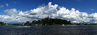
Alexandria is a town in the Thousand Islands region of the U.S. state of New York, within Jefferson County. The town's population was 3,741 at the 2020 United States Census. The town is named after Alexander LeRay, the son of an early developer. The village of Alexandria Bay is within the town.

Conesus is a town in Livingston County, New York, United States. The population was 2,473 at the 2010 census. The name is derived from a native word meaning "berry place".

Sparta is a town in Livingston County, New York, United States. The population was 1,624 at the 2010 census. Sparta is in the southeast part of the county and is north of Dansville.

Springwater is a town in Livingston County, New York, United States. The population was 2,439 at the 2010 census. Springwater is in the southeast part of the county.

West Sparta is a town in Livingston County, New York, United States. The population was 1,255 at the 2010 census. The name is derived from the neighboring town of Sparta.

Campbell is a town in Steuben County, New York, United States. The population was 3,163 at the 2020 census. The name is from Robert Campbell, an early landowner. The town is centrally located in the county and is northwest of Corning.

Dansville is a town in Steuben County, New York, United States, not to be confused with the nearby village of Dansville in Livingston County. The population was 1,842 at the 2010 census. The town was named after Daniel Faulkner.

<span class="mw-page-title-main">Ontario, New York</span> Town in Wayne County, New York, US

Ontario is a town in the northwest corner of Wayne County, New York, United States. The population was 9,778 at the 2000 census, and 10,136 at the 2010 census. The town is named after the Great Lake on its northern border.

<span class="mw-page-title-main">Milo, New York</span> Town in New York, United States

Milo is a town in Yates County, New York, United States. The population was 7,006 at the 2010 census. The town was named after Milo of Croton, a famous athlete from Ancient Greece.

Avon is a town in Livingston County, New York, United States. It is south of Rochester. The town population was 7,146 at the 2010 census. The town was named after the River Avon in England. The village of Avon is in the northwest part of the town.

Livonia is a town in Livingston County, New York, United States. As of the 2010 census, the town population was 7,809. The town contains a village also named Livonia. The town is on the eastern border of the county.

Mount Morris is a village in the town of Mount Morris in Livingston County, New York, United States. The village population was 2,986 at the 2010 census, out of 4,465 in the entire town. The village and town are named after Robert Morris.

Cohocton is a town in Steuben County, New York, United States. The population was 2,268 at the 2020 census. The town contains a village, also called Cohocton and is located in the northwestern part of the county.

Wayland is a town in Steuben County, New York, United States. The population was 3,733 at the 2020 census.

<span class="mw-page-title-main">Owego, New York</span> Town in Tioga County, New York, US

Owego is a town in Tioga County, New York, United States. The population was 18,728 at the 2020 census. The name is derived from the Iroquois word Ahwaga, meaning "where the valley widens".

<span class="mw-page-title-main">Geneseo, New York</span> Town

Geneseo is a town in Livingston County in the Finger Lakes region of New York, United States. It is at the south end of the five-county Rochester Metropolitan Area. The population of the town was 10,483 at the 2010 census.

<span class="mw-page-title-main">New York State Route 256</span> State highway in Livingston County, New York, US

New York State Route 256 (NY 256) is a north–south state highway located within Livingston County, New York, in the United States. It extends for 21.08 miles (33.92 km) across mostly rural terrain from an intersection with NY 63 in the village of Dansville to a junction with NY 15 on the Geneseo–Livonia town line. The northern half of NY 256, named West Lake Road, passes along the western shore of Conesus Lake. NY 256 was assigned as part of the 1930 renumbering of state highways in New York to an alignment extending from Groveland to modern U.S. Route 20A (US 20A) west of Lakeville. It was extended north to its current northern terminus c. 1940 and south to Dansville in stages during the 1930s and 1940s.

Scottsburg is a hamlet and census-designated place (CDP) in Livingston County, New York, United States. Its population was 117 as of the 2010 census. New York State Route 256 passes through the community.

References

  1. "2016 U.S. Gazetteer Files". United States Census Bureau. Retrieved July 5, 2017.
  2. 1 2 "Population and Housing Unit Estimates" . Retrieved June 9, 2017.
  3. "Total Population: 2010 Census DEC Summary File 1 (P1), Groveland town, New York". data.census.gov. U.S. Census Bureau. Retrieved June 2, 2020.
  4. Stephen J. Paterwic, Historical Dictionary of the Shakers, 2d. ed., (2017), 141.
  5. Trompeter, Grace (2012). "New York's Craig Colony for Epileptics tracing the deepest roots of deinstitutionalization" (PDF). Middle States Geographer. 45: 76–83. Archived from the original (PDF) on December 8, 2015. Retrieved December 3, 2015.
  6. 1 2 3 4 "National Register Information System". National Register of Historic Places . National Park Service. March 13, 2009.
  7. "Charles A. Goheen". Archived from the original on July 14, 2014. Retrieved July 1, 2014.
  8. "Daniel Armer Kelly". Archived from the original on August 8, 2014. Retrieved August 2, 2014.
  9. "U.S. Gazetteer Files: 2019: Places: New York". U.S. Census Bureau Geography Division. Retrieved June 2, 2020.
  10. "Census of Population and Housing". Census.gov. Retrieved June 4, 2015.
  11. "U.S. Census website". United States Census Bureau . Retrieved January 31, 2008.
  12. Beauchamp, William Martin (1907). Aboriginal Place Names of New York. New York State Education Department. p. 109. ISBN   9781404751552.

42°39′53″N77°46′11″W / 42.66472°N 77.76972°W / 42.66472; -77.76972