
Bulawayo is the second largest city in Zimbabwe, and the largest city in the country's Matabeleland region. The city's population is disputed; the 2022 census listed it at 665,940, while the Bulawayo City Council claimed it to be about 1.2 million. Bulawayo covers an area of 546 square kilometres in the western part of the country, along the Matsheumhlope River. Along with the capital Harare, Bulawayo is one of two cities in Zimbabwe that are also provinces.

Matabeleland North is a province in western Zimbabwe. With a population of 827,645 as of the 2022 census, it is the country's second-least populous province, after Matabeleland South, and is the country's least densely populated province. Matabeleland North and Matabeleland South were established in 1974, when the original Matabeleland Province was bifurcated. In 1997, the province lost territory when the city of Bulawayo became a province in its own right. Matabeleland North is divided into seven districts. Its capital is Lupane, and Victoria Falls and Hwange its largest towns. The name "Matabeleland" is derived from the Matabele or Ndebele people, the province's largest ethnic group.

Matabeleland South is a province in southwestern Zimbabwe. With a population of 683,893 as of the 2012 Zimbabwean census, it is the country's least populous province. After Matabeleland North, it is Zimbabwe's second-least densely populated province. Matabeleland South and Matabeleland North were established in 1974, when the original Matabeleland Province was bifurcated. The province is divided into six districts. Gwanda is the capital, and Beitbridge is the province's largest town. The name "Matabeleland" is derived from Ndebele, the province's largest ethnic group.

Gweru, originally known as Gwelo, is a city in central Zimbabwe. It is on the centre of Midlands Province. Originally an area known to the Ndebele as "The Steep Place" because of the Gweru River's high banks, in 1894 it became the site of a military outpost established by Leander Starr Jameson. In 1914 it attained municipal status, and in 1971 it became a city.

Matabeleland is a region located in southwestern Zimbabwe that is divided into three provinces: Matabeleland North, Bulawayo, and Matabeleland South. These provinces are in the west and south-west of Zimbabwe, between the Limpopo and Zambezi rivers and are further separated from Midlands by the Shangani River in central Zimbabwe. The region is named after its inhabitants, the Ndebele people who were called "Amatabele"(people with long spears – Mzilikazi 's group of people who were escaping the Mfecani wars). Other ethnic groups who inhabit parts of Matabeleland include the Tonga, Bakalanga, Venda, Nambya, Khoisan, Xhosa, Sotho, Tswana, and Tsonga.

Beitbridge is a border town in the province of Matabeleland South, Zimbabwe. The name also refers to the border post and bridge spanning the Limpopo River, which forms the political border between South Africa and Zimbabwe. The border on the South African side of the river is also named Beitbridge.

Insiza District is one of the seven districts located in the Matabeleland South province of Zimbabwe. It is a rural area. Insiza District lies to the South East of Bulawayo and borders Gwanda District to the South, Zvishavane District to the east, and Umzingwane District to the West. The total distance between Insiza and Bulawayo is 77 km and 469 km from Harare. The district is mostly in natural region four. This region experiences fairly low total rainfall (450–650 mm) and is subject to periodic seasonal droughts and severe dry spells during the rainy season. The rainfall is too low and uneven for cash cropping except in certain very favourable localities, where limited drought resistant crops can afford a side-line. The farming system, in accord with natural factors, should be based on livestock production, but it: can be intensified to some extent by the growing of drought resistant fodder crops.
Esigodini, originally known as Essexvale, is a town in the Matabeleland South Province of Zimbabwe. It is the administrative centre for Umzingwane District, one of the seven administrative districts in Matabeleland South. It was originally an estate of Frederick Selous, a British explorer, officer, professional hunter, and conservationist.

West Nicholson or Tshabezi is a town in the Matabeleland South Province of Zimbabwe.
Colleen Bawn is a town in Zimbabwe.
Plumtree is a town in Zimbabwe. Marula trees, wild plum trees grow abundantly in the area. The town was once called Getjenge by baKalanga. Another name by which it is often caled, is Titji, meaning station and referring to the railway station which was operating in the area around 1897.

Filabusi is a town in the Matabeleland South Province of Zimbabwe. The town is the administrative capital of Insiza District and a service centre for the surrounding mining and farming areas.
Brunapeg is a settlement in the Matabeleland South Province of Zimbabwe. It is one of the urban centres in Mangwe District, one of the seven administrative districts in the province.
Mbalabala, originally known as Balla Balla, is a village on the main Beitbridge-Bulawayo road in uMzingwane district(at the junction with the Filabusi Road) in Matabeleland South providence, Zimbabwe. Situated approximately 41 miles (66 km) south-east of the city of Bulawayo. The name is derived from the Ndebele name for the greater kudu ( ibhalabhala). It was originally rendered Balla Balla by Europeans, which was altered to its present name in 1982 by the Zimbabwean government in order to coincide closer with the local orthography.
The A6 is a highway in Zimbabwe running from the Beitbridge border with South Africa, through Gwanda, to Bulawayo. It is part of the R9 Route, which links Beitbridge with Victoria Falls.
Albert Nyathi is a Zimbabwean poet, musician, writer, actor, and philanthropist. Nyathi is particularly famous for the poem and song "Senzeni na?", which he composed following the assassination of Chris Hani. Nyathi is married to Caroline and they have three children together.
The following is a timeline of the history of the city of Bulawayo, Zimbabwe.
Umzingwane is a district in the northern part of Matabeleland South province in Zimbabwe. It was formerly known as Esigodini and before 1982 as Essexvale.
The Colleen Bawn Solar Power Station is a 32 MW (43,000 hp) solar power plant under development in Zimbabwe. The project is owned by Pretoria Portland Cement Limited, who own a cement factory in Colleen Bawn and plan to consume 16 megawatts of the electricity generated and sell the rest to the Zimbabwe national grid.
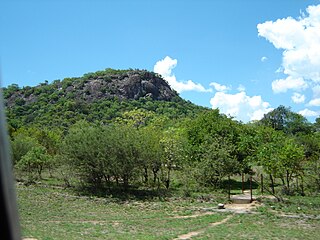
Maphisa is a small town in the Matobo District of the province of Matabeleland South. It also serves as the seat of Matobo Rural District Council and ultimately the district's largest business centre and development node. Three kilometres west of Maphisa is the Bhalagwe mountain on the Maphisa to Matjilotje Road. Maphisa Town's economic activity includes extensive gold mining by both large scale and artisanal miners. There are also many informal miners locally known as 'oTsheketshe'. It also boasts in excess of a 1500 hectare intensive farming under pivot irrigation system. There is also extensive commercial ranching in its precinct. The legendary liberation fighter Joshua Mqabuko Nkomo's home village is 40km South West of Maphisa. The amenities found in Maphisa include a modern hotel, Minda Mission which provides education from primary to Advanced level. There are modern supermarkets, a referral Maphisa Hospital and Hlalani Kuhle suburb. King Mzilikazi's grave and Cecil John Rhodes's grave are 84km and 65km respectively North East of Maphisa. The Matobo national park, a World Heritage Site is located 50km North East of Maphisa. SADC Icrisat is located 70km North East of Maphisa.

