Haubstadt, Indiana

Last updated

Haubstadt, Indiana
Town of Haubstadt
Haubstadt, Indiana.jpg
Haubstadt's town hall
Motto(s): 
"Preserving Our Past, Planning Our Future"
Gibson County Indiana Incorporated and Unincorporated areas Haubstadt Highlighted 1832512.svg
Location of Haubstadt in Gibson County, Indiana.
Coordinates: 38°12′14″N87°34′31″W / 38.20389°N 87.57528°W / 38.20389; -87.57528
Country United States
State Indiana
County Gibson
Township Johnson
Named for Henry Haub
Area
[1]
  Total0.72 sq mi (1.87 km2)
  Land0.71 sq mi (1.85 km2)
  Water0.01 sq mi (0.02 km2)
Elevation
[2]
479 ft (146 m)
Population
 (2020)
  Total1,638
  Density2,297.34/sq mi (886.83/km2)
Time zone UTC-6 (CST)
  Summer (DST) UTC-5 (CDT)
ZIP code
47639
Area code(s) 812, 930
FIPS code 18-32512 [3]
GNIS feature ID2396991 [2]
U.S. Highways US 41.svg
Major State Roads Indiana 68.svg

Haubstadt is the second largest town, after Fort Branch, and fourth largest community in Gibson County, Indiana, United States. The population was 1,638 at the 2020 census. Haubstadt has recently become a bedroom community of Evansville and such, is part of the Evansville, Indiana, Metropolitan Area.

Contents

History

Haubstadt was originally called Haub's Station, and under the latter name, meaning "Haub town" in German, was laid out in 1855. [4] Named after an early settler, Henry Haub, the town was incorporated in 1913. [5]

Haub built the community's first home, combining a stagecoach shop, general store, and trading post to accommodate travelers on the Noon Day Stage Coach route running to Vincennes. A dance hall was later also built above Mr. Haub's tavern and store, and the complex would later become known as The Log Inn, the area's famous restaurant. The Log Inn is officially recognized as the oldest restaurant in Indiana.

The Haubstadt State Bank (now Town Hall) was listed on the National Register of Historic Places in 1984. [6]

Haubstadt Train Wreck of 1990

On June 14, 1990, a train, operated by Jacksonville, Florida-based CSX Transportation, was coming into Haubstadt from the south and around 7:00pm suddenly there was a large crash followed by a lightning-like flash from an electric pole accompanied by a thunderclap and a town-wide power failure. It did not take long for people to realize that a train had de-railed. In the derailment, at least five buildings, most of downtown and much of Haubstadt's history was destroyed in about ten seconds. When it was later learned the train was possibly carrying ammonia, Haubstadt was mostly evacuated, mainly by people with respiratory illnesses such as asthma. It was later found that the ammonia cars were empty and that the smell was residue that was released into the air. It was also discovered that the tracks had not been maintained properly and that a couple of loose ties coupled with the speed at which the trains move through Haubstadt and neighboring Fort Branch (between 55 - 65 mph) were to blame for the accident. There is fear among many in Haubstadt and nearby Fort Branch and Princeton that a worse train wreck may occur as the track's speed limit was increased to 70 mph from Princeton to Darmstadt in 2000.

Geography

According to the 2010 census, Haubstadt has a total area of 0.71 square miles (1.84 km2), of which 0.7 square miles (1.81 km2) (or 98.59%) is land and 0.01 square miles (0.03 km2) (or 1.41%) is water. [7]

Haubstadt has several schools, including Haubstadt Community School (or HCS), Saints Peter and Paul (or Sts. P&P), and Saint James, located approximately 2 miles south of town.

The Haubstadt area has two catholic churches, Saint James and Saints Peter & Paul, both having their own K-8 schools, plus several smaller churches scattered in town or around the surrounding Johnson Township.

Demographics

Historical population
CensusPop.Note
1880 278
1930 674
1940 76213.1%
1950 89417.3%
1960 1,02915.1%
1970 1,17113.8%
1980 1,38918.6%
1990 1,4554.8%
2000 1,5295.1%
2010 1,5773.1%
2020 1,6383.9%
U.S. Decennial Census [8]
Town of Haubstadt, Indiana, 1924 Haubstadt1924.JPG
Town of Haubstadt, Indiana, 1924

2010 census

As of the census [9] of 2010, there were 1,577 people, 667 households, and 431 families living in the town. The population density was 2,252.9 inhabitants per square mile (869.8/km2). There were 701 housing units at an average density of 1,001.4 per square mile (386.6/km2). The racial makeup of the town was 98.2% White, 0.6% African American, 0.2% Native American, 0.2% Asian, 0.2% from other races, and 0.6% from two or more races. Hispanic or Latino of any race were 0.6% of the population.

There were 667 households, of which 29.1% had children under the age of 18 living with them, 52.5% were married couples living together, 6.9% had a female householder with no husband present, 5.2% had a male householder with no wife present, and 35.4% were non-families. 31.3% of all households were made up of individuals, and 13.2% had someone living alone who was 65 years of age or older. The average household size was 2.35 and the average family size was 2.96.

The median age in the town was 41.1 years. 23% of residents were under the age of 18; 7.2% were between the ages of 18 and 24; 25.1% were from 25 to 44; 27.9% were from 45 to 64; and 16.7% were 65 years of age or older. The gender makeup of the town was 50.3% male and 49.7% female.

2000 census

As of the census [3] of 2000, there were 1,529 people, 613 households, and 424 families living in the town. The population density was 2,232.1 inhabitants per square mile (861.8/km2). There were 640 housing units at an average density of 934.3 per square mile (360.7/km2). The racial makeup of the town was 99.67% White, 0.07% African American, 0.07% Asian, 0.07% from other races, and 0.13% from two or more races. Hispanic or Latino of any race were 0.13% of the population.

There were 613 households, of which 34.6% had children under the age of 18 living with them, 59.7% were married couples living together, 7.5% had a female householder with no husband present, and 30.7% were non-families. 28.7% of all households were made up of individuals, and 12.9% had someone living alone who was 65 years of age or older. The average household size was 2.48 and the average family size was 3.08.

In the town, the population was spread out, with 26.8% under the age of 18, 5.6% from 18 to 24, 30.3% from 25 to 44, 21.1% from 45 to 64, and 16.3% who were 65 years of age or older. The median age was 38 years. For every 100 females, there were 99.1 males. For every 100 females age 18 and over, there were 95.6 males.

The median income for a household in the town was $42,837, and the median income for a family was $54,000. Males had a median income of $37,098 versus $24,750 for females. The per capita income for the town was $22,482. About 4.0% of families and 5.7% of the population were below the poverty line, including 4.3% of those under age 18 and 9.6% of those age 65 or over.

Education

Former Schools

Haubstadt Johnson High School (merged into Gibson Southern High School in 1974)

Public library

Haubstadt has a public library, a branch of the Fort Branch-Johnson Township Public Library system. [10]

Sports

Tri-State Speedway, a 1/4 mile dirt oval racing track, was opened in 1957, roughly 1 mile east of town, next to US 41. and is host to World of Outlaws and USAC National Sprint Car Championship racing.

Related Research Articles

<span class="mw-page-title-main">Zanesville, Indiana</span> Town in Indiana, United States

Zanesville is a town in Wells and Allen counties in the U.S. state of Indiana, southwest of Fort Wayne. The population was 580 at the 2020 Census, down from 600 at the 2010 census.

<span class="mw-page-title-main">Fort Branch, Indiana</span> Town in Indiana, United States

Fort Branch is the largest town and 2nd largest community in Gibson County, Indiana after Princeton. The population was 2,965 at the 2020 census. It is part of the Evansville, Indiana, Metropolitan Area.

<span class="mw-page-title-main">Mackey, Indiana</span> Town in Indiana, United States

Mackey is a town in Barton Township, Gibson County, Indiana, United States. With a population of 106 at the 2010 census, Mackey is the smallest incorporated community in Gibson County and one of the smallest incorporated communities in the state.

<span class="mw-page-title-main">Oakland City, Indiana</span> City in Indiana, United States

Oakland City is the second-largest city, but third largest community in Gibson County, Indiana, United States, after Princeton and the town of Fort Branch. It is the site of Oakland City University. The population was 2,279 at the 2020 census.

<span class="mw-page-title-main">Owensville, Indiana</span> Town in Indiana, United States

Owensville is the third largest town and the smallest of the five larger communities in Gibson County, Indiana, United States. The population was 1,338 in 2020.

<span class="mw-page-title-main">Patoka, Indiana</span> Town in Indiana, United States

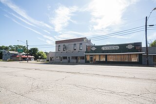
Patoka is the fourth largest town and sixth largest community in Gibson County, Indiana, United States. The population was 735 at the 2010 census.

<span class="mw-page-title-main">Somerville, Indiana</span> Town in Indiana, United States

Somerville is a town in Barton Township, Gibson County, Indiana, United States. The population was 293 at the 2010 census, making it the third-smallest community in the county.

<span class="mw-page-title-main">Upland, Indiana</span> Town in Indiana, United States

Upland is a town in Jefferson Township, Grant County, Indiana, United States. The population was 3,821 at the 2020 census. It is the home of Taylor University, a Christian college.

<span class="mw-page-title-main">McCordsville, Indiana</span> Town in Indiana, United States

McCordsville is a town in Vernon Township, Hancock County, Indiana, United States. The town is a fast-growing suburb of Indianapolis with an estimated population of 8,592 in 2020.

<span class="mw-page-title-main">Medora, Indiana</span> Town in Indiana, United States

Medora is a town in Carr Township, Jackson County, Indiana, United States. The population was 693 at the 2010 census.

<span class="mw-page-title-main">New Whiteland, Indiana</span> Town in Indiana, United States

New Whiteland is a town in Pleasant Township, Johnson County, Indiana, United States. The population was 5,550 at the 2020 census.

<span class="mw-page-title-main">Prince's Lakes, Indiana</span> Town in Indiana, United States

Prince's Lakes is a town in Nineveh Township, Johnson County, Indiana, United States. The population was 1,312 at the 2010 census.

<span class="mw-page-title-main">Shipshewana, Indiana</span> Town and Census designated place in Indiana, United States

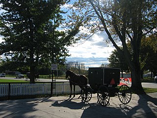
Shipshewana is a town in Newbury Township, LaGrange County, Indiana, United States. The population was 658 at the 2010 census. It is the location of the Menno-Hof Amish & Mennonite Museum, which showcases the history of the Amish and Mennonite peoples.

<span class="mw-page-title-main">Lapel, Indiana</span> Town in Indiana, United States

Lapel is a town in Stony Creek and Green townships, Madison County, Indiana, United States. It is part of the Indianapolis–Carmel–Anderson metropolitan statistical area. The population was 2,325 at the 2020 census, up from 2,068 in 2010.

<span class="mw-page-title-main">Summitville, Indiana</span> Town in Indiana, United States

Summitville is a town in Van Buren Township, Madison County, Indiana, United States. It is part of the Indianapolis–Carmel–Anderson metropolitan statistical area. The population was 989 at the 2020 census.

<span class="mw-page-title-main">La Paz, Indiana</span> Town in the United States

LaPaz is a town in North Township, Marshall County, Indiana, United States. The population was 475 at the 2020 census, down from 561 in 2010.

<span class="mw-page-title-main">Winslow, Indiana</span> Town in Indiana, United States

Winslow is a town in Patoka Township, Pike County, in the U.S. state of Indiana. The population was 864 at the 2010 census. It is part of the Jasper Micropolitan Statistical Area.

<span class="mw-page-title-main">Fillmore, Indiana</span> Town in Indiana, United States

Fillmore is a town in Marion Township, Putnam County, in the U.S. state of Indiana. The population was 532 at the 2020 census.

<span class="mw-page-title-main">Napoleon, Indiana</span> Town in Indiana, United States

Napoleon is a town in Jackson Township, Ripley County, in the U.S. state of Indiana. The population was 234 at the 2010 census.

<span class="mw-page-title-main">Elberfeld, Indiana</span> Town in Indiana, United States

Elberfeld is a town in Greer Township, Warrick County, in the U.S. state of Indiana. The population was 625 as of the 2010 census.

References

  1. "2020 U.S. Gazetteer Files". United States Census Bureau. Retrieved March 16, 2022.
  2. 1 2 U.S. Geological Survey Geographic Names Information System: Haubstadt, Indiana
  3. 1 2 "U.S. Census website". United States Census Bureau . Retrieved January 31, 2008.
  4. Peattie, Elia Wilkinson (1897). History of Gibson County, Indiana. Cook & McDowell Publications. p. 13.
  5. Stormont, Gil R. (1914). History of Gibson County, Indiana: Her People, Industries and Institutions. B.F. Bowen. pp.  351.
  6. "National Register Information System". National Register of Historic Places . National Park Service. July 9, 2010.
  7. "G001 - Geographic Identifiers - 2010 Census Summary File 1". United States Census Bureau. Archived from the original on February 13, 2020. Retrieved July 17, 2015.
  8. "Census of Population and Housing". Census.gov. Retrieved June 4, 2015.
  9. "U.S. Census website". United States Census Bureau . Retrieved December 11, 2012.
  10. "Indiana public library directory" (PDF). Indiana State Library. Retrieved March 7, 2018.