Holland, Massachusetts

Last updated

Holland, Massachusetts
Library, Holland MA.jpg
Holland Public Library
HollandMA-seal.png
Hampden County Massachusetts incorporated and unincorporated areas Holland highlighted.svg
Location in Hampden County in Massachusetts
Coordinates: 42°03′50″N72°09′28″W / 42.06389°N 72.15778°W / 42.06389; -72.15778
Country United States
State Massachusetts
County Hampden
Settled1725
Incorporated1783
Government
  Type Open town meeting
Area
  Total13.1 sq mi (33.8 km2)
  Land12.3 sq mi (31.8 km2)
  Water0.8 sq mi (2.0 km2)
Elevation
743 ft (226 m)
Population
 (2020)
  Total2,603
  Density200/sq mi (77/km2)
Time zone UTC-5 (Eastern)
  Summer (DST) UTC-4 (Eastern)
ZIP Code
01521
Area code 413
FIPS code 25-30665
GNIS feature ID0618185
Website town.holland.ma.us

Holland is a town in Hampden County, Massachusetts, United States. The population was 2,603 at the 2020 census. [1] It is part of the Springfield, Massachusetts Metropolitan Statistical Area.

Contents

The area around the town center comprises the census-designated place of Holland.

History

In 1730, the area that would become the town of Holland was settled by Joseph Blodgett, whose descendants still live in the town today. The town was named after Lord Holland, an English statesman who lobbied for independence for the American colonies. The town was incorporated on July 5, 1783. It separated from the town of Wales, which had in turn separated from Brimfield a few years earlier, in 1775. Holland separated from Wales because the town center of Wales was up through a mountain which made it hard to get through.

Throughout the years, Holland has remained an example of the charm and beauty of the traditional New England village. At different times, it has sustained industries such as farming, the manufacturing of cloth, and brickmaking. Holland is now known most for its recreational opportunities. There are extensive recreational facilities at the Hamilton Reservoir, which is stocked with trout each year by the state of Massachusetts. There is also a park and a swimming area at the picturesque Lake Siog.

The 200-year-old town hall was destroyed in a fire in December 1995. The new town hall was dedicated on July 11, 1998, by Congressman Richard Neal of Springfield, whose congressional district includes Holland.

Geography

Holland is located in the southeast corner of Hampden County in western Massachusetts. It is drained by the Quinebaug River and contains the Hamilton Reservoir, one of the largest reservoirs in southern New England. The town is nestled amongst two hill ranges, where elevations reach up to greater than 1,100 feet (340 m), for example on Rattlesnake Mountain in the northwest part of town.

According to the United States Census Bureau, the town has a total area of 13.1 square miles (33.8 km2), of which 12.3 square miles (31.8 km2) are land and 0.77 square miles (2.0 km2), or 5.88%, are water. [2] Holland is bounded on the east by Sturbridge in Worcester County, on the south by Union, Connecticut, on the west by Wales, and on the north by Brimfield. Holland is 32 miles (51 km) by road east of Springfield, 26 miles (42 km) southwest of Worcester, and 40 miles (64 km) northeast of Hartford, Connecticut. Interstate 84 touches the southeast corner of Holland at the Massachusetts–Connecticut border; the closest access is from Exit 74 in Union, Connecticut.

Demographics

At the 2010 census, there were 2,481 people, 994 households and 697 families residing in the town. There were 1,365 housing units in the town. The racial makeup of the town was 96.9% White, 0.6% Black or African American, 0.4% Native American, 0.4% Asian, 0.4% some other race, and 1.2% from two or more races. Hispanic or Latino of any race were 2.3% of the population. [14]

Of the 994 households, 31.5% had children under the age of 18 living with them, 56.3% were headed by married couples living together, 8.2% had a female householder with no husband present, and 29.9% were non-families. 22.1% of all households were made up of individuals, and 6.6% were someone living alone who was 65 years of age or older. The average household size was 2.50, and the average family size was 2.90. [14]

21.2% of the population were under the age of 18, 6.9% were from 18 to 24, 25.6% were from 25 to 44, 35.3% were from 45 to 64, and 11.0% were 65 years of age or older. The median age was 42.6 years. For every 100 females, there were 107.4 males. For every 100 females age 18 and over, there were 105.7 males. [14]

For the period 2011-15, the estimated median household income was $75,000, and the median family income was $85,952. Male full-time workers had a median income of $60,915 and females $43,922. The per capita income was $34,188. About 3.2% of families and 7.4% of the population were below the poverty line, including 3.9% of those under age 18 and 2.9% of those age 65 or over. [15]

Education

Holland Elementary School, serving grades Pre-K–6, has its own school committee, part of School Union 61. Holland students attend Tantasqua Regional Junior High School (grades 7–8) and Tantasqua Regional High School in Sturbridge. Union 61 and the Tantasqua district share administrators, including the superintendent, and both include Brimfield, Brookfield, Holland, Sturbridge and Wales.

Notable people

Related Research Articles

<span class="mw-page-title-main">Hampden County, Massachusetts</span> County in Massachusetts, United States

<span class="mw-page-title-main">Egremont, Massachusetts</span> Town in Massachusetts, United States

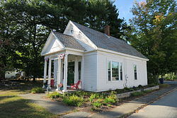
Egremont is a town in Berkshire County, Massachusetts, United States. It is part of the Pittsfield, Massachusetts Metropolitan Statistical Area. The population was 1,372 at the 2020 census. Egremont consists of two villages, North Egremont and South Egremont, and their outlying areas, which are mostly lightly settled forests and farmland.

<span class="mw-page-title-main">Mount Washington, Massachusetts</span> Town in Massachusetts, United States

Mount Washington is a town in Berkshire County, Massachusetts, United States. It is part of the Pittsfield, Massachusetts Metropolitan Statistical Area. The population was 160 at the 2020 census, making it the least populous town in Berkshire County and, after Gosnold and Monroe, the third least populous in Massachusetts. The name of the town is a tribute to George Washington, who at the time of incorporation was Commander-in-Chief of the Continental Army during the American Revolutionary War.

<span class="mw-page-title-main">Otis, Massachusetts</span> Town in Massachusetts, United States

Otis is a town in Berkshire County, Massachusetts, United States. It is part of the Pittsfield, Massachusetts, Metropolitan Statistical Area. The population was 1,634 at the 2020 census.

<span class="mw-page-title-main">Sandisfield, Massachusetts</span> Town in Massachusetts, United States

Sandisfield is a town in Berkshire County, Massachusetts, United States. It is part of the Pittsfield, Massachusetts Metropolitan Statistical Area. The population was 989 at the 2020 census.

<span class="mw-page-title-main">Brimfield, Massachusetts</span> Town in Massachusetts, United States

Brimfield is a town in Hampden County, Massachusetts, United States. The population was 3,694 at the 2020 census. It is part of the Springfield, Massachusetts Metropolitan Statistical Area.

<span class="mw-page-title-main">Chester, Massachusetts</span> Town in Massachusetts, United States

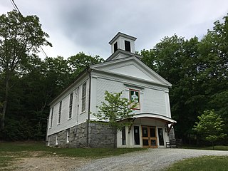
Chester is a town in Hampden County, Massachusetts, United States, situated in Western Massachusetts. It is part of the Springfield metropolitan statistical area. The town includes the Chester Factory Village Historic District. The total population was 1,228 in the 2020 census.

<span class="mw-page-title-main">Granville, Massachusetts</span> Town in Massachusetts, United States

Granville is a town in Hampden County, Massachusetts, United States. The population was 1,538 at the 2020 census. It is part of the Springfield, Massachusetts Metropolitan Statistical Area. The town is named for John Carteret, 2nd Earl Granville.

<span class="mw-page-title-main">Monson, Massachusetts</span> Town in Massachusetts, United States

Monson is a town in Hampden County, Massachusetts, United States. The population was 8,150 at the 2020 census. It is part of the Springfield, Massachusetts Metropolitan Statistical Area.

<span class="mw-page-title-main">Montgomery, Massachusetts</span> Town in Massachusetts, United States

Montgomery is a town in Hampden County, Massachusetts, United States. The population was 819 at the 2020 census. It is part of the Springfield, Massachusetts Metropolitan Statistical Area.

<span class="mw-page-title-main">Southwick, Massachusetts</span> Town in Massachusetts, United States

Southwick is a town in Hampden County, Massachusetts, United States. The population was 9,232 at the 2020 census, down from 9,502 at the 2010 census. It is part of the Springfield, Massachusetts Metropolitan Statistical Area.

<span class="mw-page-title-main">Tolland, Massachusetts</span> Town in Massachusetts, United States

Tolland is a town in Hampden County, Massachusetts, United States. It is part of the Springfield, Massachusetts Metropolitan Statistical Area. The population was 471 at the 2020 census, making it the smallest town in Hampden County by population. It is most known for its historical Black Fly Day Parade; a small town parade celebrating the legend of the Canabalistic black fly tribe. The parade has since been replaced by a pot luck supper in the green.

<span class="mw-page-title-main">Wales, Massachusetts</span> Town in Massachusetts, United States

Wales is a town in Hampden County, Massachusetts, United States. The population was 1,838 at the 2020 census. It is part of the Springfield, Massachusetts Metropolitan Statistical Area.

<span class="mw-page-title-main">Huntington, Massachusetts</span> Town in Massachusetts, United States

Huntington is a town in Hampshire County, Massachusetts, United States. The population was 2,094 at the 2020 census. It is part of the Springfield, Massachusetts Metropolitan Statistical Area.

<span class="mw-page-title-main">Brookfield, Massachusetts</span> Town in Massachusetts, United States

Brookfield is a town in Worcester County, Massachusetts, United States. Brookfield was first settled by Europeans in 1660. The population was 3,439 at the 2020 census.

<span class="mw-page-title-main">Fiskdale, Massachusetts</span> CDP in Sturbridge, Massachusetts, United States

Fiskdale is a census-designated place (CDP) in the town of Sturbridge in Worcester County, Massachusetts, United States. The population was 2,583 at the 2010 census.

<span class="mw-page-title-main">Holland (CDP), Massachusetts</span> Census-designated place in Massachusetts, United States

Holland is a census-designated place (CDP) in the town of Holland in Hampden County, Massachusetts, United States, comprising the town center and other populated areas in the eastern part of the town. The population was 1,464 at the 2010 census, out of a total 2,481 people in the town. It is part of the Springfield, Massachusetts Metropolitan Statistical Area.

<span class="mw-page-title-main">Palmer, Massachusetts</span> City in Massachusetts, United States

Palmer is a city in Hampden County, Massachusetts, United States. The population was 12,448 at the 2020 census. It is part of the Springfield, Massachusetts Metropolitan Statistical Area. Palmer adopted a home rule charter in 2004 with a council-manager form of government. Palmer is one of thirteen Massachusetts municipalities that have city forms of government but retain "The town of" in their official names.

<span class="mw-page-title-main">Sturbridge, Massachusetts</span> Town in Massachusetts, United States

Sturbridge is a town in Worcester County, Massachusetts, United States. It is home to Old Sturbridge Village living history museum and other sites of historical interest such as Tantiusques.

<span class="mw-page-title-main">Warren, Massachusetts</span> Town in Massachusetts, United States

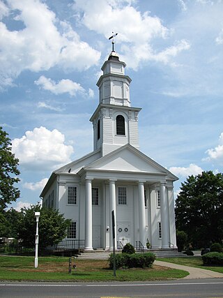
Warren is a town in Worcester County, Massachusetts, United States. The population was 4,975 at the 2020 census. The town contains the villages of Warren and West Warren.

References

  1. "Census - Geography Profile: Holland town, Hampden County, Massachusetts". U.S. Census Bureau. Retrieved November 13, 2021.
  2. "Geographic Identifiers: 2010 Census Summary File 1 (G001): Holland town, Hampden County, Massachusetts". American Factfinder. U.S. Census Bureau. Archived from the original on February 13, 2020. Retrieved August 3, 2017.
  3. "Total Population (P1), 2010 Census Summary File 1". American FactFinder, All County Subdivisions within Massachusetts. United States Census Bureau. 2010.
  4. "Massachusetts by Place and County Subdivision - GCT-T1. Population Estimates". United States Census Bureau. Retrieved July 12, 2011.
  5. "1990 Census of Population, General Population Characteristics: Massachusetts" (PDF). US Census Bureau. December 1990. Table 76: General Characteristics of Persons, Households, and Families: 1990. 1990 CP-1-23. Retrieved July 12, 2011.
  6. "1980 Census of the Population, Number of Inhabitants: Massachusetts" (PDF). US Census Bureau. December 1981. Table 4. Populations of County Subdivisions: 1960 to 1980. PC80-1-A23. Retrieved July 12, 2011.
  7. "1950 Census of Population" (PDF). Bureau of the Census. 1952. Section 6, Pages 21-10 and 21-11, Massachusetts Table 6. Population of Counties by Minor Civil Divisions: 1930 to 1950. Retrieved July 12, 2011.
  8. "1920 Census of Population" (PDF). Bureau of the Census. Number of Inhabitants, by Counties and Minor Civil Divisions. Pages 21-5 through 21-7. Massachusetts Table 2. Population of Counties by Minor Civil Divisions: 1920, 1910, and 1920. Retrieved July 12, 2011.
  9. "1890 Census of the Population" (PDF). Department of the Interior, Census Office. Pages 179 through 182. Massachusetts Table 5. Population of States and Territories by Minor Civil Divisions: 1880 and 1890. Retrieved July 12, 2011.
  10. "1870 Census of the Population" (PDF). Department of the Interior, Census Office. 1872. Pages 217 through 220. Table IX. Population of Minor Civil Divisions, &c. Massachusetts. Retrieved July 12, 2011.
  11. "1860 Census" (PDF). Department of the Interior, Census Office. 1864. Pages 220 through 226. State of Massachusetts Table No. 3. Populations of Cities, Towns, &c. Retrieved July 12, 2011.
  12. "1850 Census" (PDF). Department of the Interior, Census Office. 1854. Pages 338 through 393. Populations of Cities, Towns, &c. Retrieved July 12, 2011.
  13. "City and Town Population Totals: 2020−2022". United States Census Bureau . Retrieved November 24, 2023.
  14. 1 2 3 "Profile of General Population and Housing Characteristics: 2010 Census Summary File 1 (DP-1): Holland town, Hampden County, Massachusetts". American Factfinder. U.S. Census Bureau. Archived from the original on February 14, 2020. Retrieved August 3, 2017.
  15. "Selected Economic Characteristics: 2011-2015 American Community Survey 5-Year Estimates (DP03): Holland town, Hampden County, Massachusetts". American Factfinder. U.S. Census Bureau. Archived from the original on February 13, 2020. Retrieved August 3, 2017.
  16. "Obituary, Ephraim Paddock". The Historical Magazine and Notes and Queries. New York, NY: C. Benjamin Richardson. September 1, 1859. pp. 286–287.