Jamestown Township, Blue Earth County, Minnesota

Last updated

Jamestown Township
USA Minnesota location map.svg
Red pog.svg
Jamestown Township
Location within the state of Minnesota
Usa edcp location map.svg
Red pog.svg
Jamestown Township
Jamestown Township (the United States)
Coordinates: 44°13′13″N93°49′40″W / 44.22028°N 93.82778°W / 44.22028; -93.82778
Country United States
State Minnesota
County Blue Earth
Area
  Total17.5 sq mi (45.4 km2)
  Land15.3 sq mi (39.7 km2)
  Water2.2 sq mi (5.7 km2)
Elevation
1,017 ft (310 m)
Population
 (2000)
  Total628
  Density40.9/sq mi (15.8/km2)
Time zone UTC-6 (Central (CST))
  Summer (DST) UTC-5 (CDT)
FIPS code 27-31688 [1]
GNIS feature ID0664571 [2]

Jamestown Township is a township in Blue Earth County, Minnesota, United States. The population was 628 as of the 2000 census. [3]

Contents

History

Jamestown Township was organized in 1858, and named after Jamestown, Virginia. [4]

Geography

Jamestown and Lime Township Plat Maps from the Standard Atlas, Blue Earth County, Minnesota Jamestown and Lime Township Plat Maps from the Standard Atlas, Blue Earth County, Minnesota.jpg
Jamestown and Lime Township Plat Maps from the Standard Atlas, Blue Earth County, Minnesota

According to the United States Census Bureau, the township has a total area of 17.5 square miles (45 km2), of which 15.3 square miles (40 km2) is land and 2.2 square miles (5.7 km2) (12.54%) is water.

The vast majority of the city of Madison Lake is within the township geographically but is a separate entity.

Major highway

Lakes

Adjacent townships

Cemeteries

The township includes the following cemeteries: Calvary and Sugar Grove.

Demographics

As of the census [1] of 2000, there were 628 people, 231 households, and 182 families residing in the township. The population density was 40.9 inhabitants per square mile (15.8/km2). There were 354 housing units at an average density of 23.1/sq mi (8.9/km2). The racial makeup of the township was 99.68% White, and 0.32% from two or more races. Hispanic or Latino of any race were 0.64% of the population.

There were 231 households, out of which 34.2% had children under the age of 18 living with them, 72.7% were married couples living together, 3.0% had a female householder with no husband present, and 21.2% were non-families. 17.7% of all households were made up of individuals, and 6.1% had someone living alone who was 65 years of age or older. The average household size was 2.72 and the average family size was 3.09.

In the township the population was spread out, with 26.3% under the age of 18, 6.5% from 18 to 24, 25.3% from 25 to 44, 30.4% from 45 to 64, and 11.5% who were 65 years of age or older. The median age was 40 years. For every 100 females, there were 103.2 males. For every 100 females age 18 and over, there were 103.1 males.

The median income for a household in the township was $56,875, and the median income for a family was $62,188. Males had a median income of $36,071 versus $27,353 for females. The per capita income for the township was $26,014. About 2.8% of families and 3.6% of the population were below the poverty line, including 2.5% of those under age 18 and none of those age 65 or over.

Related Research Articles

<span class="mw-page-title-main">Waseca County, Minnesota</span> County in Minnesota, United States

Waseca County is a county in the U.S. state of Minnesota. As of the 2020 census, the population was 18,968. Its county seat is Waseca.

<span class="mw-page-title-main">Le Sueur County, Minnesota</span> County in Minnesota, United States

Le Sueur County is a county located in the south central portion of the U.S. state of Minnesota. As of the 2020 census, the population was 28,674. Its county seat is Le Center.

<span class="mw-page-title-main">Blue Earth County, Minnesota</span> County in Minnesota, United States

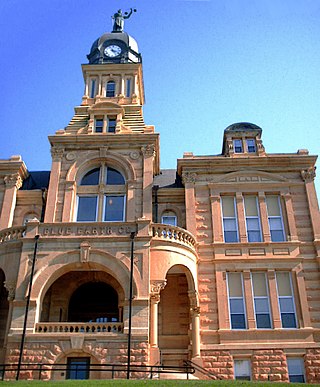
Blue Earth County is a county in the State of Minnesota. As of the 2020 census, the population was 69,112. Its county seat is Mankato. The county is named for the Blue Earth River and for the deposits of blue-green clay once evident along the banks of the Blue Earth River. Blue Earth County is part of the Mankato-North Mankato metropolitan area.

Le Ray Township is a township in Blue Earth County, Minnesota, United States. The population was 846 as of the 2000 census.

Lime Township is a township in Blue Earth County, Minnesota, United States. The population was 1,395 as of the 2010 census.

Mankato Township is a township in Blue Earth County, Minnesota, United States. The population was 1,969 as of the 2010 census.

Kego Township is a township in Cass County, Minnesota, United States. The population was 465 as of the 2000 census. Kego is a name derived from the Ojibwe language, meaning "fish".

Cleveland Township is a township in Le Sueur County, Minnesota, United States. The population was 615 at the 2000 census.

Cordova Township is a township in Le Sueur County, Minnesota, United States. The population was 517 at the 2000 census.

Derrynane Township is a township in Le Sueur County, Minnesota, United States. The population was 549 at the 2000 census.

Elysian Township is a township in Le Sueur County, Minnesota, United States. The population was 985 at the 2000 census.

Kasota Township is a township in Le Sueur County, Minnesota, United States. The population was 1,487 at the 2000 census.

Kilkenny Township is a township in Le Sueur County, Minnesota, United States. The population was 393 at the 2000 census.

Lanesburgh Township is a township in Le Sueur County, Minnesota, United States. The population was 2,074 at the 2000 census.

Lexington Township is a township in Le Sueur County, Minnesota, United States. The population was 763 at the 2000 census.

Montgomery Township is a township in Le Sueur County, Minnesota, United States. The population was 745 at the 2000 census.

Ottawa Township is a township in Le Sueur County, Minnesota, United States. The population was 290 at the 2000 census. Ottawa Township was organized in 1858.

Sharon Township is a township in Le Sueur County, Minnesota, United States. The population was 658 at the 2000 census.

<span class="mw-page-title-main">Tyrone Township, Le Sueur County, Minnesota</span> Township in Minnesota, United States

Tyrone Township is a township in Le Sueur County, Minnesota, United States. The population was 564 for the 2000 census.

Washington Township is a township in Le Sueur County, Minnesota, United States. The population was 797 at the 2000 census.

References

  1. 1 2 "U.S. Census website". United States Census Bureau . Retrieved January 31, 2008.
  2. "US Board on Geographic Names". United States Geological Survey. October 25, 2007. Retrieved January 31, 2008.
  3. "U.S. Census website" . Retrieved December 30, 2008.
  4. Upham, Warren (1920). Minnesota Geographic Names: Their Origin and Historic Significance. Minnesota Historical Society. p.  60.