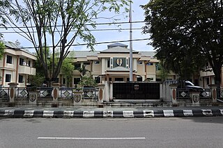
Wonosobo Regency is a regency in Central Java province in Indonesia. The administrative centre of the regency is located in the town of Wonosobo, located at 7.3684940°S 109.8983841°E, about 120 km from Semarang on the Dieng Plateau. The regency's area is 984.68 km2 and its population was 754,883 at the 2010 census and 879,124 at the 2020 census; the official estimate as at mid 2023 was 909,664.

Muaro Jambi Regency is a regency of Jambi Province, Sumatra, Indonesia. It was created on 4 October 1999 by the separation of what were formerly the eastern districts of Batang Hari Regency. It surrounds the major city of Jambi, the provincial capital, and includes many of the expanding suburbs of Jambi outside the city boundaries; consequently it has experienced population growth greater than elsewhere in the province. From the 4th until the 13th century, it was the seat of the Hindu-Buddhist Melayu Kingdom. It has an area of 5,246.00 km2 and had a population of 342,952 at the 2010 census and 390,347 at the 2020 census; the official estimate as at mid 2022 is 412,830.

Barito Kuala Regency is one of the regencies (kabupaten) in the Indonesian province of South Kalimantan, situated in the southwest of the province. The area is 2,996.46 km2, and the population was 276,147 at the 2010 Census and 313,021 at the 2020 Census; the latest official estimate was 321,769. The capital is the town of Marabahan. The Motto of the Regency is "Selidah".

South Hulu Sungai Regency is one of the regencies (kabupaten) in South Kalimantan province, Indonesia. It had an area of 1,804.94 km2, and a population of 212,485 at the 2010 Census and 228,006 at the 2020 Census; the official estimate as at mid 2022 was 232,212. The capital of the regency is the town of Kandangan, which is famous for its culinary ketupat Kandangan.
Central Hulu Sungai Regency is one of the regencies in the Indonesian province of South Kalimantan. The area is 1,770.77 km2 and the population was 243,460 at the 2010 Census and 258,721 at the 2020 Census; the official estimate as at mid 2022 was 263,061. The administrative centre is the town of Barabai.

Tabalong Regency is the most northerly of the regencies in the Indonesian province of South Kalimantan, on Borneo Island. It was created on 14 July 1965 by splitting off the northern districts of North Hulu Sungai Regency. It has an area of 3,553.36 km2, and had a population at the 2010 Census of 218,620 and 253,305 at the 2020 Census; the official estimate as of mid-2022 was 261,353. The administrative capital is the town of Tanjung. Motto: "Saraba Kawa" (Banjarese).
Tapin Regency is one of regencies in the Indonesian province of South Kalimantan. The regency was created on 14 July 1965 by splitting off the districts which had until then comprised the southern part of South Hulu Sungai Regency. The regency's motto is "Ruhui Rahayu", and this is also shared by another Indonesian province. It covers an area of 2,174.95 km2 and had a population of 167,877 at the 2010 Census and 189,475 at the 2020 Census; the official estimate as at mid 2022 was 194,628. The administrative centre of the regency is at the town of Rantau.

South Bengkulu is a regency of Bengkulu Province, Indonesia, on the island of Sumatra. It originally comprised all of that part of Bengkulu Province situated to the southeast of the city of Bengkulu, but on 25 February 2003 this area was split into three parts, with the most southeastern districts split off to form a new Kaur Regency and the most northwestern districts split off to form a new Seluma Regency. The reduced South Bengkulu Regency now covers 1,186.10 km2, and had a population of 142,940 at the 2010 Census and 166,249 at the 2020 Census; the official estimate as at mid 2022 was 170,093. The regency's administrative centre is the coastal town of Manna.

South Labuhanbatu Regency is a regency of North Sumatra Province of Indonesia, created on 21 July 2008 by being carved out of the southern districts of the existing Labuhanbatu Regency. The new South Labuhanbatu Regency covers an area of 3,596 square kilometres and according to the 2010 census it had a population of 277,673, which rose to 314,094 at the 2020 Census; the official estimate as at mid 2023 was 330,797. Its administrative headquarters are at the town of Kotapinang.

South Central Timor Regency is a regency in East Nusa Tenggara province of Indonesia. Established in 1958, the regency has its seat (capital) in the town of Soe. It covers an area of 3,955.36 km2 and had a population of 440,470 at the 2010 Census and 455,410 at the 2020 Census; the official estimate as at mid 2023 was 474,521.
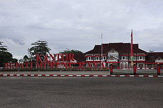
Murung Raya Regency is the most northerly of the thirteen regencies (kabupaten) which comprise the province of Central Kalimantan on the island of Borneo, Indonesia. It was created on 10 April 2002 from the former northwestern two-thirds of the North Barito Regency. The capital of the regency is the town of Puruk Cahu. The regency covers an area of 23,700 km2 and had a population of 96,857 inhabitants at the 2010 census and 111,527 at the 2020 census; the official estimate as at mid 2022 was 113,483.

Paser Regency is a regency (kabupaten) within East Kalimantan province in Indonesia, it is the southernmost regency of the East Kalimantan province. Its administrative centre is Tana Paser. It covers an area of 7,730 km2, and it had a population of 230,316 at the 2010 Census and 275,452 at the 2020 Census; the official estimate as at mid-2022 was 280,065 . Before 2007, this regency was formerly named Pasir Regency.

Meranti Islands is an archipelago forming a regency (kabupaten) of Riau Province and lies off the eastern coast of the island of Sumatra, Indonesia. It was created on 19 December 2008 by the separating of this archipelago from the mainland regency of Bengkalis. The regency comprises the islands of Tebing Tinggi, Rangsang, Padang, and Merbau, together with minor offshore islands, but does not include Bengkalis Island which is geographically part of the archipelago but remains within Bengkalis Regency. The principal town is Selat Panjang on Tebing Tinggi Island. The regency covers an area of 3,623.93 km2 and had a population of 176,290 at the 2010 Census and 206,116 at the 2020 Census; the official estimate as of mid-2022 was 213,532.

Ogan Ilir Regency is a regency of South Sumatra Province, Indonesia. It takes its name from the main river which stream that area, Ogan River. And the name Ilir means downstream. Indralaya is the regency seat. The regency borders Palembang City and Muara Enim Regency to the north, Ogan Komering Ilir Regency to the east, Ogan Komering Ilir Regency, and East Ogan Komering Ulu Regency to the south, and Muara Enim Regency to the west.

North Barito Regency is one of the thirteen regencies which divide the Central Kalimantan Province on the island of Kalimantan, Indonesia. It originally included much more of the northern part of the province, but on 10 April 2002 the larger northwestern part of the regency was split off to create a new Murung Raya Regency. Muara Teweh is the capital of North Barito Regency, which covers an area of 10,152.25 km2. The population of North Barito Regency was 121,573 at the 2010 Census and 154,812 at the 2020 Census; the official estimate as at mid 2022 was 160,235.

West Kotawaringin Regency is one of the thirteen regencies which comprise the Central Kalimantan Province on the island of Kalimantan (Borneo), Indonesia. It originally comprised the whole western part of the province, having been split from a single Kotawaringin Regency on 26 June 1959 into separate regencies for West and East Kotawaringin, but on 10 April 2002 the most westerly districts of West Kotawaringin were split off to form the new Lamandau Regency and Sukamara Regency. The residual West Kotawaringin Regency has a land area of about 10,759 km2, and its population was 235,803 at the 2010 Census and 270,388 at the 2020 Census; the official estimate as at mid 2023 was 279,740. The town of Pangkalan Bun in Arut Selatan District is the capital of West Kotawaringin Regency.

Pulang Pisau Regency is one of the thirteen regencies which comprise the Central Kalimantan Province on the island of Kalimantan (Borneo), Indonesia. It was created on 10 April 2002 from what were previously the southwest districts of Kapuas Regency. The town of Pulang Pisau is the capital of Pulang Pisau Regency. The land area of Pulang Pisau Regency is 9,650.86 km2, and its population was 120,062 at the 2010 Census and 134,499 at the 2020 Census; the official estimate as at mid 2023 was 138,119.

Seruyan Regency is one of the thirteen regencies which comprise the Central Kalimantan Province on the island of Kalimantan (Borneo), Indonesia. It was created on 10 April 2002 from what were previously the western districts of East Kotawaringin Regency. The town of Kuala Pembuang in Seruyan Hilir District is the capital of Seruyan Regency. The population of the Regency was 139,931 at the 2010 Census and 162,906 at the 2020 census; the official estimate was at mid 2023 was 171,304.

South Minahasa Regency is a regency in North Sulawesi, Indonesia. Its capital is the town of Amurang. It was originally part of the Minahasa Regency until it was established as a separate regency on 25 February 2003. In turn, nearly four years later, a new Southeast Minahasa Regency was established as a separate regency from part of the South Minahasa Regency on 2 January 2007. The residual Regency now covers an area of 1,456.74 km2, and had a population of 195,553 at the 2010 Census; this had risen to 236,463 at the 2020 Census; the official estimate as at mid 2023 was 244,590.
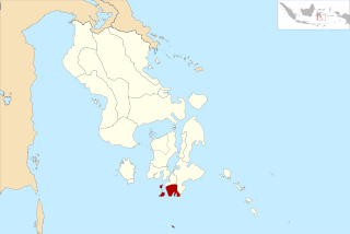
South Buton Regency is a regency located on Buton Island in Southeast Sulawesi Province of Indonesia. This regency was formed from the southern part of Buton Regency, from which it was separated by Act No.16 of 2014, dated 23 July 2014. It covers an area of 546.58 km2, and the population of the districts now comprising the new regency was 74,974 at the 2010 Census and 95,261 at the 2020 Census; the official estimate as at mid 2023 was 101,635. The regency capital is located in Batauga.