
Flushing is a neighborhood in the north-central portion of the New York City borough of Queens. The neighborhood is the fourth-largest central business district in New York City. Downtown Flushing is a major commercial and retail area, and the intersection of Main Street and Roosevelt Avenue at its core is the third-busiest in New York City, behind Times Square and Herald Square.

Fresh Meadows is a neighborhood in the northeastern section of the New York City borough of Queens. Fresh Meadows used to be part of the broader town of Flushing and is bordered to the north by the Horace Harding Expressway and Auburndale; to the west by Pomonok, St. John's University, Hillcrest, and Utopia; to the east by Cunningham Park and the Clearview Expressway; and to the south by the Grand Central Parkway.

Kew Gardens Hills is a neighborhood in the middle of the New York City borough of Queens. The borders are Flushing Meadows-Corona Park to the west, the Long Island Expressway to the north, Union Turnpike to the south, and Parsons Boulevard to the east.

Pomonok is a working class neighborhood in the New York City borough of Queens. This large public housing development in South Flushing was built in 1949 on the former site of Pomonok Country Club. The name comes from the Algonquian name for Long Island, and means either "land of tribute" or "land where there is travelling by water".
Woodhaven Boulevard and Cross Bay Boulevard are two parts of a major boulevard in the New York City borough of Queens. Woodhaven Boulevard runs roughly north–south in the central portion of Queens. South of Liberty Avenue, it is known as Cross Bay Boulevard, which is the main north–south road in Howard Beach. Cross Bay Boulevard is locally known as simply "Cross Bay", and Woodhaven Boulevard, "Woodhaven". The completion of the boulevard in 1923, together with the construction of the associated bridges over Jamaica Bay, created the first direct roadway connection to the burgeoning Atlantic Ocean beachfront communities of the Rockaway Peninsula from Brooklyn and most of Queens.

The Q17 bus route constitutes a public transit line in Queens, New York City, running primarily along Kissena Boulevard, the Long Island Expressway service road and 188th Street between two major bus-subway hubs in the neighborhoods of Jamaica and Flushing. It is one of the busiest local bus routes in Queens. Operated by the North Shore Bus Company until 1947, the route is now operated by MTA Regional Bus Operations under the New York City Transit brand.

The Q27 bus route constitutes a public transit line in Queens, New York City, running primarily along 46th Avenue, Rocky Hill Road and Springfield Boulevard between a major bus-subway hub in Flushing and Cambria Heights. The route is operated by MTA Regional Bus Operations under the New York City Transit brand.
The North Shore Bus Company operated public buses in Queens, New York City. It was established in 1920 as the successor to the New York and North Shore Traction Company trolley system, and operated until 1947 when it went bankrupt, and its operations were taken over by the New York City Board of Transportation.

Jamaica Avenue is a major avenue in the New York City boroughs of Brooklyn and Queens, New York, in the United States. Jamaica Avenue's western end is at Broadway and Fulton Street, as a continuation of East New York Avenue, in Brooklyn's East New York neighborhood. Physically, East New York Avenue connects westbound to New York Avenue, where East New York Avenue changes names another time to Lincoln Road; Lincoln Road continues to Ocean Avenue in the west, where it ends. Its eastern end is at the city line in Bellerose, Queens, where it becomes Jericho Turnpike to serve the rest of Long Island. The section of Jamaica Avenue designated as New York State Route 25 runs from Braddock Avenue to the city line, where Jamaica Avenue becomes Jericho Turnpike.

Roosevelt Avenue and Greenpoint Avenue are main thoroughfares in the New York City boroughs of Queens and Brooklyn. Roosevelt Avenue begins at 48th Street and Queens Boulevard in the neighborhood of Sunnyside. West of Queens Boulevard, the road is named Greenpoint Avenue and continues through Sunnyside and Long Island City across the Greenpoint Avenue Bridge into the borough of Brooklyn, terminating at WNYC Transmitter Park on the East River in the neighborhood of Greenpoint. Roosevelt Avenue goes through Woodside, Jackson Heights, Elmhurst, Corona, Flushing Meadows–Corona Park and Flushing. In Flushing, Roosevelt Avenue ends at 156th Street and Northern Boulevard.

Astoria Boulevard is an important east–west commercial street in Astoria and East Elmhurst, Queens, New York City. It runs from 1st Street at the East River to the World's Fair Marina on Flushing Bay, where it merges with Northern Boulevard. Just before the junction of the two boulevards, there is a large two lane ramp leading to the Whitestone Expressway. Most of the traffic on Astoria Boulevard heads toward this ramp, and then onto the Expressway.
Parsons Boulevard is a road in Queens, New York. Its northern end is at Malba Drive in the Malba neighborhood and its southern end is at Archer Avenue in downtown Jamaica.

The 165th Street Bus Terminal, also known as Jamaica Bus Terminal, the Long Island Bus Terminal, Jamaica−165th Street Terminal, or simply 165th Street Terminal, is a major bus terminal in Jamaica, Queens. Owned by FBE Limited, the terminal serves both NYCT and MTA Bus lines as well as NICE Bus lines to Nassau County, and was a hub to Green Bus Lines prior to MTA takeover. It is located at 89th Avenue and Merrick Boulevard, near the Queens Public Library's main branch. Most buses that pass through Jamaica serve either this terminal, the Jamaica Center subway station at Parsons Boulevard, or the LIRR station at Sutphin Boulevard.

Main Street is a major north–south street in the borough of Queens in New York City, extending from Queens Boulevard in Briarwood to Northern Boulevard in Flushing. Created in the 17th century as one of Flushing's main roads, Main Street has been lengthened at various points in its existence.
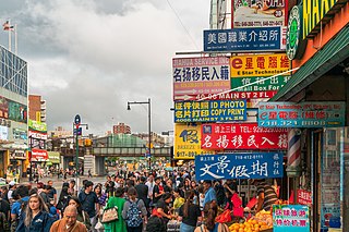
There are multiple Chinatowns in the borough of Queens in New York City. The original Queens Chinatown emerged in Flushing, initially as a satellite of the original Manhattan Chinatown, before evolving its own identity, surpassing in scale the original Manhattan Chinatown, and subsequently, in turn, spawning its own satellite Chinatowns in Elmhurst, Corona, and eastern Queens. As of 2023, illegal Chinese immigration to New York has accelerated, and its Flushing neighborhood has become the present-day global epicenter receiving Chinese immigration as well as the international control center directing such migration.

The Q58 and Q58 Limited are bus routes that constitute a public transit line operating primarily in Queens, New York City, with its southern terminal on the border with Brooklyn. The Q58 is operated by the MTA New York City Transit Authority. Its precursor was a streetcar line that began operation in November 1899. and was known variously as the Flushing–Ridgewood Line, the Corona Avenue Line, and the Fresh Pond Road Line. The route became a bus line in 1949.

The Q65 bus route constitutes a public transit line in Queens, New York City. The south-to-north route runs primarily on 164th Street, operating between two major bus-subway hubs: Sutphin Boulevard–Archer Avenue station in Jamaica and Flushing–Main Street station in Flushing. It then extends north along College Point Boulevard to College Point at the north end of the borough. The route is city-operated under the MTA Bus Company brand of MTA Regional Bus Operations.
The Q25 and Q34 bus routes constitute a public transit line in Queens, New York City. The south-to-north route runs primarily on Parsons Boulevard and Kissena Boulevard, serving two major bus-subway hubs: Sutphin Boulevard–Archer Avenue–Jamaica and Flushing–Main Street. The Q25 terminates in College Point, and the Q34 in Whitestone, both in northern Queens.
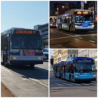
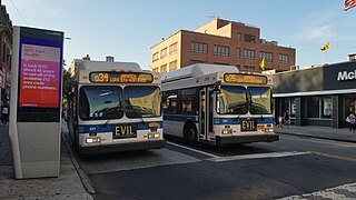
The Q20A and Q20B and Q44 bus routes constitute the Main Street Line, a public transit line in Queens, New York City, running primarily along Main Street between two major bus-subway hubs in the neighborhoods of Jamaica and Flushing. The Q20A/B terminates in College Point at the north end of Queens. The Q44 continues north into the borough of the Bronx, terminating in the West Farms neighborhood near the Bronx Zoo. The Q44 is one of two Queens bus routes to operate between the two boroughs.
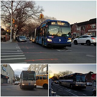
The Q64, QM4 and QM44 bus routes constitute a public transit line in Queens, New York City. The east-to-west Q64 route runs primarily on Jewel Avenue operating between the Forest Hills–71st Avenue subway station in Forest Hills and 164th Street in Electchester. The QM4 route is an express bus route running from Midtown Manhattan to Electchester running via Sixth Avenue in Manhattan and Jewel Avenue in Queens. The QM44 route is an express bus route running from Midtown Manhattan to Electchester via Third Avenue in Manhattan and Jewel Avenue in Queens.


