Linden Boulevard

Last updated
Linden Boulevard
NY-27.svg
Central Avenue (former)
Linden - Springfield Blvd jeh.JPG
Maintained by NYCDOT and NCDPW
Length12.7 mi (20.4 km) [1] [1] [2]
Combined length of three segments
Component
highways
NY-27.svg NY 27 from Flatbush to Ozone Park
Location Brooklyn and Queens
West end Flatbush Avenue in Flatbush
Major
junctions
NY-27.svg NY 27 in Ozone Park
I-678.svg I-678 in South Ozone Park
Cross Island Pkwy Shield free.svg Cross Island Parkway in Cambria Heights
East endSouthern Pkwy Shield.svg Southern State Parkway in North Valley Stream
Linden Boulevard in East New York, Brooklyn LindenBlvd.jpg
Linden Boulevard in East New York, Brooklyn

Linden Boulevard is a boulevard in New York City. Its western end is at Flatbush Avenue in Brooklyn, where Linden Boulevard travels as an eastbound-only street to Caton Avenue, where it becomes a two-way street. The boulevard stretches through both Brooklyn and Queens. This boulevard, especially the area of Cambria Heights between Springfield Boulevard and the Nassau County line represents a smaller version of shopping centers located on Jamaica Avenue and Queens Boulevard. Linden Boulevard also continues into Nassau County to Valley Stream where it turns into Central Avenue; this was one of several former names of the street in Queens.

Contents

Description

Linden Boulevard runs through both Brooklyn and Queens, but is interrupted by Aqueduct Racetrack and the street grid in Ozone Park, Queens. The street's character is very different in each borough. Linden Boulevard in Brooklyn, between Flatbush Avenue and Sapphire Street, is 6.0 miles (9.7 km) long. The five Queens stretches are a combined 6.4 miles (10.3 km) long.

Linden Blvd. at Flatbush Avenue, 2012. Linden Blvd. with Flatbush Ave on the left 2012.jpg
Linden Blvd. at Flatbush Avenue, 2012.

In Brooklyn, between the intersection with Kings Highway and Remsen Avenue, and the intersection with 79th Street and South Conduit Avenue one block east of the Brooklyn–Queens border, it is one of the widest boulevards in the entire city, being a multi-median divided, 8-lane wide boulevard, similar to Queens' Woodhaven Boulevard and Queens Boulevard. While the speed limit on the rest of Linden Boulevard was set at 25 miles per hour in 2015, in line with the city speed limit, this section of Linden Boulevard was lowered over time. [3] The speed limit was lowered to 30 MPH as part of the city's Vision Zero program in 2015, and was subsequently further lowered to 25 MPH in 2019. [4] [5] It is also one of Brooklyn's busiest streets, carrying many trucks, as it is the only direct route for commercial vehicles between Long Island and the Verrazzano-Narrows Bridge since commercial traffic is banned from the Belt Parkway, which runs between the same points. The stretch of Linden Boulevard from Caton Avenue to Conduit Avenue is part of New York State Route 27.

In Queens, it is mostly a simple two-lane, two-way residential street, no wider than the numbered avenues it parallels, and hardly busier until it reaches Cambria Heights, where it serves as a main commercial strip. Between Aqueduct Racetrack and Cross Bay Boulevard, there is a seven-block section of the boulevard that is mostly residential but is the only road between Rockaway Boulevard and Conduit Avenue on which traffic can flow east of the elevated railroad. One block west of Cross Bay Boulevard, contained within one block, are two short sections (each less than half a block), that are dead ends. One is off Desarc Road, and the other is located at the intersection of Sitka Street and Pitkin Avenue. [6]

Conduit Avenue in Queens interrupts Linden Boulevard. The majority of its traffic merges into the Nassau Expressway, which starts just east of the Linden Boulevard/Conduit Avenue intersection. Linden Boulevard becomes a dead-end street at Pitkin Avenue; another dead-end stretch of the boulevard is at Desarc Road, one block east of Pitkin Avenue. Linden Boulevard then resumes at Cross Bay Boulevard one block east of the dead-end stretches, is interrupted by Aqueduct Racetrack, resumes at Rockaway Boulevard in South Ozone Park, and continues into Nassau County from there.

Transportation

In Brooklyn, the B20 bus runs on Linden Boulevard between Ashford Street and Elderts Lane in East New York. The B8 runs on Linden Boulevard between Rockaway and Church Avenues. In Queens, the Q4 bus line serves Linden Boulevard between Merrick Boulevard and the Nassau County border. Until 2010, The Q89 also served a small stretch of Linden Boulevard in Richmond Hill.

Rappers Q-Tip and Phife Dawg, the founding members of the hip-hop group A Tribe Called Quest, both grew up on Linden Boulevard in the neighborhood of St. Albans, Queens in the 1970s and 80s. They later referred to Linden Boulevard in their songs "Check the Rhime" and "Jazz (We've Got)" (from the album The Low End Theory ), "Steve Biko (Stir It Up)" (from Midnight Marauders ) and "1nce Again", "Mind Power" and "Get A Hold" (from Beats, Rhymes and Life ). The music video for "Check the Rhime" was mostly filmed on Linden Boulevard, and showed Q-Tip and Phife Dawg rapping above a crowd on the rooftop of a dry-cleaning store on Linden and 192nd Street. [7] In July 2016, several months after Phife Dawg's death, a mural honoring A Tribe Called Quest was put up on the side of that dry cleaning store. [7] In November 2016, the section of Linden Boulevard at the corner of 192nd St. was honorarily renamed to Malik 'Phife Dawg' Taylor Way. [8]

The 1998 film Belly features Linden Boulevard.

Major intersections

CountyLocationmi [1] [2] kmDestinationsNotes
Brooklyn Flatbush 0.00.0 Flatbush Avenue
0.20.32West plate.svg
NY-27.svg
NY 27 west (Caton Avenue) / Bedford Avenue
NY 27 leaves/joins Linden Boulevard
East Flatbush 0.50.80 Nostrand Avenue
1.93.1 Kings Highway No eastbound left turns; western terminus of service roads
Brownsville 2.54.0 Rockaway Parkway
East New York 3.76.0 Pennsylvania Avenue
Queens Ozone Park 6.09.7East plate.svg
NY-27.svg
NY 27 east (Conduit Avenue)
Partial interchange; NY 27 continues east
Gap in route, including a 0.4-mile (0.6 km) long segment with no major intersections [1]
South Ozone Park 0.00.0 Rockaway Boulevard
1.11.8I-678.svgAirport Sign.svg I-678 (Van Wyck Expressway) Kennedy Airport, Whitestone Bridge, Bronx Exit 3 on I-678; access via service roads
South Jamaica 2.64.2 Merrick Boulevard
Cambria Heights 4.47.1 Francis Lewis Boulevard
4.57.2 Springfield Boulevard
5.58.9West plate.svg
Belt Pkwy Shield free.svg
North plate.svg
Cross Island Pkwy Shield free.svg
Airport Sign.svg Belt Parkway west / Cross Island Parkway north Kennedy Airport, Whitestone Bridge, Bronx
Exit 25B on Belt / Cross Island Parkways; access via service roads
QueensNassau
county line
Cambria Heights
North Valley Stream line
5.69.0Western terminus of unsigned CR C36
Nassau North Valley Stream 5.89.3To plate.svg
East plate.svg
Southern Pkwy Shield.svg
Elmont Road (CR C71) to Southern State Parkway east
6.310.1East plate.svg
Southern Pkwy Shield.svg
Central Avenue (CR C36) / Southern State Parkway east East Islip
Exit 13 on Southern Parkway; CR C36 continues south
1.000 mi = 1.609 km; 1.000 km = 0.621 mi

Related Research Articles

<span class="mw-page-title-main">Belt Parkway</span> Highway in New York

The Belt Parkway is the name given to a series of connected limited-access highways that form a belt-like circle around the New York City boroughs of Brooklyn and Queens. The Belt Parkway comprises three of the four parkways in what is known as the Belt System: the Shore Parkway, the Southern Parkway, and the Laurelton Parkway. The three parkways in the Belt Parkway are a combined 25.29 miles (40.70 km) in length. The Cross Island Parkway makes up the fourth parkway in the system, but is signed separately.

<span class="mw-page-title-main">Flatbush Avenue</span> Avenue in Brooklyn, New York

Flatbush Avenue is a major avenue in the New York City Borough of Brooklyn. It runs from the Manhattan Bridge south-southeastward to Jamaica Bay, where it joins the Marine Parkway–Gil Hodges Memorial Bridge, which connects Brooklyn to the Rockaway Peninsula in Queens. The north end was extended from Fulton Street to the Manhattan Bridge as "Flatbush Avenue Extension".

<span class="mw-page-title-main">Atlantic Avenue (New York City)</span> Avenue in Brooklyn and Queens, New York

Atlantic Avenue is a major thoroughfare in the New York City boroughs of Brooklyn and Queens. It stretches from the Brooklyn waterfront on the East River all the way to Jamaica, Queens. Atlantic Avenue runs parallel to Fulton Street for much of its course through Brooklyn, where it serves as a border between the neighborhoods of Prospect Heights and Fort Greene and between Bedford-Stuyvesant and Crown Heights, and between Brooklyn Heights and Cobble Hill. This stretch of avenue is known for having a high rate of pedestrian fatalities and has been described as "the killing fields of the city."

<span class="mw-page-title-main">Phife Dawg</span> American rapper (1970–2016)

Malik Izaak Taylor, known professionally as Phife Dawg, was an American rapper and a member of the group A Tribe Called Quest with Q-Tip and Ali Shaheed Muhammad. He was also known as the "Five-Foot Assassin" and "the Five-Footer", because he stood at 5 feet 3 inches (1.60 m).

<span class="mw-page-title-main">New York State Route 878</span> Highway on Long Island in New York, US

New York State Route 878 (NY 878) is an east-west expressway on Long Island and in New York City. The route exists in two sections, which both form the Nassau Expressway. NY 878's western terminus is the Belt Parkway and Conduit Avenue (NY 27) in Ozone Park, within southern Queens. Its southern terminus is immediately before the Village of Atlantic Beach, at the Atlantic Beach Bridge in Lawrence, within southwestern Nassau County. NY 878 is discontinuous between Farmers Boulevard in Queens and the town of Inwood in Nassau County. The two sections are connected to each other by Rockaway Boulevard and Rockaway Turnpike.

<span class="mw-page-title-main">Merrick Road</span>

Merrick Road is an east–west urban arterial in Queens, Nassau, and Suffolk counties in New York, United States. It is known as Merrick Boulevard or Floyd H. Flake Boulevard in Queens, within New York City.

The IND Fulton Street Line is a rapid transit line of the IND Division of the New York City Subway, running from the Cranberry Street Tunnel under the East River through all of central Brooklyn to a terminus in Ozone Park, Queens. The IND Rockaway Line branches from it just east of Rockaway Boulevard. The A train runs express during daytime hours and local at night on the underground portion of the line; it runs local on the elevated portion of the line at all times. The C train runs local on the underground portion of the line at all times except late nights.

<span class="mw-page-title-main">New York State Route 27</span> State highway on Long Island, New York, United States

New York State Route 27 (NY 27) is a 120.58-mile (194.05 km) long state highway that runs east–west from Interstate 278 (I-278) in the New York City borough of Brooklyn to Montauk Point State Park on Long Island, New York. Its two most prominent components are Sunrise Highway and Montauk Highway, the latter of which includes the Montauk Point State Parkway. NY 27 acts as the primary east–west highway on southern Long Island east of the interchange with the Heckscher State Parkway in Islip Terrace. The entire route in Suffolk, Nassau, and Queens counties were designated by the New York State Senate as the POW/MIA Memorial Highway. The highway gives access to every town on the South Shore. NY 27 is the easternmost state route in the state of New York, as well as the longest highway on Long Island.

<span class="mw-page-title-main">Aqueduct Racetrack station</span> New York City Subway station in Queens

The Aqueduct Racetrack station is a station on the IND Rockaway Line of the New York City Subway. Located on the west side of Aqueduct Racetrack near Pitkin Avenue in Ozone Park, Queens, it is served by northbound A trains at all times. The station contains four tracks, of which the outer two are in passenger service; the two center express tracks have been disconnected from the line and permanently removed. There is a single side platform next to the northbound local track.

<span class="mw-page-title-main">Rockaway Boulevard station</span> New York City Subway station in Queens

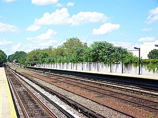
The Rockaway Boulevard station is a station on the IND Fulton Street Line of the New York City Subway. Located at the intersection of Rockaway Boulevard, Woodhaven and Cross Bay Boulevards, and Liberty Avenue in Ozone Park, Queens, it is served by the A train at all times.

<span class="mw-page-title-main">Check the Rhime</span> 1991 single by A Tribe Called Quest

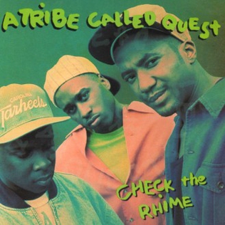
"Check the Rhime" is the first single from A Tribe Called Quest's second album The Low End Theory. The song was written by group members Phife Dawg, Q-Tip, and Ali Shaheed Muhammad. It was recorded at the legendary Greene St. Recording studio in New York City. The song peaked at number 59 on Billboard on November 16, 1991. Rolling Stone listed "Check the Rhime" as one of the group's 20 essential songs, noting that Phife Dawg "quickly proves himself Q-Tip's lyrical equal."

<span class="mw-page-title-main">Aqueduct–North Conduit Avenue station</span> New York City Subway station in Queens

The Aqueduct–North Conduit Avenue station is a station on the IND Rockaway Line of the New York City Subway. Located at North Conduit Avenue near the intersection of Cohancy Street in Ozone Park, Queens, it is served at all times by the A train.

Woodhaven Boulevard and Cross Bay Boulevard are two parts of a major boulevard in the New York City borough of Queens. Woodhaven Boulevard runs roughly north–south in the central portion of Queens. South of Liberty Avenue, it is known as Cross Bay Boulevard, which is the main north–south road in Howard Beach. Cross Bay Boulevard is locally known as simply "Cross Bay", and Woodhaven Boulevard, "Woodhaven". The completion of the boulevard in 1923, together with the construction of the associated bridges over Jamaica Bay, created the first direct roadway connection to the burgeoning Atlantic Ocean beachfront communities of the Rockaway Peninsula from Brooklyn and most of Queens.

<span class="mw-page-title-main">Francis Lewis Boulevard</span> Boulevard in Queens, New York

Francis Lewis Boulevard is a boulevard in the New York City borough of Queens. The roadway is named for Francis Lewis, a Queens resident who was a signer of the United States Declaration of Independence. The boulevard zigzags across Queens by including segments of several other roadways that were renamed to become parts of the boulevard.

<span class="mw-page-title-main">B15 (New York City bus)</span> Bus route in Brooklyn, New York

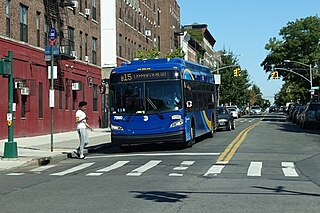
The Sumner Avenue Line and New Lots Avenue Line were two streetcar lines in Brooklyn, New York City, running mainly along Marcus Garvey Boulevard, East 98th Street, and New Lots Avenue between northern Bedford–Stuyvesant and New Lots. Originally streetcar lines, the two lines were combined as a bus route in 1947. That bus route became the present B15 Marcus Garvey Boulevard / New Lots Avenue service, operated by MTA New York City Bus' East New York Depot in East New York. The B15 continues east from New Lots to John F. Kennedy International Airport in Queens.

<span class="mw-page-title-main">Q37 (New York City bus)</span> Bus route in Queens, New York

The Q37 bus route constitutes a public transit line in Queens, New York City, running primarily along 111th Street between Kew Gardens and South Ozone Park. The Q37 was formerly privately operated by Green Bus Lines, under a subsidized franchise with the New York City Department of Transportation (NYCDOT). The route is now operated by MTA Regional Bus Operations under the MTA Bus Company brand.

<span class="mw-page-title-main">Conduit Avenue</span> Avenue in Brooklyn and Queens, New York

Conduit Avenue is an arterial road in New York City, the vast majority of which is in Queens. The divided highway runs from Atlantic Avenue in Cypress Hills, Brooklyn to Hook Creek Boulevard in Rosedale, Queens at the Nassau County border. The thoroughfare is named after an aqueduct in its right-of-way.

<span class="mw-page-title-main">Rockaway Boulevard</span> Boulevard in Queens, New York

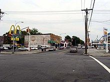
Rockaway Boulevard is a major road in the New York City borough of Queens. Unlike the similarly named Rockaway Beach Boulevard and Rockaway Freeway, it serves mainland Queens and does not enter the Rockaways.

<span class="mw-page-title-main">Q111, Q113, and Q114 buses</span> Bus routes in Queens, New York

The Q111, Q113, and Q114 bus routes constitute a public transit line between the Jamaica and Far Rockaway neighborhoods of Queens, New York City, running primarily along Guy R. Brewer Boulevard. The Q113 and Q114 provide limited-stop service between Jamaica and Far Rockaway, connecting two major bus-subway hubs, and crossing into Nassau County. The Q111 provides local service exclusively within Queens, with the exception of select rush-hour trips to or from Cedarhurst in Nassau County. Some of the last bus routes to be privately operated in the city, they are currently operated by the MTA Bus Company brand of MTA Regional Bus Operations. The Q113 and Q114 are one of the few public transit options between the Rockaway peninsula and "mainland" New York City.

<span class="mw-page-title-main">Woodhaven and Cross Bay Boulevards buses</span> Bus routes in Queens, New York

The Q11, Q21, Q52, and Q53 bus routes constitute a public transit corridor running along Woodhaven and Cross Bay Boulevards in Queens, New York City. The corridor extends primarily along the length of the two boulevards through "mainland" Queens, a distance of 6 miles (9.7 km) between Elmhurst and the Jamaica Bay shore in Howard Beach. The Q52 and Q53 buses, which provide Select Bus Service along the corridor, continue south across Jamaica Bay to the Rockaway peninsula, one of the few public transit options between the peninsula and the rest of the city.

References

  1. 1 2 3 4 Google (July 2, 2018). "Linden Boulevard" (Map). Google Maps . Google. Retrieved July 2, 2018.
  2. 1 2 Google (July 2, 2018). "Linden Boulevard" (Map). Google Maps . Google. Retrieved July 2, 2018.
  3. "current, pre-vision zero speed limit maps" (PDF).
  4. Miller, Stephen (10 June 2015). "DOT's Linden Boulevard Plan Improves the Basics and Not Much Else". Streetsblog New York City.
  5. Ricciulli, Valeria (24 October 2019). "The city's "Green Wave" inches forward with more protected bike lanes and signal-timing measures". Curbed NY.
  6. Forgotten NY: Familiar roads in unfamiliar scenes
  7. 1 2 Diep, Eric (September 23, 2016). "Here's How A Tribe Called Quest's Latest Mural Was Created in Queens". Complex.
  8. Kim, Michelle (November 19, 2016). "NYC Street Is Now Officially Named After A Tribe Called Quest's Phife Dawg". The Fader.
Template:Attached KML/Linden Boulevard
KML is from Wikidata