
Brooklyn is a borough of New York City. Located on the westernmost end of Long Island, it is coextensive with Kings County in the U.S. state of New York. With 2,736,074 residents as of the 2020 United States census, Kings County is the most populous of the five boroughs of New York City and the most populous county in the State of New York. The population density of Brooklyn was 37,339.9 inhabitants per square mile (14,417.0/km2) in 2022, making it the second-most-densely-populated county in the United States, behind Manhattan, and it had the ninth-highest population of any county nationwide. Were Brooklyn still an independent city, it would be the fourth most populous in the U.S. after the rest of New York City, Los Angeles, and Chicago.
The BMT Brighton Line, also known as the Brighton Beach Line, is a rapid transit line in the B Division of the New York City Subway in Brooklyn, New York City, United States. Local service is provided at all times by the Q train, but is joined by the B express train on weekdays. The Q train runs the length of the entire line from Coney Island–Stillwell Avenue to the Manhattan Bridge south tracks. The B begins at Brighton Beach and runs via the bridge's north tracks.

The Belt Parkway is the name given to a series of controlled-access parkways that form a belt-like circle around the New York City boroughs of Brooklyn and Queens. The Belt Parkway comprises three of the four parkways in what is known as the Belt System: the Shore Parkway, the Southern Parkway, and the Laurelton Parkway. The three parkways in the Belt Parkway are a combined 25.29 miles (40.70 km) in length. The Cross Island Parkway makes up the fourth parkway in the system, but is signed separately.

Windsor Terrace is a small residential neighborhood in the central part of the New York City borough of Brooklyn. It is bounded by Prospect Park on the east and northeast, Park Slope at Prospect Park West, Green-Wood Cemetery, and Borough Park at McDonald Avenue on the northwest, west, and southwest, and Kensington at Caton Avenue on the south. As of the 2010 United States Census, Windsor Terrace had 20,988 people living within its 0.503-square-mile (1.30 km2) area.

The Brighton Beach station is an elevated express and terminal station on the BMT Brighton Line of the New York City Subway. It is located over Brighton Beach Avenue between Brighton 5th Street and Brighton 7th Street in Brighton Beach, Brooklyn. The station is served by the Q train at all times and is the southern terminal for the B train on weekdays only.

The Ocean Parkway station is an express station on the New York City Subway's BMT Brighton Line. It is located at Brighton Beach Avenue and Ocean Parkway in Brighton Beach, Brooklyn. The station is served by the Q train at all times.

The BMT Franklin Avenue Line is a lower capacity rapid transit line of the New York City Subway in Brooklyn, New York, running between Franklin Avenue and Prospect Park. Service is full-time, and provided by the Franklin Avenue Shuttle. The line serves the neighborhoods of Bedford-Stuyvesant and Crown Heights, and allows for easy connections between the Fulton Street Line and the Brighton Line.

New York State Route 27 (NY 27) is a 120.58-mile (194.05 km) long state highway that runs east–west from Interstate 278 (I-278) in the New York City borough of Brooklyn to Montauk Point State Park on Long Island, New York. Its two most prominent components are Sunrise Highway and Montauk Highway, the latter of which includes the Montauk Point State Parkway. NY 27 acts as the primary east–west highway on southern Long Island east of the interchange with the Heckscher State Parkway in Islip Terrace. The entire route in Suffolk, Nassau, and Queens counties were designated by the New York State Senate as the POW/MIA Memorial Highway. The highway gives access to every town on the South Shore. NY 27 is the easternmost state route in the state of New York, as well as the longest highway on Long Island.

Community boards of Brooklyn are New York City community boards in the borough of Brooklyn, which are the appointed advisory groups of the community districts that advise on land use and zoning, participate in the city budget process, and address service delivery in their district.

The Prospect Park station is an express station on the BMT Brighton Line of the New York City Subway. It is located in between Lincoln Road, Lefferts Avenue, Empire Boulevard, Ocean Avenue and Flatbush Avenue in Flatbush, Brooklyn, near the border of Crown Heights, Prospect Heights, Park Slope, and Prospect Lefferts Gardens. The station, which serves Prospect Park and Brooklyn Botanic Garden, is served by the Q train and Franklin Avenue Shuttle at all times and by the B train on weekdays.

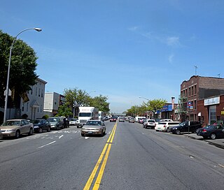
Ocean Parkway is a 4.86-mile-long (7.82 km) boulevard in the west-central portion of the New York City borough of Brooklyn. It is inventoried by the New York State Department of Transportation (NYSDOT) as New York State Route 908H (NY 908H), an unsigned reference route.

The B68 is a bus route that constitutes a public transit line operating in Brooklyn, New York City. The B68 is operated by the MTA New York City Transit Authority. Its precursor was a streetcar line that began operation in June 1862, and was known as the Coney Island Avenue Line. The route became a bus line in 1955.
The Culver Line, Gravesend Avenue Line, or McDonald Avenue Line was a surface public transit line in Brooklyn, New York City, United States, running along McDonald Avenue and built by the Prospect Park and Coney Island Railroad. Most of its main line has been essentially replaced by the IND Culver Line of the New York City Subway.

The Nassau Electric Railroad was an electric street railway company in the U.S. state of New York. The company operated throughout the borough of Brooklyn, as well as over the Brooklyn Bridge and Williamsburg Bridge into Manhattan.
The Brooklyn–Queens Greenway is a bicycling and pedestrian path connecting parks and roads in the New York City boroughs of Brooklyn and Queens, connecting Coney Island in the south to Fort Totten in the north, on Long Island Sound. The route connects major sites in the two boroughs, such as the New York Aquarium, Brooklyn Museum, the Brooklyn Botanic Garden, the New York Hall of Science, and Citi Field.
Stillwell Avenue is a major two-way north–south thoroughfare in southern Brooklyn and the central section of Coney Island. It is 2.4 miles (3.9 km) long and begins at a dead end at Riegelmann Boardwalk on Coney Island. The road goes north, leaving Coney Island, ending at Bay Parkway, where the road continues as the Bay Ridge Parkway. On December 11, 2008, it acquired the subsidiary name Polar Bear Club Walk, named for the Coney Island Polar Bear Club. The Stillwell Avenue/Surf Avenue intersection on Coney Island is the location of the Coney Island–Stillwell Avenue subway station, a major subway station in New York City.

