Katanga was one of the four large provinces created in the Belgian Congo in 1914. It was one of the eleven provinces of the Democratic Republic of the Congo between 1966 and 2015, when it was split into the Tanganyika, Haut-Lomami, Lualaba, and Haut-Katanga provinces. Between 1971 and 1997, its official name was Shaba Province.
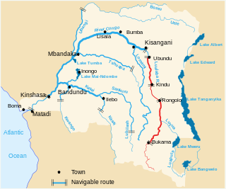
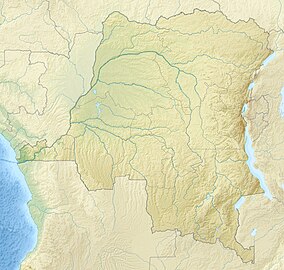
The Lualaba River flows entirely within the eastern part of Democratic Republic of the Congo. It provides the greatest streamflow to the Congo River, while the source of the Congo is recognized as the Chambeshi. The Lualaba is 1,800 kilometres (1,100 mi) long. Its headwaters are in the country's far southeastern corner near Musofi and Lubumbashi in Katanga Province, next to the Zambian Copperbelt.
Upemba National Park is a large national park in Haut-Lomami, Lualaba Province & Haut-Katanga Province of the southeastern Democratic Republic of Congo, formerly Zaire.

The Copperbelt is a natural region in Central Africa which sits on the border region between northern Zambia and the southern Democratic Republic of Congo. It is known for copper mining.
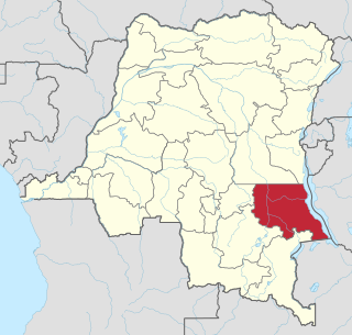
Tanganyika is one of the 21 new provinces of the Democratic Republic of the Congo created in the 2015 repartitioning. Tanganyika, Haut-Katanga, Haut-Lomami and Lualaba provinces are the result of the splitting up of the former Katanga province. Tanganyika was formed from the Tanganyika district whose town of Kalemie was elevated to capital city of the new province.
Atheris katangensis, also known as the Katanga Mountain bush viper and other common names, is a species of venomous viper found in the eastern Democratic Republic of the Congo and in Zambia. No subspecies are currently recognized.
Articles related to the Democratic Republic of the Congo include:
The Lofoi Falls is a waterfall in Kundelungu National Park, Katanga Province, Democratic Republic of the Congo. Plunging down for an unbroken 340 m, it is one of the largest waterfalls in Central Africa. The waters of the Lofoi are a tributary of the Lufira River. The falls shrink quite a bit during the drier season of June to October, but are quite dramatic during the rest of the year.
Leptopelis parvus, also known as the Kanole forest treefrog, is a species of frog in the family Arthroleptidae. It is endemic to the Democratic Republic of the Congo and is only known from the Upemba National Park.
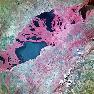
Lake Upemba is a lake in Bukama, Haut-Lomami Province, the Democratic Republic of the Congo. It, and nearby Lake Kisale, is surrounded by the Upemba Depression in Upemba National Park. The nearest town is Nyonga, and the nearest hospital is located four hours away in Kikondja.
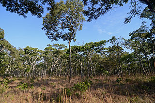
The Central Zambezian miombo woodlands ecoregion spans southern central Africa. Miombo woodland is the predominant plant community. It is one of the largest ecoregions on the continent, and home to a great variety of wildlife, including many large mammals.
Commelina orchidophylla is a monocotyledonous, herbaceous plant in the dayflower family from south-central Africa. This blue-flowered herb has been recorded only from the Haut-Katanga District of the Democratic Republic of the Congo, although at the time of its description it was known only from 3 collections. It is found in woodlands, especially in rocky areas, and on sandstone. The plant's most distinctive feature and the source of its scientific name is its orchid-like pair of broad basal leaves. Other distinctive characteristics include hairy tuberous roots, solitary spathes on long stalks that arise directly from the basal leaves before the development of elongated flowering shoots, dimorphic seeds, and unfused spathes lacking hairs which contain an upper cincinnus that barely emerges. The flowers have never been observed directly and are only partially known from bud dissections.
Letheobia kibarae, also known as the Upemba gracile blind snake or Katanga beaked snake, is a species of snakes in the family Typhlopidae. It is endemic to southern Democratic Republic of the Congo. Its type locality is in the Upemba National Park.
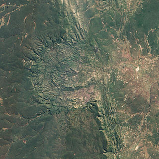
Luizi is a meteorite impact structure that lies on the Kundelungu Plateau of Haut-Katanga province, in an underexplored region of southeastern Democratic Republic of the Congo. The crater, ~17 kilometer in diameter, is visible from satellite imagery, and has been confirmed in 2011 by Ferrière et al. as being caused by a large impact event. This complex meteorite impact crater is so far the only recognized one in the Democratic Republic of the Congo and even in the whole Central Africa.
Mitwaba is a territory in the Haut-Katanga Province of the Democratic Republic of the Congo.
The Kibara Mountains are a range in the Katanga Province of the Democratic Republic of the Congo. They are partly within the Upemba National Park.
Mai-Mai Kata Katanga, also called Mai-Mai Bakata Katanga, is a mai-mai rebel group in the Democratic Republic of the Congo which advocates the independence of the Congo's Katanga Province. It was formed shortly after the group's leader, Gédéon Kyungu Mutanga, escaped from prison in September 2011 where he was serving a sentence for crimes against humanity committed by his supporters between 2002 and 2006 in central Katanga. Kata Katanga means "cut [e.g. secede] Katanga" in Swahili. It has been estimated that, at its height in 2013, the Kata Katanga rebels numbered approximately 3,000 of whom most were based in Mitwaba Territory.

The Katanga insurgency is an ongoing rebellion by a number of rebel groups in the Democratic Republic of the Congo, some of which aim for the creation of a separate state within Katanga. While the insurgency has been active in various forms since 1963, insurgent groups have recently redoubled their efforts after the 2011 jail break that freed Gédéon Kyungu Mutanga, who commanded the majority of the Katangese separatist groups until his surrender to Congolese authorities in October 2016.
Katwe Airport is an airport serving the hamlet of Katwe in Kundelungu National Park, a protected area of Haut-Katanga Province, Democratic Republic of the Congo.