Iskitim is a town in Novosibirsk Oblast, Russia, located on the Berd River. Population: 60,078 (2010 Census); 62,756 (2002 Census); 67,849 (1989 Census).

Bolotnoye is a town and the administrative center of Bolotninsky District in Novosibirsk Oblast, Russia, located 126 kilometers (78 mi) northeast of Novosibirsk, the administrative center of the oblast. Population: 16,570 (2010 Census); 18,170 (2002 Census); 20,006 (1989 Census).

Bagansky District is an administrative and municipal district (raion), one of the thirty in Novosibirsk Oblast, Russia. It is located in the southwest of the oblast. The area of the district is 3,367.73 square kilometers (1,300.29 sq mi). Its administrative center is the rural locality of Bagan. Population: 16,627 ; 18,457 (2002 Census); 18,922 (1989 Census). The population of Bagan accounts for 33.1% of the district's total population.

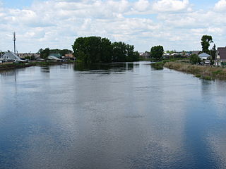
Barabinsky District is an administrative and municipal district (raion), one of the thirty in Novosibirsk Oblast, Russia. It is located in the western central part of the oblast. The area of the district is 5,400 square kilometers (2,100 sq mi). Its administrative center is the town of Barabinsk. Population: 14,169 ; 17,126 (2002 Census); 18,279 (1989 Census).
Bolotninsky District is an administrative and municipal district (raion), one of the thirty in Novosibirsk Oblast, Russia. It is located in the northeast of the oblast. The area of the district is 3,400 square kilometers (1,300 sq mi). Its administrative center is the town of Bolotnoye. Population: 29,365 ; 32,348 (2002 Census); 36,236 (1989 Census). The population of Bolotnoye accounts for 56.4% of the district's total population.

Chanovsky District is an administrative and municipal district (raion), one of the thirty in Novosibirsk Oblast, Russia. It is located in the west of the oblast. The area of the district is 5,515 square kilometers (2,129 sq mi). Its administrative center is the urban locality of Chany. Population: 25,523 ; 29,391 (2002 Census); 34,199 (1989 Census). The population of Chany accounts for 33.2% of the district's total population.
Cherepanovsky District is an administrative and municipal district (raion), one of the thirty in Novosibirsk Oblast, Russia. It is located in the southeast of the oblast. The area of the district is 2,908 square kilometers (1,123 sq mi). Its administrative center is the town of Cherepanovo. Population: 47,842 ; 50,959 (2002 Census); 53,418 (1989 Census). The population of Cherepanovo accounts for 41.4% of the district's total population.

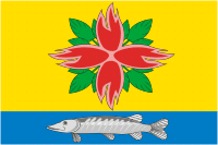
Dovolensky District is an administrative and municipal district (raion), one of the thirty in Novosibirsk Oblast, Russia. It is located in the south of the oblast. The area of the district is 4,400 square kilometers (1,700 sq mi). Its administrative center is the rural locality of Dovolnoye. Population: 17,405 ; 20,664 (2002 Census); 22,506 (1989 Census). The population of Dovolnoye accounts for 38.9% of the district's total population.

Iskitimsky District is an administrative and municipal district (raion), one of the thirty in Novosibirsk Oblast, Russia. It is located in the east of the oblast. The area of the district is 4,384 square kilometers (1,693 sq mi). Its administrative center is the town of Iskitim. Population: 62,816 ; 66,420 (2002 Census); 67,733 (1989 Census).
Kochenyovsky District is an administrative and municipal district (raion), one of the thirty in Novosibirsk Oblast, Russia. It is located in the eastern central part of the oblast. The area of the district is 5,072 square kilometers (1,958 sq mi). Its administrative center is the urban locality of Kochenyovo. Population: 43,850 ; 46,378 (2002 Census); 46,148 (1989 Census). The population of Kochenyovo accounts for 37.3% of the district's total population.
Kupinsky District is an administrative and municipal district (raion), one of the thirty in Novosibirsk Oblast, Russia. It is located in the southwest of the oblast. The area of the district is 5,809 square kilometers (2,243 sq mi). Its administrative center is the town of Kupino. Population: 31,199 ; 37,451 (2002 Census); 40,440 (1989 Census). The population of Kupino accounts for 47.7% of the district's total population.
Kuybyshevsky District is an administrative and municipal district (raion), one of the thirty in Novosibirsk Oblast, Russia. It is located in the center of the oblast. The area of the district is 8,823.3 square kilometers (3,406.7 sq mi). Its administrative center is the town of Kuybyshev. Population: 15,466 ; 19,386 (2002 Census); 21,758 (1989 Census).
Maslyaninsky District is an administrative and municipal district (raion), one of the thirty in Novosibirsk Oblast, Russia. It is located in the east of the oblast. The area of the district is 3,453 square kilometers (1,333 sq mi). Its administrative center is the urban locality of Maslyanino. Population: 24,438 ; 27,196 (2002 Census); 26,421 (1989 Census). The population of Maslyanino accounts for 53.6% of the district's total population.

Moshkovsky District is an administrative and municipal district (raion), one of the thirty in Novosibirsk Oblast, Russia. It is located in the northeast of the oblast. The area of the district is 2,591 square kilometers (1,000 sq mi). Its administrative center is the urban locality of Moshkovo. Population: 39,192 ; 41,281 (2002 Census); 41,879 (1989 Census). The population of Moshkovo accounts for 26.1% of the district's total population.

Novosibirsky District is an administrative and municipal district (raion), one of the thirty in Novosibirsk Oblast, Russia. It is located in the east of the oblast. The area of the district is 2,900 square kilometers (1,100 sq mi). Its administrative center is the city of Novosibirsk. Population: 127,891 ; 113,047 (2002 Census); 130,300 (1989 Census).

Ordynsky District is an administrative and municipal district (raion), one of the thirty in Novosibirsk Oblast, Russia. It is located in the southeast of the oblast. The area of the district is 4,748 square kilometers (1,833 sq mi). Its administrative center is the urban locality of Ordynskoye. Population: 36,708 ; 39,209 (2002 Census); 38,231 (1989 Census). The population of Ordynskoye accounts for 27.9% of the district's total population.
Severny District is an administrative and municipal district (raion), one of the thirty in Novosibirsk Oblast, Russia. It is located in the northwest of the oblast. The area of the district is 15,548 square kilometers (6,003 sq mi). Its administrative center is the rural locality of Severnoye. Population: 10,687 ; 11,835 (2002 Census); 12,923 (1989 Census). The population of Severnoye accounts for 49.7% of the district's total population.

Tatarsky District is an administrative and municipal district (raion), one of the thirty in Novosibirsk Oblast, Russia. It is located in the west of the oblast. The area of the district is 4,870 square kilometers (1,880 sq mi). Its administrative center is the town of Tatarsk. Population: 15,875 ; 19,297 (2002 Census); 20,718 (1989 Census).
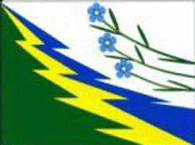
Vengerovsky District is an administrative and municipal district (raion), one of the thirty in Novosibirsk Oblast, Russia. It is located in the west of the oblast. The area of the district is 6,382.71 square kilometers (2,464.38 sq mi). Its administrative center is the rural locality of Vengerovo. As of the 2010 Census, the total population of the district was 20,446, with the population of Vengerovo accounting for 34.4% of that number.

Kochenyovo is an urban-type settlement and the administrative center of Kochenyovsky District, Novosibirsk Oblast, Russia. Population: 16,374 (2010 Census); 16,510 (2002 Census); 15,048 (1989 Census).