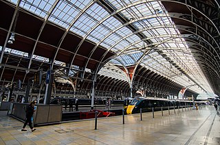
Paddington, also known as London Paddington, is a London railway station and London Underground station complex, located on Praed Street in the Paddington area. The site has been the London terminus of services provided by the Great Western Railway and its successors since 1838. Much of the main line station dates from 1854 and was designed by Isambard Kingdom Brunel. As of the 2022–23 Office of Rail & Road Statistics, it is the second busiest station in the United Kingdom, after London Liverpool Street, with 59.2 million entries and exits.

Notting Hill Gate is a London Underground station near Notting Hill, London, located on the street called Notting Hill Gate. On the Central line, it is between Holland Park to the west and Queensway to the east. On the District line and Circle line, it is between High Street Kensington and Bayswater stations. It is on the boundary of Travelcard Zone 1 and Zone 2.
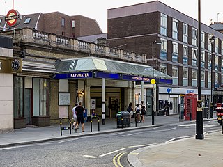
Bayswater is a London Underground station in the Bayswater area of the City of Westminster. The station is on the Circle and District lines, between Notting Hill Gate and Paddington stations and is in Travelcard Zone 1. It is less than 100 metres (330 ft) away from the Central line's Queensway station.

South Kensington is a London Underground station in the district of South Kensington, south west London. It is served by the District, Circle and Piccadilly lines. On the District and Circle lines it is between Gloucester Road and Sloane Square, and on the Piccadilly line between Gloucester Road and Knightsbridge. It is in Travelcard Zone 1. The main station entrance is located at the junction of Old Brompton Road (A3218), Thurloe Place, Harrington Road, Onslow Place and Pelham Street. Subsidiary entrances are located in Exhibition Road giving access by pedestrian tunnel to the Natural History, Science and Victoria and Albert Museums. Also close by are the Royal Albert Hall, Imperial College London, the Royal College of Music, the London branch of the Goethe-Institut and the Ismaili Centre.

Edgware Road is a London Underground station on the Circle, District and Hammersmith & City lines, located on the corner of Chapel Street and Cabbell Street, within Travelcard zone 1. A separate station of the same name but served by the Bakerloo line is located about 150 metres away on the opposite side of Marylebone Road.

Ealing Broadway is a major single-level interchange station located in Ealing, in the London Borough of Ealing, West London for London Underground services and also Elizabeth line services on the National Rail Great Western Main Line.

Gloucester Road is a London Underground station in Kensington, west London. The station entrance is located close to the junction of Gloucester Road and Cromwell Road. Close by are the Cromwell Hospital and Baden-Powell House.

High Street Kensington is a London Underground station on Kensington High Street, in Kensington. The station is on the Circle line between Gloucester Road and Notting Hill Gate, and the District line between Earl's Court and Notting Hill Gate and is in Travelcard Zone 1. Kensington Arcade forms the entrance to the station.

Great Portland Street is a London Underground station near Regent's Park. It is between Baker Street and Euston Square stations on the Circle, Hammersmith & City and Metropolitan lines. Great Portland Street station is listed as a building of National Significance and lies in Travelcard Zone 1.

Queensway is a London Underground station on the Central line in Bayswater, just inside the boundary of the City of Westminster with the Royal Borough of Kensington and Chelsea. It is at the junction of Queensway and Bayswater Road, and is opposite the north-west corner of Kensington Gardens. It is between Notting Hill Gate to the west and Lancaster Gate to the east, and is in Travelcard Zone 1.

Barbican is a London Underground station situated near the Barbican Estate, on the edge of the ward of Farringdon Within, in the City of London in Central London. It has been known by various names since its opening in 1865, mostly in reference to the neighbouring ward of Aldersgate.

Kensington (Olympia) is an interchange station located in Kensington, in West London for London Overground and National Rail services. Limited London Underground services also run here.
Latimer Road is a London Underground station in North Kensington, in the Royal Borough of Kensington and Chelsea. It is on the Circle and Hammersmith & City lines between Wood Lane and Ladbroke Grove stations and is in Travelcard Zone 2.

Greenford is a London Underground and National Rail station in Greenford, Greater London, and is owned and managed by London Underground. It is the terminus of the National Rail Greenford branch line, 2 miles 40 chains down the line from West Ealing and 9 miles 6 chains measured from London Paddington. On the Central line, it is between Perivale and Northolt stations while on National Rail, the next station to the south on the branch is South Greenford.

Holland Park is a London Underground station, on Holland Park Avenue. It is served by the Central line, lying between Shepherd's Bush and Notting Hill Gate stations, in Travelcard Zone 2.
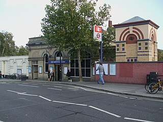
West Brompton is a station located on Old Brompton Road (A3218) in West Brompton, West London for London Underground, London Overground and National Rail services. It is immediately south of the demolished Earls Court Exhibition Centre and west of Brompton Cemetery in the Royal Borough of Kensington and Chelsea.

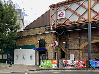
Ladbroke Grove is a London Underground station on the Circle and Hammersmith & City lines, between Latimer Road and Westbourne Park stations, and in Travelcard Zone 2 set in The Royal Borough of Kensington and Chelsea.
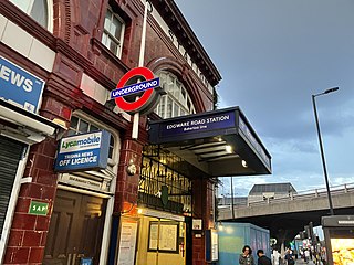
Edgware Road is a London Underground station on the Bakerloo line, located in the City of Westminster. It is between Paddington and Marylebone stations on the line and falls within Travelcard zone 1. The station is located on the north-east corner of the junction of Edgware Road, Harrow Road and Marylebone Road. It is adjacent to the Marylebone flyover.
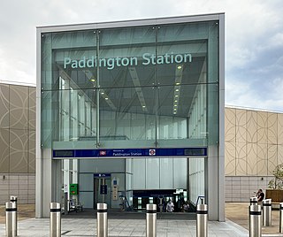
Paddington is a London Underground station served by the Circle and Hammersmith & City lines. It is located adjacent to the north side of Paddington mainline station and has entrances from within the mainline station and from Paddington Basin. The station is between Royal Oak and Edgware Road and is in London Fare Zone 1.

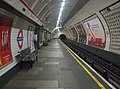
Paddington is a London Underground station served by the Bakerloo, Circle and District lines. It is located on Praed Street to the south of Paddington mainline station and has entrances from Praed Street and from within the mainline station. On the Bakerloo line the station is between Warwick Avenue and Edgware Road and on the Circle and District lines it is between Bayswater and Edgware Road. It is in London Fare Zone 1.