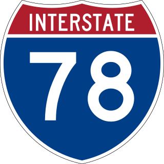
Interstate 78 (I-78) is an east–west Interstate Highway in the Northeastern United States that runs 144 miles (232 km) from I-81 northeast of Harrisburg, Pennsylvania through Allentown to western and North Jersey, terminating at the Holland Tunnel entrance to Lower Manhattan in New York City. Major metropolitan areas along I-78 route include the Lehigh Valley in Pennsylvania, the Gateway Region in New Jersey, and the New York metropolitan area.

Salisbury Township is a township in Lehigh County, Pennsylvania. The township's population was 13,505 at the 2010 census. The township borders Allentown, Pennsylvania's third-largest city, Bethlehem, and Emmaus, in the Lehigh Valley, which had a population of 861,899 and was the 68th-most populous metropolitan area in the U.S. as of the 2020 census.

U.S. Route 222 is a U.S. Highway that is a spur of US 22 in the states of Maryland and Pennsylvania. It runs for 95 miles (153 km) from US 1 in Conowingo, Maryland, north to the junction of Interstate 78 (I-78) and Pennsylvania Route 309 in Dorneyville, Pennsylvania. US 222 is almost entirely in Pennsylvania, and serves as the state's principal artery between the Lancaster and Reading areas in the west and the Lehigh Valley in the east.

The Lehigh Valley is a geographic and metropolitan region formed by the Lehigh River in Lehigh and Northampton Counties in eastern Pennsylvania. It is a component valley of the Great Appalachian Valley bounded to its north by Blue Mountain, to its south by South Mountain, to its west by Lebanon Valley, and to its east by the Delaware River and Warren County, New Jersey. The Valley is about 40 miles (64 km) long and 20 miles (32 km) wide. The Lehigh Valley's largest city is Allentown, the third-largest city in Pennsylvania and the county seat of Lehigh County, with a population of 125,845 residents as of the 2020 census.

Pennsylvania Route 100 is a 59.4-mile (95.6 km) long state highway in the U.S. state of Pennsylvania that runs from U.S. Route 202 near West Chester north to PA 309 in Pleasant Corners. The route runs between the western suburbs of Philadelphia and the Lehigh Valley region of the state, serving Chester, Montgomery, Berks, and Lehigh counties. PA 100 intersects several important highways, including US 30 in Exton, the Pennsylvania Turnpike (Interstate 76, near Lionville, US 422 near Pottstown, US 222 in Trexlertown, and I-78/US 22 in Fogelsville. Several sections of PA 100 are multi-lane divided highway with some interchanges, including between US 202 and the Pennsylvania Turnpike in Chester County between south of Pottstown and New Berlinville, and between Trexlertown and Fogelsville.
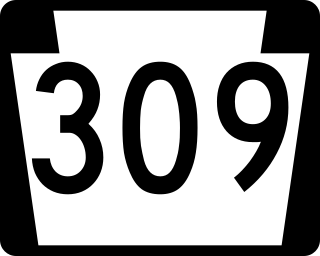
Pennsylvania Route 309 is a state highway that runs for 134 miles (216 km) through eastern Pennsylvania. The route runs from an interchange between PA 611 and Cheltenham Avenue on the border of Philadelphia and Cheltenham Township north to an intersection with PA 29 in Bowman Creek, a village in Monroe Township in Wyoming County. The highway connects Philadelphia and its northern suburbs to Allentown and the Lehigh Valley, and Hazleton and Wilkes-Barre in Wyoming Valley.
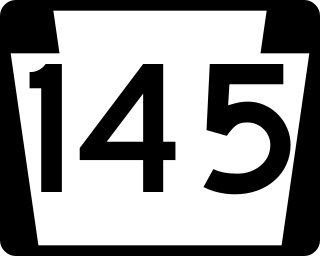
Pennsylvania Route 145 is a 20.89 mi (33.62 km) long north–south state highway in the Lehigh Valley area of eastern Pennsylvania. It connects Interstate 78 (I-78) and PA 309 in Lanark, Lehigh County, north to PA 248 in Lehigh Gap, Northampton County.

Pennsylvania Route 248 is a 31.3 mi (50.4 km) long state highway in the eastern part of the U.S. state of Pennsylvania. The western terminus of the route is at U.S. Route 209 in Weissport East, a CDP in Franklin Township. The eastern terminus is at PA 611 in Easton. The route begins at US 209 in Carbon County and heads southeast parallel to the Lehigh River as a four-lane divided highway to Bowmanstown, where it becomes a freeway and heads through Palmerton. Upon crossing Lehigh Gap in Blue Mountain, PA 248 enters Northampton County and becomes a two-lane undivided highway that heads southeast through rural areas, serving Bath and Nazareth. From here, the route runs southeast through suburban areas to Wilson, where it turns east and follows city streets through Easton.

Pennsylvania Route 329 is a Pennsylvania state highway that runs for 12.9 miles (20.8 km) through Lehigh and Northampton counties in the Lehigh Valley region of the state. It runs from PA 873 in the North Whitehall Township village of Neffs east to PA 248 and PA 987 in Bath. The route is a two-lane undivided road that runs through a mix of rural and developed areas to the north of the cities of Allentown and Bethlehem, serving the communities of Balliettsville, Egypt, Cementon, and Northampton. PA 329 intersects PA 145 near Egypt and runs concurrent with PA 987 between East Allen Township and the eastern terminus in Bath.
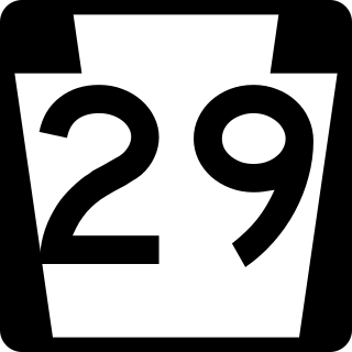
Pennsylvania Route 29 is a 118-mile-long (190 km) north–south state highway that runs through most of eastern Pennsylvania.

Pennsylvania Route 611 is a state highway in eastern Pennsylvania running 109.7 mi (176.5 km) from Interstate 95 (I-95) in the southern part of Philadelphia north to I-380 in Coolbaugh Township in the Pocono Mountains.

U.S. Route 30 (US 30) is a U.S. Highway that runs east–west across the southern part of Pennsylvania, passing through Pittsburgh and Philadelphia on its way from the West Virginia state line east to the Benjamin Franklin Bridge over the Delaware River into New Jersey.
Pennsylvania Route 987 is a state highway in the Lehigh Valley region of the U.S. state of Pennsylvania. It runs 10.3 mi (16.6 km) from U.S. Route 22 near the Lehigh Valley International Airport north of Allentown north to PA 946 in Klecknersville.

Pennsylvania Route 222 is a 4.482 mi (7.213 km)-long state highway located in Allentown and its surrounding suburbs in the Lehigh Valley region in eastern Pennsylvania.
Cedar Crest Boulevard, colloquially known as Cedar Crest and The Boulevard, is a major north-south highway in Lehigh County, Pennsylvania in the Lehigh Valley region of eastern Pennsylvania. South of Interstate 78 (I-78), the road is part of Pennsylvania Route 29. North of it, the road becomes State Route 1019.
Pennsylvania Route 873 is a north-south, two-lane road in the Lehigh Valley region of Pennsylvania, mainly located in northern Lehigh County with a small section in Northampton County. Its southern terminus is at PA 309 in Schnecksville. Its northern terminus is at PA 248 in the Lehigh Township hamlet of Weiders Crossing. The route runs through rural areas in northern Lehigh County, intersecting the western terminus of PA 329 in Neffs. PA 873 passes through Slatington as Main Street before it crosses the Lehigh River into Northampton County and immediately reaches its northern terminus south of Lehigh Gap in Blue Mountain.

Pennsylvania Route 378 (PA 378) is a north-to-south road in Lehigh and Northampton counties in the Lehigh Valley region of the U.S. state of Pennsylvania. The southern terminus is at PA 309 in Center Valley. Its northern terminus is at U.S. Route 22 (US 22) in Bethlehem. The route heads north from PA 309 as a two-lane undivided road through Upper Saucon Township and Lower Saucon Township before crossing South Mountain into Bethlehem. Here, PA 378 follows city streets through Bethlehem's South Side, intersecting the northern terminus of PA 412. The route crosses the Lehigh River and becomes a four-lane freeway that continues north to US 22. PA 378 is the only highway from US 22 to Center City Bethlehem, and a quick route for visitors traveling to the Wind Creek Bethlehem casino resort on the city's South Side.

U.S. Route 22 (US 22) is an east–west United States Numbered Highway that stretches from Cincinnati, Ohio, in the west, to Newark, New Jersey, in the east. In Pennsylvania, the route runs for 338.20 miles (544.28 km) between the West Virginia state line in Washington County, where it is a freeway through the western suburbs of Pittsburgh, and then runs east to Easton and the Pennsylvania–New Jersey state line in the Lehigh Valley region of eastern Pennsylvania.

State Route 1002(SR 1002), locally known as Tilghman Street and Union Boulevard, is a major 13.8 mi (22.2 km) long east–west road in the Lehigh Valley region of eastern Pennsylvania. The majority of the roadway is the former alignment of U.S. Route 22, maintained by the Pennsylvania Department of Transportation as a Quadrant Route, and is not signed except on small white segment markers.
Interstate 78 (I-78) is a major east–west Interstate Highway stretching from Union Township, Lebanon County, Pennsylvania, in the west to the Holland Tunnel and New York City in the east. In Pennsylvania, I-78 runs for about 78 miles (126 km) from the western terminus at I-81 in Union Township east to the New Jersey state line near Easton in Northampton County.
