
Dallas is the third-most populous city in Texas and the most populous city in the Dallas–Fort Worth metroplex, the fourth-largest metropolitan area in the United States at 7.5 million people. It is the largest city in and seat of Dallas County with portions extending into Collin, Denton, Kaufman, and Rockwall counties. With a 2020 census population of 1,304,379, it is the ninth-most populous city in the U.S. and the third-most populous city in Texas after Houston and San Antonio. Located in the North Texas region, the city of Dallas is the main core of the largest metropolitan area in the Southern United States and the largest inland metropolitan area in the U.S. that lacks any navigable link to the sea.

Liberty County is a county in the U.S. state of Texas. As of the 2020 census, its population was 91,628. The county seat is Liberty. It was founded in 1831, as a municipality in Mexico as Villa de la Santísima Trinidad de la Libertad by commissioner José Francisco Madero and organized as a county of the Republic of Texas in 1836. Its name was anglicized as Liberty based on the ideal of American liberty.
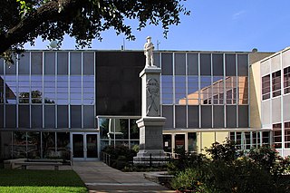
Kaufman County is a county in the northeast area of the U.S. state of Texas. As of the 2020 census, its population was 145,310. Its county seat is Kaufman. Both the county, established in 1848, and the city were named for David S. Kaufman, a U.S. Representative and diplomat from Texas. Kaufman County is part of the Dallas-Fort Worth-Arlington metropolitan statistical area.
Denton County is located in the U.S. state of Texas. As of the 2020 census, its population was 906,422, making it the 7th-most populous county in Texas. The county seat is Denton. The county, which was named for John B. Denton, was established in 1846. Denton County constitutes part of the Dallas–Fort Worth metroplex. In 2007, it was one of the fastest-growing counties in the United States.

Dallas County is the second-most populous county in the U.S. state of Texas. As of the 2020 U.S. census, the population was 2,613,539, making it the ninth-most populous county in the country. Dallas County is included in the Dallas-Arlington-Fort Worth metropolitan statistical area—colloquially referred to as the Dallas–Fort Worth metroplex. Municipal expansion within Dallas County has blurred the geographic lines between cities and between neighboring counties.

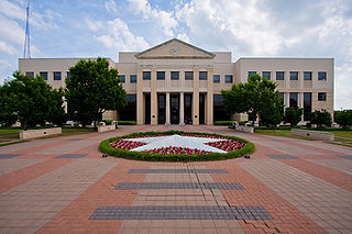
Collin County is located in the U.S. state of Texas. It is part of the Dallas-Fort Worth-Arlington metropolitan statistical area, and a small portion of the city of Dallas is in the county. At the 2020 United States census, the county's population is 1,064,465, making it the sixth-most populous county in Texas and the 43rd-largest county by population in the United States. Its county seat is McKinney.

Wright County is a county located in the southern portion of the U.S. state of Missouri. As of the 2020 census, the population was 18,188. Its county seat is Hartville. The county was officially organized on January 29, 1841, and is named after Silas Wright, a former Congressman, U.S. Senator and Governor of New York.

Texarkana is a city in Bowie County, Texas, United States, in the Ark-La-Tex region. Located approximately 180 miles (290 km) from Dallas, Texarkana is a twin city with neighboring Texarkana, Arkansas. The Texas city's population was 36,193 at the 2020 census.

Prosper is a town in Collin and Denton counties in the U.S. state of Texas. Prosper is located within the Dallas-Fort Worth-Arlington metropolitan area. As of the 2010 census, its population was 9,423; as of 2020, its population was 30,174.

Farmers Branch, officially the City of Farmers Branch, is a city in Dallas County, Texas, United States. It is an inner-ring suburb of Dallas and is part of the Dallas–Fort Worth metroplex. Its population was 35,991 at the 2020 census.

Joshua is a city in Johnson County, Texas, United States. The population was 7,891 at the 2020 census.

Rowlett is a city in Dallas and Rockwall counties in the U.S. state of Texas, and an eastern suburb of Dallas. The total population estimate is 73,270 in 2021. It is a growing, upscale community with nearly $1.5 billion in development in the Dallas–Fort Worth metroplex, located on Lake Ray Hubbard.
Clear Lake is a populated place located in Collin County, Texas on the south end of the Lavon Lake Peninsula. By land it is south of Princeton and over water northwest of Lavon, southwest of Copeville, and north of Wylie.
The Dallas–Fort Worth metroplex, officially designated Dallas–Fort Worth–Arlington by the U.S. Office of Management and Budget, is a metropolitan statistical area in the U.S. state of Texas encompassing 11 counties and anchored by the conurbated major cities of Dallas and Fort Worth. It is the economic and cultural hub of North Texas. Residents of the area also refer to it as DFW, or the Metroplex. The Dallas–Fort Worth–Arlington metropolitan statistical area's population was 7,637,387 according to the U.S. Census Bureau's 2020 census, making it the most populous metropolitan area in both Texas and the Southern United States, the fourth-largest in the U.S., and the tenth-largest in the Americas. In 2016, the Dallas–Fort Worth metroplex had the highest annual population growth in the United States.
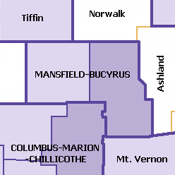
The Mansfield–Bucyrus, OH Combined Statistical Area is a CSA in the U.S. state of Ohio, as defined by the United States Census Bureau. It consists of the Mansfield Metropolitan Statistical Area ; and the Bucyrus Micropolitan Statistical Area. As of the 2000 Census, the Combined Statistical Area had a population of 175,818, but according to a US Census 2009 estimate, the CSA has a population of 167,893 residents.
Liberty Grove is a ghost town in Delta County, Texas, United States. The community was settled by 1854, the year its school opened. The farming community included the school and a cemetery as of 1936. In 1966, the community had about 25 residents. The community's cemetery was relocated in 1989, and the community was subsequently abandoned and flooded by Cooper Lake. A campsite in Cooper Lake State Park bears the community's name.
Whispering Hills is a neighborhood consisting of 615 homes within the Lake Highlands neighborhood of Dallas, Texas adjacent to the suburbs of Richardson and Garland. It is generally bounded by Buckingham Rd along the Richardson border to the north, to the east by the Garland border near Plano Rd, to the south by Walnut St, and to the west by the KCS Railroad and Audelia Branch Greenbelt near Audelia Rd.
Hiram is an unincorporated community in Kaufman County, located in the U.S. state of Texas. According to the Handbook of Texas, the community had a population of 34 in 2000. It is located within the Dallas/Fort Worth Metroplex.
Markout is an unincorporated community in Kaufman County, located in the U.S. state of Texas. According to the Handbook of Texas, the community had a population of 80 in 2000. It is located within the Dallas/Fort Worth Metroplex.


