Duncanville, Texas

Last updated

Duncanville, Texas
Nickname: 
City of Champions
Dallas County Texas Incorporated Areas Duncanville highighted.svg
Location of Duncanville in Dallas County, Texas
Coordinates: 32°38′47″N96°54′41″W / 32.64639°N 96.91139°W / 32.64639; -96.91139
Country Flag of the United States.svg United States
State Flag of Texas.svg Texas
County Dallas
Government
  Type Council-Manager
   City Council Mayor Barry L. Gordon
Joe Veracruz
Don McBurnett
Monte Anderson
Mark D. Cooks
Johnette Jameson
Patrick Harvey
   City Manager Aretha R. Ferrell-Benavides
Area
[1]
   City 11.21 sq mi (29.04 km2)
  Land11.20 sq mi (29.01 km2)
  Water0.01 sq mi (0.03 km2)
Elevation
725 ft (221 m)
Population
 (2010)
   City 38,524
  Estimate 
(2019) [2]
38,751
  Density3,459.29/sq mi (1,335.60/km2)
   Metro
6,538,850
Time zone UTC-6 (Central)
  Summer (DST) UTC-5 (Central)
ZIP codes
75116, 75137, 75138
Area code(s) 214, 469, 945, 972
FIPS code 48-21628 [3]
GNIS feature ID1334786 [4]
Website www.duncanville.com

Duncanville is a city in southwestern Dallas County, Texas, United States. Duncanville's population was 40,706 at the 2020 census. [5] The city is part of the Best Southwest area, which includes Duncanville, Cedar Hill, DeSoto, and Lancaster.

Contents

History

Settlement of the area began in 1845, when Illinois resident Crawford Trees purchased several thousand acres south of Camp Dallas. In 1880, the Chicago, Texas, and Mexican Central Railway reached the area and built Duncan Switch, named for a line foreman. Charles P. Nance, the community's first postmaster, renamed the settlement Duncanville in 1882. By the late 19th century, Duncanville was home to a dry-goods stores, a pharmacy, a domino parlor, and a school. Between 1904 and 1933, the population of Duncanville increased from 113 to more than 300. [6]

During World War II, the Army Air Corps established a landing field for flight training on property near the present-day intersection of Main St and Wheatland Road. [7]

Duncanville residents incorporated the city on August 2, 1947. During the postwar years, the military developed the Army's old landing field into the Duncanville Air Force Station, which was the headquarters for the four Nike-Hercules missile launch sites guarding Dallas/Fort Worth from Soviet bomber attack. It also housed the Air Force tracking radars for the region. [8]

Monument commemorating NIKE missile base in Duncanville Duncanville missile monument.JPG
Monument commemorating NIKE missile base in Duncanville
Plaque describing NIKE base Duncanville missile monument plaque.jpg
Plaque describing NIKE base

When the town's population reached 5,000 in 1962, citizens adopted a home-rule charter with council-manager city government. Sometimes regarded as a "white flight" suburb in the 1960s and 1970s, the city is now known for its racial diversity. Its population increased from about 13,000 in 1970 to more than 31,000 in 1988. [6]

Historic preservation

The Texas Historical Commission has designated the City of Duncanville as an official Main Street City. [9]

Duncanville recognizes the importance of the former Duncanville Air Force Station, which closed on July 1, 1964, but the Army continued to operate the Nike Missile air defense operations until 1969, when the facility was turned over to the city. The WWII-era barracks and some other structures were initially repurposed for civic and community use. Over time, the buildings were systematically demolished, removing all signs of the historic base, but the history of the facility lives on in a monument that stands outside the library and community center.

The "stone igloo", a spring house originally located near the intersection of Center Street and Cedar Ridge Road, was preserved in a unique way. In the late 1960s or early 1970s, it was demolished, thereby producing a supply of rocks used to build a replica of the structure at a nearby park and paving the way for the construction of a neighborhood retail center.

Various pieces of the city's history are preserved at the Duncanville Historical Park, which is located on Wheatland Road in Armstrong Park on land that was once a part of the Duncanville Air Force Station. Historic buildings include the city's first Music Room. [7]

Geography

Duncanville is located at 32°38′47″N96°54′41″W / 32.64639°N 96.91139°W / 32.64639; -96.91139 (32.646333, −96.911309). [10]

According to the United States Census Bureau, the city has a total area of 11.3 square miles (29 km2), all land.

Demographics

Historical population
CensusPop.Note
1950 841
1960 3,774348.8%
1970 14,105273.7%
1980 27,78197.0%
1990 35,74828.7%
2000 36,0810.9%
2010 38,5246.8%
2020 40,7065.7%
U.S. Decennial Census [11]
Water tower in the Fairmeadows neighborhood of Duncanville, depicting the city slogan Duncanville, Texas northern water tower.jpg
Water tower in the Fairmeadows neighborhood of Duncanville, depicting the city slogan
Water towers on the southern edge of Duncanville, northern edge of Cedar Hill Duncanville & Cedar Hill water towers.png
Water towers on the southern edge of Duncanville, northern edge of Cedar Hill
Water tower on east side of Clark Road Duncanville Panther water tower.png
Water tower on east side of Clark Road
War memorial monument Duncanville War Memorial.jpg
War memorial monument
Duncanville racial composition as of 2020 [12]
(NH = Non-Hispanic) [lower-alpha 1]
RaceNumberPercentage
White (NH)8,72921.44%
Black or African American (NH)12,08529.69%
Native American or Alaska Native (NH)1070.26%
Asian (NH)5501.35%
Pacific Islander (NH)170.04%
Some Other Race (NH)1240.3%
Mixed/Multi-Racial (NH)9282.28%
Hispanic or Latino 18,16644.63%
Total40,706

As of the 2020 United States census, there were 40,706 people, 13,573 households, and 10,000 families residing in the city.

Government

Duncanville City Hall is located at 203 E. Wheatland Road. Most city services are located in this facility, which also includes the Duncanville Recreation Center featuring meeting rooms, a double gymnasium, and an indoor walking track. Armstrong Park is also located next to City Hall. Duncanville has three walking trails, 17 city parks, and many other recreation spaces for team sports. [14]

U.S. Route 67 runs through the eastern portion of Duncanville. Interstate 20 passes through its northern portion.

The United States Postal Service operates the Duncanville Post Office. [15]

The Duncanville Public Library is located at 201 James Collins Boulevard.

The city of Duncanville is a voluntary member of the North Central Texas Council of Governments association, the purpose of which is to coordinate individual and collective local governments and facilitate regional solutions, eliminate unnecessary duplication, and enable joint decisions.

Politics

Duncanville city vote
by party in Presidential elections [16]
Year Democratic Republican Third Parties
2020 65.95%10,58032.64% 5,2361.41% 226

Education

Duncanville is served by the Duncanville Independent School District.

The Duncanville ISD portion is zoned to Duncanville High School, which enrolls about 3,750 students annually, with over 4,000 students during the 2010–2011 school year. [17] At about 900,000 square feet (84,000 m2), the DHS campus is the largest in Texas, the largest in the nation, and the largest in the world in terms of physical size. In total, 13 of the 17 schools in the district are rated exemplary or recognized by the Texas Education Agency, and the district's ratings continue to outperform those of the surrounding districts (Cedar Hill, DeSoto, Lancaster, Dallas, Grand Prairie). They also outperform many of the school districts throughout the Dallas–Fort Worth area.

Duncanville is also home to the administrative offices of Advantage Academy. [18]

Dallas County residents are zoned to Dallas College (formerly Dallas County Community College or DCCCD). [19]

Notable people

Notes

  1. Note: the US Census treats Hispanic/Latino as an ethnic category. This table excludes Latinos from the racial categories and assigns them to a separate category. Hispanics/Latinos can be of any race. [13]

Related Research Articles

<span class="mw-page-title-main">Dallas County, Texas</span> County in Texas, United States

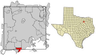
Dallas County is the second-most populous county in the U.S. state of Texas with a 2020 U.S. census of 2,613,539, making it the ninth-most populous county in the country. Dallas County is included in the Dallas-Arlington-Fort Worth metropolitan statistical area—colloquially referred to as the Dallas–Fort Worth metroplex. Municipal expansion within Dallas County has blurred the geographic lines between cities and between neighboring counties.

<span class="mw-page-title-main">Cockrell Hill, Texas</span> City in Texas, United States

Cockrell Hill is a city in Dallas County, Texas, United States. The population was 4,193 at the 2010 census, and 3,815 in 2020. It is completely surrounded by the city of Dallas.

<span class="mw-page-title-main">DeSoto, Texas</span> City in the United States

DeSoto is a city in Dallas County, Texas, United States. DeSoto is a suburb of Dallas and is part of the Best Southwest area, which includes DeSoto, Cedar Hill, Duncanville, and Lancaster.

<span class="mw-page-title-main">Lancaster, Texas</span> City in Texas, United States

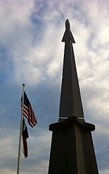
Lancaster is a city in Dallas County, Texas, United States. Its population was 41,275 according to the 2020 census. Founded in 1852 as a frontier post, Lancaster is one of Dallas County's earliest settlements. Today, it is a suburban community located in the Dallas–Fort Worth metroplex, about 15 mi (24 km) south of downtown Dallas.

<span class="mw-page-title-main">University Park, Texas</span> City in Texas, United States

University Park is a city in Dallas County, Texas, United States, in suburban Dallas. The population was 25,278 at the 2020 census. The city is home to Southern Methodist University.

<span class="mw-page-title-main">Lake Dallas, Texas</span> City in Texas, United States

Lake Dallas is a city in Denton County, Texas, United States. It is located in North Texas, northwest of the city of Dallas, on the shores of Lewisville Lake. The community's name derives from the original name of the lake. It is also one of the four communities in the Lake Cities.

<span class="mw-page-title-main">Bedford, Texas</span> City in Texas, United States

Bedford is a city located in northeastern Tarrant County, Texas, United States, in the "Mid-Cities" area between Dallas and Fort Worth. It is a suburb of Dallas and Fort Worth. The population was 49,928 at the 2020 census. Bedford is part of the Hurst-Euless-Bedford Independent School District.

<span class="mw-page-title-main">Pantego, Texas</span> Town in Texas, United States

Pantego is a town in Tarrant County, Texas, United States. Its population was 2,394 at the 2010 census. It is entirely surrounded by the cities of Arlington and Dalworthington Gardens. It is in the middle of the Dallas–Fort Worth metroplex, a metropolitan area spanning several counties.

<span class="mw-page-title-main">North Augusta, South Carolina</span> City in South Carolina, United States

North Augusta is a city in Aiken and Edgefield counties in the U.S. state of South Carolina, on the north bank of the Savannah River. It lies directly across the river, and state border, from Augusta, Georgia. The population was 24,379 at the 2020 census, making it the 21st most populous city in South Carolina. The city is included in the Central Savannah River Area (CSRA) and is part of the Augusta, Georgia, metropolitan area.

<span class="mw-page-title-main">Sachse, Texas</span> City in Texas, United States

Sachse is a city in Collin and Dallas counties in the U.S. state of Texas and is part of the DFW metroplex. A northeastern suburb of Dallas, the city population was 27,103, as of the 2020 census with an estimated population of 33, 768 people today. Sachse is located off Texas State Highway 78 and President George Bush Turnpike and is approximately 1 mile (1.6 km) north of the Firewheel Town Center.

<span class="mw-page-title-main">Wylie, Texas</span> City in Texas, United States of America

Wylie is a city and northeastern suburb of Dallas, that was once solely located in Collin County, but now extends into neighboring Dallas and Rockwall counties in the U.S. state of Texas. It is located on State Route 78 about 24 miles (39 km) northeast of central Dallas and centrally located between nearby Lavon Lake and Lake Ray Hubbard.

<span class="mw-page-title-main">Glenn Heights, Texas</span> City in Texas, United States

Glenn Heights is a city in Dallas and Ellis counties in the U.S. state of Texas. The population was 11,278 at the 2010 census, and 15,819 in 2020.

<span class="mw-page-title-main">Grand Prairie, Texas</span> City in Texas

Grand Prairie is a city in the U.S. state of Texas, located in Dallas, Tarrant, and Ellis counties. It is part of the Mid-Cities region in the Dallas–Fort Worth metroplex and an inner ring suburb of Dallas. It had a population of 175,396 according to the 2010 census, making it the fifteenth most populous city in the state. Remaining the 15th-most populous city in Texas, the 2020 census reported a population of 196,100.

<span class="mw-page-title-main">Ovilla, Texas</span> City in Texas, United States

Ovilla is a city in Dallas and Ellis Counties in the U.S. state of Texas. The population was 4,304 at the 2020 census.

Duncanville High School is a secondary school located in Duncanville, Texas, United States, in the Dallas-Fort Worth area. The school is a part of Duncanville Independent School District.

Duncanville Independent School District is a school district based in Duncanville, Texas (USA).

DeSoto High School is a comprehensive public high school in DeSoto, Texas, United States. It is part of the DeSoto Independent School District and is classified as a 6A school by the UIL. In 2015, the school was rated "Met Standard" by the Texas Education Agency.

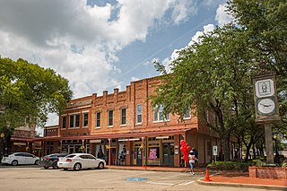
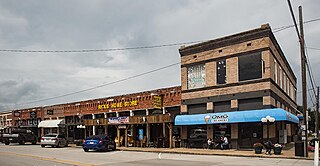
The Best Southwest is a term commonly applied to four Dallas suburbs – Cedar Hill, DeSoto, Duncanville, and Lancaster – in southwestern Dallas County, Texas, United States. As of the 2010 census, the four suburbs had a combined population of 168,960.

<span class="mw-page-title-main">Cedar Hill High School</span> Public school in Cedar Hill, Texas, United States

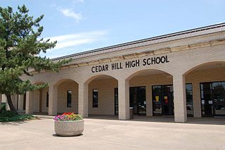
Cedar Hill High School (CHHS) is a comprehensive public high school located in the city of Cedar Hill, Texas (USA) in Dallas County and is classified as a 6A school by the UIL. It is a part of the Cedar Hill Independent School District located in southwest Dallas County. In 2018-19, the school received a "C" rating by the Texas Education Agency

<span class="mw-page-title-main">Cedar Hill, Texas</span> City in Texas, United States

Cedar Hill is a city in Dallas and Ellis counties in the U.S. state of Texas. It is located approximately 16 miles (26 km) southwest of downtown Dallas and is situated along the eastern shore of Joe Pool Lake and Cedar Hill State Park. Per the 2020 United States census, the population was 49,148. Cedar Hill is a suburb of the city of Dallas and is part of the Best Southwest area, which includes the nearby cities of DeSoto, Duncanville, and Lancaster.

References

  1. "2019 U.S. Gazetteer Files". United States Census Bureau. Retrieved August 7, 2020.
  2. "Population and Housing Unit Estimates". United States Census Bureau. May 24, 2020. Retrieved May 27, 2020.
  3. "U.S. Census website". United States Census Bureau . Retrieved January 31, 2008.
  4. "US Board on Geographic Names". United States Geological Survey. October 25, 2007. Retrieved January 31, 2008.
  5. "U.S. Census Bureaus QuickFacts: Duncanville city, Texas". United States Census Bureau . Retrieved August 6, 2023.
  6. 1 2 "Handbook of Texas". Tshaonline.org. August 11, 2013. Retrieved August 29, 2013.
  7. 1 2 "Duncanville, Texas | Tourism – Presented by Village Profile". Villageprofile.com. Retrieved August 29, 2013.
  8. "Nike Missile Dallas–Fort Worth Defense Area". Techbastard.com. Retrieved August 29, 2013.
  9. State of Texas and UTA. "CRAC Industry Profiles". Crc.uta.edu. Archived from the original on July 14, 2010. Retrieved August 29, 2013.
  10. "US Gazetteer files: 2010, 2000, and 1990". United States Census Bureau. February 12, 2011. Retrieved April 23, 2011.
  11. "Census of Population and Housing". Census.gov. Retrieved June 4, 2015.
  12. "Explore Census Data". data.census.gov. Retrieved May 22, 2022.
  13. "About the Hispanic Population and its Origin". www.census.gov. Retrieved May 18, 2022.
  14. " "Duncanville, TX - Official Website - Parks & Recreation". Archived from the original on October 29, 2013. Retrieved October 25, 2013.." Duncanville City Website. Retrieved on October 25, 2013.
  15. "Post Office Location – DUNCANVILLE Archived 2011-02-17 at the Wayback Machine ." United States Postal Service. Retrieved on September 8, 2010.
  16. "Dallas County Election Results".
  17. Greatschools.netDuncanville High School. Retrieved 17 June 2006.
  18. "Advantage Academy". Archived from the original on April 13, 2018.
  19. Texas Education Code, Sec. 130.176. DALLAS COUNTY COMMUNITY COLLEGE DISTRICT SERVICE AREA.
  20. Houston Chronicle: "Big Guy Concerns North Shore"
  21. p. xiv, xv. Jankowsky, Kurt R., ed. 1996. The Mystery of Culture Contacts, Historical Reconstruction, and Text Analysis: An Emic Approach. Washington, DC: Georgetown University Press.
  22. "biography – page 2". sweet adeline. Retrieved August 29, 2013.