Lilydale, Minnesota

Last updated
Lilydale
Dakota County Minnesota Incorporated and Unincorporated areas Lilydale Highlighted.svg
Location of the city of Lilydale
within Dakota County, Minnesota
Coordinates: 44°54′2″N93°8′22″W / 44.90056°N 93.13944°W / 44.90056; -93.13944
Country United States
State Minnesota
County Dakota
Area
[1]
  Total0.88 sq mi (2.28 km2)
  Land0.55 sq mi (1.43 km2)
  Water0.33 sq mi (0.85 km2)
Elevation
702 ft (214 m)
Population
 (2020)
  Total809
  Density1,462.93/sq mi (564.33/km2)
Time zone UTC-6 (Central (CST))
  Summer (DST) UTC-5 (CDT)
ZIP code
55118
Area code 651
FIPS code 27-37016 [2]
GNIS feature ID0646656 [3]
Website lilydale.govoffice.com

Lilydale is a city in Dakota County, Minnesota, United States. The population was 623 at the 2010 census. [4]

Contents

Geography

According to the United States Census Bureau, the city has a total area of 0.87 square miles (2.25 km2), of which 0.58 square miles (1.50 km2) is land and 0.29 square miles (0.75 km2) is water. [5]

State Highway 13 serves as a main route in Lilydale.

Demographics

Historical population
CensusPop.
1960 116
1970 322177.6%
1980 41729.5%
1990 50621.3%
2000 5529.1%
2010 62312.9%
2020 80929.9%
U.S. Decennial Census [6]

Coordinates: 44°54′58″N93°07′34″W / 44.91611°N 93.12611°W / 44.91611; -93.12611

2010 census

As of the census [7] of 2010, there were 623 people, 375 households, and 181 families living in the city. The population density was 1,074.1 inhabitants per square mile (414.7/km2). There were 444 housing units at an average density of 765.5 per square mile (295.6/km2). The racial makeup of the city was 95.5% White, 1.3% African American, 2.2% Asian, 0.3% from other races, and 0.6% from two or more races. Hispanic or Latino of any race were 0.8% of the population.

There were 375 households, of which 6.4% had children under the age of 18 living with them, 43.2% were married couples living together, 3.2% had a female householder with no husband present, 1.9% had a male householder with no wife present, and 51.7% were non-families. 46.1% of all households were made up of individuals, and 28% had someone living alone who was 65 years of age or older. The average household size was 1.66 and the average family size was 2.23.

The median age in the city was 63.3 years. 5.9% of residents were under the age of 18; 3.8% were between the ages of 18 and 24; 13.8% were from 25 to 44; 29.9% were from 45 to 64; and 46.7% were 65 years of age or older. The gender makeup of the city was 41.9% male and 58.1% female.

2000 census

As of the census [2] of 2000, there were 552 people, 338 households, and 154 families living in the city. The population density was 756.4 inhabitants per square mile (292.0/km2). There were 383 housing units at an average density of 524.8 per square mile (202.6/km2). The racial makeup of the city was 94.93% White, 0.72% African American, 0.18% Native American, 1.81% Asian, 0.18% Pacific Islander, 1.63% from other races, and 0.54% from two or more races. Hispanic or Latino of any race were 2.17% of the population.

There were 338 households, out of which 5.9% had children under the age of 18 living with them, 41.1% were married couples living together, 3.3% had a female householder with no husband present, and 54.4% were non-families. 49.4% of all households were made up of individuals, and 29.9% had someone living alone who was 65 years of age or older. The average household size was 1.63 and the average family size was 2.25.

In the city, the population was spread out, with 6.0% under the age of 18, 3.8% from 18 to 24, 14.5% from 25 to 44, 29.5% from 45 to 64, and 46.2% who were 65 years of age or older. The median age was 62 years. For every 100 females, there were 70.4 males. For every 100 females age 18 and over, there were 68.5 males.

The median income for a household in the city was $54,792, and the median income for a family was $82,001. Males had a median income of $52,500 versus $40,815 for females. The per capita income for the city was $42,724. None of the families and 2.9% of the population were living below the poverty line, including no under eighteens and 0.8% of those over 64.

Related Research Articles

<span class="mw-page-title-main">Bassett, Arkansas</span> Town in Arkansas, United States

Bassett is a town in Mississippi County, Arkansas, United States. The population was 124 at the 2020 census, down from 173 in 2010.

<span class="mw-page-title-main">Rembrandt, Iowa</span> City in Iowa, United States

Rembrandt is a city in Buena Vista County, Iowa, United States. The population was 209 at the time of the 2020 census.

<span class="mw-page-title-main">Fruitland, Iowa</span> City in Iowa, United States

Fruitland is a city in Muscatine County, Iowa, United States. The population was 963 at the time of the 2020 census. It is part of the Muscatine Micropolitan Statistical Area.

<span class="mw-page-title-main">Maysville, Iowa</span> City in Iowa, USA

Maysville is a city in Scott County, Iowa, United States. The population was 156 at the time of the 2020 census.

<span class="mw-page-title-main">Moran, Kansas</span> City in Allen County, Kansas

Moran is a city in Allen County, Kansas, United States. As of the 2020 census, the population of the city was 466.

<span class="mw-page-title-main">Hamlin, Kansas</span> City in Brown County, Kansas

Hamlin is a city in Brown County, Kansas, United States. As of the 2020 census, the population of the city was 25.

<span class="mw-page-title-main">Remer, Minnesota</span> City in Minnesota, United States

Remer is a city in Cass County, Minnesota, United States. The population was 370 at the 2010 census. It is part of the Brainerd Micropolitan Statistical Area.

<span class="mw-page-title-main">Bluffton, Minnesota</span> City in Minnesota, United States

Bluffton is a city in Otter Tail County, Minnesota, United States, along the Leaf River. The population was 210 at the 2020 census.

<span class="mw-page-title-main">Finlayson, Minnesota</span> City in Minnesota, United States

Finlayson is a city in Pine County, Minnesota, United States. The population was 315 at the 2010 census. The city's area was incorporated from Finlayson Township, the remainder of which is still adjacent to it.

<span class="mw-page-title-main">Leonidas, Minnesota</span> City in Minnesota, United States

Leonidas is a city in Saint Louis County, Minnesota, United States. The population was 52 at the 2010 census.

<span class="mw-page-title-main">Fort Calhoun, Nebraska</span> City in Nebraska, United States

Fort Calhoun is a city in Washington County, Nebraska, United States. The population was 908 at the 2010 census. The city includes Fort Atkinson, the first fort built west of the Missouri River.

<span class="mw-page-title-main">Lake Annette, Missouri</span> City in Missouri, United States

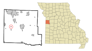
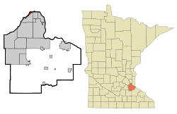
Lake Annette is a city in Cass County, Missouri, United States. The population was 100 at the 2010 census. It is part of the Kansas City metropolitan area.

<span class="mw-page-title-main">East Glenville, New York</span> Census-designated place in New York, United States

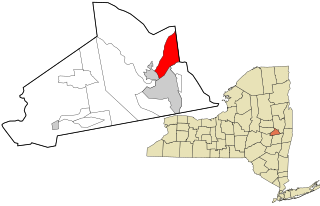
East Glenville is a hamlet in Schenectady County, New York, United States. The population was 6,616 at the 2010 census. The CDP includes the adjacent hamlet of Alplaus.

East Rockingham is a census-designated place (CDP) in Richmond County, North Carolina, United States. The population was 3,885 at the 2000 census.

<span class="mw-page-title-main">Covedale, Ohio</span> Census-designated place in Ohio, United States

Covedale is a census-designated place (CDP) in Green Township, Hamilton County, Ohio, United States. The population was 6,447 at the 2010 census. The CDP represents the part of the former village of Covedale that was not annexed by the city of Cincinnati in the 1890s.

<span class="mw-page-title-main">Lancaster Township, Butler County, Pennsylvania</span> Township in Pennsylvania, United States

Lancaster Township is a township in Butler County, Pennsylvania, United States. As of the 2010 census, the township population was 2,532.

<span class="mw-page-title-main">Flemington, Pennsylvania</span> Borough in Pennsylvania, United States

Flemington is a borough in Clinton County, Pennsylvania, United States. The population was 1,330 at the 2010 census.

<span class="mw-page-title-main">Lakeshore Gardens-Hidden Acres, Texas</span> CDP in Texas, United States

Lakeshore Gardens-Hidden Acres is a census-designated place (CDP) in San Patricio County, Texas, United States. The population was 504 at the 2010 census.

<span class="mw-page-title-main">Follansbee, West Virginia</span> City in West Virginia, United States

Follansbee is a city in Brooke County, West Virginia, United States, located along the Ohio River. The population was 2,853 at the 2020 census, a decrease from 2,986 at the 2010 census. It is part of the Weirton–Steubenville metropolitan area. The city was named after the Follansbee brothers, the proprietors of a local steel mill.

<span class="mw-page-title-main">Pennsboro, West Virginia</span> City in West Virginia, United States

Pennsboro is a city in Ritchie County, West Virginia, United States. The population was 1,050 at the 2020 census. The city is located at the junction of U.S. Route 50 and West Virginia Route 74; the North Bend Rail Trail also passes through the city.

References

  1. "2020 U.S. Gazetteer Files". United States Census Bureau. Retrieved July 24, 2022.
  2. 1 2 "U.S. Census website". United States Census Bureau . Retrieved 2008-01-31.
  3. "US Board on Geographic Names". United States Geological Survey. 2007-10-25. Retrieved 2008-01-31.
  4. "2010 Census Redistricting Data (Public Law 94-171) Summary File". American FactFinder. United States Census Bureau . Retrieved 27 April 2011.[ dead link ]
  5. "US Gazetteer files 2010". United States Census Bureau. Archived from the original on 2012-01-25. Retrieved 2012-11-13.
  6. "Census of Population and Housing". Census.gov. Retrieved June 4, 2015.
  7. "U.S. Census website". United States Census Bureau . Retrieved 2012-11-13.