Commercial airports

Los Angeles International (LAX)
Commercial aviation airports of the Greater Los Angeles area
Green = International airport
Blue = Domestic airport
Los Angeles International Airport
Los Angeles International Airport commonly referred to by its airport code, LAX (with each of its letters pronounced individually), is the primary international airport serving the Greater Los Angeles Area and the world's sixth busiest airport. [1] Located in the Westchester neighborhood of Los Angeles, it is 18 miles (30 km) southwest of Downtown Los Angeles and close to the Pacific Ocean.
LAX is a major international gateway to the United States, and also serves a connection point for passengers traveling internationally. LAX is the world's busiest origin and destination airport, since relative to other airports, many more travelers begin or end their trips in Los Angeles than use it as a connection. LAX serves as a major hub or focus city for seven airlines, more than any other airport in the United States. In 2019, LAX handled over 88 million passengers and 2 million tons of cargo. [2]
The FlyAway express bus system connects LAX with Los Angeles Union Station, the region's primary rail transportation hub.
John Wayne Airport
John Wayne Airport (SNA) is an international airport and the second-busiest airport in the region. Located in Orange County, the second-most populous county in the area and the most densely populated, the airport serves as a gateway to many of the region's popular tourist attractions, including the Disneyland Resort. It served 10.7 million passengers in 2019.
Hollywood Burbank Airport
Hollywood Burbank Airport (BUR), the smallest of the primary airports in the area, handles only domestic air service. The airport is located in Burbank, and serves the heavily populated areas of northern Los Angeles County. It is the closest airport to Burbank, the central and northeastern parts of L.A. (including Hollywood and Downtown Los Angeles), Glendale, Pasadena, the San Fernando Valley, the Santa Clarita Valley, and the western San Gabriel Valley. In addition to its small physical size, the airport only has 14 gates and for the purposes of noise abatement, only schedules commercial flights between 7:00 am and 10:00 pm. Despite these limitations, Burbank is the region's third-busiest airport, handling 6 million passengers in 2019.
Hollywood Burbank Airport is the only airport in the area with a direct rail connection to Downtown Los Angeles from two stations, Burbank Airport–North and Burbank Airport–South.
Long Beach Airport
Long Beach Airport (LGB) is the least busy of the airports in the area. The airport is located in Long Beach, south of Los Angeles. It served 3.6 million passengers in 2019.

Southern California is a geographic and cultural region that generally comprises the southern portion of the U.S. state of California. It includes the Los Angeles metropolitan area as well as the Inland Empire. The region generally contains ten of California's 58 counties: Imperial, Kern, Los Angeles, Orange, Riverside, San Bernardino, San Diego, Santa Barbara, San Luis Obispo and Ventura counties.

Greater Los Angeles is the second-largest metropolitan area in the United States, with a population of 18.5 million in 2021. It encompasses five counties in Southern California extending from Ventura County in the west to San Bernardino County and Riverside County in the east, with Los Angeles County in the center, and Orange County to the southeast. The Los Angeles–Anaheim–Riverside combined statistical area covers 33,954 square miles (87,940 km2), making it the largest metropolitan region in the United States by land area. The contiguous urban area is 2,281 square miles (5,910 km2), whereas the remainder mostly consists of mountain and desert areas.
Van Nuys Airport is a public airport in the Van Nuys neighborhood of the City of Los Angeles. The airport is operated by Los Angeles World Airports (LAWA), a branch of the Los Angeles city government, which also operates Los Angeles International Airport (LAX). Van Nuys is one of the busiest general aviation airports in the world, with the airport's two parallel runways averaging over 230,000 takeoffs and landings annually. However, as of 2022, no commercial air service operates to or from Van Nuys.

An IATA airport code, also known as an IATA location identifier, IATA station code, or simply a location identifier, is a three-letter geocode designating many airports and metropolitan areas around the world, defined by the International Air Transport Association (IATA). The characters prominently displayed on baggage tags attached at airport check-in desks are an example of a way these codes are used.

Hollywood Burbank Airport, legally and formerly marketed as Bob Hope Airport after entertainer Bob Hope, is a public airport three miles (4.8 km) northwest of downtown Burbank, in Los Angeles County, California, United States. The airport serves Burbank, Hollywood, and the northern Greater Los Angeles area, which includes Glendale, Pasadena, the San Fernando Valley and the Santa Clarita Valley. It is closer to many popular attractions, including Griffith Park, Universal Studios Hollywood, and Downtown Los Angeles, than Los Angeles International Airport (LAX), and it is the only airport in the area with a direct rail connection to Downtown Los Angeles, with service from two stations: Burbank Airport–North and Burbank Airport–South. Nonstop flights mostly serve cities in the western United States, though JetBlue has daily flights to New York City. Southwest also occasionally flies non regular routes to the East Coast.

Ontario International Airport is an international airport two miles east of downtown Ontario, in San Bernardino County, California, United States, about 38 mi (61 km) east of downtown Los Angeles and 18 mi (29 km) west of downtown San Bernardino. It is owned and operated under a joint-powers agreement with the city of Ontario and San Bernardino County.

Oxnard Airport is a county-owned, public airport a mile west of downtown Oxnard, in Ventura County, California. The airport has not had scheduled passenger service since June 8, 2010, when United Express ended flights to Los Angeles International Airport. America West Express also served the airport with nonstop flights to Phoenix in the early-2000s via a code sharing agreement with America West Airlines.

Golden West Airlines was a commuter airline that operated flights on a high volume schedule in California. It ceased operations in 1983.

Palmdale Regional Airport is an airport in Palmdale, California, United States. The city of Palmdale took over the airport at the end of 2013, managing it via the Palmdale Airport Authority. The airport currently does not have any scheduled passenger airline service.

Los Angeles World Airports (LAWA) is the airport authority that owns and operates Los Angeles International Airport (LAX) and Van Nuys Airport (VNY) for the city of Los Angeles, California. LAWA also owns and manages aviation-related property near the Palmdale Regional Airport (PMD).

Fullerton Municipal Airport, owned and operated by the City of Fullerton, is a regional relief airport in Orange County, California.

San Bernardino International Airport is a public airport two miles (3.2 km) southeast of downtown San Bernardino, California, in San Bernardino County, California, United States. The airport covers 1,329 acres (538 ha) and has one runway that can accommodate the largest existing aircraft, including the Airbus A380 and the Boeing 747.

General William J. Fox Airfield is a county-owned, public airport in Los Angeles County, California, five miles northwest of Lancaster, California, United States. Locally known as Fox Field, the airport serves the Antelope Valley. The airport is named after Brigadier General William J. Fox, "a Marine war hero, a movie stunt man, the first Los Angeles County engineer and, for 20 years after his retirement, a cowboy."
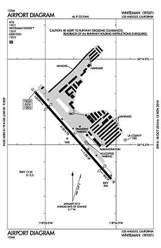
Whiteman Airport is a general aviation airport in the northeastern San Fernando Valley community of Pacoima, in the city of Los Angeles, California, United States.

Apple Valley Airport is a public airport three miles (4.8 km) north of Apple Valley in San Bernardino County, California, United States. The airport has two runways and is used for general aviation. It opened around 1970.

Eastern Sierra Regional Airport is two miles east of Bishop, in Inyo County, California, United States. It is owned by the City of Los Angeles, Department of Public Works and operated by Inyo County.

Cable Airport is a non-towered public-use airport located two miles (3 km) northwest of the central business district of Upland, a city in San Bernardino County, California, United States. It is privately owned by the Cable Land Company.

Greater Los Angeles has a complex multimodal transportation infrastructure, which serves as a regional, national and international hub for passenger and freight traffic. The transportation system of Greater Los Angeles includes the United States' largest port complex, seven commuter rail lines, Amtrak service, a subway system within the city of Los Angeles, and numerous highways. Los Angeles is integrated into the Interstate Highway System by Interstate 5, Interstate 10, and Interstate 15, along with numerous auxiliary highways and state routes. Bus service is also included locally within the area by numerous local government agencies. Subways and light commuter rail lines are present within Los Angeles proper, allowing mass transportation within the city. Commuter railroads are run by Metrolink. Amtrak has numerous railroad lines that connect Los Angeles to the rest of the country.

The Los Angeles Air Route Traffic Control Center is an air traffic control center located in Palmdale, California, United States. Located adjacent to United States Air Force Plant 42 and the Palmdale Regional Airport, it is one of 22 Air Route Traffic Control Centers (ARTCC) operated by the United States Federal Aviation Administration (FAA).
