This is a list of parks and gardens in the Brussels-Capital Region divided by municipality.
A park or garden located on the territory of several municipalities is listed for each municipality.
name | district | coordinates | size | photo |
---|---|---|---|---|
Astrid Park | Meir Quarter | 50°49′59″N4°17′53″E / 50.83306°N 4.29806°E | ||
Parc Forestier/Bospark | Scheut | 50°50′29″N4°18′40″E / 50.84139°N 4.31111°E | ||
Jean Vives Park | 50°49′34″N4°16′56″E / 50.82611°N 4.28222°E | |||
Pede Park | Neerpede | 50°49′32″N4°16′19″E / 50.82556°N 4.27194°E | ||
Parc des Étangs/Vijverspark | 50°49′28″N4°17′4″E / 50.82444°N 4.28444°E | |||
Scherdemael Park | Scherdemael Quarter | 50°49′54″N4°17′15″E / 50.83167°N 4.28750°E |
name | district | coordinates | size | photo |
---|---|---|---|---|
Jean Massart Botanical Garden | 50°48′50″N4°26′17″E / 50.81389°N 4.43806°E | |||
Red Cloister | 50°48′28″N4°26′38″E / 50.80778°N 4.44389°E | 13.61 ha (33.6 acres) | ||
Seny Park | 50°48′34″N4°25′43″E / 50.80944°N 4.42861°E | |||
Val Duchesse/Hertoginnedal | 50°49′13″N4°26′01″E / 50.82028°N 4.43361°E | |||
Woluwe Park | 50°49′44″N4°25′37″E / 50.829°N 4.427°E | 69.28 ha (171.2 acres) |
name | district | coordinates | size | photo |
---|---|---|---|---|
Wilder Wood | 50°51′31″N4°17′26″E / 50.85861°N 4.29056°E |
name | district | coordinates | size | photo |
---|---|---|---|---|
Brussels Park | Royal Quarter | 50°50′41″N4°21′49″E / 50.8446°N 4.3637°E | 13.1 ha (32 acres) [1] | |
Egmont Park | Sablon/Zavel | 50°50′19″N4°21′26″E / 50.83861°N 4.35722°E | 1.42 ha (3.5 acres) [2] | |
Halle Gate Park | Marolles/Marollen | 50°49′59″N4°20′41″E / 50.83306°N 4.34472°E | 3.2 ha (7.9 acres) [3] | |
Mont des Arts/Kunstberg | Royal Quarter | 50°50′38″N04°21′24″E / 50.84389°N 4.35667°E | 1.4 ha (3.5 acres) [4] | |
Square of the Small Sablon | Sablon/Zavel | 50°50′24″N04°21′22″E / 50.84000°N 4.35611°E | 0.29 ha (0.72 acres) [5] |
name | district | coordinates | size | photo |
---|---|---|---|---|
Parc du Cinquantenaire/Jubelpark | European Quarter | 50°50′26″N4°23′34″E / 50.84056°N 4.39278°E | 34.22 ha (84.6 acres) [6] | |
Leopold Park | Leopold Quarter | 50°50′18″N4°22′48″E / 50.83833°N 4.38000°E | 6.43 ha (15.9 acres) [7] | |
Maelbeek Valley Garden | Leopold Quarter | 50°50′38″N4°22′43″E / 50.84389°N 4.37861°E |
name | district | coordinates | size | photo |
---|---|---|---|---|
Colonial Garden | 50°53′18″N4°20′43″E / 50.88833°N 4.34528°E | |||
Florist of Stuyvenberg's Garden | 50°53′07″N4°20′55″E / 50.88528°N 4.34861°E | |||
Laeken Park | 50°53′33″N04°20′55″E / 50.89250°N 4.34861°E | 28.79 ha (71.1 acres) [8] | ||
Maximilian Park | Northern Quarter | 50°51′44″N4°21′12″E / 50.86222°N 4.35333°E | ||
Osseg(h)em Park | Heysel Quarter | 50°53′44″N4°20′47″E / 50.89556°N 4.34639°E | 15.9 ha (39 acres) | |
Sobieski Park | 50°53′08″N4°20′43″E / 50.88556°N 4.34528°E | |||
Tour & Taxis Park | Tour & Taxis | 50°52′13″N4°20′31″E / 50.87028°N 4.34194°E |
name | district | coordinates | size | photo |
---|---|---|---|---|
Bois de la Cambre/Ter Kamerenbos | Louise/Louiza Quarter | 50°48′11″N4°22′52″E / 50.80306°N 4.38111°E | 122.34 ha (302.3 acres) [9] | |
King's Garden | Louise/Louiza Quarter | 50°49′18″N4°22′17″E / 50.82167°N 4.37139°E | ||
La Cambre Abbey | Louise/Louiza Quarter | 50°49′08″N4°22′27″E / 50.81889°N 4.37417°E |
name | district | coordinates | size | photo |
---|---|---|---|---|
Jean-Félix Hap Garden | 50°50′04″N4°23′09″E / 50.83444°N 4.38583°E |
This section is empty. You can help by adding to it. (March 2022) |
name | district | coordinates | size | photo |
---|---|---|---|---|
Duden Park | Altitude Cent/Hoogte Honderd | 50°49′01″N4°19′52″E / 50.81694°N 4.33111°E | 22.76 ha (56.2 acres) | |
Forest/Vorst Park | Altitude Cent/Hoogte Honderd | 50°49′21″N4°20′13″E / 50.82250°N 4.33694°E | 13 ha (32 acres) |
name | district | coordinates | size | photo |
---|---|---|---|---|
King Baudouin Park | 50°52′53″N4°19′09″E / 50.88139°N 4.31917°E |
name | district | coordinates | size | photo |
---|---|---|---|---|
La Cambre Abbey | Louise/Louiza Quarter | 50°49′08″N4°22′27″E / 50.81889°N 4.37417°E | ||
Ixelles Ponds | Flagey Quarter | 50°49′25″N4°22′24″E / 50.82361°N 4.37333°E | 5.5 ha (14 acres) | |
Tenbosch Park | 50°49′12″N4°21′53″E / 50.82000°N 4.36472°E | 1.8 ha (4.4 acres) |
name | district | coordinates | size | photo |
---|---|---|---|---|
Dieleg(h)em Wood | 50°53′14″N4°19′26″E / 50.88722°N 4.32389°E | |||
King Baudouin Park | 50°52′53″N4°19′09″E / 50.88139°N 4.31917°E | |||
Laerbeek/Laarbeek Wood | 50°53′16″N4°17′56″E / 50.88778°N 4.29889°E |
name | district | coordinates | size | photo |
---|---|---|---|---|
Elisabeth Park | 50°51′54″N4°19′28″E / 50.86500°N 4.32444°E | 21 ha (52 acres) |
name | district | coordinates | size | photo |
---|---|---|---|---|
Albert Park | Machtens Quarter | 50°51′05″N4°18′55″E / 50.85139°N 4.31528°E | ||
Karreveld Park | Karreveld Quarter | 50°51′37″N4°18′55″E / 50.86028°N 4.31528°E | ||
Marie-José Park | Machtens Quarter | 50°51′5″N4°19′8″E / 50.85139°N 4.31889°E | ||
Scheutbos Park | Mettewie Quarter | 50°51′00″N4°17′30″E / 50.85000°N 4.29167°E |
name | district | coordinates | size | photo |
---|---|---|---|---|
Baron Pierre Paulus de Châtelet Park | 50°49′44″N4°20′57″E / 50.82889°N 4.34917°E | |||
Hélène De Rudder Garden | 50°49′46″N4°20′43″E / 50.82935°N 4.34533°E | |||
Forest/Vorst Park | Altitude Cent/Hoogte Honderd | 50°49′21″N4°20′13″E / 50.82250°N 4.33694°E | ||
Park Joséphine-Hortense Mairesse | 50°49′42″N4°20′43″E / 50.82843°N 4.34516°E |
name | district | coordinates | size | photo |
---|---|---|---|---|
Botanical Garden of Brussels | Northern Quarter | 50°51′18″N4°21′55″E / 50.85488°N 4.365192°E | 5.15 ha (12.7 acres) [10] |
name | district | coordinates | size | photo |
---|---|---|---|---|
Josaphat Park | Josaphat Quarter | 50°51′44″N4°23′06″E / 50.86222°N 4.38500°E | 30 ha (74 acres) |
name | district | coordinates | size | photo |
---|---|---|---|---|
Brugmann Park | 50°48′35″N4°21′07″E / 50.80972°N 4.35194°E | |||
Montjoie Park | 50°48′35″N4°21′27″E / 50.80972°N 4.35750°E | |||
Wolvendael Park | 50°48′00″N4°20′38″E / 50.80000°N 4.34389°E |
name | district | coordinates | size | photo |
---|---|---|---|---|
Seny Park | 50°48′34″N4°25′43″E / 50.80944°N 4.42861°E | |||
Tournay-Solvay Park | 50°47′36″N4°24′40″E / 50.79333°N 4.41111°E |
name | district | coordinates | size | photo |
---|---|---|---|---|
Malou Park | 50°50′31″N4°26′20″E / 50.842°N 4.439°E |
name | district | coordinates | size | photo |
---|---|---|---|---|
Mellaerts Ponds | 50°49′39″N4°26′02″E / 50.82750°N 4.43389°E | |||
Parmentier Park | 50°49′47″N4°26′18″E / 50.82972°N 4.43833°E | |||
Woluwe Park | 50°49′44″N4°25′37″E / 50.829°N 4.427°E | 69.28 ha (171.2 acres) |
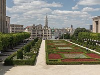
Brussels, officially the Brussels-Capital Region, is a region of Belgium comprising 19 municipalities, including the City of Brussels, which is the capital of Belgium. The Brussels-Capital Region is located in the central portion of the country and is a part of both the French Community of Belgium and the Flemish Community, but is separate from the Flemish Region and the Walloon Region, located less than 4 kilometres (2.5 mi) to the south. Historically Dutch-speaking, Brussels saw a language shift to French from the late 19th century. Nowadays, the Brussels-Capital Region is officially bilingual in French and Dutch, although French is the majority language and lingua franca. Brussels is also increasingly becoming multilingual. English is spoken widely and many migrants and expatriates speak other languages as well.
Anderlecht is one of the 19 municipalities of the Brussels-Capital Region, Belgium. Located in the south-western part of the region, it is bordered by the City of Brussels, Forest, Molenbeek-Saint-Jean, and Saint-Gilles, as well as the Flemish municipalities of Dilbeek and Sint-Pieters-Leeuw. In common with all of Brussels' municipalities, it is legally bilingual (French–Dutch).
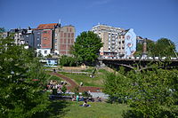
Molenbeek-Saint-Jean or Sint-Jans-Molenbeek, often simply called Molenbeek, is one of the 19 municipalities of the Brussels-Capital Region, Belgium. Located in the western part of the region, it is bordered by the City of Brussels, from which it is separated by the Brussels–Charleroi Canal, as well as by the municipalities of Anderlecht, Berchem-Sainte-Agathe, Dilbeek, Jette, and Koekelberg. The Molenbeek brook, from which it takes its name, flows through the municipality. In common with all of Brussels' municipalities, it is legally bilingual (French–Dutch).
The City of Brussels is the largest municipality and historical centre of the Brussels-Capital Region, as well as the capital of the Flemish Region and Belgium. The City of Brussels is also the administrative centre of the European Union, as it hosts a number of principal EU institutions in its European Quarter.
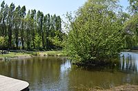
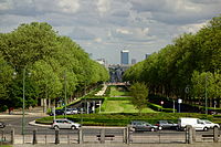
The Bois de la Cambre or Ter Kamerenbos (Dutch) is an urban public park in Brussels, Belgium. It lies in the south of the Brussels-Capital Region, in the City of Brussels, and covers an area of 1.23 km2 (0.47 sq mi), forming a natural offshoot of the Sonian Forest, which penetrates deep into the city in the south-east of Brussels. It is linked to the rest of the municipality by the Avenue Louise/Louizalaan, which was built in 1861, at the same time the park was laid out.
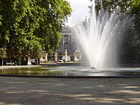
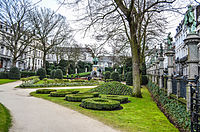
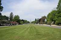
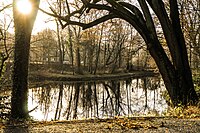
Brussels Park is the largest urban public park in central Brussels, Belgium. Formerly known and still sometimes colloquially referred to as the Royal Park, it was the city's first public park, being originally laid out between 1776 and 1783 in a neoclassical style by the French architect Gilles-Barnabé Guimard and the Austrian landscape architect Joachim Zinner, as part of an urban project including the Place Royale/Koningsplein. The area of the rectangular park is 13.1 ha.
The Parc de la Villette is the third-largest park in Paris, 55.5 hectares in area, located at the northeastern edge of the city in the 19th arrondissement. The park houses one of the largest concentrations of cultural venues in Paris, including the Cité des Sciences et de l'Industrie, three major concert venues, and the prestigious Conservatoire de Paris.
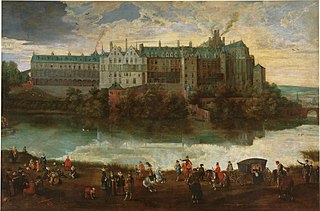
The Palace of Coudenberg was a royal residence situated on the Coudenberg or Koudenberg, a small hill in what is today the Royal Quarter of Brussels, Belgium.
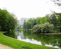
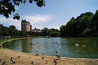
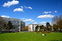
Leopold Park is a public park of 6.43 ha located within the Leopold Quarter of Brussels, Belgium. It is adjacent to the Paul-Henri Spaak building, the seat of the European Parliament. It is served by the metro stations Maalbeek/Maelbeek and Schuman on lines 1 and 5 of the Brussels Metro.
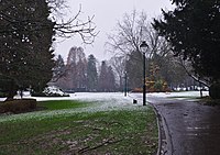
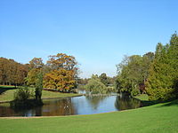
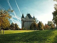
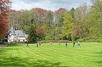
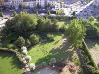
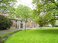
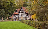
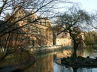
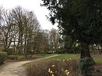
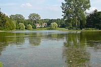
Malou Park is an urban park in the Woluwe-Saint-Lambert municipality of Brussels, Belgium. It is in the valley of the Woluwe stream, to the south-east of the Woluwe Shopping Center. It is the municipality's oldest and biggest park.
Le Champ-de-la-Pierre is a commune in the Orne department in north-western France.
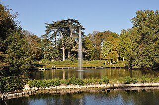
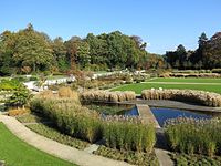
The Parc Floral de la Source is a French garden situated to the south of the River Loire, in the La Source neighbourhood of the town of Orléans, in the département of Loiret. With more than 150,000 visitors in 2007, it is the most visited site in Loiret.
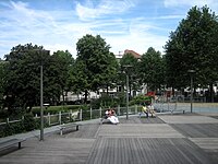
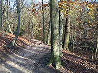
Forest Park or Vorst Park is a public park located in and named after the municipality of Forest in Brussels, Belgium. It was designed by Victor Besme and occupies an area of 13 hectares.
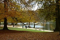
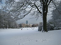
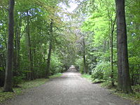
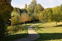
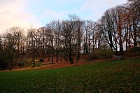
Duden Park is a public park located in the municipality of Forest in Brussels, Belgium. It covers 24 hectares and has a level difference of 45 metres (148 ft), with its highest point being at an elevation of 90 metres (300 ft).
The Rue Royale or Koningsstraat is a street in Brussels, Belgium, running through the municipalities of Schaerbeek, Saint-Josse-ten-Noode and the City of Brussels. It is limited to the south by the Place Royale/Koningsplein in the city centre and to the north by the Place de la Reine/Koninginplein in Schaerbeek.
The Botanical Garden of Brussels is a former botanical garden in Brussels, Belgium. It was created in 1826 and stood on the Rue Royale/Koningsstraat in Saint-Josse-ten-Noode, near Brussels' Northern Quarter financial district, until its relocation in 1938 to the National Botanic Garden of Belgium in Meise, Flemish Brabant.
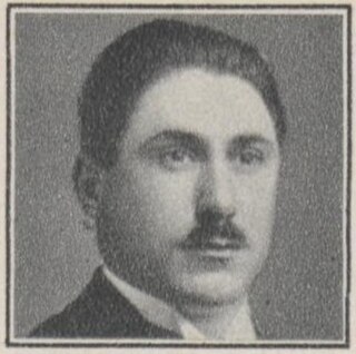
Frans Hubert Edouard Arthur Walter Robyns (1901-1986), known as Walter Robyns, was a Belgian botanist. His son, André Robyns (1935–2003), was also a botanist.
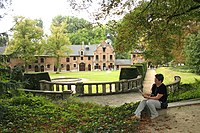
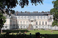
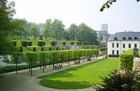
The Van Buuren Museum & Gardens are a former private house with extensive gardens, now a museum and park in Uccle, a municipality of Brussels, Belgium.
Elie Lainé (1829–1911) was a French landscape architect, chiefly remembered for the restoration of the gardens at Vaux-le-Vicomte, the layout of the grounds at Waddesdon Manor and the creation of numerous parks and gardens for King Leopold II of Belgium.