List of uninhabited regions

Last updated

World population density map (1994), showing uninhabited or nearly uninhabited areas in gray. World population density 1994 - with equator.png
World population density map (1994), showing uninhabited or nearly uninhabited areas in gray.

The list of uninhabited regions includes a number of places around the globe. The list changes year over year as human beings migrate into formerly uninhabited regions, or migrate out of formerly inhabited regions.

Contents

Definitions

The exact definition of what makes a place "uninhabited" is not simple.

Nomadic hunter-gather and pastoral societies live in extremely low population densities and range across large territories where they camp, rather than staying in any one place year-round. During the height of settler colonialism many European governments declared huge areas of the New World and Australia to be Terra nullius (land belonging to no one), but this was done to create a legal pretext to annex them to European empires; these lands were not, and are not uninhabited. While some communities are still nomadic, there are many remote and isolated communities in the less populated parts of the world that are separated from each other by hundreds or thousands kilometres of "uninhabited" wilderness, but these regions are still used for trapping, berry picking, mushroom hunting and so on, and are of spiritual significance to the settled descendants of formerly nomadic people.

Other places may not have a permanent resident population and yet still contain many humans who stay temporarily, as for example in national parks. Jasper National Park in Canada received 1,672,497 visitors in 2020 for example, but no one lives permanently in most of the park (Improvement District No. 12, the local government area that includes most of the park had a population of 0 in 2021 [1] ).

Generally speaking, only a few regions of the dry-land part of the Earth are so remote or have such a harsh climate that no one uses those areas for even part of the year. These places are tiny islands, the driest part of large deserts, very high mountains, and ice caps. The only other areas which are completely free of people are areas set aside by law such as strict nature reserves, sacred mountains, bombing ranges, and exclusion zones.

List

As a group, the list of uninhabited places are called the "nonecumene". This is a special geography term which means the uninhabited area of the world. [2]

Africa

A map of the ergs and mountain ranges of the Sahara. Saharan topographic elements map.png
A map of the ergs and mountain ranges of the Sahara.

The Sahara, the world's largest non-icecap desert, is not uninhabited and even remote areas like In Guezzam Province, Algeria, have a population of tens of thousands. The only truly uninhabited places in the Sahara are the ergs: sand dune fields. Even the hot and salty dried lake beds have Bedouin communities within them that graze their animals in the salt marshes and at nearby oases, for example the below-sea level Qattara Depression contains the tiny village of Qara Oasis and cannot be said to be truly uninhabited.

Antarctica

All of Antarctica is uninhabited aside from a few scientific research stations. [3]

Arctic

This maps shows the human settlements along the Arctic Ocean. Circumpolar coastal human population distribution ca. 2009.png
This maps shows the human settlements along the Arctic Ocean.

Tens of thousands of people live north of the Arctic Circle and many hundreds of thousands more within the Arctic Ocean drainage basin but outside of the Circle. The only parts of the Arctic that are truly uninhabited are the interior and northernmost coasts of Greenland, many of the islands in the Canadian Arctic Archipelago and some other islands in Northern Norway and the Russian North. Devon Island, in the Canadian North, is the world's largest uninhabited island.

Northeast Greenland National Park, which is the world's largest terrestrial protected area, has had a census population of 0 for many years since the only mine in the region closed. Nevertheless parts of this remote area can see seasonal use: 31 people and about 110 dogs were present over winter of 2008.[ citation needed ]

Australia

A population density map of Australia. Most of the continent is very sparsely populated, but only a few areas are truly deserted. Australian population density 2016.png
A population density map of Australia. Most of the continent is very sparsely populated, but only a few areas are truly deserted.

Even the driest regions of Australia have indigenous communities within them. In 1984 a previously-uncontacted tribe emerged from the Gibson Desert. There are however, several ergs (sand dunes and salt plains) that are truly uninhabited.

North America

Besides the in Arctic and Subarctic (see above), few areas of any size in North America can be said to be uninhabited. Most of these are strict nature reserves or wilderness area protected by law. Among the largest of these are Improvement District No. 25, Alberta (4,601.52 square kilometres (1,776.66 sq mi) and Tweedsmuir South Provincial Park, British Columbia (989,616 hectares (3,820.93 sq mi).

Others

See also

Related Research Articles

<span class="mw-page-title-main">Baker Island</span> Uninhabited Pacific atoll administered by the United States

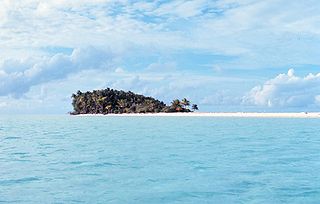
Baker Island, formerly known as New Nantucket, is an uninhabited atoll just north of the Equator in the central Pacific Ocean about 3,090 km (1,920 mi) southwest of Honolulu. The island lies almost halfway between Hawaii and Australia. Its nearest neighbor is Howland Island, 42 mi (68 km) to the north-northwest; both have been claimed as territories of the United States since 1857, though the United Kingdom considered them part of the British Empire between 1897 and 1936.

<span class="mw-page-title-main">Navassa Island</span> Caribbean island administered by the United States, claimed by Haiti

Navassa Island is a small uninhabited island in the Caribbean Sea. Located northeast of Jamaica, south of Cuba, and 40 nautical miles west of Jérémie on the Tiburon Peninsula of Haiti, it is subject to an ongoing territorial dispute between Haiti and the United States, which administers the island through the U.S. Fish and Wildlife Service.

<span class="mw-page-title-main">Geography of Russia</span>

Russia is the largest country in the world, covering over 17,125,192 km2 (6,612,074 sq mi), and encompassing more than one-eighth of Earth's inhabited land area. Russia extends across eleven time zones, and has the most borders of any country in the world, with sixteen sovereign nations.

<span class="mw-page-title-main">United States Minor Outlying Islands</span> Statistical designation of small islands of the United States

The United States Minor Outlying Islands is a statistical designation defined by the International Organization for Standardization's ISO 3166-1 code. The entry code is ISO 3166-2:UM. The minor outlying islands and groups of islands consist of eight United States insular areas in the Pacific Ocean and one in the Caribbean Sea.

<span class="mw-page-title-main">Geography of Iceland</span> Geographical features of Iceland

Iceland is an island country at the confluence of the North Atlantic and Arctic oceans, east of Greenland and immediately south of the Arctic Circle, atop the constructive boundary of the northern Mid-Atlantic Ridge. The island country is the world's 18th largest in area and one of the most sparsely populated. It is the westernmost European country when not including Greenland and has more land covered by glaciers than continental Europe. Its total size is 103,125 km2 (39,817 sq mi) and possesses an exclusive economic zone of 751,345 km2 (290,096 sq mi).

Tourism in Sweden comprised a relatively small part of the Swedish economy in 2011 at 2.9% of the country's GDP; at this time, tourism generated 264 billion Swedish krona, 98.8 billion of which was foreign-visitor expenditure in Sweden. 7.1% of Swedish household income is spent on domestic tourism.

A dependent territory, dependent area, or dependency is a territory that does not possess full political independence or sovereignty as a sovereign state and remains politically outside the controlling state's integral area. As such, a dependent territory includes a range of non-integrated not fully to non-independent territory types, from associated states to non-self-governing territories.

<span class="mw-page-title-main">Pacific Islander</span> Person from the Pacific Islands

Pacific Islanders, Pasifika, Pasefika, Pacificans or rarely Pacificers are the peoples of the Pacific Islands. As an ethnic/racial term, it is used to describe the original peoples—inhabitants and diasporas—of any of the three major subregions of Oceania.

<span class="mw-page-title-main">Pond Inlet</span> Place in Nunavut, Canada

Pond Inlet is a small, predominantly Inuit community in the Qikiqtaaluk Region of Nunavut, Canada, located on northern Baffin Island. To the Inuit the name of the place "is and always has been Mittimatalik." The Scottish explorer Sir John Ross had named an arm of the sea that separates Bylot Island from Baffin Island as Pond's Bay, and the hamlet now shares that name. On 29 August 1921, the Hudson's Bay Company opened its trading post near the Inuit camp and named it Pond Inlet, marking the expansion of its trading empire into the High Arctic.

<span class="mw-page-title-main">Fiordland</span> Geographical region of New Zealand

Fiordland is a geographical region of New Zealand in the south-western corner of the South Island, comprising the westernmost third of Southland. Most of Fiordland is dominated by the steep sides of the snow-capped Southern Alps, deep lakes, and its steep, glacier-carved and now ocean-flooded western valleys. The name "Fiordland" comes from a variant spelling of the Scandinavian word for this type of steep valley, "fjord". The area of Fiordland is dominated by, and very roughly coterminous with, Fiordland National Park, New Zealand's largest National Park.

<span class="mw-page-title-main">Uninhabited island</span> Island without human residents

An uninhabited island, desert island, or deserted island, is an island, islet or atoll that is not permanently populated by humans. Uninhabited islands are often depicted in films or stories about shipwrecked people, and are also used as stereotypes for the idea of "paradise". Some uninhabited islands are protected as nature reserves, and some are privately owned. Devon Island in Canada's far north is the largest uninhabited island in the world.

<span class="mw-page-title-main">Boundaries between the continents</span>

Determining the boundaries between the continents is generally a matter of geographical convention. Several slightly different conventions are in use. The number of continents is most commonly considered seven but may range as low as four when Afro-Eurasia and the Americas are both considered as single continents. An island can be considered to be associated with a given continent by either lying on the continent's adjacent continental shelf or being a part of a microcontinent on the same principal tectonic plate. An island can also be entirely oceanic while still being associated with a continent by geology or by common geopolitical convention. Another example is the grouping into Oceania of the Pacific Islands with Australia and Zealandia.

<span class="mw-page-title-main">Lulu Town</span> Former human settlement on Navassa Island

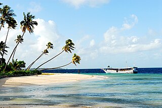
Lulu Town, also known as Lulu Ville, is a now uninhabited, former settlement on Navassa Island, claimed by both the United States and neighbouring Haiti, in the Windward Passage.

<span class="mw-page-title-main">Dependencies of Norway</span> Territories of Norway in the Southern Hemisphere

Norway has three dependent territories, all uninhabited and located in the Southern Hemisphere. Bouvet Island (Bouvetøya) is a sub-Antarctic island in the South Atlantic Ocean. Queen Maud Land is the sector of Antarctica between the 20th meridian west and the 45th meridian east. Peter I Island is a volcanic island located 450 kilometres (280 mi) off the coast of Ellsworth Land of continental Antarctica. Despite being unincorporated areas, neither Svalbard nor Jan Mayen is formally considered a dependency. While the Svalbard Treaty regulates some aspects of that Arctic territory, it acknowledges that the islands are part of Norway. Similarly, Jan Mayen is recognized as an integral part of Norway.

<span class="mw-page-title-main">Wakatobi National Park</span> Marine park in Southeast Sulawesi, Indonesia

Wakatobi National Park is a marine national park in Southeast Sulawesi, Indonesia. The name of Wakatobi is a portmanteau of the four main Tukangbesi Islands: Wangi-wangi, Kaledupa, Tomia, and Binongko. Since 2005 the park is listed as a tentative World Heritage Site.

<span class="mw-page-title-main">Fauna of California</span> Flora and fauna of the US state of California

The fauna of the State of California may be the most diverse in the United States of America. Of the Lower 48 conterminous states, California has the greatest diversity in climate, terrain and geology in general. The state's six life zones are the lower Sonoran (desert); upper Sonoran ; transition ; and the Canadian, Hudsonian, and Arctic zones, comprising California's highest elevations. California’s diverse geography gives rise to dozens of different ecosystems, each of which has its own unique native plants and animals. California is a huge state, the 3rd largest in the U.S., and can range broadly in habitat type.

<span class="mw-page-title-main">Exclusive economic zone of Vietnam</span> Economic zone exclusive to Vietnam

Vietnam claims an exclusive economic zone (EEZ) of 1,395,096 km2 (538,650 sq mi) with 200 nautical miles from its shores.

The United States has the world's second-largest exclusive economic zone (EEZ). The total size is 11,351,000 km2 (4,383,000 sq mi)2. Areas of its EEZ are located in three oceans, the Gulf of Mexico, and the Caribbean Sea. Most notable areas are Alaska, Hawaii, the East Coast, West Coast and Gulf Coast of the United States.

References

  1. "Population and dwelling counts: Canada, provinces and territories, and census subdivisions (municipalities)". Statistics Canada. February 9, 2022. Retrieved February 9, 2022.
  2. Gosh, Ajay Kumar. (2005). Academic Dictionary Of Geology, p. 84.
  3. "Antarctica" at CIA World Factbook (CIA); excerpt, "no indigenous inhabitants, but there are both permanent and summer-only staffed research stations"; retrieved 2013-4-19.
  4. "Ashmore and Cartier Islands" at CIA; excerpt, "no indigenous inhabitants"; retrieved 2013-4-19.
  5. "Baker Island" at CIA; excerpt, "no indigenous inhabitants"; retrieved 2013-4-19.
  6. "Bouvet Island" at CIA; retrieved 2013-4-19.
  7. "2013 Census QuickStats about a place: Fiordland". Statistics New Zealand. Retrieved 2017-09-27.
  8. Nussbaum, Louis-Frédéric. (2005). "Hashima" in Japan Encyclopedia, p. 294.
  9. "Heard and McDonald Islands" at CIA; retrieved 2013-4-19.
  10. "Howland Island" at CIA; excerpt, "no indigenous inhabitants"; retrieved 2013-4-19.
  11. "Jarvis Island" at CIA; excerpt, "no indigenous inhabitants"; retrieved 2013-4-19.
  12. "Kingman Reef" at CIA; excerpt, "no indigenous inhabitants"; retrieved 2013-4-19.
  13. "Navassa Island" at CIA; retrieved 2013-4-19.
  14. "Paracel Islands" at CIA; excerpt, "no indigenous inhabitants"; retrieved 2013-4-19.
  15. "Palmyra Atoll" at CIA; excerpt, "no indigenous inhabitants"; retrieved 2013-4-19.
  16. "Spratly Islands" at CIA; excerpt, "no indigenous inhabitants"; retrieved 2013-4-19.