
Swansea is a coastal city and the second-largest city of Wales. It forms a principal area, officially known as the City and County of Swansea.

Gower or the Gower Peninsula is in South West Wales and is the most westerly part of the historic county of Glamorgan, Wales. It projects towards the Bristol Channel. In 1956, the majority of Gower became the first area in the United Kingdom to be designated an Area of Outstanding Natural Beauty.

Gower electoral ward is an electoral ward in Britain. It is a ward of the City and County of Swansea, and comprises the western part of the Gower Peninsula. It lies within the UK Parliamentary constituency of Gower.

The Bristol Channel is a major inlet in the island of Great Britain, separating South Wales and South West England. It extends from the smaller Severn Estuary of the River Severn to the North Atlantic Ocean. It takes its name from the English city and port of Bristol.
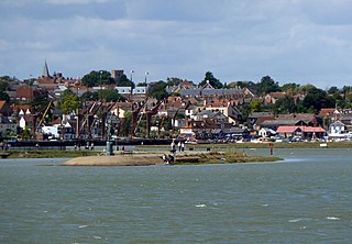
Maldon District is a local government district in Essex, England. The district is managed by Maldon District Council, which is based in Maldon, the largest town in the district. The district also includes the town of Burnham-on-Crouch and numerous villages, including Heybridge, Wickham Bishops, Southminster, Tolleshunt D'Arcy and Tollesbury. The district covers the Dengie peninsula to the south of Maldon and the Thurstable Hundred area to the north of the Blackwater Estuary, a total area of 358.78 km2.

High Halstow is a village and civil parish on the Hoo Peninsula in the unitary authority of Medway in South East England. It was, until 1998, administratively part of Kent and is still ceremonially associated via the Lieutenancies Act. The parish had a population of 1,781 according to the 2001 census, increasing to 1,807 at the 2011 census.

The River Loughor is a river in Wales which marks the border between Carmarthenshire and Swansea. The river is sourced from an underground lake at the Black Mountain emerging at the surface from Llygad Llwchwr which translates from the Welsh as "eye of the Loughor". It flows past Ammanford and Hendy in Carmarthenshire and Pontarddulais in Swansea. The river divides Carmarthenshire from Swansea for much of its course and it separates Hendy from Pontarddulais at the point where the river becomes tidal. The Loughor meets the sea at its estuary near the town of Loughor where it separates the south coast of Carmarthenshire from the north coast of the Gower Peninsula. Among its tributaries is the River Amman and the River Morlais, with the former joining the Loughor near Pantyffynnon. The area of the catchment is some 262 square kilometres (101 sq mi).
Stoke is a civil parish on the Hoo Peninsula in Kent, England, to the south of Allhallows, on the north of the Medway Estuary. The parish had a population of 1,060 at the 2011 census.

Banks is a large coastal village in Lancashire, England, south of the Ribble estuary four miles (6 km) north-east of Southport. The village is administered by West Lancashire Borough and North Meols Parish Council. It is in the South Ribble parliamentary constituency. At the 2001 census the population of the North Meols civil parish was 3,792, rising to 4,146 by the 2011 census.

A halosere is an ecological succession in a saline water saline environments. An example of a halosere is a salt marsh.

Llangennith, Llanmadoc and Cheriton is a rural community on the Gower Peninsula, Swansea, south Wales. It comprises the villages of Llangennith, Llanmadoc and Cheriton. Together they share a community council.
Llanrhidian Higher is a local government community in Swansea, south Wales. The community has its own elected community council.

Broughton Bay is a beach of the Gower Peninsula, South Wales, located at the north western tip. The bay is backed by sand dunes further inland. Access to the adjacent Whiteford Sands beach to the west is only available at low tide.
Wernffrwd (Gwernffrwd) is a village in the south of Wales. It is located approximately 8.5 miles (13.7 km) from Swansea, and is within the Community of Llanrhidian Higher.

The cuisine of Gower, a peninsula in south Wales, is based on ingredients grown, raised or collected on or around the peninsula. The cuisine is based on fresh ingredients with recipes based around a fish or meat dish. Until the twentieth century, the peninsula was virtually cut off from other markets due to poor roads, and no rail connection. The result was that Gower became self-sufficient in food.

The Gower and Swansea Bay Coast Path (Welsh: Llwybr arfordir Penrhyn Gŵyr a Bae Abertawe is part of the Wales Coast Path, an 1,400-kilometre long-distance walking route around the whole coast of Wales that opened in 2012. The Gower and Swansea Bay stretch is 156 kilometres in length, running along the coast of the Gower Peninsula from Loughor, Swansea to Kenfig Dunes near Port Talbot, South Wales. The number of people using the Wales Coast Path in the Swansea local authority area was 349,333.
Reynoldston is a rural village and a community in the City and County of Swansea, Wales, which had a population of 439 in 2011. The community has its own elected community council. The village is located deep in the heart of the Gower Peninsula.
The geology of the Gower Peninsula in South Wales is central to the area's character and to its appeal to visitors. The peninsula is formed almost entirely from a faulted and folded sequence of Carboniferous rocks though both the earlier Old Red Sandstone and later New Red Sandstone are also present. Gower lay on the southern margin of the last ice sheet and has been a focus of interest for researchers and students in that respect too. Cave development and the use of some for early human occupation is a further significant aspect of the peninsula's scientific and cultural interest.

The coastline of Wales extends from the English border at Chepstow westwards to Pembrokeshire then north to Anglesey and back eastwards to the English border once again near Flint. Its character is determined by multiple factors, including the local geology and geological processes active during and subsequent to the last ice age, its relative exposure to or shelter from waves, tidal variation and the history of human settlement and development which varies considerably from one place to another. The majority of the coast east of Cardiff in the south, and of Llandudno in the north, is flat whilst that to the west is more typically backed by cliffs. The cliffs are a mix of sandstones, shales and limestones, the erosion of which provides material for beach deposits. Of the twenty-two principal areas which deliver local government in Wales, sixteen have a coastline, though that of Powys consists only of a short section of tidal river some distance from the open sea. Its length has been estimated at 1,680 miles (2,700 km).


