
Prince George's County is a county located in the U.S. state of Maryland, bordering the eastern portion of Washington, D.C. As of the 2010 U.S. Census, the population was 863,420, making it the second-most populous county in Maryland, behind Montgomery County. Its county seat is Upper Marlboro. It is the largest and the most affluent African American-majority county in the United States, with five of its communities identified in a 2015 top ten list.

Calvert County is located in the U.S. state of Maryland. As of the 2010 census, the population was 88,737. Its county seat is Prince Frederick. The county's name is derived from the family name of the Barons of Baltimore, the proprietors of the English Colony of Maryland.

Lusby is an unincorporated community and census-designated place (CDP) in Calvert County, Maryland, United States. The population of the CDP was 1,835 at the 2010 census. Residents of the Chesapeake Ranch Estates and Drum Point communities also use the Lusby ZIP code designation.

Owings is a census-designated place (CDP) in Calvert County, Maryland, United States. The population was 2,149 at the 2010 census, up from 1,325 in 2000.

Upper Marlboro, officially the Town of Upper Marlboro, is the seat of Prince George's County, Maryland, United States. The population within the town limits was 631 at the 2010 U.S. Census, although Greater Upper Marlboro is many times larger.

Leonardtown is a town in and the county seat of St. Mary's County, Maryland, United States. The population was 2,930 at the 2010 census. Leonardtown is perhaps most famous for the national oyster-shucking championship that is held annually at the St. Mary's County fairgrounds.

Lexington Park is a census-designated place (CDP) in St. Mary's County, Maryland, United States, and the principal community of the Lexington Park, Maryland Micropolitan Statistical Area. The population was 11,626 at the 2010 census.

The Patuxent River is a tributary of the Chesapeake Bay in the state of Maryland. There are three main river drainages for central Maryland: the Potomac River to the west passing through Washington, D.C., the Patapsco River to the northeast passing through Baltimore, and the Patuxent River between the two. The 908-square-mile (2,352 km2) Patuxent watershed had a rapidly growing population of 590,769 in 2000. It is the largest and longest river entirely within Maryland, and its watershed is the largest completely within the state.

Clarksville is an unincorporated community in Howard County, Maryland; the second highest-earning county in the United States according to the U.S. Census Bureau. The community is named for William Clark, a farmer who owned much of the land on which the community now lies and served as a postal stop that opened on the 4th of July 1851.

Queen Anne in Prince George's County, Maryland, United States, is a former seaport on the Patuxent River. It was delineated as a CDP for the 2010 census, at which time it had a population of 1,280.
Woodwardville is an unincorporated community situated in western Anne Arundel County, Maryland, United States, containing 27 structures, 16 of which are historic and included in the Woodwardville Historic District, listed on the National Register of Historic Places in 2003. Most of the structures are located adjacent to Patuxent Road, which runs through the center of the community. On the north end of the district, a small street, 5th Avenue, runs west from Patuxent Road underneath the train tracks. Prior to the establishment of what would be later known as Fort George G. Meade in 1917, the road once continued on to Laurel. Three of the seven buildings along 5th Avenue are historic. Woodwardville's building stock consists principally of late-19th and early-20th century domestic architecture. Good examples of the Bungalow, Foursquare, Tudor Revival, and Queen Anne styles are present, as well as older traditional vernacular classifications such as the I-house. These older forms are supplemented by a handful of post-World War II era structures. Woodwardville also features several public or commercial buildings including a church, a former schoolhouse, the ruins of a store and storage or service buildings associated with the railroad. Many of Woodwardville's older buildings fell into decline following World War II, but in recent years, due to its close proximity to commuter rail service, Woodwardville has evolved into a bedroom community for persons working in Washington and Baltimore. Investment by new residents resulted in the restoration and renovation of many buildings which had formerly been in deteriorating condition. Despite the intense development a mile away in Piney Orchard, this quaint community retains its ability to communicate its historic qualities and distinct sense of place.
Broad Creek in Prince George's County was the first footprint of European settlement in the immediate counties around what would become the nation's capital, Washington, D.C. The area is part of greater Fort Washington.

Hazelwood is a historic home located outside Upper Marlboro, Prince George's County, Maryland, United States. The home is a large asymmetrical frame dwelling, built in three discrete sections over a long period of time. They are: a low gambrel-roofed section dating from the 18th century, about 1770; a gable-roofed Federal-style dwelling dating from the very early 19th century; and a tall gable-front Italianate-style central section constructed about 1860. The house stands on high ground west of and overlooking the site of historic Queen Anne town on the Patuxent River. Also on the property are several domestic and agricultural outbuildings, and the reputed sites of two cemeteries.
Nottingham is a small town on the Patuxent River in Prince George's County, Maryland, United States. It contains an archaeological site which was listed on the National Register of Historic Places in 1975.
Mattapany-Sewall Archeological Site is an archaeological site in St. Mary's County, Maryland. It is located at the Patuxent River Naval Air Station on a level terrace approximately 45' above sea level, less than 1000' south of the Patuxent River in an unused wooded/grassy tract. Documentary evidence identifies the site as Mattapany-Sewall, a manor established in 1663 and occupied from 1666 to 1684 by Charles Calvert, 3rd Baron Baltimore. It served as a governmental meeting place and colonial arsenal, and was the scene of the 1689 battle, known as the Protestant Revolution of 1689, in which Maryland's Proprietary government was overthrown.
Johnstown is an unincorporated community in Calvert County, Maryland, United States. Preston-on-the-Patuxent was listed on the National Register of Historic Places in 1974.
Bristol is an unincorporated community in Anne Arundel County, Maryland, United States. Jug Bay Wetlands Sanctuary and the colonial town of Pig Point are on the Patuxent River waterfront portion of Bristol. Pig Point saw War of 1812 action and was the county's largest steamboat port on the Patuxent in the mid-19th century. Pig Point is a very significant Native American Early Archaic Period archaeological site.

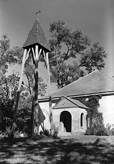
Chaptico is an unincorporated community in St. Mary's County, Maryland, United States. It lies on Chaptico Run, which forms a bay as it enters the Wicomico River.
Great Mills is an unincorporated community in St. Mary's County, Maryland, United States. Great Mills High School serves the lower end of the county, including the town of Lexington Park.
Town Creek is a tributary of the Patuxent River in Saint Mary's County, Maryland.

