Owings, Maryland

Last updated

Owings, Maryland
Calvert County Maryland Incorporated and Unincorporated areas Owings Highlighted.svg
Location of Owings, Maryland
Coordinates: 38°42′43″N76°36′14″W / 38.71194°N 76.60389°W / 38.71194; -76.60389
CountryUnited States
State Maryland
County Calvert
Area
[1]
  Total3.95 sq mi (10.23 km2)
  Land3.94 sq mi (10.20 km2)
  Water0.01 sq mi (0.03 km2)
Elevation
89 ft (27 m)
Population
 (2020)
  Total2,141
  Density543.54/sq mi (209.85/km2)
Time zone UTC−5 (Eastern (EST))
  Summer (DST) UTC−4 (EDT)
ZIP Code
20736
Area code(s) 410, 443, and 667
FIPS code 24-59375
GNIS feature ID0590959

Owings is a town center and census-designated place (CDP) in northern Calvert County, Maryland, United States. The population was 2,149 at the 2010 census, [2] up from 1,325 in 2000.

Contents

Geography

Owings is located along the northern border of Calvert County at 38°42′43″N76°36′14″W / 38.71194°N 76.60389°W / 38.71194; -76.60389 (38.711919, 76.603901). [3] It is bordered to the north by Friendship in Anne Arundel County. Maryland Route 2 (Solomons Island Road) passes through the CDP west of the center of town, leading north 23 miles (37 km) to Annapolis and south 13 miles (21 km) to Prince Frederick, the Calvert County seat. Maryland Route 260 passes through the center of town and leads southeast 4 miles (6 km) to Chesapeake Beach and northwest 11 miles (18 km) to Upper Marlboro, via MD 4.

According to the United States Census Bureau, the Owings CDP has a total area of 3.9 square miles (10.2 km2), of which 0.01 square miles (0.03 km2), or 0.32%, is water. [2]

The Owings area is considered exurban by the Washington Post . It includes a mix of farmland, single-family detached homes and subdivisions. Aerial maps show that about 50% of the Owings CDP is wooded with county regulations to keep it that way. The place center lies on the former Chesapeake Beach Railway line, which was converted to the roadway Maryland Route 260. Owings was a stop on the railway local service. Hall Creek originates in the Owings vicinity, forms part of the CDP's northern border and winds west until it empties into the Patuxent River. The creek bed cuts a significant valley across the hilly central ridge of the Calvert County peninsula.

Demographics

Historical population
CensusPop.Note
2000 1,325
2020 2,141
U.S. Decennial Census [4]

As of the census [5] of 2000, there were 1,325 people, 426 households, and 356 families residing in the CDP. The population density was 337.2 inhabitants per square mile (130.2/km2). There were 443 housing units at an average density of 112.7 per square mile (43.5/km2). The racial makeup of the CDP was 86.87% White, 11.47% African American, 0.15% Native American, 0.60% Asian, 0.45% from other races, and 0.45% from two or more races. Hispanic or Latino of any race were 0.75% of the population.

There were 426 households, out of which 42.3% had children under the age of 18 living with them, 71.8% were married couples living together, 8.2% had a female householder with no husband present, and 16.4% were non-families. 10.8% of all households were made up of individuals, and 3.5% had someone living alone who was 65 years of age or older. The average household size was 3.06 and the average family size was 3.30.

In the CDP, the population was spread out, with 29.7% under the age of 18, 5.5% from 18 to 24, 29.9% from 25 to 44, 25.9% from 45 to 64, and 9.1% who were 65 years of age or older. The median age was 38 years. For every 100 females, there were 96.6 males. For every 100 females age 18 and over, there were 89.4 males.

The median income for a household in the CDP was $74,150, and the median income for a family was $74,702. Males had a median income of $49,250 versus $31,204 for females. The per capita income for the CDP was $27,287. About 2.5% of families and 3.5% of the population were below the poverty line, including none of those under age 18 and 9.5% of those age 65 or over.

History

Before the arrival of the railroad, Calvert County was a rural county with few roads and no railroads. It had no factories, and the primary industry was tobacco farming, like most of Southern Maryland before the Civil War. [6]

The Owings family had been present in Maryland since the 18th century in various roles, such as real-estate brokers, merchants, and tradesmen. The family was instrumental in the development of the North Beach/Chesapeake Beach area as a summer resort. It was also instrumental in planning the Chesapeake Beach Railway and utilizing it to ship canned goods out of the county. [6]

Owings was named after Harry P. Owings. The railway station located at the line's intersection with Solomons Island Road was originally known as "Friendship". To avoid confusion with the town of Friendship, located 1.6 miles (2.6 km) northeast of Owings in Anne Arundel County, the president of the railway, David Moffatt, renamed the station "Owings". [7] It was also a tribute to Harry P. Owings. Mr. Owings had been a one-time member of the Maryland House of Delegates as a Democrat from 1888 to 1889. He was a local farmer and was interested in the real estate business. The town of Owings was a result of that interest as many residents purchased land in the area which he had subdivided through his real estate business. He also served as a sales agent in the county for lime, fertilizer, coal, and corrugated metal roofs. [6] In August 1900, Harry P. Owings requested the position of station manager in a letter sent from Owings Station and now in the archives of the Chesapeake Bay Railway Museum archives [7] and was granted the position. [6]

Harry P. Owings also owned the Owings House located at 9740 Old Solomons Road, which is currently recorded with the Maryland Historical Trust. The house was built in 1850 and later served as a boarding house for county residents visiting Owings. The residents would board their horses in the stables and sleep at the Owings House before boarding the train the following morning. The Owings railway stop was the only one in Calvert County in the early days of the line. [6]

A sawmill that operated in Owings in the early 20th century near Old Solomonds Road has disappeared. [8]

The Maidstone Plantation was listed on the National Register of Historic Places in 1971. [9]

Community resources

Businesses

Owings has a single convenience storefilling station, two childcare centers, at least one church, and a handful of other small businesses clustered around its center. A medical office building with a now-closed pharmacy is at the southeast corner of the Route 2 and Route 260 intersection. A small industrial site has a concrete provider and an automotive shop. There is a funeral home near the southern edge of the CDP.

Public services

The Owings Post Office is located at 9440 Old Solomon's Island Road approximately 0.4 miles (0.64 km) south of the town center. [10] Windy Hill Elementary and Windy Hill Middle School are located at the eastern edge of the CDP on a contiguous campus. [11] [12]

Hutchins Pond is a public pond located within the boundaries of the CDP off of Mount Harmony Lane. It was donated by the Hutchins family. It is managed by the Calvert Nature Society and stocked with trouts by the Maryland Department of Natural Resources. [13]

Owings has a Boys & Girls Club affiliate, the Owings Outlaws, with teams participating in football and basketball.

Housing subdivisions include Cabin Branch, Cross Point, Grover's Summit (1998), Sycamore Ridge (1989), the three Quince Views, Arbor Greene, Fairview and Amber Woods.

Related Research Articles

<span class="mw-page-title-main">Calvert County, Maryland</span> County in Maryland, United States

Calvert County is a county located in the U.S. state of Maryland. As of the 2020 census, the population was 92,783. Its county seat is Prince Frederick. The county's name is derived from the family name of the Barons of Baltimore, the proprietors of the English Colony of Maryland. Calvert County is included in the Washington–Arlington–Alexandria, DC–VA–MD–WV Metropolitan Statistical Area. It occupies the Calvert Peninsula, which is bordered on the east by Chesapeake Bay and on the west by the Patuxent River. Calvert County is part of the Southern Maryland region. The county has one of the highest median household incomes in the United States. It is one of the older counties in Maryland, after St. Mary's, Kent County and Anne Arundel counties.

<span class="mw-page-title-main">Lake Shore, Maryland</span> Census-designated place in Maryland, United States

Lake Shore is a census-designated place and unincorporated community in Anne Arundel County, Maryland, United States, located east of Pasadena. The population of Lake Shore was 19,477 at the 2010 census.

<span class="mw-page-title-main">Mayo, Maryland</span> Census-designated place in Maryland, United States

Mayo is a census-designated place (CDP) in Anne Arundel County, Maryland, United States. The population was 8,298 in the 2010 census. The Mayo CDP of 2010 includes all of the area that used to be counted as the Selby-on-the-Bay CDP. The beach in Mayo used to be a popular weekend resort.

<span class="mw-page-title-main">Parole, Maryland</span> Census-designated place in Maryland, United States

Parole, a suburb of Annapolis, is a census-designated place (CDP) in Anne Arundel County, Maryland, United States. The population was 15,922 at the 2010 census. It has several major roads intersect at the western edge of the state capital, Annapolis, and it contains the Annapolis Mall, a number of other large shopping centers, and the Anne Arundel Medical Center. It is generally considered to be part of Annapolis, rather than a separate town. The neighborhood was named because it was a parole camp, where Union and Confederate prisoners of war were brought for mutual exchange and eventual return to their respective homes.

<span class="mw-page-title-main">Pasadena, Maryland</span> Census-designated place in Maryland, United States

Pasadena is a census-designated place (CDP) in Anne Arundel County, Maryland, United States. The population was 24,287 at the 2010 census.

<span class="mw-page-title-main">Shady Side, Maryland</span> Census-designated place in Maryland, United States

Shady Side is a census-designated place (CDP) in Anne Arundel County, Maryland, United States. The population was 5,803 at the 2010 census.

<span class="mw-page-title-main">Essex, Maryland</span> Census-designated place in Maryland, United States

Essex is an unincorporated community and census-designated place in Baltimore County, Maryland, United States. Essex has a long history dating back to 1909. The population was 40,505 in the 2020 census, up from 39,262 in the 2010 census.

<span class="mw-page-title-main">Calvert Beach-Long Beach, Maryland</span> Former Census-designated place in Maryland, United States

Calvert Beach-Long Beach was a census-designated place (CDP) in Calvert County, Maryland, United States. The population was 2,487 at the 2000 census. For the 2010 census the area was split into two CDPs: Calvert Beach and Long Beach.

<span class="mw-page-title-main">Chesapeake Beach, Maryland</span> Town in Maryland

Chesapeake Beach is a town in Calvert County, Maryland, United States. Its major attractions include the Chesapeake Beach Railway Station, the Chesapeake Beach Rail Trail, a water park, marinas, piers, and charter boat fishing. The town's population was recorded as 5,753 in the 2010 census.

<span class="mw-page-title-main">Chesapeake Ranch Estates-Drum Point, Maryland</span> Former Census-designated place in Maryland, United States

Chesapeake Ranch Estates-Drum Point was a census-designated place in Calvert County, Maryland, for the 2000 United States Census, when it had a population of 11,503. For the 2010 census the area was split into the CDPs of Chesapeake Ranch Estates and Drum Point. The communities are only a few minutes from the popular weekend resort town Solomons as well as the Calvert Cliffs Nuclear Power Plant, Calvert Cliffs State Park and fossil grounds, and the Dominion Cove Point liquefied natural gas terminal.

<span class="mw-page-title-main">Dunkirk, Maryland</span> Census-designated place in Maryland, United States

Dunkirk is a census-designated place (CDP) in Calvert County, Maryland, United States. The population was 2,521 at the 2010 census.

<span class="mw-page-title-main">Huntingtown, Maryland</span> Census-designated place in Maryland, United States

Huntingtown, established 1683, is a census-designated place (CDP) in Calvert County, Maryland, United States. The population was 3,311 at the 2010 census, up from 2,436 in 2000. Many large estate homes have recently been built in small developments off routes 2/4. It has a public high school called Huntingtown High. The Calverton School is located just south of the town center. State-operated commuter buses and private vanpools carry residents to Washington.

<span class="mw-page-title-main">Lusby, Maryland</span> Census-designated place in Maryland, United States

Lusby is an unincorporated community and census-designated place (CDP) in Calvert County, Maryland, United States. The population of the CDP was 1,835 at the 2010 census. Residents of the Chesapeake Ranch Estates and Drum Point communities also use the Lusby ZIP code designation.

<span class="mw-page-title-main">Prince Frederick, Maryland</span> Census-designated place in Maryland, United States

Prince Frederick is an unincorporated community and census-designated place (CDP) in Calvert County, Maryland, United States. As of the 2020 census, the population of Prince Frederick was 3,226, up from 2,538 in 2010. It is the county seat of Calvert County.

<span class="mw-page-title-main">Solomons, Maryland</span> Census-designated place in Maryland, United States

Solomons, also known as Solomons Island, is an unincorporated community and census-designated place (CDP) in Calvert County, Maryland, United States. The population was 2,368 at the 2010 census, up from 1,536 in 2000. Solomons is a popular weekend destination spot in the Baltimore–Washington metropolitan area.

<span class="mw-page-title-main">St. Leonard, Maryland</span> Census-designated place in Maryland

St. Leonard is a census-designated place (CDP) in Calvert County, Maryland, United States. The population was 742 at the 2010 census. Residents of the Calvert Beach and Long Beach communities also use the St. Leonard ZIP code designation. St. Leonard has a large antique dealer complex.

<span class="mw-page-title-main">Edgewood, Maryland</span> Census-designated place in Maryland, United States

Edgewood is an unincorporated community and census-designated place (CDP) in Harford County, Maryland, United States. The population was 25,562 at the 2010 census, up from 23,378 in 2000.

<span class="mw-page-title-main">Seat Pleasant, Maryland</span> City in Maryland

Seat Pleasant is an incorporated city in Prince George's County, Maryland, United States, located immediately east of Washington D.C.. Per the 2020 census, the population was 4,522. Two state highways pass through the community — Maryland routes 704 and 214. The Washington Metro's Blue and Silver Lines are nearby. The Washington Commanders' stadium is east of Seat Pleasant, near the Capital Beltway (I-95/495).

<span class="mw-page-title-main">Lexington Park, Maryland</span> CDP in Maryland, United States

Lexington Park is a census-designated place (CDP) in St. Mary's County, Maryland, United States, and the principal community of the Lexington Park, Maryland Micropolitan Statistical Area. The population was 11,626 at the 2010 census.

<span class="mw-page-title-main">Maryland Route 260</span>

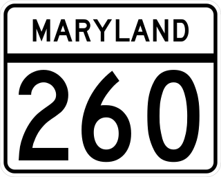
Maryland Route 260 is a state highway in the U.S. state of Maryland. Known as Chesapeake Beach Road, the highway runs 8.51 miles (13.70 km) from MD 4 at Lyons Creek east to MD 261 in Chesapeake Beach. MD 260 connects the twin towns of Chesapeake Beach and North Beach in northern Calvert County with highways to Upper Marlboro, Washington, Annapolis, and Baltimore. Much of the highway follows part of the course of the former Chesapeake Beach Railway, which ended service in the mid-1930s. MD 260 was constructed in the early 1920s from MD 2 south of Owings east to Chesapeake Beach. The highway was extended west to what is now MD 4 south of Dunkirk in the early 1930s. MD 260 was relocated to a road built on the railroad right-of-way from Lyons Creek through Owings in the mid-1950s.

References

  1. "2020 U.S. Gazetteer Files". United States Census Bureau. Retrieved April 26, 2022.
  2. 1 2 "Geographic Identifiers: 2010 Demographic Profile Data (G001): Owings CDP, Maryland". U.S. Census Bureau, American Factfinder. Archived from the original on February 12, 2020. Retrieved August 22, 2014.
  3. "US Gazetteer files: 2010, 2000, and 1990". United States Census Bureau. February 12, 2011. Retrieved April 23, 2011.
  4. "Census of Population and Housing". Census.gov. Retrieved June 4, 2016.
  5. "U.S. Census website". United States Census Bureau . Retrieved January 31, 2008.
  6. 1 2 3 4 5 Maryland Historical Trust - Owings House - CT-1299
  7. 1 2 Remembering Harry P. Owings of Owings Chesapeake Bay Railway Museum - Historical Articles from May 99 - Harry P. Owings
  8. The Chesapeake Dispatcher - November 1998 Chesapeake Beach Railway Museum website
  9. "National Register Information System". National Register of Historic Places . National Park Service. April 15, 2008.
  10. USPS Website - Owings Post Office
  11. Windy Hill Elementary webpage
  12. Windy Hill Middle School webpage
  13. Calvert Nature Society - Hutchins Pond page