There are 34 largest subdivisions of the country Indonesia and the highest tier of the local government. Provinces are further divided into regencies and cities, which are in turn subdivided into districts (kecamatan).

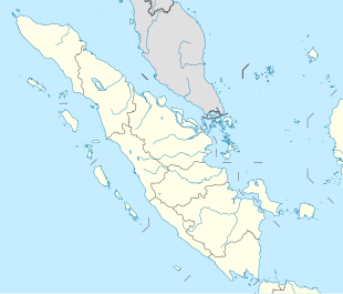
Bengkulu is a province of Indonesia. It is located on the southwest coast of Sumatra. It was formed on 18 November 1968 by separating out the former Bengkulu Residency area from the province of South Sumatra under Law No. 9 of 1967 and was finalised by Government Regulation No. 20 of 1968. Spread over 19,813 km2, it is bordered by the provinces of West Sumatra to the north, Jambi to the northeast, Lampung to the southeast, and South Sumatra to the east, and by the Indian Ocean to the northwest, south, southwest, and west.

Sibolga is a city and a port located in the natural harbour of Sibolga Bay on the west coast of North Sumatra province, in Indonesia.

Enggano Island is about 100 km southwest of Sumatra, Indonesia. It is one of the 92 officially listed outlying islands of Indonesia.
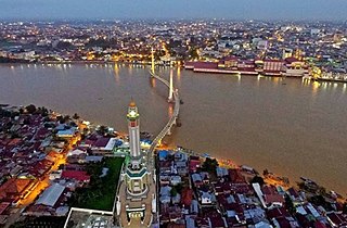
Jambi is the capital and largest city of the Indonesian province of Jambi. Located on the island of Sumatra, the city is a busy port on the Batang Hari River and an oil- and rubber-producing centre. The city is located 26 km (16 mi) from the ruins of Muaro Jambi Temple Compounds, an important city in the ancient Srivijaya kingdom.

National Institute of Aeronautics and Space is the Indonesian government space agency. It was established on November 27, 1963, by former Indonesian president Sukarno after one year's existence of an informal space agency organization. LAPAN is responsible for long-term civilian and military aerospace research.

Bengkulu is the capital of the Indonesian province of Bengkulu. The city is the second largest city on the west coast of Sumatra Island after Padang. Previously this area is under the influence of the kingdom of Inderapura and the Sultanate of Banten. The city also became the exile of Sukarno during the period of 1939 - 1942. It had a population of 308,756 at the 2010 Census, the latest estimate is 328,827. The city is also the largest city of Bengkulu Province.

More than 700 living languages are spoken in Indonesia. These figures indicate that Indonesia has about 10% of the world’s languages, establishing its reputation as the second most linguistically diverse nation in the world after Papua New Guinea. Most languages belong to the Austronesian language family, while there are over 270 Papuan languages spoken in eastern Indonesia.
Pagar Alam, is a city in South Sumatra, Indonesia. Before established as a definitive city, Pagaralam was an administrative city in Lahat Regency. It has an area of 633.66 km² and a population of 146,973 (2011).

Subulussalam is a city in Aceh province of Indonesia. It is located on the island of Sumatra. Since 2 January 2007, the provincial government of Aceh declared Subussalam as a city as a result of the administration expansion from Aceh Singkil Regency. It is located at 2°38′32″N98°00′15″E. It covers an area of 1,391 km2, and it had a population of 67,446 at the 2010 Census and of 75,044 at the 2015 Census; the latest official estimate is 79,991.
Curup is a town and district of Rejang Lebong Regency, part of Bengkulu Province of Indonesia. It is also the administrative capital of the regency. Curup is the second-largest town in the province of Bengkulu. Curup District has an area of 4.64 km², consisting of nine Administrative villages, with 28,173 residents at the 2010 Census. However, the urban area of which Curop District is the centre - including also South Curup, North Curup, Central Curup, and East Curup Districts - covered 101.3 km² and had a 2010 Census population of 115,909.
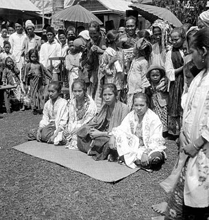
Rejang people are an Austronesian ethnolinguistic group, native to the some parts of Bengkulu Province and South Sumatera Province in the southwestern part of Sumatera Island, Indonesia. They occupied some area in an cool mountain slopes of the Barisan mountain range in both sides of Bengkulu and South Sumatra. With approximately more than 1,3 million people, they form the largest ethnic group in Bengkulu Province. Rejangese people predominantly live as a majority in 5 out 10 regencies and city of Bengkulu Province, while the rest of them who lives in South Sumatera resides at 7 villages in the district called as Bermani Ulu Rawas. The Rejangs are predominantly an Islam adherent group with small numbers following a religion other than Islam. According to research, Rejangese people are the descendants of the Bukar-Sadong people who migrated from Northern Borneo (Sarawak).

Bungin Tambun I is a village in district Padang Guci Hulu, in Kaur Regency in Bengkulu province and is one the three villages in the district with the name "Bungin Tambun". Its population is 1068.
Bungin Tambun II is a village in Padang Guci Hulu district, Kaur Regency in Bengkulu province and is one the three villages in the district with the name "Bungin Tambun". Its population is 855.
Bungin Tambun III is a village in Padang Guci Hulu district, Kaur Regency in Bengkulu province and is one the three villages in the district with the name "Bungin Tambun". Its population is 485.

Teluk Kuantan is a town and the seat of Kuantan Singingi Regency, Riau province, Indonesia.
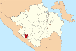
Mukomuko is a town, district and the regency seat of Mukomuko Regency in Bengkulu province, Indonesia. Its population is 15,005.
Arga Makmur is a town, district and the seat of North Bengkulu Regency in Bengkulu province, Indonesia. Its population is 47,457.
Kayu Agung is a city and the capital of Ogan Komering Ilir Regency in South Sumatra province, Indonesia. Its population is 62,694.