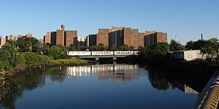
Coney Island Creek is a 1.8-mile-long (2.9 km) tidal inlet in Brooklyn, New York City. It was created from a series of streams and inlets by land filling and digging activities starting in the mid-18th century which, by the 19th century, became a 3-mile-long (4.8 km) continual strait and a partial mudflat connecting Gravesend Bay and Sheepshead Bay, separating Coney Island from the mainland. The strait was closed off in the early 20th century due to further land development and later construction projects. Today only the western half of Coney Island Creek exists.
Barren Island is a peninsula and former island on the southeast shore of Brooklyn in New York City. Located on Jamaica Bay, it was geographically part of the Outer Barrier island group on the South Shore of Long Island. The island was occupied by the Lenape Native Americans prior to the arrival of Dutch settlers in the 17th century. Its name is a corruption of Beeren Eylandt, the Dutch-language term for "Bears' Island".

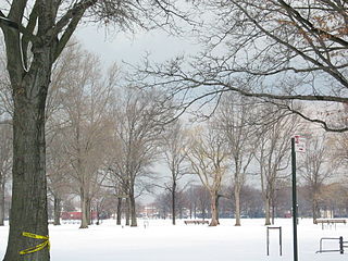
Pelham Bay Park is a municipal park located in the northeast corner of the New York City borough of the Bronx. It is, at 2,772 acres (1,122 ha), the largest public park in New York City. The park is more than three times the size of Manhattan's Central Park. The park is operated by the New York City Department of Parks and Recreation.

Gerritsen Beach is a neighborhood in the New York City borough of Brooklyn, located between Sheepshead Bay to the west and Marine Park to the east. The area is served by Brooklyn Community Board 15. The population of the neighborhood is 4,797 as of the 2020 U.S. census.
The Chimney Sweeps Islands are a pair of small islands located within New York City in the northern part of City Island Harbor in the borough of The Bronx. The islands, along with High Island, New York, divide City Island Harbor from Pelham Bay. The islands are entirely made out of bedrock. The islands are uninhabited, but are home to many birds, such as gulls, skuas, and great blue herons. The islands are owned by the New York City Department of Parks and Recreation, which acquired them in 1939 from the Chimney Sweeps Islands Corporation, a private group that used the islands for recreation, and are now a part of Pelham Bay Park.
Hunter Island is a 166-acre (67 ha) peninsula and former island in the Bronx, New York City, United States. It is situated on the western end of Long Island Sound, along the sound's northwestern shore, and is part of Pelham Bay Park in the northeastern part of the Bronx. Hunter Island initially covered 215 acres (87 ha) and was one of the Pelham Islands, the historical name for a group of islands in western Long Island Sound that once belonged to Thomas Pell. The island is connected to another former island, Twin Island, on the northeast.
Mill Basin is a residential neighborhood in southeastern Brooklyn, New York City. It is on a peninsula abutting Jamaica Bay and is bordered by Avenue U on the northwest and the Mill Basin/Mill Island Inlet on its remaining sides. Mill Basin is adjacent to the neighborhood of Bergen Beach to the northeast, Flatlands to the northwest, Marine Park to the southwest, and Floyd Bennett Field and the former Barren Island to the southeast. Mill Basin also contains a subsection called Old Mill Basin, north of Avenue U.
Marine Park is a public park located in the neighborhood of Marine Park in Brooklyn, New York. Its 798 acres (3.2 km2) surround the westernmost inlet of Jamaica Bay. Most of the land for Marine Park was donated to New York City to be turned into public park land by the Whitney family in 1920 and by Frederic B. Pratt and Alfred Tredway White, who jointly donated 150 acres (0.61 km2) in 1917. The land donated consists of the area between the current day Fillmore Avenue and Gerritsen Avenue and East 38th Street. Originally almost 2,000 acres (810 ha), over half of which has been donated to the National Park Service as part of the Gateway National Recreation Area, the park is mainly a fertile salt marsh which is supplied with freshwater from Gerritsen Creek.
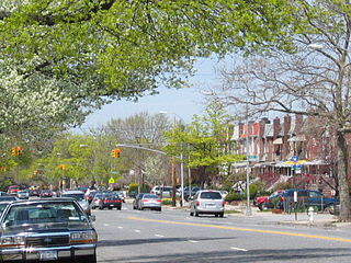
Marine Park is a neighborhood in the New York City borough of Brooklyn. The neighborhood lies between Flatlands and Mill Basin to the east, and Gerritsen Beach, Midwood, and Sheepshead Bay to the south and west. It is mostly squared off in area by Gerritsen Avenue, Flatbush Avenue, Avenue U and Kings Highway. The neighborhood's eponymous park is the largest public park in Brooklyn. Charles Downing Lay won a silver medal in town planning at the 1936 Olympics for the planning of Marine Park.
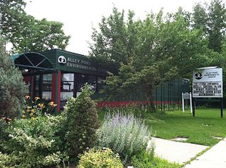
Alley Pond Park is the second-largest public park in Queens, New York City, occupying 655.3 acres (265.2 ha). The park is bordered to the east by Douglaston, to the west by Bayside, to the north by Little Neck Bay, and to the south by Union Turnpike. The Cross Island Parkway travels north-south through the park, while the Long Island Expressway and Grand Central Parkway travel east-west through the park. The park primarily consists of woodlands south of the Long Island Expressway and meadowlands north of the expressway. It is run and operated by the New York City Department of Parks and Recreation.

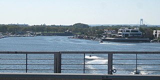
Dead Horse Bay is a small body of water off Barren Island, between the Gerritsen Inlet and Rockaway Inlet in the New York City borough of Brooklyn.

Canarsie Pol is an uninhabited island south of Canarsie, Brooklyn in Jamaica Bay, New York City. It is part of Gateway National Recreation Area. Canarsie Pol is an irregular oval of about 300 acres (120 ha). On 1910 maps, the island was originally much smaller; however, when nearby waterways were dredged to expand them for improved navigation, the sand and soil were piled on Canarsie Pol. Near the island are other islands and marshes in the bay. Canarsie Pol has an elevation of 10 feet (3.0 m), and is a popular destination for kayakers embarking from the Canarsie Pier.
Baisley Pond Park is a public park located in the southeastern part of Queens, New York City, bordering the neighborhoods of South Jamaica, Rochdale, and St. Albans. It covers 109.61 acres (44.36 ha), including the 30-acre (12 ha) Baisley Pond in the center of the park. It is maintained by the New York City Department of Parks and Recreation.
Mussel Island was an island in Newtown Creek located near its confluence with Maspeth Creek, between the Brooklyn neighborhood of Greenpoint and the Queens neighborhood of Maspeth in New York City.

Gerritsen Creek is a short watercourse in Brooklyn, New York City, that empties into Jamaica Bay. The creek has been described as one of the "fingers" that formed the original shoreline of Jamaica Bay. The creek lies just beyond the maximum extent of the Wisconsin Glacier.

Spring Creek Park is a public park along the Jamaica Bay shoreline between the neighborhoods of Howard Beach, Queens, and Spring Creek, Brooklyn, in New York City. Created on landfilled former marshland, the park is mostly an undeveloped nature preserve, with only small portions accessible to the public for recreation.


