Related Research Articles
Bus rapid transit (BRT), also referred to as a busway or transitway, is a bus-based public transport system designed to have much more capacity, reliability and other quality features than a conventional bus system. Typically, a BRT system includes roadways that are dedicated to buses, and gives priority to buses at intersections where buses may interact with other traffic; alongside design features to reduce delays caused by passengers boarding or leaving buses, or paying fares. BRT aims to combine the capacity and speed of a light rail transit (LRT) or mass rapid transit (MRT) system with the flexibility, lower cost and simplicity of a bus system.
Metro Transit is the primary public transportation operator in the Minneapolis–Saint Paul area of the U.S. state of Minnesota and the largest operator in the state. Although Metro Transit is one of the smallest transit systems for a large metropolitan area in the United States, it has previously been ranked as one of the best. In 2022, the system had a ridership of 38,794,700, or about 138,800 per weekday as of the third quarter of 2023.
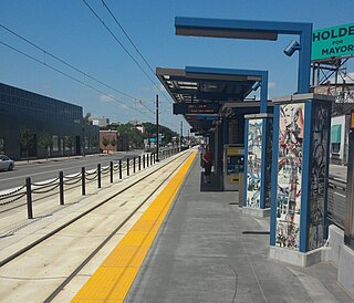
Snelling Avenue station is a light rail station along the Metro Green Line in Saint Paul, Minnesota. It is located along University Avenue on either side of the intersection with Snelling Avenue. The station has split side platforms, with the westbound platform on the north side of the tracks west of Snelling and the eastbound platform on the south side of the tracks east of the intersection.
The Red Rock Corridor is a proposed bus rapid transit transitway in the Twin Cities of Minneapolis and Saint Paul. The route connects the metropolitan area's southeastern suburbs to downtown St. Paul, and through it to downtown Minneapolis. The transitway would originate in Hastings with planned stops in Cottage Grove, Newport and Saint Paul. The route will terminate at Saint Paul's Union Depot. From Union Depot, riders will connect with express buses, local buses, and the Metro Green Line to Minneapolis, Minneapolis–Saint Paul International Airport, and the Mall of America.
The Metro Purple Line, formerly known as the Rush Line Corridor, is a proposed bus rapid transit service that would run from Union Depot in downtown Saint Paul to the northeastern suburbs of Saint Paul. Along the corridor's 21 proposed stations there are 106,000 jobs within a 10-minute walk. The project is currently in an environmental analysis phase with further development, engineering, and construction expected to take at least six more years. Service would run 7-days a week with 10-minute headways in peak periods and 15-minute service at most other times. The corridor was named the Rush Line because it was originally planned to end in Rush City, Minnesota. After using the color purple since 2017, the route was officially named the Purple Line and became part of the Metro network on July 14, 2021.
The Riverview Corridor is a transit corridor connecting Downtown Saint Paul and the Mall of America in Bloomington via the Minneapolis-Saint Paul International Airport. The corridor serves an area from the Saint Paul Union Depot to the Mall via a route along West 7th Street, which runs southwest from Downtown Saint Paul. The corridor creates a triangle connecting opposite ends of the Blue Line and Green Line.

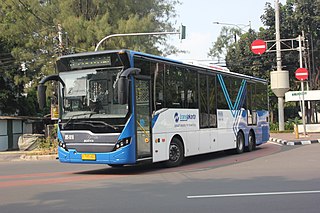
The Metro Orange Line is a bus rapid transit line in the Twin Cities, Minnesota operated by Metro Transit. The line operates primarily along Interstate 35W from downtown Minneapolis through Richfield and Bloomington before terminating in Burnsville, Minnesota. The Orange Line provides access to 198,000 jobs with roughly a quarter of them outside downtown Minneapolis. The route serves a mix of stations located in the center of the highway, stations near highway exits, and on-street stations. The line has features typical of bus rapid transit systems with off-board fare payment, articulated buses with extra doors, stations with improved passenger amenities, and transit-only bus lanes on portions of the route.
The I-77 Bus Rapid Transit is a proposed bus rapid transit (BRT) service, connecting the towns northern Mecklenburg and southern Iredell counties to Uptown Charlotte, North Carolina. The BRT replaces the previously planned commuter rail service, the Lynx Red Line, that was routed along the existing Norfolk Southern O-Line right-of-way. However, several issues had arisen that included ineligibility for federal funding and Norfolk Southern refusal to allow access to its right-of-way. In 2019, after a reevaluation of the entire corridor, the Charlotte Area Transit System (CATS) decided to move forward with BRT and shelve the commuter rail; which had been met with frustration by various city leaders and residents impacted by it.

I-35W & Lake Street station is a bus rapid transit station along the Metro Orange Line and planned B Line bus rapid transit (BRT) routes in Minneapolis, Minnesota. In addition to the BRT services, the station is also served by Metro route 578, Minnesota Valley Transit Authority routes 460, 465, 467, 470, 472, 475 and 477, along with SouthWest Transit routes 600 and 695.

The Cebu Bus Rapid Transit System is a mass transit system under construction in Cebu City, Philippines. It is expected to become the first operational bus rapid transit project in the Philippines. Only one line has been planned in detail so far, but scheme developers note the potential to develop a larger network comprising the adjacent cities of Lapu-Lapu, Mandaue, and Talisay, all of which, together with Cebu City, form part of the Cebu metropolitan area.
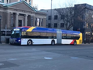
The METRO Gold Line is an under construction bus rapid transit line in Minnesota. The line will travel from downtown Saint Paul, Minnesota to the eastern terminus in Woodbury, Minnesota. The 10-mile line runs largely along I-94 in bus only lanes with stops at designated stations. The project was initially called the Gateway Corridor before being named a color to match the rest of the Metro system operated by Metro Transit. The project is expected to open in 2025.

Metro is a transit network in Minnesota serving the cities of Minneapolis and Saint Paul. It also provides service to some suburban areas. As of 2022, the system consists of two light rail lines and five bus rapid transit (BRT) lines all of which are operated by the local public transit company: Metro Transit. The five lines connect Downtown Minneapolis and St Paul with the Bloomington, Minneapolis-St Paul International Airport, Roseville, Richfield, Burnsville and Brooklyn Center.

The Metro A Line is a bus rapid transit line in the Twin Cities, Minnesota operated by Metro Transit. The A Line operates primarily along the Snelling Avenue corridor and travels through the cities of Minneapolis, Saint Paul, Falcon Heights, and Roseville. From the Blue Line in Minneapolis, the line travels past Minnehaha Park, through the Highland Village commercial area, past Macalester College, and connects to the Green Line near Allianz Field. The line continues through Saint Paul, past Hamline University, before traveling through Falcon Heights and Roseville, where the line passes the Minnesota State Fairgrounds, Har Mar Mall, and terminates at Rosedale Center.
The RapidRide G Line is a future RapidRide bus service in Seattle, Washington, operated by King County Metro on Madison Street between Downtown Seattle and Madison Valley. The line is projected to open for service in 2024 and cost $133.4 million.

The Metro C Line is a bus rapid transit line in Brooklyn Center and Minneapolis, Minnesota operated by Metro Transit. The line is part of Metro Transit's Metro network of light rail and bus rapid transit lines. The route operates from the Brooklyn Center Transit Center along Penn Avenue and Olson Memorial Highway, terminating in downtown Minneapolis. The route is analogous to the existing Route 19 and is projected to increase ridership on this corridor from 7,000 to 9,000 by 2030. Eventually, part of its route will shift south to Glenwood Avenue from Olson Memorial Highway.

The Metro D Line is a bus rapid transit line in Minneapolis-Saint Paul, Minnesota. The 18.5-mile (29.8 km) route primarily operates on Fremont and Chicago Avenues from Brooklyn Center through Minneapolis to the Mall of America in Bloomington. As part of BRT service, the D Line features "train-like amenities" including improved station facilities, off-board fare payment, modern vehicles, fewer stops, and higher frequency. The current alignment would substantially replace the existing Route 5, the highest ridership bus route in Minnesota.

The Metro B Line is an under construction bus rapid transit route in Minneapolis and St. Paul. The route will operate mostly on Lake Street in Minneapolis before crossing the Mississippi River into St. Paul and operating mostly on Selby Avenue and ending in downtown St. Paul. The route was identified in Metro Transit's 2014 Arterial Transitway Corridors Study as one of eleven local routes to be upgraded to bus rapid transit. The route will have "train-like" features to speed up service, such as signal priority, all-door boarding, further stop spacing, and specialized vehicles. Planning and design was completed in 2021, with construction beginning in May 2023. The line will join a number of Metro Transit's future Metro system lines, as well as the currently operating A Line, C Line, and D Line. Full funding for the line was secured in October 2020 with a final $35 million from the state of Minnesota.
The Metro E Line is a planned bus rapid transit route in Minneapolis, Saint Paul, and Edina. The route will operate from Southdale Center Transit Center in Edina, Minnesota to Westgate station in Saint Paul. Running mostly on France Avenue, Hennepin Avenue, and University Avenue, the line will serve major destinations such as Southdale Center, Fairview Hospital, 50th & France, Linden Hills, Uptown, Minneapolis Sculpture Garden, Downtown Minneapolis, Dinkytown, the University of Minnesota, and Prospect Park. The route will have "train-like" features to speed up service and improve reliability, such as signal priority, bus lanes, all-door boarding, further stop spacing, and specialized vehicles. In 2019 planning and design were underway, with construction slated for 2023 and operations beginning a year later but that timeline has been moved back. The E Line would largely replace Route 6 which carries 9,000 trips each weekday. The project was fully funded with $60 million by the state of Minnesota in 2021 and is expected to open in 2025.

The Marq2 transit corridor is a north–south thoroughfare in Minneapolis, Minnesota, United States. It consists of the parallel streets of Marquette and Second avenues in the downtown area. Each public streetway has two contraflow bus lanes with two lanes available for general-purpose traffic in the opposite direction. Vehicular transit flows south on Marquette Avenue and north on Second Avenue. The inner curb lane allows buses to stop for riders, while the second bus-only lane allows buses to pass each other along the corridor. Bus routes that operate on the corridor stop at every other block at an assigned gate with each route assigned a northbound and southbound gate. Gates are assigned letters A, B, C, or D on Marquette Avenue and E, F, G, and H on Second Avenue. Custom bus shelters are installed at each stop with heaters and real time transit information. The corridor primarily serves express buses operated by all five public transit agencies in the Twin Cities.
References
- ↑ "Arterial BRT Corridor Concepts" (PDF). metrotransit.org. Metro Transit. December 2020. pp. 39–42. Retrieved February 19, 2021.
- ↑ https://www.metrotransit.org/g-line-project
- ↑ Empson, Donald L. (2006). The Street Where You Live: A Guide to the Place Names of Saint Paul. University of Minnesota Press. p 232. ISBN 0-8166-4729-1 ISBN 978-0-8166-4729-3.
- ↑ "Robert Street Corridor". Dakota County. Archived from the original on September 1, 2012. Retrieved September 13, 2012.
- ↑ Lindsay, Meggen (May 25, 2006). "WISH LIST GRANTED -- SORT OF - MINNESOTA ZOO AND BUS LINE WIN, BUT PUBLIC SAFETY CENTER LOSES OUT". Saint Paul Pioneer Press .
- ↑ Berg, Steve (February 2, 2011). "LRT or BRT? It depends on the potential of the corridor". MinnPost.com . Retrieved October 8, 2012.
- ↑ "2030 Transportation Policy Plan Summary" (PDF). 2030 Transportation Policy Plan. Metropolitan Council. pp. 6–7. Archived from the original (PDF) on November 6, 2012. Retrieved October 8, 2012.
- ↑ Dornfield, Steve (October 31, 2012). "Could bus rapid transit increase ridership 30 percent in the Twin Cities?". MinnPost.com . Retrieved October 8, 2012.
- ↑ Harlow, Tim (February 19, 2021). "Metro Transit eyes Central Avenue for next BRT line". Star Tribune. Retrieved February 19, 2021.
- ↑ Roth, Katie. "Network Next Outcomes: F, G, H Line Recommendations". metrotransit.org. Metro Transit. Retrieved February 19, 2021.