Metro (Minnesota)

Last updated

Metro
Metro Minnesota logo.svg
Green Line trains on both tracks.jpg
A Minneapolis-bound train (left) passes a Saint Paul-bound train (right) on the Green Line near East Bank station.
Overview
Owner Metropolitan Council
Locale Minneapolis-St. Paul metropolitan area
Transit type Light rail (LRT)
Bus rapid transit (BRT)
Number of lines2 LRT lines
5 BRT lines
Line number Metro Minnesota icon.svg   Blue Line  
Metro Minnesota icon.svg   Green Line  
Metro Minnesota icon.svg   Orange Line  
Metro Minnesota icon.svg   Red Line  
Metro Minnesota icon.svg   A Line  
Metro Minnesota icon.svg   C Line  
Metro Minnesota icon.svg   D Line  
Number of stations121
Daily ridership41,600 (light rail, weekdays, Q3 2023) [1]
Annual ridership12,366,700 (light rail, 2022) [2]
Website metrotransit.org/metro
Operation
Began operationJune 26, 2004; 19 years ago
Operator(s) Metro Transit
Number of vehicles Bombardier Flexity Swift
Siemens S70
Siemens S700
Gillig Low Floor
New Flyer XD60
New Flyer XE60
Technical
Track gauge 4 ft 8+12 in (1,435 mm) standard gauge
System map
Metro (Minnesota)
A geographic map of the Metro network. The official system map can be viewed on the Metro Transit website.
System diagram
Southwest LRT
Southwest
BSicon PARKING.svg
BSicon uexKBHFa.svg
Eden Prairie Town Center
BSicon uexHST.svg
Golden Triangle
BSicon PARKING.svg
BSicon uexHST.svg
City West
BSicon PARKING.svg
BSicon uexHST.svg
Opus
BSicon PARKING.svg
BSicon uexHST.svg
Shady Oak Road
BSicon PARKING.svg
BSicon uexHST.svg
Downtown Hopkins
BSicon uexHST.svg
Blake Road
BSicon uexHST.svg
Louisiana Boulevard
BSicon PARKING.svg
BSicon uexHST.svg
Wooddale Avenue
BSicon uexHST.svg
Beltline Boulevard
BSicon PARKING.svg
BSicon uexHST.svg
BSicon KINTa.svg
Brooklyn Center C Line D Line
West Lake Street
BSicon uexHST.svg
BSicon HST.svg
Xerxes & 56th Avenue
West 21st Street
BSicon uexHST.svg
BSicon HST.svg
Brooklyn & 51st Avenue
Bryn Mawr
BSicon uexHST.svg
BSicon KRW+l.svg
BSicon KRWrxl.svg
BSicon exKRW+r.svg
Penn & 43rd Avenue
BSicon uexSTR.svg
BSicon HST.svg
BSicon exHST.svg
44th Avenue & Penn
Penn & Dowling
BSicon uexSTR.svg
BSicon HST.svg
BSicon exHST.svg
44th Avenue & Girard
Penn & 36th Avenue
BSicon uexSTR.svg
BSicon HST.svg
BSicon exHST.svg
Fremont & 42nd Avenue
Penn & Lowry
BSicon uexSTR.svg
BSicon HST.svg
BSicon exHST.svg
Fremont & Dowling
Penn & 29th Avenue
BSicon uexSTR.svg
BSicon HST.svg
BSicon exHST.svg
Fremont & 35th Avenue
Penn & West Broadway
BSicon uexSTR.svg
BSicon HST.svg
BSicon exSPLa.svg
Penn & Golden Valley
BSicon uexSTR.svg
BSicon HST.svg
BSicon vNULfg.svg
BSicon exvHST.svg
Fremont-Emerson & Lowry
Penn & Plymouth
BSicon uexSTR.svg
BSicon HST.svg
BSicon vNULfg.svg
BSicon exvHST.svg
Fremont-Emerson & 26th Street
Olson & Penn
BSicon uexSTR.svg
BSicon HST.svg
BSicon vNULfg.svg
BSicon exvHST.svg
Fremont-Emerson & West Broadway
Olson & Humboldt
BSicon uexSTR.svg
BSicon HST.svg
BSicon vNULfg.svg
BSicon exvHST.svg
Fremont-Emerson & Plymouth
Olson & Bryant
BSicon uexSTR.svg
BSicon HST.svg
BSicon exSPLe.svg
Olson & 7th Street
BSicon uexSTR.svg
BSicon HST.svg
BSicon exHST.svg
7th Street & Bryant
Basset Creek Valley
BSicon uexHST.svg
BSicon KRWl.svg
BSicon KRW+rxl.svg
BSicon exKRWr.svg
BSicon uexLCONTg.svg
Bottineau LRT
Royalston Avenue/Farmers Market
BSicon uexSTRl.svg
BSicon exlINT-L.svg
BSicon uexKSTReq.svg
BSicon eINT-R.svg
BSicon uexKSTRaq.svg
BSicon uexSTR+r.svg
BSicon uexLKRW+l.svg
BSicon uexLKRWr.svg
7th Street & Olson-5th Street
BSicon MHUB.svg
BSicon MHUB.svg
BSicon SPLa.svg
BSicon MHUB.svg
BSicon uKBHFxa.svg
BSicon lhBHFae.svg
BSicon HUBa.svg
BSicon MHUB.svg
BSicon MHUB.svg
Blue Line Green Line
7th Street/Ramp A Transit Center
BSicon MHUB.svg
BSicon MHUB.svg
BSicon vHST-STR.svg
BSicon vNULf-.svg
BSicon MHUB.svg
BSicon uhINTae.svg
BSicon HUBe.svg
BSicon MHUB.svg
BSicon MHUB.svg
Aiga railtransportation 25.svg
Target Field
7th-8th Street & Hennepin
BSicon MHUB.svg
BSicon MHUB.svg
BSicon vHST.svg
BSicon vNULfg.svg
BSicon MHUB.svg
BSicon uHST.svg
BSicon MHUB.svg
BSicon MHUB.svg
Warehouse District/Hennepin Avenue
7th-8th Street & Nicollet
BSicon MHUB.svg
BSicon MHUB.svg
BSicon vHST.svg
BSicon vNULfg.svg
BSicon MHUB.svg
BSicon uHST.svg
BSicon MHUB.svg
BSicon MHUB.svg
Nicollet Mall
Marq-2nd & 7th Street
BSicon exkvSTRc2.svg
BSicon MHUB.svg
BSicon exkvSTR3+l.svg
BSicon MHUB.svg
BSicon vSTR.svg
BSicon exvHSTq.svg
BSicon vNULfgq.svg
BSicon MHUB.svg
BSicon uSTR.svg
BSicon exvHSTq.svg
BSicon vNULfgq.svg
BSicon MHUB.svg
BSicon exvSTR+r.svg
BSicon MHUB.svg
Marq-2nd & 5th Street
7th-8th Street & 3rd/4th Avenue
BSicon exkvSTR+1.svg
BSicon MHUB.svg
BSicon exkvSTR-c4.svg
BSicon MHUB.svg
BSicon vHST.svg
BSicon vNULfg.svg
BSicon MHUB.svg
BSicon uHST.svg
BSicon MHUB.svg
BSicon exvSTR.svg
BSicon MHUB.svg
Government Plaza
7th-8th Street & Park C Line
BSicon exvSTR.svg
BSicon MHUB.svg
BSicon MHUB.svg
BSicon vKBHFxe.svg
BSicon vNULfg.svg
BSicon MHUB.svg
BSicon uHST.svg
BSicon MHUB.svg
BSicon exvSTR.svg
BSicon MHUB.svg
U.S. Bank Stadium
Marq-2nd & 11th Street
BSicon exvHST.svg
BSicon vNULfg.svg
BSicon MHUB.svg
BSicon exSTRc2.svg
BSicon MHUB.svg
BSicon exSPLg+3.svg
BSicon MHUB.svg
BSicon uSTR.svg
BSicon MHUB.svg
BSicon exvKBHFe.svg
BSicon vNULfg.svg
BSicon MHUB.svg
Marq-2nd & 3rd Street Orange Line
BSicon exSPLe.svg
BSicon exSTR+1.svg
BSicon uKRW+l.svg
BSicon exSTRc4.svg
BSicon uKRWlr.svg
BSicon uKRW+r.svg
I-35W & Lake Street
BSicon exhHSTae.svg
BSicon exSTR.svg
BSicon uSTR.svg
BSicon uHST.svg
West Bank
I-35W & 46th Street
BSicon exHST.svg
BSicon exSTR.svg
BSicon uSTR.svg
BSicon uHST.svg
East Bank
Cedar-Riverside
BSicon exSTR.svg
BSicon exSTR.svg
BSicon uHST.svg
BSicon uHST.svg
Stadium Village
Franklin Avenue
BSicon exSTR.svg
BSicon exSTR.svg
BSicon uhHSTae.svg
BSicon uHST.svg
Prospect Park
Lake Street/Midtown
BSicon exSTR.svg
BSicon exSTR.svg
BSicon uhHSTae.svg
BSicon uHST.svg
Westgate
38th Street
BSicon exSTR.svg
BSicon exSTR.svg
BSicon uHST.svg
BSicon uHST.svg
Raymond Avenue
46th Street
BSicon exSTR.svg
BSicon exSTR.svg
BSicon uINT-L.svg
BSicon KINTa-R.svg
BSicon uHST.svg
Fairview Avenue
Chicago & 14th Street
BSicon exSTR.svg
BSicon exHST.svg
BSicon uSTR.svg
BSicon HST.svg
BSicon uSTR.svg
46th Street & Minnehaha
Chicago & Franklin
BSicon exSTR.svg
BSicon exHST.svg
BSicon uSTR.svg
BSicon HST.svg
BSicon uSTR.svg
46th Street & 46th Avenue
Chicago & 24th Street
BSicon exSTR.svg
BSicon exHST.svg
BSicon uSTR.svg
BSicon HST.svg
BSicon uSTR.svg
Ford & Woodlawn
Chicago & 26th Street
BSicon exSTR.svg
BSicon exHST.svg
BSicon uSTR.svg
BSicon HST.svg
BSicon uSTR.svg
Ford & Finn
Chicago-Lake Transit Center
BSicon exSTR.svg
BSicon exHST.svg
BSicon uSTR.svg
BSicon HST.svg
BSicon uSTR.svg
Ford & Kenneth
Chicago & 34th Street
BSicon exSTR.svg
BSicon exHST.svg
BSicon uSTR.svg
BSicon HST.svg
BSicon uSTR.svg
Ford & Fairview
Chicago & 38th Street
BSicon exSTR.svg
BSicon expHST.svg
BSicon uSTR.svg
BSicon HST.svg
BSicon uSTR.svg
Snelling & Highland
Chicago & 42nd Street
BSicon exSTR.svg
BSicon exHST.svg
BSicon uSTR.svg
BSicon HST.svg
BSicon uSTR.svg
Snelling & Randolph
Chicago & 46th Street
BSicon exSTR.svg
BSicon exHST.svg
BSicon uSTR.svg
BSicon HST.svg
BSicon uSTR.svg
Snelling & St. Clair
Chicago & 48th Street
BSicon exSTR.svg
BSicon exHST.svg
BSicon uSTR.svg
BSicon HST.svg
BSicon uSTR.svg
Snelling & Grand
Chicago & 52nd Street
BSicon exSTR.svg
BSicon exHST.svg
BSicon uSTR.svg
BSicon HST.svg
BSicon uSTR.svg
Snelling & Dayton
Chicago & 56th Street
BSicon exSTR.svg
BSicon exHST.svg
BSicon uSTR.svg
BSicon lINT-2.svg
BSicon STR.svg
BSicon uSTR.svg
BSicon lINT-c3.svg
Snelling & University
Portland & 60th Street
BSicon exSTR.svg
BSicon exHST.svg
BSicon uSTR.svg
BSicon STR.svg
BSicon lINT-c1.svg
BSicon lINT-4.svg
BSicon uSTR.svg
Snelling Avenue
Portland & 66th Street
BSicon exSTR.svg
BSicon exHST.svg
BSicon uSTR.svg
BSicon HST.svg
BSicon uSTR.svg
Snelling & Minnehaha
Portland & 70th Street
BSicon exSTR.svg
BSicon exHST.svg
BSicon uSTR.svg
BSicon HST.svg
BSicon uSTR.svg
Snelling & Hewitt
Portland & 73rd Street
BSicon exSTR.svg
BSicon exHST.svg
BSicon uSTR.svg
BSicon HST.svg
BSicon uSTR.svg
Snelling & Como
Portland & 77th Street
BSicon exSTR.svg
BSicon exHST.svg
BSicon uSTR.svg
BSicon lvHST.svg
BSicon vNULfg.svg
BSicon STR.svg
BSicon uSTR.svg
Snelling & Hoyt-Nebraska
American & Chicago
BSicon exSTR.svg
BSicon exHST.svg
BSicon uSTR.svg
BSicon HST.svg
BSicon uSTR.svg
Snelling & Larpenteur
American & Bloomington
BSicon exSTR.svg
BSicon exHST.svg
BSicon uSTR.svg
BSicon HST.svg
BSicon uSTR.svg
Snelling & County Road B
American & Thunderbird
BSicon exSTR.svg
BSicon exHST.svg
BSicon uSTR.svg
BSicon KBHFe.svg
BSicon uSTR.svg
Rosedale
50th Street/Minnehaha Park
BSicon exSTR.svg
BSicon exSTR.svg
BSicon uHST.svg
BSicon uHST.svg
Hamline Avenue
VA Medical Center
BSicon exSTR.svg
BSicon exSTR.svg
BSicon uHST.svg
BSicon uHST.svg
Lexington Parkway
Fort Snelling
BSicon PARKING.svg
BSicon exSTR.svg
BSicon exSTR.svg
BSicon uHST.svg
BSicon uHST.svg
Victoria Street
I-35W & 66th Street
BSicon exHST.svg
BSicon exSTR.svg
BSicon utSTRa.svg
BSicon uHST.svg
Dale Street
Terminal 1-Lindbergh
BSicon FLUG.svg
BSicon exSTR.svg
BSicon exSTR.svg
BSicon gtKHSTa.svg
BSicon utKSTRe.svg
BSicon uHST.svg
Western Avenue
Knox & 76th Street
BSicon PARKING.svg
BSicon exHST.svg
BSicon exSTR.svg
BSicon gtSTRe.svg
BSicon uHST.svg
BSicon MHUB.svg
Capitol/Rice Street
Terminal 2-Humphrey
BSicon FLUG.svg
BSicon exSTR.svg
BSicon exSTR.svg
BSicon gKHSTe.svg
BSicon uKSTRa.svg
BSicon uHST.svg
BSicon MHUB.svg
Robert Street
American Boulevard
BSicon exSTR.svg
BSicon exSTR.svg
BSicon uHST.svg
BSicon uHST.svg
BSicon MHUB.svg
10th Street
Bloomington Central
BSicon exSTR.svg
BSicon exSTR.svg
BSicon uHST.svg
BSicon uHST.svg
BSicon MHUB.svg
Central
28th Avenue
BSicon PARKING.svg
BSicon exSTR.svg
BSicon exSTR.svg
BSicon uHST.svg
BSicon uKBHFe.svg
BSicon MHUB.svg
BSicon LOGO Amtrak2.svg
Saint Paul Union Depot Green Line
Knox & American Boulevard
BSicon exHST.svg
BSicon xKINTe-L.svg
BSicon uKINTe-M.svg
BSicon KINTa-R.svg
Mall of America Blue Line Red Line D Line
I-35W & 98th Street
BSicon PARKING.svg
BSicon exHST.svg
BSicon HST.svg
BSicon PARKING.svg
Cedar Grove
BSicon exABZgl.svg
BSicon exSTR+r.svg
BSicon HST.svg
140th Street
Burnsville Heart of the City
BSicon exSTR.svg
BSicon NULf.svg
BSicon exKBHFe.svg
BSicon HST.svg
147th Street
I-35W & Burnsville Pkwy
BSicon NULg.svg
BSicon exKHSTe.svg
BSicon KBHFe.svg
BSicon PARKING.svg
Apple Valley
Orange Line
Red Line

light rail
BSicon uSTRq.svg
BSicon exKSTRaq.svg
BSicon uexKSTReq.svg
under construction
bus rapid transit
BSicon STRq.svg
BSicon MHUB.svg
downtown fare zones
free airport zone
BSicon gSTRq.svg
BSicon PARKING.svg
park and ride
BSicon lACC.svg
all stations
accessible

Metro (styled as METRO) is a transit network in Minnesota serving the cities of Minneapolis and Saint Paul. It also provides service to some suburban areas. As of 2022, the system consists of two light rail lines (Blue and Green Lines) and five bus rapid transit (BRT) lines (Orange Line, Red Line, A, C, and D Lines) all of which are operated by the local public transit company: Metro Transit. The five lines connect Downtown Minneapolis and St Paul with the Bloomington, Minneapolis-St Paul International Airport, Roseville, Richfield, Burnsville and Brooklyn Center.

Contents

Prior to August 17, 2019, service along the entire length of the Green Line operated 24/7, the only one of 22 light rail systems in the United States to do so, but a common practice on some heavy rail lines such as the New York City Subway and PATH. The service gap from 2AM to 4AM was replaced by bus service. [3] [4] [5] [6] The current schedule on the Blue Line sees the first departure at 3:19AM and the last arrival at 12:50AM. [7] On the Green Line, the first departure is at 4:29AM and the last arrival is at 12:10AM. [8] Metro Transit also provides a shuttle service between the stations serving the Lindbergh and Humphrey terminals of MSP Airport during the overnight service gap on the Blue Line. [9]

In the 1970s, roughly contemporaneous with the construction of Washington D.C.'s Metro system and San Francisco's Bay Area Rapid Transit, the newly formed Metropolitan Council contemplated the creation of a similar mass transit for the Minneapolis-St. Paul metro area, but the idea was eventually abandoned due to opposition from the Minnesota Legislature. [10] For the next few decades, there were repeated proposals to build light rail along several corridors, particularly the University Avenue corridor between downtown Minneapolis and Saint Paul (the present Green Line), but the idea of light rail only gained steam in the late 1990s.

In 1999, the Minnesota Legislature approved funding for the first line (the present Blue Line) along Hiawatha Avenue (initially named the Hiawatha Line [11] ) in south Minneapolis, which opened in 2004. In 2011, in anticipation of the opening of the Red Line and Green Line, and in order to help passengers better identify with each of the routes, Metro Transit announced that the system would be rebranded and each line assigned a unique color. The first phase of the Red Line opened in mid-2013, and the first phase of the Green Line (also known as the Central Corridor) in mid-2014. Expansion is planned to upgrade existing transit corridors and to construct new transitways.

Current system

Lines

The current Metro system consists of seven Lines. There are two light rail lines: the Blue Line, which runs from Target Field in downtown Minneapolis under Minneapolis-St Paul International Airport to the Mall of America, and the Green Line, which runs from Target Field past the University of Minnesota to Union Depot in downtown Saint Paul. The BRT Red Line serves as an extension of the Blue Line across the Minnesota River, where it connects with southern suburbs at four different stations. Low ridership projections would have made the required bridge for an extension of the Blue Line economically infeasible. The Orange Line is bus rapid transit route that runs along I-35W from Minneapolis south into Richfield, Bloomington and Burnsville. The arterial BRT A, C, and D lines serve as upgrades to existing local bus routes and connect with the Blue and Green lines at certain shared stations. [12]

Together, the two light rail lines run on 21.8 miles (35.1 km) of route. [13] [14] There are a total of 121 stations; five shared between the Green and Blue Lines in downtown Minneapolis, one shared at the Mall of America between the Blue, Red, and D Lines, one shared at 46th Street station between the Blue and the A Lines, one shared at Snelling Avenue station between the Green and the A Lines, the C and D lines share 3 stations in Brooklyn Center and 6 in Downtown Minneapolis. 13 Stations are exclusively for the Blue Line, 16 for the Green Line, 12 for the Orange Line, 4 for the Red Line, 18 for the A Line, 11 for the C Line, and 30 for the D Line. The main hub of the system is Target Field Station in Minneapolis, Mall of America Station is also a hub, and Saint Paul Union Depot is envisioned as an additional future hub.

Most trains and buses run at least every 15 minutes throughout the day, with reduced schedules at night and on weekends. All stations have electronic displays that show predicted real-time departure information, known as NexTrip. Predicted real-time departure information is also available through Metro Transit's website.

Fares

Metro uses a proof-of-payment system, requiring riders to carry tickets at all times. Fares are purchased before boarding, either at ticket machines located in the stations or by scanning a Go-To card at dedicated pedestals. Tickets are valid for 2 1/2 hours after purchase. An unlimited number of transfers between Metro lines and Metro Transit bus routes, within the same fare level, are allowed within this period. [15] Within the two Downtown Zones of Minneapolis and St. Paul, tickets are 50¢; otherwise they follow normal Metro Transit fares: [16]

(Rush hour is classified as Monday - Friday, 6-9 am & 3-6:30 pm)

In addition, passes are available for various lengths of time or numbers of trips at appropriate discounts.

All University of Minnesota undergraduate and graduate students (that pay the Transportation and Safety fee) are provided a Universal Transit Pass through their U-Cards. This allows Student-IDs to be used for unlimited rides on all regular route transit busses, Light Rail and Bus Rapid Transit, as well a reduced fare on the Northstar Line commuter rail. [17] Staff at the Twin Cities Campus may be eligible for a Metropass, this pass allows all the same benefits as the Universal Transit Pass, without the fare reduction on the Northstar Line. As of January 2023, cost of this pass is $83 per month. This will reach a break even point after between 26 and 33 trips per month. [18]

Passengers at Minneapolis-St Paul International Airport can use the Blue Line between the Terminal 1-Lindbergh station and Terminal 2–Humphrey station free of charge. These two stations are served 24/7. [19]

Future

Several expansion projects are planned for the Metro system, at various stages of completion. These include both light rail extensions and connecting bus rapid transit services. Other Transit projects are under planning stages by other organizations in the region, these may be operated or integrated in the METRO system in the future.

Under construction

Construction of the future 21st St Station on the Green Line. SWLRT W. 21st St Station (52905739100).jpg
Construction of the future 21st St Station on the Green Line.

The Green Line extension (also known as the Southwest LRT) is an under construction expansion of the Green Line, to run from Target Field Station to several southwestern suburbs. The project was given federal approval in November 2018, and ground was broken on construction on November 30, 2018. [20] Completion of the project is expected in 2027, at an expected cost of over US$2 billion. It will be the largest infrastructure project in state history. [21]

The Gold Line is an under construction bus rapid transit route to run along Interstate 94 from Woodbury to downtown Saint Paul along Mounds Boulevard. Once in downtown it would travel from the Saint Paul Union Depot, through downtown before terminating near United Hospital. [22] The project will use dedicated lanes while running along I-94. Construction on the project began in October 2022 with service on the line expected to begin in 2025. [23]

Engineering and environmental assessment phases

The Purple Line is a planned bus rapid transit route to run largely along the Ramsey County Regional Railroad Authority corridor adjacent to the Bruce Vento Regional Trail from downtown Saint Paul to downtown White Bear Lake, Minnesota. [24] The project's Environmental Assessment was released in May 2021 for public comment. [25] [26] The project is currently in an engineering and design phase, this should be complete in 2023. Construction is expected to begin in 2024, with operation beginning in 2026.

The B Line is an arterial bus rapid transit route undergoing engineering and design for the Twin Cities' Lake Street/Marshall Avenue corridor, running from Bde Maka Ska in Minneapolis' Uptown neighborhood [27] to downtown Saint Paul along Selby Avenue. This line will largely replace route 21 and will connect with ten current or planned METRO Lines, [28] [29] Station design is complete with beginning of construction anticipated in 2023.

The E Line is an arterial bus rapid transit route undergoing engineering and design for the Twin Cities's Hennepin Avenue corridor. [30] Metro Transit's 2012 rapid bus study identified a route that would run from downtown Minneapolis to a future Lake Street station on the Metro Green Line extension. However, after further study in the spring of 2019, Metro Transit recommended a route from the Green Line's Stadium Village stop, through Dinkytown to Hennepin Avenue, and then south via Hennepin, 44th Street, and France Avenue to the Southdale Transit Center, replacing most of route 6. [31] Pending full project funding, E Line construction could begin as soon as 2023.

Planned projects

The Blue Line extension (known as Bottineau LRT) is a planned extension of the Blue Line to Brooklyn Park. After failing to come to an agreement with BNSF over colocating light rail and freight trains in the railroad's corridor, the Metropolitan Council announced they would begin to "explore opportunities to advance this critical project without using BNSF Railway right of way." [32] New alignments for the southern portion of route were presented for public comment in March 2021. [33]

The F Line is an arterial bus rapid transit route undergoing engineering and design for the Twin Cities's Central Avenue corridor, running from Downtown Minneapolis to Northtown Mall in Blaine, replacing much of route 10. [34] The Line is currently undergoing planning, with engineering and design from expected in 2023-2024, construction is scheduled on track to begin in 2025 with opening planned for 2026.

The Riverview Corridor is a transit corridor connecting Downtown Saint Paul and the Mall of America in Bloomington via the Minneapolis-Saint Paul International Airport. The corridor serves an area from the Saint Paul Union Depot to the Mall via parts of the Metro Green Line and the Metro Blue Line, and a route running parallel to West 7th Street, which runs southwest from Downtown Saint Paul. The corridor creates a triangle connecting opposite ends of the Blue Line and Green Line. In December 2017, a modern streetcar system similar to systems in Portland, Kansas City, and Detroit was selected as the locally preferred alternative with an alignment along West Seventh Street and MN-5. [35]

Proposed projects

The next three arterial bus rapid transit lines have been proposed. The G Line, and H Line would serve the corridor, Rice Street and Robert Street corridors, and an alignment from downtown Minneapolis to the East Side of Saint Paul along Como Avenue respectively. The three lines are planned to be built by 2030. [36] [37]

There are also numerous proposals in early planning stages for routes along Interstate 394 from Minneapolis to Wayzata, Highway 169 from Minneapolis to Shakopee, Interstate 35 from Minneapolis and St. Paul to Forest Lake, Highway 36 from St. Paul to Stillwater and Highway 61 from St. Paul to Hastings (Red Rock Corridor).

Operations

The first Type II LRV arrives at a media event on October 10, 2012, displaying "Green Line" on the destination board. Metro Transit (Minnesota) Siemens S70 arriving Target Field.jpg
The first Type II LRV arrives at a media event on October 10, 2012, displaying "Green Line" on the destination board.

The Metro system's rail lines use a combination of exclusive and shared right-of-way, depending on the circumstances. Within the two Downtown Zones, trains run on surface streets in an exclusive right-of-way, without preemption. The Blue Line runs primarily alongside Hiawatha Avenue (Minnesota State Highway 55), along land originally acquired for expansion of that highway, except for a brief stretch in a tunnel underneath Minneapolis-St Paul International Airport. The Green Line runs along the median of University Avenue in an exclusive right-of-way, except for a brief stretch of the Washington Avenue Transit Mall where its tracks are shared with buses. The Blue Line's at-grade crossings are protected by automated grade crossing gates; the Green Line's crossings move in regular traffic, with signal priority but no preemption.

Since the completion of three-car station extensions in winter 2010, Metro Transit operates one-, two- and three-car trains on the Blue Line, depending on the time of day and ridership needs. Many stations on the line were initially built to be capable of serving only one- or two-car trains, as a cost-saving measure; all of the shorter platforms were designed and built with future extension in mind and currently all stations are capable of serving three-car trains. The Green Line was built with three-car platforms at all stations.

Rolling stock

Currently three models of LRVs run in the Metro system.

Type I LRVs are Bombardier Flexity Swifts, utilizing a low floor for accessible boarding at all stations. Metro Transit operates 27 vehicles on the lines, numbered 101 through 127. Initially painted with Metro Transit livery, all have been repainted as of 2015 to reflect the Metro system branding. During this time, Type I cars also were retrofitted with colored LCD headboards for route destination displays and other improvements.

Type II LRVs are Siemens S70/Avantos. 64 vehicles were purchased, primarily to serve the Green Line. Type II LRVs are mechanically, but not electronically, compatible with the current fleet of 27 "type I" vehicles, so while the two generations do run on the tracks at the same time and both types are able to push a malfunctioning unit of the other type, multiple-unit consists may only be assembled of one type. [38]

Type III LRVS are Siemens S700. In 2016, Metro Transit placed an order for 27 more Siemens S70 LRVs for its planned Southwest Corridor expansion. [39] The cars in this order were considered to be model S70 at the time the order was placed, but in 2019/20 were retroactively rebranded as model S700 by Siemens. [40] These used a modified center-truck design that allowed sideways-facing seating in the center section, [41] for better passenger flow. [40] In 2018, Siemens adopted a new model number, S700, for S70 LRVs that used the new center-section design, and in 2020 it retroactively applied the new designation to all previous S70 LRVs built to the new design; as a result, all of Metro Transit's type III LRVs (301–327) are now Siemens model S700. [40] [42] The first two S700 vehicles arrived in May 2020. [43]

Map

Metro (Minnesota)

See also

Related Research Articles

<span class="mw-page-title-main">Metro Blue Line (Minnesota)</span> Light rail line in Hennepin County, Minnesota

The Metro Blue Line is a 12-mile (19.3 km) light rail line in Hennepin County, Minnesota, that is part of the Metro network. It travels from downtown Minneapolis to Minneapolis–Saint Paul International Airport and the southern suburb of Bloomington. Formerly the Hiawatha Line prior to May 2013, the line was originally named after the Milwaukee Road's Hiawatha passenger train and Hiawatha Avenue, reusing infrastructure from the former and running parallel to the latter for a portion of the route. The line opened June 26, 2004, and was the first light rail service in Minnesota. An extension, Bottineau LRT, is planned to open in 2028.

Metro Transit is the primary public transportation operator in the Minneapolis–Saint Paul area of the U.S. state of Minnesota and the largest operator in the state. Although Metro Transit is one of the smallest transit systems for a large metropolitan area in the United States, it has previously been ranked as one of the best. In 2022, the system had a ridership of 38,794,700, or about 138,800 per weekday as of the third quarter of 2023.

<span class="mw-page-title-main">Metro Green Line (Minnesota)</span> Light rail transit line in Minnesota, US

The Metro Green Line is an 11-mile (18 km) light rail line that connects the central business districts of Minneapolis and Saint Paul in Minnesota as well as the University of Minnesota. An extension is under construction that will extend the line to the southwest connecting St. Louis Park, Hopkins, Minnetonka and Eden Prairie. The line follows the path of former Metro Transit bus route 16 along University Avenue and Washington Avenue. It is the second light-rail line in the region, after the Blue Line, which opened in 2004 and connects Minneapolis with the southern suburb of Bloomington.

<span class="mw-page-title-main">Government Plaza station</span> Light rail station in Minneapolis, Minnesota

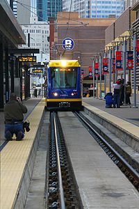
Government Plaza station is a Metro light rail station on the Blue Line and Green Line in Minneapolis, Minnesota. The station is located on 5th Street South, between 3rd and 4th Avenues South in downtown Minneapolis. This station opened on June 26, 2004, with initial light rail service in the Twin Cities.

<span class="mw-page-title-main">Mall of America station</span> Light rail and bus station in Bloomington, Minnesota

The Mall of America station is the busiest transit center in Minnesota, with bus and light rail service linking the Mall of America to many destinations in the Minneapolis–St. Paul metro. Public transit service is provided by Metro Transit and the Minnesota Valley Transit Authority. The station is served by Metro Blue Line and Red Line. The station previously hosted private shuttle services to hotels and Mystic Lake Casino until those services moved to a new charter bus terminal on the north side of the mall in 2015.

<span class="mw-page-title-main">Siemens S700 and S70</span> Light rail transit vehicle

The Siemens S70; its successor, the S700; and European variant, the Avanto; are a series of low-floor light-rail vehicles (LRV) and streetcars manufactured by Siemens Mobility, a division of German conglomerate Siemens AG.

<span class="mw-page-title-main">Southwest LRT</span> Under-construction light rail transit line in Minneapolis

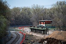
The Southwest LRT is an under–construction 14.5-mile (23.3 km) light rail transit corridor in Hennepin County, Minnesota, with service between Minneapolis and Eden Prairie. The estimated one-way travel time from Southwest Station in Eden Prairie to Target Field Station in Minneapolis is 32 minutes. The Southwest LRT will extend through St. Louis Park, Hopkins and Minnetonka along the route. Major locations on the line will include Bde Maka Ska, Cedar Lake, the Walker Art Center, the Minneapolis Sculpture Garden and Target Field in downtown Minneapolis.

<span class="mw-page-title-main">Snelling Avenue station</span> Light rail and bus rapid transit station in Saint Paul, Minnesota

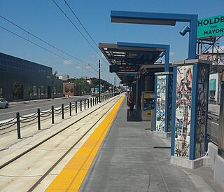
Snelling Avenue station is a light rail station along the Metro Green Line in Saint Paul, Minnesota. It is located along University Avenue on either side of the intersection with Snelling Avenue. The station has split side platforms, with the westbound platform on the north side of the tracks west of Snelling and the eastbound platform on the south side of the tracks east of the intersection.

<span class="mw-page-title-main">Stadium Village station</span> Light rail station in Minneapolis, Minnesota

Stadium Village station is a light rail station on the Green Line on the University of Minnesota campus in Minneapolis. Located in the Stadium Village area, it lies east of 23rd Avenue Southeast between University Avenue and 4th Street, across the road from Huntington Bank Stadium. East of the station, the rail line parallels the U of M Transitway until 29th Street SE, where it turns to enter Prospect Park station.

<span class="mw-page-title-main">Transportation in Minnesota</span> Overview of transportation in Minnesota

Transportation in the U.S. State of Minnesota consists of a complex network of roadways, railways, waterways and airports. The transportation system is generally overseen by the Minnesota Department of Transportation, a cabinet-level agency of the state government. Additionally, regional governments such as the Metropolitan Council have authority over regional planning for the transportation system and local governments such as cities and counties oversee the local transportation network.

The Riverview Corridor is a transit corridor connecting Downtown Saint Paul and the Mall of America in Bloomington via the Minneapolis-Saint Paul International Airport. The corridor serves an area from the Saint Paul Union Depot to the Mall via a route along West 7th Street, which runs southwest from Downtown Saint Paul. The corridor creates a triangle connecting opposite ends of the Blue Line and Green Line.

The Minneapolis Streetcar System was a proposed streetcar system for the city of Minneapolis, Minnesota. Extensive studies and plans for the new system were completed in 2007 and presented to the Minneapolis City Council in January 2008; on April 2, 2010, the Council voted to approve the plans and seek funding. On December 21, 2010 the Federal Transit Administration granted $900,000 to further study the Nicollet and Central Avenue corridors. In June 2021, after no further development on the system, a bill authorized the Metropolitan Council to use funds collected for the Nicollet-Central line to be spent on bus rapid transit funding.

In addition to the proposed transit projects in the Twin Cities region, there have been some transit corridors that are no longer proposed.

The opening of the Metro Blue Line in 2004 marked the beginning of Metro Transit's expansion into rail transit, 50 years after the last Twin Cities Rapid Transit streetcars were taken out of service. Several new rail transit projects are either under construction or in planning stages and more are expected to be explored in the near future. Metro Transit will likely be acquiring a significant amount of rolling stock as these new projects move forward.

<span class="mw-page-title-main">Metro A Line (Minnesota)</span> Bus rapid transit line in the Minneapolis metropolitan area of the United States

The Metro A Line is a bus rapid transit line in the Twin Cities, Minnesota operated by Metro Transit. The A Line operates primarily along the Snelling Avenue corridor and travels through the cities of Minneapolis, Saint Paul, Falcon Heights, and Roseville. From the Blue Line in Minneapolis, the line travels past Minnehaha Park, through the Highland Village commercial area, past Macalester College, and connects to the Green Line near Allianz Field. The line continues through Saint Paul, past Hamline University, before traveling through Falcon Heights and Roseville, where the line passes the Minnesota State Fairgrounds, Har Mar Mall, and terminates at Rosedale Center.

<span class="mw-page-title-main">Metro C Line (Minnesota)</span> Bus rapid transit line in the Minneapolis metropolitan area of the United States

The Metro C Line is a bus rapid transit line in Brooklyn Center and Minneapolis, Minnesota operated by Metro Transit. The line is part of Metro Transit's Metro network of light rail and bus rapid transit lines. The route operates from the Brooklyn Center Transit Center along Penn Avenue and Olson Memorial Highway, terminating in downtown Minneapolis. The route is analogous to the existing Route 19 and is projected to increase ridership on this corridor from 7,000 to 9,000 by 2030. Eventually, part of its route will shift south to Glenwood Avenue from Olson Memorial Highway.

<span class="mw-page-title-main">Metro D Line (Minnesota)</span> Bus rapid transit line in the Minneapolis metropolitan area of the United States

The Metro D Line is a bus rapid transit line in Minneapolis-Saint Paul, Minnesota. The 18.5-mile (29.8 km) route primarily operates on Fremont and Chicago Avenues from Brooklyn Center through Minneapolis to the Mall of America in Bloomington. As part of BRT service, the D Line features "train-like amenities" including improved station facilities, off-board fare payment, modern vehicles, fewer stops, and higher frequency. The current alignment would substantially replace the existing Route 5, the highest ridership bus route in Minnesota.

<span class="mw-page-title-main">Metro B Line (Minnesota)</span> Planned bus rapid transit line in the Minneapolis metropolitan area of the United States

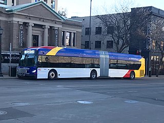
The Metro B Line is an under construction bus rapid transit route in Minneapolis and St. Paul. The route will operate mostly on Lake Street in Minneapolis before crossing the Mississippi River into St. Paul and operating mostly on Selby Avenue and ending in downtown St. Paul. The route was identified in Metro Transit's 2014 Arterial Transitway Corridors Study as one of eleven local routes to be upgraded to bus rapid transit. The route will have "train-like" features to speed up service, such as signal priority, all-door boarding, further stop spacing, and specialized vehicles. Planning and design was completed in 2021, with construction beginning in May 2023. The line will join a number of Metro Transit's future Metro system lines, as well as the currently operating A Line, C Line, and D Line. Full funding for the line was secured in October 2020 with a final $35 million from the state of Minnesota.

<span class="mw-page-title-main">Metro E Line (Minnesota)</span> Bus rapid transit line in the Minneapolis metropolitan area of the United States

The Metro E Line is a planned bus rapid transit route in Minneapolis, Saint Paul, and Edina. The route will operate from Southdale Center Transit Center in Edina, Minnesota to Westgate station in Saint Paul. Running mostly on France Avenue, Hennepin Avenue, and University Avenue, the line will serve major destinations such as Southdale Center, Fairview Hospital, 50th & France, Linden Hills, Uptown, Minneapolis Sculpture Garden, Downtown Minneapolis, Dinkytown, the University of Minnesota, and Prospect Park. The route will have "train-like" features to speed up service and improve reliability, such as signal priority, bus lanes, all-door boarding, further stop spacing, and specialized vehicles. In 2019 planning and design were underway, with construction slated for 2023 and operations beginning a year later but that timeline has been moved back. The E Line would largely replace Route 6 which carries 9,000 trips each weekday. The project was fully funded with $60 million by the state of Minnesota in 2021 and is expected to open in 2025.

References

  1. "Transit Ridership Report Third Quarter 2023" (PDF). American Public Transportation Association. November 30, 2023. Retrieved December 6, 2023.
  2. "Transit Ridership Report Fourth Quarter 2022" (PDF). American Public Transportation Association. March 1, 2023. Retrieved March 29, 2023.
  3. Combs, Marianne (May 17, 2019). "Green Line pulls back some overnight service". MPR News. Retrieved September 24, 2020.
  4. "Routes will change Aug. 17". www.metrotransit.org. 2020. Archived from the original on August 1, 2019. Retrieved September 24, 2020.
  5. Moore, Janet (August 19, 2019). "'Transit is not a shelter': Green Line curtails all-night service". Star Tribune. Retrieved September 24, 2020.
  6. "Online Schedules – METRO Green Line". Metro Transit. Retrieved June 23, 2014.
  7. "Metro Transit – Online Schedules – METRO Blue Line". www.metrotransit.org.
  8. "Metro Transit – Online Schedules – METRO Green Line". www.metrotransit.org.
  9. "Airport - Metro Transit". www.metrotransit.org. Retrieved February 4, 2024.
  10. "Special Review Hiawatha Avenue Light Rail Transit Line". OFFICE OF THE LEGISLATIVE AUDITOR STATE OF MINNESOTA. March 1, 2002. Archived from the original on July 14, 2014. Retrieved June 23, 2014.
  11. "News Updates & Events – Metro Transit". www.metrotransit.org.
  12. "Welcome to the expanding METRO network". Metro Transit. Retrieved June 14, 2019.
  13. "METRO Blue Line – Facts About Trains and Construction". Metro Transit. 2013. Archived from the original on February 14, 2014. Retrieved June 15, 2014.
  14. "Metro Green Line Fact Sheet". Metropolitan Council. 2014. Archived from the original on June 12, 2014. Retrieved June 15, 2014.
  15. "Transfers". Metro Transit. Retrieved January 18, 2023.
  16. "Fares". Metro Transit. Retrieved January 18, 2023.
  17. "Universal Transit Pass". University of Minnesota – Parking and Transportation Services. Retrieved January 18, 2023.
  18. "Metropass (staff/faculty) | University of Minnesota – Parking and Transportation Services" . Retrieved January 18, 2023.
  19. "Between the terminals". Minneapolis–Saint Paul International Airport . Retrieved June 3, 2021.
  20. "Federal, state and local officials break ground on Southwest LRT" . Retrieved May 24, 2019.
  21. "SWLRT GETS CRITICAL APPROVAL FROM FEDERAL GOVERNMENT TO BEGIN CONSTRUCTION". Metropolitan Council. November 14, 2018. Retrieved November 19, 2018.
  22. "General Project Fact Sheet" (PDF).
  23. Moore, Janet (October 19, 2022). "Construction officially begins on Gold Line BRT linking St. Paul and Woodbury". Star Tribune. Retrieved December 3, 2022.
  24. "Rush Line BRT Project". Ramsey County. August 28, 2017.
  25. Moore, Janet (May 18, 2021). "Rush Line assessment 'major milestone' for east metro transit project". Star Tribune. Retrieved May 25, 2021.
  26. Weniger, Deanna (May 11, 2021). "Rush Line bus route linking St. Paul-White Bear Lake clears hurdle. Public comment period ahead". St. Paul Pioneer Press. Retrieved May 25, 2021.
  27. "METRO B Line (Lake Street / Marshall Avenue)" . Retrieved May 24, 2019.
  28. "St. Paul chamber, mayor call for new B Line bus to extend to downtown St. Paul". May 6, 2019. Retrieved May 24, 2019.
  29. Roth, Katie; Smith, Adam (October 28, 2019). "METRO B Line Update and Preliminary Recommendations" . Retrieved November 20, 2019.
  30. "E Line (Hennepin Avenue rapid bus project)" . Retrieved May 24, 2019.
  31. "METRO E Line Corridor Study" . Retrieved November 1, 2019.
  32. "Project partners announce new direction for METRO Blue Line Extension". August 3, 2020. Retrieved August 3, 2020.
  33. "Reboot of Bottineau Blue Line LRT would better serve north Minneapolis". Star Tribune . March 12, 2020. Retrieved March 12, 2020.
  34. "F Line Project" . Retrieved January 19, 2023.
  35. Melo, Fredrick (December 14, 2017). "Panel approves St. Paul-to-airport streetcar concept, but much more work to come". Pioneer Press. Retrieved December 18, 2017.
  36. Harlow, Tim (February 19, 2021). "Metro Transit eyes Central Avenue for next BRT line". Star Tribune. Retrieved February 19, 2021.
  37. Roth, Katie. "Network Next Outcomes: F, G, H Line Recommendations". metrotransit.org. Metro Transit. Retrieved February 19, 2021.
  38. "Transportation Committee Meeting July 26, 2010". Metropolitan Council. July 26, 2010. Retrieved August 6, 2010.
  39. "Twin Cities' Metropolitan Council Chooses Siemens to Provide New Light Rail Vehicles". Mass Transit. October 28, 2016. Retrieved November 14, 2020.
  40. 1 2 3 "Siemens rebadges North American low-floor cars". Tramways & Urban Transit . No. 993. UK: Mainspring Enterprises Ltd. September 2020. p. 336. ISSN   1460-8324.
  41. "Southwest LRT Project Update". Metropolitan Council. May 13, 2020. p. 6. Retrieved November 14, 2020.
  42. "Worldwide Review [regular news section]". Tramways & Urban Transit . No. 994. UK: Mainspring Enterprises Ltd. October 2020. p. 402. ISSN   1460-8324.
  43. McKinney, Kevin (2020). "Rush Hour [transit news section]". Passenger Train Journal . Vol. 44, no. 3 – Third quarter 2020. White River Productions, Inc. p. 52. ISSN   0160-6913.

Commons-logo.svg Media related to Metro Transit (Minneapolis-Saint Paul) at Wikimedia Commons

44°59′5″N93°16′54″W / 44.98472°N 93.28167°W / 44.98472; -93.28167