Government Plaza station

Last updated

Government Plaza
Minneapolis City Hall (42498885215).jpg
Green Line train stopped at the station, with Minneapolis City Hall behind it.
General information
Location352 South 5th Street [1]
Minneapolis, Minnesota
Coordinates 44°58′36″N93°15′57″W / 44.9768°N 93.2658°W / 44.9768; -93.2658
Owned by Metro Transit
Platforms2 side platforms
Tracks2
ConnectionsAiga bus trans.svg Metro Transit: 3
Construction
Structure typeAt-grade
Bicycle facilities Nice Ride stations
AccessibleYes
ArchitectBarbour LaDouceur Architects, Seitu Jones
Other information
Station code
  • GOVT
  • 51424 (northbound/westbound)
  • 51409 (southbound/eastbound)
Fare zoneDowntown
History
OpenedJune 26, 2004 (2004-06-26)
Rebuilt2009
Services
Preceding station Metro Minnesota icon.svg Metro Following station
Nicollet Mall
toward Target Field
Blue Line U.S. Bank Stadium
Green Line U.S. Bank Stadium
Location
Government Plaza station

Government Plaza station is a Metro light rail station on the Blue Line and Green Line in Minneapolis, Minnesota. The station is located on 5th Street South, between 3rd and 4th Avenues South in downtown Minneapolis. This station opened on June 26, 2004, with initial light rail service in the Twin Cities.

Contents

History and design

A Hiawatha Line train stopped at Government Plaza before platform lengthening. Hiawatha Line-Government Plaza.jpg
A Hiawatha Line train stopped at Government Plaza before platform lengthening.

In 1905, Twin Cities Rapid Transit (TCRT) streetcars began running on new track down 5th Street from Hennepin Avenue to 4th Avenue in order to relieve congestion on the High Street Loop. In 1920, TCRT's flagship Interurban between Downtown Minneapolis and Downtown Saint Paul, streetcar predecessor to the Green Line, was rerouted down 5th Street from Washington Avenue via 5th Avenue. Streetcars continued this routing through downtown and were converted to buses on November 28, 1953. [2]

Fifth Avenue was converted to westward one-way traffic in the mid-1960s in conjunction with the construction of Interstate 94 and Interstate 35W. The westbound stop remained for Routes 16, a bus predecessor to the Green Line and replacement of the Interubran. Soon after the Metropolitan Transit Commission assumed TCRT's operations in 1970, the corridor would remain critical for westbound service from Saint Paul. In 1976 express bus service between downtowns was inaugurated along Interstate 94. [3] In June 1998 limited-stop Route 50 began operating, supplementing Route 16 during rush hours. [4] In order to compensate for the loss of westbound bus traffic on 5th Street at the beginning of light rail construction, a contraflow bus lane was placed one block north on 4th Street South. Construction of the downtown stations began summer 2002. [5] Service began at this station when the first phase of the Hiawatha Line, now the Blue Line, opened on June 26, 2004. Additional light rail service commenced June 14, 2014, with opening of the Green Line to Saint Paul.

The station was designed by Barbour LaDouceur Architects, with Seitu Jones serving as architectural design team artist. In response to historic preservation concerns wanting to retain sightlines of Minneapolis City Hall from the adjacent street and plaza, particularly the Richardsonian Romanesque facade and arched entrance, the shelters at this station are spaced widely apart at each end of the long platforms. [5] Surrounding architecture influenced the station's design. For shelters, stone bases match that of City Hall's red granite and the canopies' exposed truss beam design was inspired by the nearby Milwaukee Road Depot train shed. Semicircular enclosures are oriented towards the direction of travel. Platform brickwork is continuous with the adjoining plaza. [6]

Side platforms extend into the sidewalk, closing off 5th Street to vehicle traffic. This is the only segment of the light rail along 5th Street with no vehicle traffic adjacent to the tracks. Government Plaza was the only downtown station that could not accommodate 3-car long trains, only being built for a maximum of 2-cars. The platform was lengthened from 200 feet (61 m) to 300 feet (91 m) the weekend of June 26, 2009. [7]

The Green Line Night Bus and rail replacement buses serve regular bus stops at 5th Street, the westbound stop is adjacent on 4th Avenue with the eastbound stop one block away on 5th Avenue. [8]

Public art

North column of Local Connections: Minneapolis Views and Visions of Democracy. Railwaystation Minneapolis.jpg
North column of Local Connections: Minneapolis Views and Visions of Democracy.

The public art installation, Local Connections: Minneapolis Views and Visions of Democracy, by Keith Christensen, features two granite columns roughly demarcating the boundary between the southbound platform and the plaza. The artwork also consists of eight printed images, two in each shelter, on two-sided panels of enameled glass. Images are either of different work gloves, solicited from community residents and workers, or aerial photography, historic and contemporary, of Minneapolis neighborhoods. The gloves allude to diverse population and democracy in work. Aerials contextualize how local activities fit into a larger scale. Phrases accompanying the columns and images pertain to community and civic engagement, and are translated into five languages common to Minneapolis: English, Spanish, Somali, Hmong, and Ojibwe. [9]

Small Kindness, Weather Permitting, by Janet Zweig, has four interactive boxes at the station: All the way around! #17, Ring the bell and see. #18, Go ahead and let it snow. #23, and Open the curtains please. #27. [10]

Notable places nearby

The station is surrounded by a high concentration of government buildings, suggestive of its name: Minneapolis City Hall, Hennepin County Government Center, Minneapolis Federal Courthouse, Hennepin County Public Safety Facility, and, most recently, Minneapolis Public Service Building. Directly adjoining the southbound platform is The People's Plaza. The Minneapolis Skyway System can be accessed from City Hall or Government Center, and a rare underground portion of the system runs beneath the station.

Landmarks nearby include CenturyLink Building, U.S. Bank Plaza, and Capella Tower.

Two and three blocks away are connections to the C Line and D Line at 7th–8th Street & 3rd/4th Avenue.

See also

Related Research Articles

<span class="mw-page-title-main">Metro Blue Line (Minnesota)</span> Light rail line in Hennepin County, Minnesota

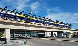
The Metro Blue Line is a 12-mile (19.3 km) light rail line in Hennepin County, Minnesota, that is part of the Metro network. It travels from downtown Minneapolis to Minneapolis–Saint Paul International Airport and the southern suburb of Bloomington. Formerly the Hiawatha Line prior to May 2013, the line was originally named after the Milwaukee Road's Hiawatha passenger train and Hiawatha Avenue, reusing infrastructure from the former and running parallel to the latter for a portion of the route. The line opened June 26, 2004, and was the first light rail service in Minnesota. An extension, Bottineau LRT, is planned to open in 2028.

Metro Transit is the primary public transportation operator in the Minneapolis–Saint Paul area of the U.S. state of Minnesota and the largest operator in the state. Although Metro Transit is one of the smallest transit systems for a large metropolitan area in the United States, it has previously been ranked as one of the best. In 2022, the system had a ridership of 38,794,700, or about 137,400 per weekday as of the second quarter of 2023.

<span class="mw-page-title-main">Warehouse District/Hennepin Avenue station</span> Light rail station in Minneapolis, Minnesota

The Warehouse District/Hennepin Avenue station station is a light rail station on the Blue Line and Green Line in Minneapolis, Minnesota. This was the original northern terminus of the Blue Line until the new Target Field station opened on November 14, 2009 to provide access to the new Northstar Commuter Rail line.

<span class="mw-page-title-main">Nicollet Mall station</span>

Nicollet Mall station is a light rail station on the Metro Blue Line and Green Line in Minneapolis, Minnesota. Adjacent to the light rail platforms is the southbound Metro Orange Line bus rapid transit station Marquette & 5th Street.

<span class="mw-page-title-main">U.S. Bank Stadium station</span> A Minneapolis, Minnesota light rail station, named for the neighboring U.S. Bank Stadium.

U.S. Bank Stadium station station is a light rail station on the Metro Blue Line and Green Line in Minneapolis, Minnesota.

<span class="mw-page-title-main">Lake Street/Midtown station</span> Light rail station in Minneapolis, Minnesota

Lake Street/Midtown station, also referred locally as either the Lake Street station or Midtown station, is a Blue Line light rail stop in Minneapolis, Minnesota, United States.

<span class="mw-page-title-main">Mall of America station</span> Light rail and bus station in Bloomington, Minnesota

The Mall of America station is the busiest transit center in Minnesota, with bus and light rail service linking the Mall of America to many destinations in the Minneapolis–St. Paul metro. Public transit service is provided by Metro Transit and the Minnesota Valley Transit Authority. The station is served by Metro Blue Line and Red Line. The station previously hosted private shuttle services to hotels and Mystic Lake Casino until those services moved to a new charter bus terminal on the north side of the mall in 2015.

<span class="mw-page-title-main">Lake Street (Minneapolis)</span>

Lake Street is a major east-west thoroughfare between 29th and 31st streets in Minneapolis, Minnesota United States. From its western most end at the city's limits, Lake Street reaches the Chain of Lakes, passing over a small channel linking Bde Maka Ska and Lake of the Isles, and at its eastern most end it reaches the Mississippi River. In May 2020, the Lake Street corridor suffered extensive damage during local unrest over the death of George Floyd. In August of the same year, city officials designated East Lake Street as one of seven cultural districts to promote racial equity, preserve cultural identity, and promote economic growth.

<span class="mw-page-title-main">Snelling Avenue station</span> Light rail and bus rapid transit station in Saint Paul, Minnesota

Snelling Avenue station is a light rail station along the Metro Green Line in Saint Paul, Minnesota. It is located along University Avenue on either side of the intersection with Snelling Avenue. The station has split side platforms, with the westbound platform on the north side of the tracks west of Snelling and the eastbound platform on the south side of the tracks east of the intersection.

<span class="mw-page-title-main">Target Field station</span> Transit hub in Minneapolis, Minnesota

Target Field station is a multimodal commuter train and light rail station in Minneapolis, Minnesota. Located in the North Loop area of Downtown Minneapolis, the station is named for Target Field, the Minnesota Twins baseball stadium. METRO Blue Line light rail service started on November 14, 2009; Northstar Line commuter rail service started November 16, 2009; METRO Green Line light rail service started on June 14, 2014.

The Minneapolis Streetcar System was a proposed streetcar system for the city of Minneapolis, Minnesota. Extensive studies and plans for the new system were completed in 2007 and presented to the Minneapolis City Council in January 2008; on April 2, 2010, the Council voted to approve the plans and seek funding. On December 21, 2010 the Federal Transit Administration granted $900,000 to further study the Nicollet and Central Avenue corridors. In June 2021, after no further development on the system, a bill authorized the Metropolitan Council to use funds collected for the Nicollet-Central line to be spent on bus rapid transit funding.

<span class="mw-page-title-main">Metro (Minnesota)</span> Rapid transit network in the Minneapolis metropolitan area of the United States

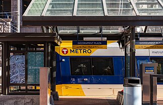
Metro is a transit network in Minnesota serving the cities of Minneapolis and Saint Paul. It also provides service to some suburban areas. As of 2022, the system consists of two light rail lines and five bus rapid transit (BRT) lines all of which are operated by the local public transit company: Metro Transit. The five lines connect Downtown Minneapolis and St Paul with the Bloomington, Minneapolis-St Paul International Airport, Roseville, Richfield, Burnsville and Brooklyn Center.

<span class="mw-page-title-main">Metro C Line (Minnesota)</span> Bus rapid transit line in the Minneapolis metropolitan area of the United States

The Metro C Line is a bus rapid transit line in Brooklyn Center and Minneapolis, Minnesota operated by Metro Transit. The line is part of Metro Transit's Metro network of light rail and bus rapid transit lines. The route operates from the Brooklyn Center Transit Center along Penn Avenue and Olson Memorial Highway, terminating in downtown Minneapolis. The route is analogous to the existing Route 19 and is projected to increase ridership on this corridor from 7,000 to 9,000 by 2030. Eventually, part of its route will shift south to Glenwood Avenue from Olson Memorial Highway.

<span class="mw-page-title-main">Royalston Avenue/Farmers Market and 7th Street & Olson/5th Avenue station</span> Light rail and bus rapid transit station in Minneapolis, Minnesota

Royalston Avenue/Farmers Market (Royalston) and 7th Street & Olson/5th Avenue is a Metro station in Minneapolis, Minnesota. The light rail (LRT) stop, Royalston, is under construction as part of the Southwest LRT extension of the Green Line, anticipated to open 2027. The bus rapid transit (BRT) stop, 7th Street & Olson/5th Avenue, is served by the C Line and then by the D Line beginning December 3, 2022.

<span class="mw-page-title-main">Metro B Line (Minnesota)</span> Planned bus rapid transit line in the Minneapolis metropolitan area of the United States

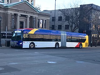
The Metro B Line is an under construction bus rapid transit route in Minneapolis and St. Paul. The route will operate mostly on Lake Street in Minneapolis before crossing the Mississippi River into St. Paul and operating mostly on Selby Avenue and ending in downtown St. Paul. The route was identified in Metro Transit's 2014 Arterial Transitway Corridors Study as one of eleven local routes to be upgraded to bus rapid transit. The route will have "train-like" features to speed up service, such as signal priority, all-door boarding, further stop spacing, and specialized vehicles. Planning and design was completed in 2021, with construction beginning in May 2023. The line will join a number of Metro Transit's future Metro system lines, as well as the currently operating A Line, C Line, and D Line. Full funding for the line was secured in October 2020 with a final $35 million from the state of Minnesota.

<span class="mw-page-title-main">Metro E Line (Minnesota)</span> Bus rapid transit line in the Minneapolis metropolitan area of the United States

The Metro E Line is a planned bus rapid transit route in Minneapolis, Saint Paul, and Edina. The route will operate from Southdale Center Transit Center in Edina, Minnesota to Westgate station in Saint Paul. Running mostly on France Avenue, Hennepin Avenue, and University Avenue, the line will serve major destinations such as Southdale Center, Fairview Hospital, 50th & France, Linden Hills, Uptown, Minneapolis Sculpture Garden, Downtown Minneapolis, Dinkytown, the University of Minnesota, and Prospect Park. The route will have "train-like" features to speed up service and improve reliability, such as signal priority, bus lanes, all-door boarding, further stop spacing, and specialized vehicles. In 2019 planning and design were underway, with construction slated for 2023 and operations beginning a year later but that timeline has been moved back. The E Line would largely replace Route 6 which carries 9,000 trips each weekday. The project was fully funded with $60 million by the state of Minnesota in 2021 and is expected to open in 2025.

<span class="mw-page-title-main">Snelling & Dayton station</span> Bus station in Saint Paul, Minnesota, United States

Snelling & Dayton is a bus rapid transit station on the Metro A Line in Saint Paul, Minnesota.

<span class="mw-page-title-main">Ford & Kenneth station</span> Bus station in Saint Paul, Minnesota

Ford & Kenneth is a bus rapid transit station on the Metro A Line in Saint Paul, Minnesota.

<span class="mw-page-title-main">7th-8th Street & Nicollet station</span>

7th-8th Street & Nicollet is a bus rapid transit station on the Metro C Line and D Line in downtown Minneapolis, Minnesota. The station is located at the intersection of Nicollet Mall, with the northbound platform located on 7th Street and the southbound platform on 8th Street. The platforms are referred to as 7th Street & Nicollet and 8th Street & Nicollet, respectively. The station is located within the Downtown Minneapolis Fare Zone, where riders can travel in the zone for 50¢ with no transfers.

References

  1. "Blue Line Station Maps". metrotransit.org. Metro Transit. Retrieved November 11, 2022.
  2. Russell, Olson L. (1976). The Electric Railways of Minnesota. Hopkins, Minnesota: Minnesota Transportation Museum.
  3. "Route 94: Saving time and money between the Twin Cities". metrotransit.org. Metro Transit. February 14, 2014. Retrieved November 11, 2022.
  4. "Route 50: Limited stops for longer rides". metrotransit.org. Metro Transit. December 6, 2013. Retrieved November 11, 2022.
  5. 1 2 Reilly, Mark (February 24, 2002). "Stations connect city to rail". Minneapolis/St. Paul Business Journal. Archived from the original on November 11, 2022. Retrieved November 11, 2022.
  6. Lovaasen, Jennifer. "Descriptions of Hiawatha Light-Rail Stations" (Press release). Hiawatha Project Office.
  7. "Part of Hiawatha light-rail to shut down this weekend". MPR News. June 24, 2009. Archived from the original on November 11, 2022. Retrieved November 11, 2022.
  8. "Rail Closures". metrotransit.org. Metro Transit. Retrieved November 11, 2022.
  9. ""Local Connections"". metrotransit.org. Metro Transit. Archived from the original on November 11, 2022. Retrieved November 11, 2022.
  10. "Government Plaza Station Public Art". metrotransit.org. Metro Transit. Archived from the original on November 11, 2022. Retrieved November 11, 2022.