
The Metro Green Line is an 11-mile (18 km) light rail line that connects the central business districts of Minneapolis and Saint Paul in Minnesota as well as the University of Minnesota. An extension is under construction that will extend the line to the southwest connecting St. Louis Park, Hopkins, Minnetonka and Eden Prairie. The line follows the path of former Metro Transit bus route 16 along University Avenue and Washington Avenue. It is the second light-rail line in the region, after the Blue Line, which opened in 2004 and connects Minneapolis with the southern suburb of Bloomington.
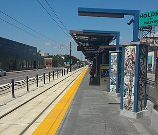
Lake Street/Midtown station, also referred locally as either the Lake Street station or Midtown station, is a Blue Line light rail stop in Minneapolis, Minnesota, United States.

Lake Street is a major east-west thoroughfare between 29th and 31st streets in Minneapolis, Minnesota United States. From its western most end at the city's limits, Lake Street reaches the Chain of Lakes, passing over a small channel linking Bde Maka Ska and Lake of the Isles, and at its eastern most end it reaches the Mississippi River. In May 2020, the Lake Street corridor suffered extensive damage during local unrest over the death of George Floyd. In August of the same year, city officials designated East Lake Street as one of seven cultural districts to promote racial equity, preserve cultural identity, and promote economic growth.

Downtown Mountain View station is an intermodal transit station providing public bus and rail service, located in Mountain View, California. The station is served by the Caltrain commuter rail service, for which it is simply called Mountain View station. Santa Clara VTA Orange Line light rail service is provided to an adjacent, dedicated light rail facility, known as Downtown Mountain View station. VTA local transit bus and employer-operated shuttle services are accommodated from the Mountain View Transit Center on the Evelyn Avenue side of the station.

Lexington Parkway station is a light rail station along the Metro Green Line in Saint Paul, Minnesota. It is located along University Avenue on both sides of the intersection with Lexington Parkway. The station has split side platforms, with the westbound platform on the north side of the tracks west of Lexington and the eastbound platform on the south side of the tracks east of the intersection.
Snelling Avenue station is a light rail station along the Metro Green Line in Saint Paul, Minnesota. It is located along University Avenue on either side of the intersection with Snelling Avenue. The station has split side platforms, with the westbound platform on the north side of the tracks west of Snelling and the eastbound platform on the south side of the tracks east of the intersection.

Raymond Avenue station is a light rail station along the Metro Green Line in Saint Paul, Minnesota. It is located a block east of the intersection of Raymond Avenue with University Avenue, between Carleton Street and La Salle Street.

Westgate station is a light rail station along the Metro Green Line in Saint Paul, Minnesota. It is located in the median of University Avenue with split side platforms either side of Berry Street. The westbound platform in on the north side of the tracks west of Berry Street, while the eastbound platform is on the south side of the tracks on the east side of the intersection. It is the last station in Saint Paul before entering Minneapolis.

Prospect Park station is a light rail station on the Green Line in the Prospect Park neighborhood of Minneapolis. It is located in the median of 29th Avenue just south of the University of Minnesota Transitway between 4th Street Southeast and University Avenue. It is the last stop in Minneapolis on the Green Line before Saint Paul.
Stadium Village station is a light rail station on the Green Line on the University of Minnesota campus in Minneapolis. Located in the Stadium Village area, it lies east of 23rd Avenue Southeast between University Avenue and 4th Street, across the road from Huntington Bank Stadium. East of the station, the rail line parallels the U of M Transitway until 29th Street SE, where it turns to enter Prospect Park station.

West Bank station is a light rail station along the Metro Green Line in Minneapolis. It serves the West Bank campus of the University of Minnesota, as well as the Cedar-Riverside neighborhood.

Target Field Station is a multimodal commuter train and light rail station in Minneapolis, Minnesota. Located in the North Loop area of Downtown Minneapolis, the station is named for Target Field, the Minnesota Twins baseball stadium. METRO Blue Line light rail service started November 14, 2009; Northstar Line commuter rail service started November 16, 2009; METRO Green Line light rail service started on June 14, 2014.

Saint Paul, Minnesota, consists of 17 officially defined city districts or neighborhoods.

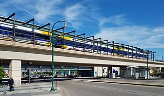
Mount Baker station is a light rail station located in Seattle, Washington. It is situated between the Columbia City and Beacon Hill stations on the 1 Line, which runs from Seattle–Tacoma International Airport to Downtown Seattle, the University of Washington, and Northgate as part of the Link light rail system. The elevated station consists of two side platforms located west of the intersection of Rainier Avenue and Martin Luther King Jr. Way in the Mount Baker neighborhood, part of Seattle's Rainier Valley.

Frogtown is a neighborhood in Saint Paul in the U.S. state of Minnesota. Built around University Avenue, the Thomas-Dale neighborhood is colloquially known as Frogtown. Historically, Frogtown was a subsection of the current Thomas-Dale neighborhood. It is bordered by University Avenue on the south, the Burlington Northern Railroad tracks to the north, Lexington Parkway on the west and Rice Street on the east.

Hamline Avenue station is a light rail station on the Metro Green Line in Saint Paul, Minnesota. It is located along University Avenue on both sides of the intersection with Hamline Avenue. The station has split side platforms, with the westbound platform on the north side of the tracks west of Hamline and the eastbound platform on the south side of the tracks east of the intersection.

Victoria Street station is a light rail stop on the Metro Green Line along University Avenue on both sides of the intersection with Victoria Street in Saint Paul, Minnesota. The station has split side platforms, with the westbound platform on the north side of the tracks west of Victoria and the eastbound platform on the south side of the tracks east of the intersection.

Western Avenue station is a light rail station on the Metro Green Line in Saint Paul, Minnesota, United States. It is located along University Avenue on both sides of the intersection with Western Avenue. The station has split side platforms, with the westbound platform on the north side of the tracks west of Western and the eastbound platform on the south side of the tracks east of Western.

Metro is a transit network in Minnesota serving the cities of Minneapolis and Saint Paul. It also provides service to some suburban areas. As of 2022 the system consists of two light rail lines and five bus rapid transit (BRT) lines all of which are operated by the local public transit company: Metro Transit. The five lines connect Downtown Minneapolis and St Paul with the Bloomington, Minneapolis-St Paul International Airport, Roseville, Richfield, Burnsville and Brooklyn Center.

The Metro A Line is a bus rapid transit line in the Twin Cities, Minnesota operated by Metro Transit. The A Line operates primarily along the Snelling Avenue corridor and travels through the cities of Minneapolis, Saint Paul, Falcon Heights, and Roseville. From the Blue Line in Minneapolis, the line travels past Minnehaha Park, through the Highland Village commercial area, past Macalester College, and connects to the Green Line near Allianz Field. The line continues through Saint Paul, past Hamline University, before traveling through Falcon Heights and Roseville, where the line passes the Minnesota State Fairgrounds, Har Mar Mall, and terminates at Rosedale Center.

