Minnesota State Highway 101

Last updated

MN-101 wide.svg

Trunk Highway 101

Route information
Maintained by MnDOT
Existed1934 [1] –present
Section 1
Length2.4 mi (3.9 km)
South endMN-5.svg MN 5 at Chanhassen
North endCounty 62 (MN).svg CSAH 62
Section 2
Length6.9 mi (11.1 km)
South endI-94.svg I-94 at Rogers
North endUS 10.svgUS 169.svg US 10  / US 169 at Elk River
Location
Country United States
State Minnesota
Counties Carver, Hennepin, Wright, Sherburne
Highway system
  • Minnesota Trunk Highway System
MN-100 wide.svg MN 100 MN-102 wide.svg MN 102

Minnesota State Highway 101 (MN 101) is a state highway in the U.S. state of Minnesota. The present day route currently has two separate segments. The roadway was a continuous route until 1988.

Contents

Route description

The northern section of the roadway, between Rogers and Elk River, is 6.9 miles (11.1 km) in length. This is a busy highway, well-used on weekends by Twin Cities travelers going west on Interstate 94/US Highway 52 (I-94/US 52) through Elk River and continuing north on US 169 to Mille Lacs Lake and other lakes in Central Minnesota. This amount of use led Minnesota Department of Transportation (MnDOT) to build interchanges along the route and convert the portion of MN 101 in Wright County to a full freeway. These interchanges are at County Road 36 (CR 36), CR 37, CR 39, and CR 42. [2] The project of converting the Wright County portion to a freeway was completed in 2008. In 2010, MnDOT built a new flyover ramp at the interchange of MN 101 and I-94/US 52. This ramp allows traffic connecting from westbound I-94 to northbound MN 101 to bypass the stoplights at the interchange and the South Diamond Lake Road intersection. In 2014, the intersection at CR 144 was converted to a diverging diamond interchange, leaving the intersection at South Diamond Lake Road as the only intersection on MN 101 between I-94/US 52 and US 10.

MN 101 originally had a longer mileage, starting in Elk River, continuing south through Rogers, Maple Grove, Plymouth, Wayzata, Minnetonka, and Chanhassen before crossing the Minnesota River and terminating in Shakopee. Beginning in 1988, the section of MN 101 between Chanhassen and Rogers has been turned back to county maintenance in several stages. [3]

The section of MN 101 in Chanhassen is still active as a state highway. However, this part of the highway has also had some turnbacks. MN 101 used to cross the Minnesota River and enter downtown Shakopee, then turned east and proceeded just south of the Minnesota River to a junction with MN 13 in Savage. The new US 169 freeway bypass of Shakopee in 1996 meant that MN 101 was no longer necessary to maintain as a state marked route east of downtown Shakopee. The section of old MN 101 east of US 169 to MN 13 at Savage is still maintained as a state highway, but not with a signed route number. Instead, it has the unmarked route number of Trunk Highway 901B. The 2004 Control Section Guide states that this section is considered part of the US 169/CR 101/MN 13 interchange (at the Shakopee–Savage boundary line) and will not have a route or control section number. [4]

All sections of old MN 101 that have been turned back to county maintenance since 1988 are signed as County Road 101 to maintain a unity in the eyes of the general public.

One section south of Rogers remains signed as MN 101 as of 2019: a section between Vine Hill Road in Eden Prairie and the east intersection with MN 5 in Chanhassen.

History

MN 101 was defined, along with many other routes, by Chapter 440 of the 1933 Minnesota Session Laws. The Minnesota Department of Highways (now MnDOT) took over maintenance of the roadway in 1934. MN 101 began at MN 13 in Savage, at the intersection of Dakota Avenue and McColl Drive and ran west on McColl Drive and Eagle Creek Boulevard to downtown Shakopee. Old MN 101 crossed the Minnesota River with US 169, and crossed US 212 along the present day Carver County portion of MN 101. From Shakopee to near Rogers, the original routing of MN 101 matched the present day State MN 101 and County Road 101 except in downtown Chanhassen, where old MN 101 had followed Great Plains Boulevard and 78th Street (the later MN 5), in downtown Wayzata, where old MN 101 followed LaSalle Street to Central Avenue, and on the State MN 55/MN 101 concurrency at Plymouth–Medina, which was along Old Rockford Road and Hamel Road. Instead of using old MN 152 (now CR 81) into Rogers, old MN 101 continued north on Brockton Avenue (now CR 13) and crossed the Crow River at its mouth, then heading northwest and north on River Road and Parrish Avenue to the Parrish Avenue Bridge over the Mississippi River. Upon crossing the bridge, old MN 101 entered Elk River and immediately ended at US 10 and US 169 via short pieces of Main Street and Jackson Avenue. [1] [5]

The US 169 bypass east of downtown Elk River was built in 1961, and old MN 101 was extended north on old US 169 (Jackson Avenue) to the north end of the bypass. [6] Later, in 1968, the bypass was extended south to old MN 152 in Rogers, and MN 101 was realigned to be concurrent with old MN 152 and use the new bypass from Rogers north to Elk River. The original alignment of MN 101 was turned over to the counties (renumbered as CR 13/Brockton Avenue in northern Hennepin County and CR 42 in Wright County), and the extension north of downtown Elk River was renumbered State Highway 201 until 1987. [1] [7] MN 101 was realigned to the present day CR 101 between Savage and downtown Shakopee in 1940. In 1964, the MN 5 bypass of downtown Chanhassen was built, but MN 101 remained on the old route until the 1980s, when it was moved to the bypass. The relocation of MN 55 at Plymouth–Medina, and with it the brief MN 55/MN 101 concurrency, came in 1942 west of and 1954 east of the intersection with the old alignment. [8]

Major intersections

The following list includes the major intersections of both present day MN 101 and CR 101.

CountyLocationmi [9] kmDestinationsNotes
Scott Savage 0.0000.000MN-13.svg MN 13 South end of unmarked route 901B
Shakopee 1.128–
1.188
1.815–
1.912
South plate.svg
US 169.svg
County 21 (MN).svg US 169 south / CSAH 21  Mankato
Northbound exit and southbound entrance; interchange
1.7042.742North plate.svg
US 169.svg
US 169 north Bloomington
North end of unmarked route 901B; south end of CR 101; interchange
County 69 (MN).svg CSAH 69 Old US 169 southbound
Minnesota River 8.32813.403 Shakopee Bridge
Carver Chanhassen 8.837–
8.902
14.222–
14.326
East plate.svg
County 61 square.svg
CR 61 east (Flying Cloud Drive)
Old US 212 eastbound
9.03714.544West plate.svg
County 61 square.svg
CR 61 west (Flying Cloud Drive)
Old US 212 westbound
11.50018.507US 212.svg US 212 New US 212 freeway
12.75520.527West plate blue.svg
MN-5.svg
MN 5 west
North end of CR 101
13.39121.551East plate blue.svg
MN-5.svg
MN 5 east
South end of MN 101
Hennepin Eden Prairie 15.53425.000Vine Hill RoadNorth end of MN 101; south end of CR 101
Minnetonka County 62 (MN).svg CR 62
MN-7.svg MN 7
Wayzata East plate.svg
US 12.svg
County 15 (MN).svg US 12 east / CR 15
Interchange
US 12.svg US 12 Interchange
Plymouth East plate blue.svg
MN-55.svg
MN 55 east
South end of MN 55 overlap
Medina West plate blue.svg
MN-55.svg
MN 55 west
North end of MN 55 overlap
Maple Grove County 10 (MN).svg CR 10 14-mile (0.40 km) overlap segment with CR 10 eliminated in 2010, now intersection
Dayton County 81 (MN).svgCounty 13 (MN).svg CR 81  / CR 13 Northern terminus of CR 101; old MN 101 uses CR 81; CR 101 becomes CR 13
Rogers 39.624–
39.663
63.769–
63.831
I-94.svg I-94 (US 52) Minneapolis, St. Paul, St. Cloud North end of CR 81; south end of MN 101
39.85664.142South Diamond Lake RoadA flyover ramp connecting WB I-94 with NB MN 101 bypasses this intersection.
40.70865.513County 144 (MN).svg CR 144 (141st Avenue)Replaced with an interchange [2]
Wright St. Michael 42.02867.638County 36 (MN).svgWest plate blue.svg
Alternate plate blue.svg
I-94.svg
CSAH 36 (53rd Street) / I-94 Alt. west
Replaced with an interchange [2]
43.63570.224County 37 (MN).svg CSAH 37 (70th Street)Replaced with an interchange [2]
Otsego 44.44871.532County 42 (MN).svg CSAH 42 (River Road)Replaced with an interchange [2]
45.68873.528County 39 (MN).svg CSAH 39 (90th Street)Replaced with an interchange [2]
Mississippi River 46.200–
46.334
74.352–
74.567
Betty Adkins Bridge
Sherburne Elk River 46.466–
46.479
74.780–
74.801
US 10.svgUS 169.svg US 10  / US 169  Anoka, Elk River, Princeton Northern terminus of MN 101
1.000 mi = 1.609 km; 1.000 km = 0.621 mi

Related Research Articles

<span class="mw-page-title-main">U.S. Route 53</span> U.S. Highway in Minnesota and Wisconsin

U.S. Route 53, or U.S. Highway 53 (U.S. 53), is a north–south U.S. highway that runs for 404 miles (650 km) from La Crosse, Wisconsin to International Falls, Minnesota. It is the primary north–south route in northwestern Wisconsin, serving as a vital link between I-94 at Eau Claire, Wisconsin and the Twin Ports of Superior, Wisconsin, and Duluth, Minnesota. The entire route from Eau Claire to the city limits of Superior is a four lane divided highway. The highway's northern terminus is at the Fort Frances–International Falls International Bridge in International Falls, Minnesota, at the Canada–US border. Its southern terminus is in La Crosse, Wisconsin, at U.S. Highway 14.

<span class="mw-page-title-main">U.S. Route 218</span> Highway in the United States

U.S. Highway 218 (US 218) is an original United States Highway that was created in 1926. Although technically a spur of US 18, US 218 neither begins nor ends at US 18, but overlaps US 18 for eight miles (13 km) near Charles City, Iowa. US 218 begins at U.S. 136 in downtown Keokuk and ends 319 miles (513 km) away at Interstate 35 (I-35) and US 14 at Owatonna, Minnesota. A large portion of US 218 in Iowa is part of the Avenue of the Saints, which connects St. Louis, Missouri, and Saint Paul, Minnesota.

<span class="mw-page-title-main">Minnesota State Highway 65</span> Highway in Minnesota

Minnesota State Highway 65 is a highway in the east–central and northeast parts of the U.S. state of Minnesota, which starts at its split from I-35W, skipping past the downtown Minneapolis core, only to resume at the intersection with Washington Avenue at the north end of downtown Minneapolis to continue north to its northern terminus at its intersection with U.S. Highway 71 (US 71) in Littlefork near International Falls.

<span class="mw-page-title-main">Minnesota State Highway 7</span> Highway in Minnesota

Minnesota State Highway 7, or Trunk Highway 7, is a state highway in Minnesota, which runs from its intersection with MN 28 near Beardsley and continues east to its terminus with MN 100 and County Road 25 (CR 25) in St. Louis Park. The highway runs east–west for approximately 194.2 miles (312.5 km) through mostly rural farmland in the central part of the state. On its western end, it is part of the Minnesota River Valley Scenic Byway where it runs northwest–southeast along the Minnesota River and associated lakes near the border with the adjoining state of South Dakota. For roughly 24 miles (39 km) of its route, it runs concurrently with U.S. Highway 59 (US 59) between Appleton and Montevideo. In Montevideo, the highway turns to the east cutting across the state. It passes through several small towns before entering the Twin Cities metropolitan area. In the metro area, MN 7 follows an expressway through several suburbs before terminating in St. Louis Park. Two different segments have been listed on the National Highway System, system of roads considered important to the country.

<span class="mw-page-title-main">Minnesota State Highway 5</span> Highway in Minnesota

Minnesota State Highway 5 is a 76.347-mile-long (122.869 km) highway in Minnesota, which runs from its intersection with MN 19 and MN 22 in Gaylord and continues east and northeast to its eastern terminus at its intersection with MN 120 in Maplewood. The route passes through downtown Saint Paul.

<span class="mw-page-title-main">Minnesota State Highway 23</span> State highway in Minnesota, United States

Minnesota State Highway 23 (MN 23) is a state highway that stretches from southwestern to northeastern Minnesota. At 343.723 miles (553.169 km) in length, it is the second longest state route in Minnesota, after MN 1.

<span class="mw-page-title-main">Minnesota State Highway 610</span> State highway in Minnesota, United States

Minnesota State Highway 610 (MN 610) is an east–west freeway in the Twin Cities region of Minnesota. The freeway connects Interstate 94 (I-94), County Road 81, and CR 130 in northern Hennepin County to U.S. Highway 10 (US 10) in southern Anoka County. MN 610 crosses the Mississippi River on the Richard P. Braun Bridge between suburban Brooklyn Park and Coon Rapids. The highway is 12.3 miles (19.8 km) long.

<span class="mw-page-title-main">Minnesota State Highway 371</span> State highway in Minnesota, United States

Minnesota State Highway 371 (MN 371) is a 107.411-mile-long (172.861 km) highway in central and north-central Minnesota. The route connects Minnesota's northern lakes region with the central part of the state. It runs south–north from U.S. Highway 10 (US 10) in Little Falls to US 2 in Cass Lake. MN 371 has become a heavily traveled arterial route that was once a two-lane roadway over almost all of its length, but has been widened to four lanes across most of its southern half. Much of the traffic utilizing the route is Twin Cities-based traffic heading to their cabins on one of the many northern lakes.

<span class="mw-page-title-main">Minnesota State Highway 252</span> State highway in Minnesota, United States

Minnesota State Highway 252 (MN 252) is a 4.4-mile-long (7.1 km) state highway in Minnesota, which runs from its interchange with Interstate 94 (I-94), I-694 and US Highway 52 (US 52) in Brooklyn Center and continues north to its northern terminus at its interchange with MN 610 in Brooklyn Park. MN 252 generally follows not far from the west bank of the Mississippi River throughout its route.

<span class="mw-page-title-main">Minnesota State Highway 15</span> State highway in Minnesota, United States

Minnesota State Highway 15 is a 154.322-mile-long (248.357 km) highway in south-central and central Minnesota, which runs from Iowa Highway 15 at the Iowa state line and continues north to its northern terminus at its interchange with U.S. Highway 10 outside of Sartell and Sauk Rapids, north of St. Cloud.

<span class="mw-page-title-main">Minnesota State Highway 33</span> State highway in Minnesota, United States

Minnesota State Highway 33 (MN 33) is a 19.748-mile (31.781 km) state highway in northeast Minnesota, which runs from its interchange with Interstate 35 (I-35) at Cloquet and continues to its northern terminus at its interchange with U.S. Highway 53 (US 53) at Independence. The highway is constructed as a four-lane expressway with a 65 mph (105 km/h) speed limit, except for a short distance through the city of Cloquet, where the route is located on a four-lane city surface street. MN 33 is a bypass of Duluth for travelers headed to the Iron Range of northern Minnesota and International Falls.

<span class="mw-page-title-main">Minnesota State Highway 27</span> State highway in Minnesota, United States

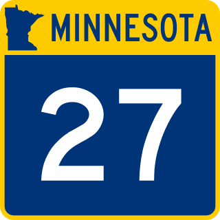
Minnesota State Highway 27 (MN 27) is a 247.623-mile-long (398.511 km) state highway in west-central and east-central Minnesota, which runs from its intersection with MN 28 in Browns Valley and continues east to its interchange with Interstate 35 (I-35) in Moose Lake. For part of its route, it runs concurrently with MN 65 in Kanabec and Aitkin counties between Woodland and Rice River Township.

<span class="mw-page-title-main">Minnesota State Highway 41</span> State highway in Minnesota, United States

Minnesota State Highway 41 (MN 41) is a 9.382-mile-long (15.099 km) highway in Minnesota, which runs from its intersection with U.S. Highway 169 in Jackson Township near Shakopee and continues north to its northern terminus at its intersection with State Highway 7 in Shorewood.

<span class="mw-page-title-main">U.S. Route 52 in Minnesota</span> Section of U.S. Highway in Minnesota, United States

U.S. Highway 52 (US 52) enters the state of Minnesota at the unincorporated community of Prosper, north of the town of Burr Oak, Iowa. The route is marked north–south in Minnesota along its independent segment from the Iowa state line to downtown St. Paul. US 52 is not signed along the length of its concurrency with Interstate 94 (I-94) from downtown St. Paul to the North Dakota state line at Moorhead and Fargo.

<span class="mw-page-title-main">County Road 81 (Hennepin County, Minnesota)</span> Highway in Hennepin County, Minnesota, US

County State-Aid Highway 81, also known as County Road 81, (County 81) is a county highway in Hennepin County, Minnesota, which runs from its interchange with Interstate 94 (I-94), CR 66, and CR 152 in the city of Minneapolis, and continues northwest to its terminus at Main Street in suburban Rogers. CR 81 is approximately 20 miles (32 km) long.

<span class="mw-page-title-main">County Road 122 (Hennepin County, Minnesota)</span> Highway in Minneapolis, Minnesota, US

Hennepin County Road 122 (CR 122) or County State-Aid Highway 122 (CSAH 122) is an unsigned county state-aid highway within the city of Minneapolis, Hennepin County, Minnesota, United States, crossing the Mississippi River on the Washington Avenue Bridge.

<span class="mw-page-title-main">U.S. Route 169 in Minnesota</span> Section of U.S. Highway in Minnesota, United States

U.S. Highway 169 (U.S. 169) is a major north–south highway in the U.S. state of Minnesota, connecting the Minnesota River valley with the Twin Cities and the Iron Range. Much of the route is built to expressway or freeway standards.

<span class="mw-page-title-main">Special routes of U.S. Route 169</span>

Six special routes of U.S. Route 169 exist, one each in Oklahoma, Kansas, Missouri, and Iowa, and two in Minnesota.

<span class="mw-page-title-main">U.S. Route 212 in Minnesota</span> Section of U.S. Highway in Minnesota, United States

U.S. Highway 212 (US 212) within the state of Minnesota travels from the South Dakota state line in the west, crosses the southwestern part of the state, to the Minneapolis–Saint Paul metropolitan area in the east and end at its interchange with US 169 and State Highway 62 (MN 62) in the Minneapolis suburb of Edina. US 212 in Minnesota has an official length of 161.8 miles (260.4 km). It is an urban freeway within the Minneapolis–Saint Paul area and is mostly a two-lane rural road elsewhere in the state.

References

  1. 1 2 3 Staff. "Control Section 7005" (PDF). Construction Project Log Records. Minnesota Department of Transportation.
    • Staff. "Control Section 1009" (PDF). Construction Project Log Records. Minnesota Department of Transportation.
    • Staff. "Control Section 1010" (PDF). Construction Project Log Records. Minnesota Department of Transportation.
    • Staff. "Control Section 2736" (PDF). Construction Project Log Records. Minnesota Department of Transportation.
    • Staff. "Control Section 2737" (PDF). Construction Project Log Records. Minnesota Department of Transportation.
    • Staff. "Control Section 2768" (PDF). Construction Project Log Records. Minnesota Department of Transportation.
    • Staff. "Control Section 8608" (PDF). Construction Project Log Records. Minnesota Department of Transportation.
    • Staff. "Control Section 7105" (PDF). Construction Project Log Records. Minnesota Department of Transportation.
  2. 1 2 3 4 5 6 "Reconstruction of Hwy 101 interchanges set between the Crow River and Elk River" (Press release). Minnesota Department of Transportation. June 2, 2006. Archived from the original on August 8, 2007.
  3. Riner, Steve. "Details of Routes 101–149". The Unofficial Minnesota Highways Page. Retrieved April 8, 2006.[ self-published source ]
  4. "MNDOT Control Section Guide" (pdf). MnDOT Transportation Data and Analysis. Minnesota Department of Transportation. 2004. Retrieved April 7, 2006.[ dead link ]
  5. Minnesota Highway Department; McGill-Warner (1934). Map of Trunk Highway System, State of Minnesota (Map). Scale not given. St. Paul: Minnesota Highway Department. Minneapolis, Saint Paul and Vicinity inset. OCLC   5673160, 80405240 via Minnesota Digital Library. (Showing road conditions as of May 1, 1934)
  6. United States Geological Survey (1964). Elk River (Topographic map). 1:62,500. Reston, VA: United States Geological Survey.[ permanent dead link ]
  7. Staff. "Control Section 2738" (PDF). Construction Project Log Records. Minnesota Department of Transportation.
  8. Staff. "Control Section 7110" (PDF). Construction Project Log Records. Minnesota Department of Transportation.
  9. Staff (July 2006). "Trunk Highway Log Point Files". Minnesota Department of Transportation.
Template:Attached KML/Minnesota State Highway 101
KML is from Wikidata