Dayton, Minnesota

Last updated

Dayton
Hennepin County Minnesota Incorporated and Unincorporated areas Dayton Highlighted.svg
Location of the city of Dayton
within Hennepin County, Minnesota
Coordinates: 45°12′N93°30′W / 45.200°N 93.500°W / 45.200; -93.500
CountryUnited States
State Minnesota
Counties Hennepin, Wright
Government
   Mayor Dennis Fisher
Area
[1]
   City 25.18 sq mi (65.22 km2)
  Land23.42 sq mi (60.65 km2)
  Water1.76 sq mi (4.57 km2)
Elevation
879 ft (268 m)
Population
 (2020) [2]
   City 7,262
  Estimate 
(2022) [3]
9,242
  Density310.09/sq mi (119.73/km2)
   Metro
3,693,729
Time zone UTC-6 (Central)
  Summer (DST) UTC-5 (Central)
ZIP codes
55327, 55369
Area code 763
FIPS code 27-15022 [4]
GNIS feature ID0642665 [5]
Website cityofdaytonmn.com

Dayton is a city in Hennepin and Wright counties in the U.S. state of Minnesota. The population was 7,262 at the 2020 census. [2] Dayton is mainly located within Hennepin County, but a part of the city extends into Wright County as well. It is the northernmost city in Hennepin County and is a suburb of the Minneapolis–St. Paul "Twin Cities" metropolitan area.

Contents

The city of Dayton, platted in 1855, is named for city founder, Lyman Dayton. Through his energy and finances, Lyman Dayton was instrumental in bringing the railroad into Minnesota and development of the Lake Superior and Mississippi Railroad, of which he was president until 1865. [6] The line is now part of the Burlington Northern Santa Fe Railroad.

Geography

According to the United States Census Bureau, the city has a total area of 25.15 square miles (65.14 km2), of which 23.25 square miles (60.22 km2) is land and 1.90 square miles (4.92 km2) is water. [7] On January 15, 2003, the city's most recent geographical expanse extended its boundaries.

Fernbrook Lane (County 121); North Diamond Lake Road (County 144); South Diamond Lake Road; and Dayton River Road (County 12) are four of the main routes in Dayton. Interstate 94 and County Road 81 pass briefly through the southwest corner of Dayton. Brockton Lane (County 13) runs north-south along Dayton's western boundary line with adjacent city of Rogers.

The neighboring cities are Champlin, Rogers, Maple Grove, Anoka, Ramsey, Elk River, and Otsego. Corcoran is nearby, but does not border Dayton.

Dayton is located at the confluence of the Mississippi and Crow Rivers.

Economy

Dayton is a small town in regards to the economy scale with few retail outlets. Dayton's economy comes from mostly small business operations such as Two golf courses, various car repair shops, famous local manor, and custom home builders. Its one mall, Raintree Plaza, has Marathon gas station and convenience store as well as several other small businesses.

City government

In 2011, the city was forced to lay off several staff members and reduce services due to budget cuts.

Demographics

Historical population
CensusPop.Note
1880 255
1910 343
1920 299−12.8%
1930 265−11.4%
1940 253−4.5%
1950 36343.5%
1960 45625.6%
1970 51713.4%
1980 4,070687.2%
1990 4,4439.2%
2000 4,6995.8%
2010 4,671−0.6%
2020 7,21254.4%
2022 (est.)9,242 [3] 28.1%
U.S. Decennial Census [8]
2020 Census [2]
Historical population
CensusPop.Note
1860 540
1870 95176.1%
1880 1,19725.9%
1890 1,075−10.2%
1900 1,1385.9%
1910 778−31.6%
1920 744−4.4%
1930 718−3.5%
1940 7413.2%
1950 715−3.5%
1960 80412.4%
1970 2,162168.9%
U.S. Census for Dayton Township [8]

2010 census

As of the census of 2010, there were 4,671 people, 1,638 households, and 1,319 families living in the city. The population density was 200.9 inhabitants per square mile (77.6/km2). There were 1,699 housing units at an average density of 73.1 per square mile (28.2/km2). The racial makeup of the city was 93.7% White, 0.5% African American, 0.2% Native American, 2.0% Asian, 0.1% Pacific Islander, 1.8% from other races, and 1.7% from two or more races. Hispanic or Latino of any race were 8.8% of the population.

There were 1,638 households, of which 35.5% had children under the age of 18 living with them, 66.8% were married couples living together, 7.4% had a female householder with no husband present, 6.3% had a male householder with no wife present, and 19.5% were non-families. 14.3% of all households were made up of individuals, and 4.2% had someone living alone who was 65 years of age or older. The average household size was 2.85 and the average family size was 3.12.

The median age in the city was 41.7 years. 24.6% of residents were under the age of 18; 8.2% were between the ages of 18 and 24; 22.5% were from 25 to 44; 35.7% were from 45 to 64; and 9% were 65 years of age or older. The gender makeup of the city was 52.2% male and 47.8% female.

2000 census

As of the census of 2000, there were 4,699 people, 1,550 households, and 1,292 families living in the city. The population density was 200.4 inhabitants per square mile (77.4/km2). There were 1,566 housing units at an average density of 66.8 per square mile (25.8/km2). The racial makeup of the city was 95.28% White, 0.64% African American, 0.64% Native American, 0.81% Asian, 1.87% from other races, and 0.77% from two or more races. Hispanic or Latino of any race were 2.75% of the population. 31.6% were of German, 13.5% Swedish, 11.0% Norwegian and 7.9% Irish ancestry.

There were 1,550 households, out of which 45.7% had children under the age of 18 living with them, 71.9% were married couples living together, 7.9% had a female householder with no husband present, and 16.6% were non-families. 11.7% of all households were made up of individuals, and 2.1% had someone living alone who was 65 years of age or older. The average household size was 3.03 and the average family size was 3.29.

In the city, the population was spread out, with 30.5% under the age of 18, 7.8% from 18 to 24, 33.2% from 25 to 44, 23.7% from 45 to 64, and 4.7% who were 65 years of age or older. The median age was 35 years. For every 100 females, there were 103.1 males. For every 100 females age 18 and over, there were 105.1 males.

The median income for a household in the city was $66,875, and the median income for a family was $71,356. Males had a median income of $41,476 versus $30,386 for females. The per capita income for the city was $27,756. About 1.0% of families and 2.7% of the population were below the poverty line, including 3.7% of those under age 18 and none of those age 65 or over.

Politics

From 1960 to 1996, Dayton was a Democratic stronghold, having voted Democrat in every election except for 1984 when it voted narrowly for then incumbent Ronald Reagan, who won in a landslide over Minnesota Senator Walter Mondale. Since 2000 however, the city has drifted more and more Republican, having voted Republican in every election at the presidential level since 2000 when it voted by 12% for George W. Bush. The city was last won by Donald Trump in 2020.

Presidential election results
2020 Precinct Results Spreadsheet [9] 2016 Precinct Results Spreadsheet [10] 2012 Precinct Results Spreadsheet [11] 2008 Precinct Results Spreadsheet [12] 2004 Precinct Results Spreadsheet [13] 2000 Precinct Results Spreadsheet [14] 1996 Precinct Results [15] 1992 Precinct Results [16] 1988 Precinct Results [17] 1984 Precinct Results [18] 1980 Precinct Results [19] 1976 Precinct Results [20] 1968 Precinct Results [21] 1964 Precinct Results [22] 1960 Precinct Results [23]
Year Republican Democratic Third parties
2020 51.7%2,36945.4% 2,0822.9% 133
2016 55.9%1,64334.9% 1,0269.2% 272
2012 60.3%1,66737.0% 1,0232.7% 74
2008 58.3%1,60139.8% 1,0921.9% 53
2004 59.0%1,62839.6% 1,0941.4% 39
2000 52.2%1,30940.6% 1,0187.2% 179
1996 38.2% 82545.7%98616.1% 347
1992 32.8% 77234.4%81132.8% 773
1988 47.9% 94552.1%1,0270.0% 0
1984 52.0%97648.0% 9020.0% 0
1980 40.2% 70051.2%8938.6% 150
1976 34.3% 55264.2%1,0331.5% 24
1968 25.3% 4573.0%1301.7% 3
1964 22.3% 3777.7%1290.0% 0
1960 25.8% 4874.2%1380.0% 0

Points of interest

St. John The Baptist Catholic Church, July 2009 Dayton Catholic Church.jpg
St. John The Baptist Catholic Church, July 2009

St. John the Baptist Catholic Church, constructed in 1904, can be seen for miles and from four different counties.

Related Research Articles

Benton Township is a rural township in Carver County, Minnesota, United States. The population was 939 as of the 2000 census.

Camden Township is a rural township in Carver County, Minnesota, United States. The population was 955 as of the 2000 census.

<span class="mw-page-title-main">Hancock Township, Carver County, Minnesota</span> Township in Minnesota, United States

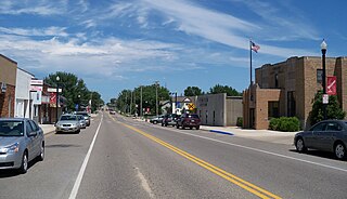
Hancock Township is a township in Carver County, Minnesota, United States. The population was 367 as of the 2000 census.

Hollywood Township is a rural township in Carver County, Minnesota, United States. The population was 1,102 as of the 2000 census.

Laketown Township is a township in Carver County, Minnesota, United States. The population was 2,331 as of the 2000 census.

<span class="mw-page-title-main">Manhattan Beach, Minnesota</span> City in Minnesota, United States

Manhattan Beach is a small city in Crow Wing County, Minnesota, United States, near Crosslake. The population was 57 at the 2010 census. It is part of the Brainerd Micropolitan Statistical Area.

<span class="mw-page-title-main">Apple Valley, Minnesota</span> City in Minnesota, United States

Apple Valley is a city in northwestern Dakota County in the State of Minnesota, and a suburb of the Twin Cities. The population was 56,374 at the 2020 census, making it the 17th most populous city in Minnesota. In 2014, Money.com named Apple Valley the 17th best place to live in the United States, up from 20th in 2010, 24th in 2008 and 28th in 2007.

<span class="mw-page-title-main">Mendota Heights, Minnesota</span> City in Minnesota, United States

Mendota Heights is a city in Dakota County, Minnesota, United States. It is a first ring southern suburb of the Twin Cities. The population was 11,744 at the 2020 census.

<span class="mw-page-title-main">Greenfield, Minnesota</span> City in Minnesota, United States

Greenfield is a city in northwestern Hennepin County, Minnesota. It has a population of 2,903 residents, according to the 2020 United States Census, and is located 26.5 miles northwest of Minneapolis. It is part of the Twin Cities Metropolitan Statistical Area.

<span class="mw-page-title-main">Long Lake, Minnesota</span> City in Minnesota, United States

Long Lake is a small city in Hennepin County, Minnesota, United States named after the lake the eastern end of town lies on. A commercial hub for the surrounding communities, Long Lake is home to many local shops and businesses. U.S. Highway 12 runs through the town. The population was 1,768 at the 2010 census.

<span class="mw-page-title-main">Maple Plain, Minnesota</span> City in Minnesota, United States

Maple Plain is a city in Hennepin County, Minnesota, United States. The population was 1,768 at the 2010 census.

<span class="mw-page-title-main">Glencoe, Minnesota</span> City in Minnesota, United States

Glencoe is the county seat of McLeod County, Minnesota, United States. The population was 5,631 at the 2010 census.

<span class="mw-page-title-main">Hutchinson, Minnesota</span> City in Minnesota, United States

Hutchinson is the largest city in McLeod County, Minnesota, United States. It lies along the South Fork of the Crow River. The population was 14,599 at the 2020 census.

<span class="mw-page-title-main">Lester Prairie, Minnesota</span> City in Minnesota, United States

Lester Prairie is a city in McLeod County, Minnesota, United States, along the South Fork of the Crow River. The population was 1,730 at the 2010 census. Noted composer and conductor of The Concordia Choir, Rene Clausen was raised in Lester Prairie.

<span class="mw-page-title-main">Red Lake Falls, Minnesota</span> City in Minnesota, United States

Red Lake Falls is a city in Red Lake County, Minnesota, United States. The population was 1,339 at the 2020 census. It is the county seat of Red Lake County. The city lies in the middle of Red Lake Falls Township, from which it was separated when incorporated as a village in 1881. Its status was raised to that of a city in 1898.

<span class="mw-page-title-main">Cokato, Minnesota</span> City in Minnesota, United States

Cokato is a city in Wright County, Minnesota, United States. The population was 2,799 at the 2020 census.

<span class="mw-page-title-main">Montrose, Minnesota</span> City in Minnesota, United States

Montrose is a small city in Wright County, Minnesota, United States. Montrose is surrounded by farmland, prairies, and lakes. The population was 2,847 at the 2010 census.

<span class="mw-page-title-main">Arden Hills, Minnesota</span> City in Minnesota, United States

Arden Hills is a city in Ramsey County, Minnesota, United States. The population was 9,939 at the 2020 census. Bethel University and its seminary is located in the city of Arden Hills. Also, the campus of University of Northwestern – St. Paul straddles the Arden Hills – Roseville border. The city contains the headquarters of Land O'Lakes and Catholic United Financial, a fraternal benefit society. Boston Scientific also has a large campus within Arden Hills as well.

<span class="mw-page-title-main">Howard Lake, Minnesota</span> City in Minnesota, United States

Howard Lake is a city in Wright County, Minnesota, United States. The population was 1,962 at the 2010 census.

<span class="mw-page-title-main">Hastings, Minnesota</span> City in Minnesota, United States

Hastings is a city mostly in Dakota County, Minnesota, of which it is the county seat, with a portion in Washington County, Minnesota, United States. It is near the confluence of the Mississippi, Vermillion, and St. Croix Rivers. The population was 22,154 at the 2020 census. It is named for the first elected governor of Minnesota, Henry Hastings Sibley.

References

  1. "2020 U.S. Gazetteer Files". United States Census Bureau. Retrieved July 24, 2022.
  2. 1 2 3 "Explore Census Data". United States Census Bureau . Retrieved June 2, 2022.
  3. 1 2 "City and Town Population Totals: 2020-2022". United States Census Bureau. June 9, 2023. Retrieved June 9, 2023.
  4. "American FactFinder". United States Census Bureau. Archived from the original on February 12, 2020. Retrieved January 31, 2008.
  5. "US Board on Geographic Names". United States Geological Survey. October 25, 2007. Retrieved January 31, 2008.
  6. Upham, Warren (1920). Minnesota Geographic Names: Their Origin and Historic Significance. Minnesota Historical Society. p.  221.
  7. "US Gazetteer files 2010". United States Census Bureau. Archived from the original on January 25, 2012. Retrieved November 13, 2012.
  8. 1 2 "Census of Population and Housing". Census.gov. Archived from the original on May 7, 2015. Retrieved May 4, 2019.
  9. "Minnesota Secretary of State - 2020 Precinct Results Spreadsheet".
  10. "Minnesota Secretary of State - 2016 Precinct Results Spreadsheet".
  11. "Minnesota Secretary of State - 2012 Precinct Results Spreadsheet".
  12. "Minnesota Secretary of State - 2008 Precinct Results Spreadsheet".
  13. "Minnesota Secretary of State - 2004 Precinct Results Spreadsheet".
  14. "Minnesota Secretary of State - 2000 Precinct Results Spreadsheet".
  15. (PDF) https://www.lrl.mn.gov/archive/sessions/electionresults/1996-11-05-g-sec.pdf.{{cite web}}: Missing or empty |title= (help)
  16. (PDF) https://www.lrl.mn.gov/archive/sessions/electionresults/1992-11-03-g-sec.pdf.{{cite web}}: Missing or empty |title= (help)
  17. (PDF) https://www.lrl.mn.gov/archive/sessions/electionresults/1988-11-08-g-sec.pdf.{{cite web}}: Missing or empty |title= (help)
  18. (PDF) https://www.lrl.mn.gov/archive/sessions/electionresults/1984-11-06-g-sec.pdf.{{cite web}}: Missing or empty |title= (help)
  19. (PDF) https://www.lrl.mn.gov/archive/sessions/electionresults/1980-11-04-g-sec.pdf.{{cite web}}: Missing or empty |title= (help)
  20. (PDF) https://www.lrl.mn.gov/archive/sessions/electionresults/1976-11-02-g-sec.pdf.{{cite web}}: Missing or empty |title= (help)
  21. (PDF) https://www.lrl.mn.gov/archive/sessions/electionresults/1968-11-05-g-man.pdf.{{cite web}}: Missing or empty |title= (help)
  22. (PDF) https://www.lrl.mn.gov/archive/sessions/electionresults/1964-11-03-g-man.pdf.{{cite web}}: Missing or empty |title= (help)
  23. (PDF) https://www.lrl.mn.gov/archive/sessions/electionresults/1960-11-08-g-man.pdf.{{cite web}}: Missing or empty |title= (help)

45°12′N93°30′W / 45.200°N 93.500°W / 45.200; -93.500