Spring Park, Minnesota

Last updated

Spring Park
2009-0713-SpringPark-CH.jpg
City hall
Hennepin County Minnesota Incorporated and Unincorporated areas Spring Park Highlighted.svg
Location of Spring Park
within Hennepin County, Minnesota
Country United States
State Minnesota
County Hennepin
Incorporated1951
Government
   Mayor Jerome P. "Jerry" Rockvam
Area
[1]
  Total0.60 sq mi (1.57 km2)
  Land0.35 sq mi (0.91 km2)
  Water0.25 sq mi (0.65 km2)
Population
 (2020)
  Total1,734
  Density4,912.18/sq mi (1,896.34/km2)
Time zone UTC-6 (Central (CST))
  Summer (DST) UTC-5 (CDT)
ZIP code
55384 [2]
Area code 952
FIPS code 27-62014
Website springpark.govoffice.com

Spring Park is a city nestled on the shores of Lake Minnetonka in Hennepin County, Minnesota, United States and is about 20 miles west of Minneapolis. The population was 1,669 at the 2010 census. [3]

Contents

The small town is rich in history. What is now Spring Park was once the grounds of Hotel Del Otero, a summer lake resort built by James J. Hill. [4] [5]

It was incorporated in 1951 and at that time had a population of a little over 200.

Geography

According to the United States Census Bureau, the city has a total area of 0.62 square miles (1.61 km2), of which 0.36 square miles (0.93 km2) is land and 0.26 square miles (0.67 km2) is water. [6] County 15 and County 51 are two of the main routes.

Demographics

Historical population
CensusPop.Note
1960 668
1970 1,08762.7%
1980 1,46534.8%
1990 1,5717.2%
2000 1,7179.3%
2010 1,669−2.8%
2020 1,7343.9%
U.S. Decennial Census

2010 census

As of the census [7] of 2010, there were 1,669 people, 897 households, and 314 families living in the city. The population density was 4,636.1 inhabitants per square mile (1,790.0/km2). There were 1,072 housing units at an average density of 2,977.8 per square mile (1,149.7/km2). The racial makeup of the city was 94.1% White, 2.0% African American, 0.1% Native American, 2.6% Asian, 0.2% from other races, and 1.0% from two or more races. Hispanic or Latino of any race were 1.4% of the population.

There were 897 households, of which 15.3% had children under the age of 18 living with them, 24.7% were married couples living together, 6.6% had a female householder with no husband present, 3.7% had a male householder with no wife present, and 65.0% were non-families. 55.0% of all households were made up of individuals, and 22.9% had someone living alone who was 65 years of age or older. The average household size was 1.67 and the average family size was 2.52.

The median age in the city was 49.2 years. 13.1% of residents were under the age of 18; 5.1% were between the ages of 18 and 24; 25.8% were from 25 to 44; 25.8% were from 45 to 64; and 30.1% were 65 years of age or older. The gender makeup of the city was 46.4% male and 53.6% female.

2000 census

As of the census [8] of 2000, there were 1,717 people, 930 households, and 321 families living in the city. The population density was 4,724.3 inhabitants per square mile (1,824.1/km2). There were 983 housing units at an average density of 2,704.7 per square mile (1,044.3/km2). The racial makeup of the city was 96.51% White, 1.40% African American, 0.35% Native American, 0.70% Asian, 0.23% from other races, and 0.82% from two or more races. Hispanic or Latino of any race were 0.82% of the population.

There were 930 households, out of which 11.3% had children under the age of 18 living with them, 26.3% were married couples living together, 4.6% had a female householder with no husband present, and 65.4% were non-families. 55.1% of all households were made up of individuals, and 22.5% had someone living alone who was 65 years of age or older. The average household size was 1.63 and the average family size was 2.43.

In the city, the population was spread out, with 9.3% under the age of 18, 8.3% from 18 to 24, 30.3% from 25 to 44, 20.2% from 45 to 64, and 31.9% who were 65 years of age or older. The median age was 47 years. For every 100 females, there were 87.9 males. For every 100 females age 18 and over, there were 85.0 males.

The median income for a household in the city was $36,071, and the median income for a family was $42,969. Males had a median income of $40,750 versus $33,750 for females. The per capita income for the city was $30,290. About 8.0% of families and 8.8% of the population were below the poverty line, including 17.9% of those under age 18 and 6.5% of those age 65 or over.

Economy

Tonka Toys was headquartered in Spring Park between 1946 and 1991.

Related Research Articles

<span class="mw-page-title-main">North Auburn, California</span> Census-designated place in California, United States

North Auburn is a census-designated place (CDP) in Placer County, California, United States. It is part of the Sacramento–Arden-Arcade–Roseville Metropolitan Statistical Area. The population was 13,452 at the 2020 census.

<span class="mw-page-title-main">East Quincy, California</span> Census-designated place in California, United States

East Quincy is a census-designated place (CDP) in Plumas County, California, United States. The population was 2,489 at the 2010 census, up from 2,398 at the 2000 census.

<span class="mw-page-title-main">Moyie Springs, Idaho</span> City in Idaho, United States

Moyie Springs is a city in Boundary County, Idaho, United States. The population was 718 at the 2010 census.

<span class="mw-page-title-main">Soda Springs, Idaho</span> City in the United States

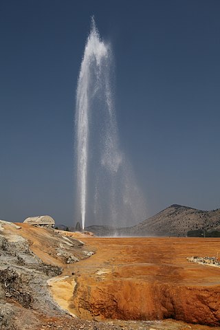
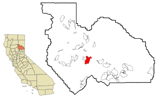
Soda Springs is a city in Caribou County, Idaho, United States. Its population was 3,133 at the time of the 2020 census. The city has been the county seat of Caribou County since the county was organized in 1919. In the 1860s, Soda Springs served as the seat of Oneida County.

<span class="mw-page-title-main">Rock Falls, Iowa</span> City in Iowa, United States

Rock Falls is a city in Cerro Gordo County, Iowa, United States, along the Shell Rock River. The population was 150 at the time of the 2020 census. It is part of the Mason City Micropolitan Statistical Area.

<span class="mw-page-title-main">Spring Hill, Iowa</span> City in Iowa, United States

Spring Hill is a city in Warren County, Iowa, United States. The population was 68 at the time of the 2020 census. It is part of the Des Moines–West Des Moines Metropolitan Statistical Area.

<span class="mw-page-title-main">Spring Mill, Kentucky</span> City in Kentucky, United States

Spring Mill is a home rule-class city in Jefferson County, Kentucky, United States. The population was 287 at the 2010 census, down from 380 at the 2000 census.

<span class="mw-page-title-main">Tonka Bay, Minnesota</span> City in Minnesota, United States

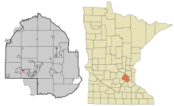
Tonka Bay is a city in Hennepin County, Minnesota, United States. It is located on Lake Minnetonka between the upper and lower lakes. It gained some popularity in the 1880s and 1890s as a summer lake resort. The population of Tonka Bay was 1,475 at the 2010 census.

<span class="mw-page-title-main">Urbank, Minnesota</span> City in Minnesota, United States

Urbank is a city in Otter Tail County, Minnesota, United States. The population was 52 at the 2020 census.

<span class="mw-page-title-main">Pine Springs, Minnesota</span> City in Minnesota, United States

Pine Springs is a city in Washington County, Minnesota, United States. The population was 408 at the 2010 census.

<span class="mw-page-title-main">Crystal Lakes, Missouri</span> City in Missouri, United States

Crystal Lakes is a city in western Ray County, Missouri, and part of the Kansas City metropolitan area within the United States. The population was 390 at the 2020 census.

<span class="mw-page-title-main">Blue Springs, Nebraska</span> City in Nebraska, United States

Blue Springs is a city in Gage County, Nebraska, United States. The population was 282 at the 2020 census.

<span class="mw-page-title-main">Spring Hill, Minnesota</span> City in Minnesota, United States

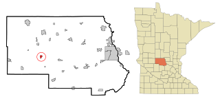
Spring Hill is a city in Stearns County, Minnesota, United States. The population was 85 at the 2010 census. It is part of the St. Cloud Metropolitan Statistical Area.

<span class="mw-page-title-main">Reeds Spring, Missouri</span> City in Missouri, United States

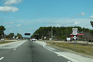
Reeds Spring is a city in Stone County, Missouri, United States. The population was 1,136 at the 2020 census.

<span class="mw-page-title-main">Kings Grant, North Carolina</span> CDP in North Carolina, United States

Kings Grant is a census-designated place (CDP) in New Hanover County, North Carolina, United States. The population was 8,113 at the 2010 census, up from 7,738 in 2000. It is part of the Wilmington Metropolitan Statistical Area.

<span class="mw-page-title-main">Sodaville, Oregon</span> City in Oregon, United States

Sodaville is a city in Linn County, Oregon, United States. The population was 308 at the 2010 census.

<span class="mw-page-title-main">West Leechburg, Pennsylvania</span> Borough in Pennsylvania, United States

West Leechburg is a borough in Westmoreland County, Pennsylvania, United States, along the Kiskiminetas River. The population was 1,294 at the 2010 census.

<span class="mw-page-title-main">Glenville, West Virginia</span> Town in West Virginia, United States

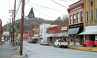
Glenville is a town in and the county seat of Gilmer County, West Virginia, United States, along the Little Kanawha River. The population was 1,128 at the 2020 census. It is the home of Glenville State University.

<span class="mw-page-title-main">Osseo, Wisconsin</span> City in Wisconsin, United States

Osseo is a city located in Trempealeau County, Wisconsin, at the confluence of the North and South Forks of the Buffalo River. The population was 1,701 at the 2010 census.

<span class="mw-page-title-main">Spring Lake Park, Minnesota</span> City in Minnesota, United States

Spring Lake Park is a city in Anoka and Ramsey counties in the state of Minnesota. The population was 6,412 at the 2010 census. The city is located mainly within Anoka County. Minnesota State Highways 47 and 65 and County Highway 10 are three of the main routes in the city.

References

  1. "2020 U.S. Gazetteer Files". United States Census Bureau. Retrieved July 24, 2022.
  2. "Spring Park MN ZIP Code". zipdatamaps.com. 2024. Retrieved February 5, 2024.
  3. "2010 Census Redistricting Data (Public Law 94-171) Summary File". American FactFinder. U.S. Census Bureau, 2010 Census. Retrieved April 23, 2011.[ dead link ]
  4. "Our Fair City welcomes you!". www.ci.spring-park.mn.us. Retrieved December 6, 2021.
  5. Patriot, Sun. "Lake Minnetonka history: A look at the Del Otero Hotel". hometownsource.com. Retrieved December 6, 2021.
  6. "US Gazetteer files 2010". United States Census Bureau. Archived from the original on January 25, 2012. Retrieved November 13, 2012.
  7. "U.S. Census website". United States Census Bureau . Retrieved November 13, 2012.
  8. "U.S. Census website". United States Census Bureau . Retrieved January 31, 2008.

44°56′07″N93°37′56″W / 44.93528°N 93.63222°W / 44.93528; -93.63222