Related Research Articles

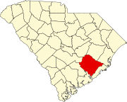
Berkeley County is a county in the U.S. state of South Carolina. As of the 2020 census, its population was 229,861. Its county seat is Moncks Corner, and the largest community is Goose Creek. After two previous incarnations of Berkeley County, the current county was created in 1882. Berkeley County is included in the Charleston-North Charleston, SC Metropolitan Statistical Area.

Shelby Charter Township, officially the Charter Township of Shelby, is a charter township located in Macomb County in the U.S. state of Michigan. The township is an affluent northern suburb of Detroit. As of the 2020 census, the population was 79,408, up from 73,804 in 2010. Shelby Charter Township is one of the fastest-growing communities in Metro Detroit.

Mount Pleasant is a large suburban town in Charleston County, South Carolina, United States. In the Lowcountry, it is the fourth-most populous municipality in South Carolina, and for several years was one of the state's fastest-growing areas, doubling in population between 1990 and 2000. The population was 90,801 at the 2020 census. It is part of the Charleston metropolitan area.

Eutawville is a town in Orangeburg County, South Carolina, United States. Prior to 1910, Eutawville was located in the northwest portion of Saint James Goose Creek Township, Berkeley County. The population was 315 at the 2010 census.

Holly Hill is a town in Orangeburg County, South Carolina, United States. The population was 1,277 at the 2010 census.. Prior to 1910 it was located in the northwest portion of Saint James Goose Creek Township.
Medway is a conurbation and unitary authority in Kent, South East England.

Goose Creek is the most populous city in Berkeley County in the U.S. state of South Carolina. The population was 45,946 at the 2020 census, making it the 7th-most populous city in the state. Most of the Naval Weapons Station Charleston is in Goose Creek. As defined by the U.S. Office of Management and Budget, and used only by the U.S. Census Bureau and other federal agencies for statistical purposes, Goose Creek is included within the Charleston-North Charleston, SC Metropolitan Statistical Area.
Ladson is a census-designated place (CDP) in Berkeley, Charleston and Dorchester counties in the U.S. state of South Carolina. The population was 13,790 at the 2010 census. It is named in honor of the Ladson family, one of the oldest planter and merchant families in the Charleston area; one of its members was lieutenant governor James Ladson.
Stratford High School is a public high school located in Goose Creek, South Carolina. It serves grades 9–12 and is a part of the Berkeley County School District. The school was originally built in 1981, and opened in 1983 with approximately 1100 students. An addition was added in 1998 to increase the physical capacity to 1600 students. The high school now serves over 1800 students who are housed in 113 classrooms in the main building and 16 portable classrooms outside the main building.
Goose Creek High School is a public high school located in Goose Creek, South Carolina, United States. It is a part of the Berkeley County School District.

Medway or the Medway Plantation is a plantation in Mount Holly, South Carolina within Berkeley County, South Carolina. It is about 2 mi (3.2 km) east of U.S. Route 52 from the unincorporated community of Mount Holly, which is directly north of Goose Creek, South Carolina. It was named to the National Register of Historic Places on July 16, 1970.
Thomas Porcher Stoney was the fifty-third mayor of Charleston, South Carolina, serving between 1923 and 1931.
Daisy Swamp is a swamp in Berkeley County, South Carolina, in the United States.
Strawberry is an unincorporated community in Berkeley County, in the U.S. state of South Carolina.
Chicken Creek is a stream in Berkeley County, South Carolina, in the United States.
Carlos is an unincorporated community in Washington Township, Randolph County, in the U.S. state of Indiana.
Potato Creek is a stream in the U.S. state of South Dakota. It is a tributary of the White River.
Goffs is an unincorporated community in Ritchie County, in the U.S. state of West Virginia.
References
- ↑ U.S. Geological Survey Geographic Names Information System: Mount Holly, South Carolina
- ↑ "Berkeley County". Jim Forte Postal History. Retrieved March 6, 2015.
- ↑ Heitzler, Michael James (2005). Goose Creek, South Carolina: A Definitive History 1670-2003. The History Press. p. 25. ISBN 978-1-59629-055-6.
- ↑ "Medway, Berkeley County (off U.S. Hwy. 52, Mount Holly vicinity)". National Register Properties in South Carolina. South Carolina Department of Archives and History. Retrieved 8 April 2009.
