Moyer Township, Swift County, Minnesota

Last updated

Moyer Township, Minnesota
USA Minnesota location map.svg
Red pog.svg
Moyer Township, Minnesota
Location within the state of Minnesota
Usa edcp location map.svg
Red pog.svg
Moyer Township, Minnesota
Moyer Township, Minnesota (the United States)
Coordinates: 45°17′24″N95°55′21″W / 45.29000°N 95.92250°W / 45.29000; -95.92250
Country United States
State Minnesota
County Swift
Area
  Total34.8 sq mi (90.1 km2)
  Land34.8 sq mi (90.1 km2)
  Water0.0 sq mi (0.0 km2)
Elevation
1,060 ft (323 m)
Population
 (2000)
  Total125
  Density3.6/sq mi (1.4/km2)
Time zone UTC-6 (Central (CST))
  Summer (DST) UTC-5 (CDT)
FIPS code 27-44674 [1]
GNIS feature ID0665059 [2]

Moyer Township is a township in Swift County, Minnesota, United States. The population was 125 at the 2000 census.

Contents

Moyer Township was organized in 1879, and named for William Moyer, a pioneer settler. [3]

Geography

According to the United States Census Bureau, the township has a total area of 34.8 square miles (90.1 km2), of which 34.8 square miles (90.1 km2) is land and 0.03% is water.

Demographics

As of the census [1] of 2000, there were 125 people, 46 households, and 37 families residing in the township. The population density was 3.6 people per square mile (1.4/km2). There were 53 housing units at an average density of 1.5/sq mi (0.6/km2). The racial makeup of the township was 94.40% White, 4.00% Asian, 0.80% from other races, and 0.80% from two or more races. Hispanic or Latino of any race were 0.80% of the population.

There were 46 households, out of which 32.6% had children under the age of 18 living with them, 71.7% were married couples living together, 8.7% had a female householder with no husband present, and 17.4% were non-families. 17.4% of all households were made up of individuals, and 4.3% had someone living alone who was 65 years of age or older. The average household size was 2.72 and the average family size was 3.05.

In the township the population was spread out, with 27.2% under the age of 18, 3.2% from 18 to 24, 28.8% from 25 to 44, 23.2% from 45 to 64, and 17.6% who were 65 years of age or older. The median age was 40 years. For every 100 females, there were 108.3 males. For every 100 females age 18 and over, there were 116.7 males.

The median income for a household in the township was $41,250, and the median income for a family was $43,125. Males had a median income of $25,625 versus $20,833 for females. The per capita income for the township was $16,497. There were 11.4% of families and 7.3% of the population living below the poverty line, including no under eighteens and 16.0% of those over 64.

Related Research Articles

Kragero Township is a township in Chippewa County, Minnesota, United States. The population was 164 at the 2000 census.

Mandt Township is a township in Chippewa County, Minnesota, United States. The population was 175 at the 2000 census.

Humboldt Township is a township in Clay County, Minnesota, United States. The population was 239 at the 2000 census.

Foster Township is a township in Faribault County, Minnesota, United States. The population was 314 at the 2000 census.

Brownsville Township is a township in Houston County, Minnesota, United States. The population was 462 at the 2000 census.

<span class="mw-page-title-main">Drammen Township, Lincoln County, Minnesota</span> Township in Minnesota, United States

Drammen Township is a township in Lincoln County, Minnesota, United States. The population was 141 at the 2000 census.

Bejou Township is a township in Mahnomen County, Minnesota, United States. The population was 98 at the 2000 census.

Big Woods Township is a township in Marshall County, Minnesota, United States. The population was 79 at the 2000 census.

Clover Township is a township in Pine County, Minnesota, United States. The population was 316 at the 2000 census.

Munch Township is a township in Pine County, Minnesota, United States. The population was 222 at the 2000 census.

Angus Township is a township in Polk County, Minnesota, United States. It is part of the Grand Forks-ND-MN Metropolitan Statistical Area. The population was 112 at the 2000 census.

<span class="mw-page-title-main">Roome Township, Polk County, Minnesota</span> Township in Minnesota, United States

Roome Township is a township in Polk County, Minnesota, United States. It is part of the Grand Forks-ND-MN Metropolitan Statistical Area. The population of the township was 185 at the 2000 census. The unincorporated community of Eldred is located within Roome Township.

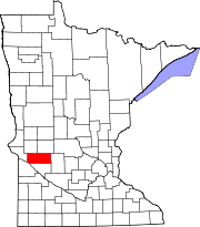
Winfield Township is a township in Renville County, Minnesota, United States. The population was 252 at the 2000 census.

Cedarbend Township is a township in Roseau County, Minnesota, United States. The population was 230 as per the 2000 census.

Pohlitz Township is a township in Roseau County, Minnesota, United States. The population was 36 at the 2000 census.

Grove Township is a township in Stearns County, Minnesota, United States. The population was 493 at the 2010 census. The township includes the southern one-third of the City of Melrose and the City of Greenwald.

St. Wendel Township is a township in Stearns County, Minnesota, United States. The population was 2,150 at the 2010 census.

Bullard Township is a township in Wadena County, Minnesota, United States. The population was 207 at the 2000 census.

Mount Vernon Township is a township in Winona County, Minnesota, United States. The population was 273 at the 2010 census.

Barto Township is a township in Roseau County, Minnesota, United States. The population was 142 at the 2000 census.

References

  1. 1 2 "U.S. Census website". United States Census Bureau . Retrieved January 31, 2008.
  2. "US Board on Geographic Names". United States Geological Survey. October 25, 2007. Retrieved January 31, 2008.
  3. Upham, Warren (1920). Minnesota Geographic Names: Their Origin and Historic Significance. Minnesota Historical Society. p.  541.