
Rhondda Cynon Taf is a county borough in the south-east of Wales. It consists of five valleys: the Rhondda Fawr, Rhondda Fach, Cynon, Taff and Ely valleys, plus a number of towns and villages away from the valleys.
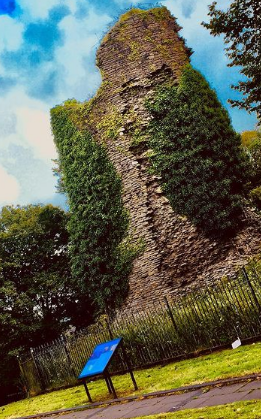
Llantrisant is a town in the county borough of Rhondda Cynon Taf, within the historic county boundaries of Glamorgan, Wales, lying on the River Ely and the Afon Clun. The three saints of the town's name are SS. Illtyd, Gwynno, and Dyfodwg. Llantrisant is a hilltop settlement, at an altitude of 174 m (571 ft) above sea level. The town is home to the Royal Mint.

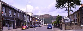
Llwynypia is a village and community in Rhondda Cynon Taf, Wales, near Tonypandy in the Rhondda Fawr Valley. Before 1850 a lightly populated rural farming area, Llwynypia experienced a population boom between 1860 and 1920 with the sinking of several coal mines after the discovery of large coal deposits throughout the Rhondda Valleys.

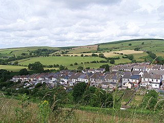
Ynyshir is a village and community located in the Rhondda Valley, within Rhondda Cynon Taf, South Wales. The name of the village means "long island" in Welsh and takes its name from a farm in the area, falling within the historic parishes of Ystradyfodwg and Llanwynno (Llanwonno). The community of Ynyshir lies between the small adjoining village of Wattstown and the larger town of neighbouring Porth.

Ogmore is a constituency created in 1918 represented in the House of Commons of the UK Parliament by Chris Elmore of the Labour Party.

Taff-Ely was a local government district with borough status in Wales from 1974 to 1996.
Treherbert is a village and community situated at the head of the Rhondda Fawr valley in the county borough of Rhondda Cynon Taf, Wales. Historically part of Glamorgan, Treherbert is a former industrial coal mining village which was at its economic peak between 1850 and 1920. Treherbert is the upper most community of the Rhondda Fawr and encompasses the districts of Blaencwm, Blaenrhondda, Tynewydd and Pen-yr-englyn.

Tonyrefail is a village and community in the Rhondda Cynon Taf County Borough, Wales. It is situated at the head of the River Ely; 4 miles (6.4 km) northwest of Llantrisant, about 1.5 miles (2.4 km) from Trebanog and about 2 miles (3.2 km) from Williamstown. During the second half of the 19th century, when coal and steel became synonymous with the South Wales Valleys, Tonyrefail evolved from being a rural hamlet to an industrial village. The population at the 2001 census was 11,035.

Glyncorrwg is a village in the Afan Valley, in southern Wales.

Mynydd y Betws is a mountain or large hill located on the northern side of the border between Swansea and Carmarthenshire in South Wales, between Ammanford and Clydach. It is an area of upland with large stretches of tussocky grassland. The medieval castle of Penlle'r Castell is located on Mynydd y Gwair to the south-south west, Mynydd y Betws Wind Farm is prominent with fifteen 110 m (361 ft) wind turbines.
Ogmore is a constituency of the Senedd. It elects one Member of the Senedd by the first past the post method of election. It is one of seven constituencies in the South Wales West electoral region, which also elects four additional members, to produce a degree of proportional representation for the region as a whole.
Gilfach Goch is a community, electoral ward and small former coal mining village mostly in the Borough of Rhondda Cynon Taf, south Wales, near the larger community of Tonyrefail. Some areas in the North Western part of the village lie within Bridgend County Borough. It is situated in the Cwm Ogwr Fach between the Cwm Ogwr Fawr to the west and the Cwm Rhondda to the east.

Gelli is a village in the Rhondda Fawr valley, in the county borough of Rhondda Cynon Taff, Wales, situated on the southern bank of the Rhondda Fawr River. Gelli is a former coal mining village which is a district of the community of Ystrad.

The Afon Clun is a 14-mile (23 km) long tributary of the River Ely, in the counties of Cardiff and Rhondda Cynon Taf, Wales. Its bedrock is predominantly of sandstone. Beginning on the western slope of The Garth the river is fast-flowing, in clear shallow water with a hard substrate, flowing to the south of Llantrisant and generally west to its confluence with the River Ely at Pontyclun, falling 715 feet (218 m) over its course.

Mynydd Merthyr is a broad ridge of high ground between Taff Vale and the Cwm Cynon in the Valleys region of South Wales. It forms the boundary between the unitary authorities of Rhondda Cynon Taff to the west and Merthyr Tydfil to the east.

Mynydd Cilfach-yr-encil attains a height of 445m at OS grid reference SO 079033 making it the high point of the broad ridge of high ground between Taff Vale and Cwm Bargod in the Valleys region of South Wales. It lies within the County Borough of Merthyr Tydfil.

Mynydd William Meyrick is a 535-metre-high hill straddling the boundary of Bridgend and Rhondda Cynon Taf county boroughs between the valley of the Rhondda Fawr and Ogmore Valley in South Wales. It takes the form of a broad northwest-southeast ridge with numerous broad shoulders extending to the east, south and west, each of which have different names and some of which constitute minor tops. Listed clockwise from the north these are; Mynydd Maendy, Mynydd Ton, Mynydd Bwllfa, Mynydd Pwllyrhebog, Mynydd Maes-teg, Mynydd y Gwair and Mynydd yr Aber. The summit of the entire massif is often referred to as Mynydd Ton. Its western sides are open moorland whilst its eastern sides have been afforested by the Forestry Commission.
