Nassau Village-Ratliff, Florida

Last updated

Nassau Village-Ratliff, Florida
CDP
Nassau County Florida Incorporated and Unincorporated areas Nassau Village-Ratliff Highlighted.svg
Location in Nassau County and the state of Florida
Coordinates: 30°31′10″N81°47′50″W / 30.51944°N 81.79722°W / 30.51944; -81.79722
Country Flag of the United States.svg  United States
State Flag of Florida.svg  Florida
County   Nassau
Area
[1]
  Total14.67 sq mi (37.98 km2)
  Land14.67 sq mi (37.98 km2)
  Water0.00 sq mi (0.00 km2)
Population
 (2020)
  Total5,561
  Density379.18/sq mi (146.40/km2)
Time zone UTC-5 (Eastern (EST))
  Summer (DST) UTC-4 (EDT)
FIPS code 12-47787 [2]

Nassau Village-Ratliff is a census-designated place (CDP) in Nassau County, Florida, United States. The population was 5,561 at the 2020 census, up from 5,337 at the 2010 census. It is part of the Jacksonville, Florida Metropolitan Statistical Area.

Contents

Geography

Nassau Village-Ratliff is located at 30°31′10″N81°47′50″W / 30.51944°N 81.79722°W / 30.51944; -81.79722 (30.519362, -81.797327). [3] The main roads through the community are U.S. Routes 1 and 23, though Florida State Road 115 runs through the northeastern edge of the community. The southwestern side is bordered along Thomas Creek Road and the Norfolk Southern Railway Valdosta District.

According to the United States Census Bureau, the CDP has a total area of 14.8 square miles (38.4 km2), all land.

Demographics

Historical population
CensusPop.Note
1990 4,047
2000 4,66715.3%
2010 5,33714.4%
2020 5,5614.2%
U.S. Decennial Census [4]

As of the census [2] of 2000, there were 4,667 people, 1,640 households, and 1,353 families residing in the CDP. The population density was 315.1 inhabitants per square mile (121.7/km2). There were 1,708 housing units at an average density of 115.3 per square mile (44.5/km2). The racial makeup of the CDP was 97.45% White, 0.39% African American, 0.56% Native American, 0.28% Asian, 0.15% from other races, and 1.18% from two or more races. Hispanic or Latino of any race were 0.96% of the population.

There were 1,640 households, out of which 38.3% had children under the age of 18 living with them, 68.0% were married couples living together, 8.5% had a female householder with no husband present, and 17.5% were non-families. 13.8% of all households were made up of individuals, and 5.7% had someone living alone who was 65 years of age or older. The average household size was 2.85 and the average family size was 3.11.

In the CDP, the population was spread out, with 27.0% under the age of 18, 8.1% from 18 to 24, 29.9% from 25 to 44, 25.2% from 45 to 64, and 9.8% who were 65 years of age or older. The median age was 36 years. For every 100 females, there were 100.6 males. For every 100 females age 18 and over, there were 98.1 males.

The median income for a household in the CDP was $43,442, and the median income for a family was $46,857. Males had a median income of $35,340 versus $24,924 for females. The per capita income for the CDP was $17,410. About 5.5% of families and 6.8% of the population were below the poverty line, including 7.4% of those under age 18 and 10.8% of those age 65 or over.

Related Research Articles

<span class="mw-page-title-main">Buckingham, Florida</span> Census-designated place in Florida, United States

Buckingham is an unincorporated community and census-designated place (CDP) in Lee County, Florida, United States. The population was 4,443 at the 2020 census, up from 4,036 at the 2010 census. It is part of the Cape Coral-Fort Myers, Florida Metropolitan Statistical Area.

<span class="mw-page-title-main">Lochmoor Waterway Estates, Florida</span> Census-designated place in Florida, United States

Lochmoor Waterway Estates is an unincorporated community and census-designated place (CDP) in Lee County, Florida, United States. The population was 5,828 at the 2020 census, up from 4,204 at the 2010 census. It is part of the Cape Coral-Fort Myers, Florida Metropolitan Statistical Area.

<span class="mw-page-title-main">Tice, Florida</span> Census-designated place in Florida, United States

Tice is an unincorporated community and census-designated place (CDP) in Lee County, Florida, United States. As of the 2020 census, the CDP population was 4,853. It is part of the Cape Coral-Fort Myers, Florida Metropolitan Statistical Area.

<span class="mw-page-title-main">Villas, Florida</span> Census-designated place in Florida, United States

Villas, Florida is an unincorporated community and census-designated place (CDP) in Lee County, Florida, United States. The population was 12,687 at the 2020 census, up from 11,569 at the 2010 census. It is part of the Cape Coral-Fort Myers, Florida Metropolitan Statistical Area.

<span class="mw-page-title-main">Conway, Florida</span> Census-designated place in Florida, United States

Conway is a census-designated place and an unincorporated area in Orange County, Florida, United States. The population was 13,467 at the 2010 census. It is part of the Orlando–Kissimmee–Sanford, Florida Metropolitan Statistical Area.

<span class="mw-page-title-main">Fairview Shores, Florida</span> Census-designated place in Florida, United States

Fairview Shores is a census-designated place and an unincorporated area in Orange County, Florida, United States. The population was 10,239 at the 2010 census. It is part of the Orlando–Kissimmee–Sanford, Florida Metropolitan Statistical Area.

<span class="mw-page-title-main">Holden Heights, Florida</span> Census-designated place in Florida, United States

Holden Lakes is a census-designated place and unincorporated area in Orange County, Florida, United States. The population was 3,679 at the 2010 census. The ZIP code serving the CDP is 32839. It is part of the Orlando–Kissimmee Metropolitan Statistical Area.

<span class="mw-page-title-main">Lockhart, Florida</span> Census-designated place in Florida, United States

Lockhart is a census-designated place in Orange County, Florida, United States. The population was 13,060 at the 2010 census. It is part of the Orlando–Kissimmee–Sanford, Florida Metropolitan Statistical Area. The community is named for David Lockhart.

<span class="mw-page-title-main">Oak Ridge, Florida</span> Census-designated place in Florida, United States

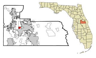
Oak Ridge is a census-designated place and unincorporated area in Orange County, Florida, United States. The population was 22,685 at the 2010 census. It is part of the Orlando–Kissimmee–Sanford, Florida Metropolitan Statistical Area.

<span class="mw-page-title-main">Orlo Vista, Florida</span> Census-designated place & Unincorporated community in Florida, United States

Orlo Vista is an unincorporated community and census-designated place in Orange County, Florida, United States. While the spelling "Orlo Vista" is used by the U.S. Postal Service, the community is shown as Orlovista on federal maps. The population of the Orlovista census-designated place was 6,123 at the 2010 census. It is part of the Orlando–Kissimmee Metropolitan Statistical Area. The boundaries of the Orlovista CDP are West Colonial Drive on the north, Pine Hills Road on the east, Old Winter Garden Road and Carter Street at the Orlando city limits on the south, and Hiawassee Road on the west.

<span class="mw-page-title-main">Sky Lake, Florida</span> Census-designated place in Florida, United States

Sky Lake is a census-designated place (CDP) and an unincorporated area in Orange County, Florida, United States. The population was 6,153 at the 2010 census. It is part of the Orlando-Kissimmee, Florida Metropolitan Statistical Area.

<span class="mw-page-title-main">South Apopka, Florida</span> Census-designated place in Florida, United States

South Apopka is a census-designated place and an unincorporated area in Orange County, Florida, United States. Per the 2020 census, the population was 6,803. It is part of the Orlando–Kissimmee Metropolitan Statistical Area.

<span class="mw-page-title-main">Southchase, Florida</span> Census-designated place in Florida, United States

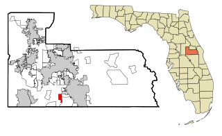
Southchase is a census-designated place and an unincorporated area in Orange County, Florida, United States. The population was 15,921 at the 2010 census. It is part of the Orlando–Kissimmee–Sanford, Florida Metropolitan Statistical Area.

<span class="mw-page-title-main">Taft, Florida</span> Census-designated place in Florida, United States

Taft is a census-designated place and an unincorporated area in Orange County, Florida, United States. The population was 2,205 at the 2010 census. It is part of the Orlando–Kissimmee Metropolitan Statistical Area.

<span class="mw-page-title-main">Zellwood, Florida</span> Census-designated place in Florida, United States

Zellwood is a census-designated place and an unincorporated area in Orange County, Florida, United States. The population was 2,817 at the 2010 census. It is part of the Orlando–Kissimmee Metropolitan Statistical Area.

<span class="mw-page-title-main">East Palatka, Florida</span> CDP in Florida, United States

East Palatka is a census-designated place (CDP) in Putnam County, Florida, United States. It is located on the east side of the City of Palatka at the intersection of U.S. Route 17/State Road 20/State Road 100 and the southwestern terminus of State Road 207. The population was 1,573 at the 2020 census, down from 1,654 at the 2010 census. It is part of the Palatka, Florida Micropolitan Statistical Area.

<span class="mw-page-title-main">Samsula-Spruce Creek, Florida</span> CDP in Florida, United States

Samsula-Spruce Creek is a census-designated place (CDP) in Volusia County, Florida, United States. The population was 5,047 at the 2010 census. While many households reside here, it is principally an agricultural area west of the cities of Port Orange and New Smyrna Beach.

<span class="mw-page-title-main">Selby-on-the-Bay, Maryland</span> Former census-designated place in Maryland, United States

Selby-on-the-Bay is a census-designated place (CDP) in Anne Arundel County, Maryland, United States, for the 2000 census, at which time its population was 3,674. It was added to the Mayo CDP for the 2010 census.

<span class="mw-page-title-main">South Miami Heights, Florida</span> Census-designated place in Florida

South Miami Heights is a census-designated place (CDP), originally known as Eureka, in Miami-Dade County, Florida. It is part of the Miami metropolitan area of South Florida. The population was 36,770 as of the 2020 census.

<span class="mw-page-title-main">North Lynbrook, New York</span> Hamlet and census-designated place in New York, United States

North Lynbrook is a hamlet and census-designated place (CDP) in the Town of Hempstead in Nassau County, on Long Island, in New York, United States. The population was 747 at the 2020 census.

References

  1. "2020 U.S. Gazetteer Files". United States Census Bureau. Retrieved October 31, 2021.
  2. 1 2 "U.S. Census website". United States Census Bureau . Retrieved January 31, 2008.
  3. "US Gazetteer files: 2010, 2000, and 1990". United States Census Bureau. February 12, 2011. Retrieved April 23, 2011.
  4. "Census of Population and Housing". Census.gov. Retrieved June 4, 2016.