This is a list of the National Register of Historic Places listings in Chisago County, Minnesota. It is intended to be a complete list of the properties and districts on the National Register of Historic Places in Chisago County, Minnesota, United States. The locations of National Register properties and districts for which the latitude and longitude coordinates are included below, may be seen in an online map.
There are 18 properties and districts listed on the National Register in the county. A supplementary list includes three additional sites that were formerly listed on the National Register.
This National Park Service list is complete through NPS recent listings posted March 4, 2022. [1]
Chisago County's National Register properties reflect its role as an early focus of Euro-American settlement in Minnesota and its evolving land use. An intensive logging industry beginning in the 1830s gave way to agriculture, spurred by railroad access and increased European immigration—particularly Swedish immigration—by the 1870s. Several properties reflect the prosperity achieved by several individuals of this period in the county's booming trackside towns. Around the beginning of the 20th century, Chisago County developed a modest resort and tourism industry. [2]
[3] | Name on the Register | Image | Date listed [4] | Location | City or town | Description |
---|---|---|---|---|---|---|
1 | Gustaf Anderson House | July 21, 1980 (#80002000) | 13045 Lake Boulevard 45°23′24″N92°50′33″W / 45.389968°N 92.842621°W | Lindström | 1879 brick Italianate house of a notable settler and land speculator. [5] Now a Chisago County Historical Society museum. [6] | |
2 | Angel's Hill Historic District | April 11, 1972 (#72000675) | Roughly bounded by Military Rd. and Mill, Mulberry, and Government Sts. 45°24′01″N92°39′18″W / 45.400379°N 92.655129°W | Taylors Falls | Architecturally cohesive mid-19th-century neighborhood of New England-style Greek Revival buildings, [7] with 28 contributing properties including the 1854 Folsom House. [8] | |
3 | Archeological Site No. 21CH23 | January 16, 1989 (#88003129) | Address restricted [9] | Taylors Falls | Shell midden accumulated from 600 to 1499 CE with very few artifacts, indicating a briefly but repeatedly used site for harvesting mussels that could illuminate Woodland period subistence and settlement patterns. [10] | |
4 | J.C. Carlson House | July 21, 1980 (#80002004) | 640 Bremer Ave., S. 45°40′59″N92°57′41″W / 45.682936°N 92.961324°W | Rush City | 1899 Queen Anne house designed by Augustus F. Gauger for the leading entrepreneur of Chisago County's leading railroad town. [11] | |
5 | Center City Historic District | July 21, 1980 (#80001996) | Summit Ave. 45°23′39″N92°49′00″W / 45.394167°N 92.816667°W | Center City | Chisago County's best-preserved late-19th/early-20th-century residential district, whose 19 houses and one church also reflect the area's Swedish Lutheran heritage. [12] | |
6 | John Daubney House | July 21, 1980 (#80002008) | 767 River St. 45°24′35″N92°39′02″W / 45.409586°N 92.65059°W | Taylors Falls | c. 1870 Italianate house purchased by a prominent early settler for his retirement in 1893. [13] | |
7 | Franconia Historic District | June 17, 1980 (#80000406) | Roughly Cornelian, Summer, and Henry Sts. 45°22′11″N92°41′36″W / 45.369725°N 92.693346°W | Franconia | Community of seven houses built 1850s–1880s embodying pioneer settlement on the St. Croix River. [14] | |
8 | Grant House | July 21, 1980 (#80002005) | 4th St. and Bremer 45°41′05″N92°57′43″W / 45.684599°N 92.961958°W | Rush City | Longstanding hotel built in 1896 during Rush City's peak as a stop on the St. Paul and Duluth Railroad. [15] | |
9 | Interstate State Park CCC/WPA/Rustic Style Campground | June 11, 1992 (#92000638) | Off U.S. Route 8 45°23′33″N92°40′08″W / 45.3925°N 92.668889°W | Taylors Falls vicinity | Six park structures built 1938–1941 significant as examples of New Deal federal work relief, early state park development, National Park Service rustic design, and landscape architecture. [16] | |
10 | Interstate State Park WPA/Rustic Style Historic District | June 11, 1992 (#89001664) | Off U.S. Route 8 45°24′00″N92°39′04″W / 45.400004°N 92.651205°W | Taylors Falls vicinity | Six park structures built 1920–1939 significant as examples of New Deal federal work relief, early state park development, National Park Service rustic design, and landscape architecture. [17] | |
11 | Frank A. Larson House | July 21, 1980 (#80002001) | 12625 Newell Ave. 45°23′18″N92°51′02″W / 45.388274°N 92.850571°W | Lindström | c. 1898 summer home noted for its association with the local resort and tourism industry and its especially picturesque design. [18] | |
12 | Moody Barn | July 21, 1980 (#80001998) | County Highway 24 45°18′07″N92°52′15″W / 45.301826°N 92.870768°W | Chisago Lake Township | 1915 round barn, prominent symbol of Chisago County's early-20th-century dairy farming industry. [19] Now a Chisago County Historical Society property. [20] | |
13 | Paul Munch House | May 4, 1976 (#76001050) | Summer St. 45°22′16″N92°41′39″W / 45.371134°N 92.694047°W | Franconia | Rare Minnesota example, built c. 1855, of an affluent, late Greek Revival-style house. [21] Also a contributing property to the Franconia Historic District. [22] | |
14 | Munch-Roos House | November 20, 1970 (#70000289) | 360 Bench St. [now 190 2nd St.] 45°24′13″N92°39′08″W / 45.403524°N 92.6521°W | Taylors Falls | Rare intact example, built 1853, of the modest Greek Revival houses once common in Minnesota Territory. [23] | |
15 | Point Douglas to Superior Military Road: Deer Creek Section | February 7, 1991 (#90002200) | Off County Highway 16 45°30′22″N92°43′04″W / 45.505986°N 92.717743°W | Amador Township | 1853 section of the Point Douglas to Superior Military Road, some of the first transportation infrastructure in Minnesota. Now part of Wild River State Park's trail system. [24] [25] | |
16 | Sayer House | July 21, 1980 (#80002002) | County Highways 9 and 30 45°35′09″N92°58′27″W / 45.585833°N 92.974167°W | Harris | Large Italianate house/inn built c. 1875, dating to a period of land speculation as Chisago County was settled. [26] Also known as the George Flanders House. [27] | |
17 | Taylors Falls Public Library | October 15, 1970 (#70000290) | 473 Bench St. 45°24′14″N92°39′10″W / 45.40397°N 92.652815°W | Taylors Falls | Example of an early small-town library as well as Carpenter Gothic and Stick style architecture, stemming from an 1887 conversion of an 1854 building. [28] | |
18 | Charles A. Victor House | July 21, 1980 (#80002003) | 30495 Park St. 45°23′21″N92°50′53″W / 45.38929°N 92.848004°W | Lindström | c. 1905 house of one of the entrepreneurs who helped develop their respective Chisago County towns. [29] |
[3] | Name on the Register | Image | Date listed | Date removed | Location | City or town | Description |
---|---|---|---|---|---|---|---|
1 | Aaron Diffenbacher Farmhouse | July 21, 1980 (#80002007) | June 22, 1998 | County Highway 5 | Rushseba Township | Greek Revival farmhouse built c. 1868. Burned down by an accidental fire on April 3, 1985. [30] | |
2 | Chisago County Courthouse | July 21, 1980 (#80001997) | September 17, 1990 | Main St. (original address) Current coordinates are 45°27′50″N92°44′33″W / 45.463936°N 92.742502°W | Center City | 1876 courthouse. [31] Moved in 1990 for a new government center; now located on the Almelund Threshing Show Grounds with other preserved buildings. [32] | |
3 | Johnson Block | July 31, 1980 (#80002006) | May 15, 1987 | 4th St. and Ave. D | Rush City | Prominent 1897 Romanesque Revival commercial building. Destroyed by a fire in 1981. [30] |
This is a list of sites in Minnesota which are included in the National Register of Historic Places. There are more than 1,700 properties and historic districts listed on the NRHP; each of Minnesota's 87 counties has at least 2 listings. Twenty-two sites are also National Historic Landmarks.
This list is of the properties and historic districts which are designated on the National Register of Historic Places or that were formerly so designated, in Hennepin County, Minnesota; there are 186 entries as of October 2021. A significant number of these properties are a result of the establishment of Fort Snelling, the development of water power at Saint Anthony Falls, and the thriving city of Minneapolis that developed around the falls. Many historic sites outside the Minneapolis city limits are associated with pioneers who established missions, farms, and schools in areas that are now suburbs in that metropolitan area.
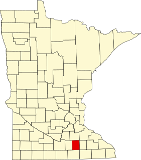
This is a list of the National Register of Historic Places listings in Scott County, Minnesota. It is intended to be a complete list of the properties and districts on the National Register of Historic Places in Scott County, Minnesota, United States. The locations of National Register properties and districts for which the latitude and longitude coordinates are included below, may be seen in an online map.
This is a list of the National Register of Historic Places listings in Rice County, Minnesota. It is intended to be a complete list of the properties and districts on the National Register of Historic Places in Rice County, Minnesota, United States. The locations of National Register properties and districts for which the latitude and longitude coordinates are included below, may be seen in an online map.
This is a list of the National Register of Historic Places listings in Carver County, Minnesota. It is intended to be a complete list of the properties and districts on the National Register of Historic Places in Carver County, Minnesota, United States. The locations of National Register properties and districts for which the latitude and longitude coordinates are included below, may be seen in an online map.
This is a list of the National Register of Historic Places listings in Goodhue County, Minnesota. It is intended to be a complete list of the properties and districts on the National Register of Historic Places in Goodhue County, Minnesota, United States. The locations of National Register properties and districts for which the latitude and longitude coordinates are included below, may be seen in an online map.
This is a list of the National Register of Historic Places listings in Saint Louis County, Minnesota. It is intended to be a complete list of the properties and districts on the National Register of Historic Places in Saint Louis County, Minnesota, United States. The locations of National Register properties and districts for which the latitude and longitude coordinates are included below, may be seen in an online map.
This is a list of the National Register of Historic Places listings in Stearns County, Minnesota. It is intended to be a complete list of the properties and districts on the National Register of Historic Places in Stearns County, Minnesota, United States. The locations of National Register properties and districts for which the latitude and longitude coordinates are included below, may be seen in an online map.
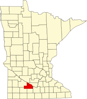
This is a list of the National Register of Historic Places listings in Brown County, Minnesota. It is intended to be a complete list of the properties and districts on the National Register of Historic Places in Brown County, Minnesota, United States. The locations of National Register properties and districts for which the latitude and longitude coordinates are included below, may be seen in an online map.
This is a list of the National Register of Historic Places listings in Crow Wing County, Minnesota. It is intended to be a complete list of the properties and districts on the National Register of Historic Places in Crow Wing County, Minnesota, United States. The locations of National Register properties and districts for which the latitude and longitude coordinates are included below, may be seen in an online map.
This is a list of the National Register of Historic Places listings in Winona County, Minnesota. It is intended to be a complete list of the properties and districts on the National Register of Historic Places in Winona County, Minnesota, United States. The locations of National Register properties and districts for which the latitude and longitude coordinates are included below, may be seen in an online map.
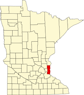
This is a list of the National Register of Historic Places listings in Le Sueur County, Minnesota. It is intended to be a complete list of the properties and districts on the National Register of Historic Places in Le Sueur County, Minnesota, United States. The locations of National Register properties and districts for which the latitude and longitude coordinates are included below, may be seen in an online map.
This is a list of the National Register of Historic Places listings in Washington County, Minnesota. It is intended to be a complete list of the properties and districts on the National Register of Historic Places in Washington County, Minnesota, United States. The locations of National Register properties and districts for which the latitude and longitude coordinates are included below, may be seen in an online map.
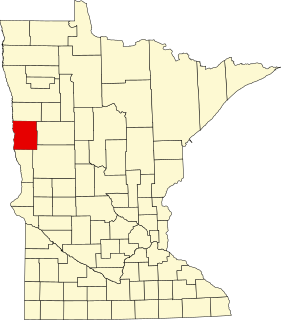
This is a list of the National Register of Historic Places listings in Clay County, Minnesota. It is intended to be a complete list of the properties and districts on the National Register of Historic Places in Clay County, Minnesota, United States. The locations of National Register properties and districts for which the latitude and longitude coordinates are included below, may be seen in an online map.
This is a list of the National Register of Historic Places listings in Pope County, Minnesota. It is intended to be a complete list of the properties and districts on the National Register of Historic Places in Pope County, Minnesota, United States. The locations of National Register properties and districts for which the latitude and longitude coordinates are included below, may be seen in an online map.
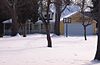
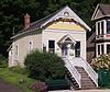
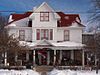
Center City Historic District is a grouping of 19 homes and one church located along the east side of Summit Avenue situated on a hill overlooking North Center Lake in Center City, Minnesota, United States. It was listed as a historic district on the National Register of Historic Places in 1980. Center City became the county seat of Chisago County in the 1870s, during a time of Swedish migration and settlement in the county. The buildings in the historic district include the Chisago Lake Evangelical Lutheran Church, which was the main Swedish Lutheran parish in the area, as well as a number of residences built between 1888 and 1910. The homes have moderate ornamentation and attention to architectural styling details of their period.
This is a list of the National Register of Historic Places listings in Steele County, Minnesota. It is intended to be a complete list of the properties and districts on the National Register of Historic Places in Steele County, Minnesota, United States. The locations of National Register properties and districts for which the latitude and longitude coordinates are included below, may be seen in an online map.
This is a list of the National Register of Historic Places listings in Beltrami County, Minnesota. This is intended to be a complete list of the properties and districts on the National Register of Historic Places in Beltrami County, Minnesota, United States. The locations of National Register properties and districts for which the latitude and longitude coordinates are included below, may be seen in an online map.
This is a list of the National Register of Historic Places listings in Isanti County, Minnesota. It is intended to be a complete list of the properties and districts on the National Register of Historic Places in Isanti County, Minnesota, United States. The locations of National Register properties and districts for which the latitude and longitude coordinates are included below, may be seen in an online map.
{{cite journal}}
: Cite journal requires |journal=
(help){{cite journal}}
: Cite journal requires |journal=
(help){{cite journal}}
: Cite journal requires |journal=
(help){{cite journal}}
: Cite journal requires |journal=
(help){{cite journal}}
: Cite journal requires |journal=
(help){{cite journal}}
: Cite journal requires |journal=
(help){{cite journal}}
: Cite journal requires |journal=
(help){{cite journal}}
: Cite journal requires |journal=
(help){{cite journal}}
: Cite journal requires |journal=
(help){{cite journal}}
: Cite journal requires |journal=
(help){{cite journal}}
: Cite journal requires |journal=
(help){{cite journal}}
: Cite journal requires |journal=
(help){{cite journal}}
: Cite journal requires |journal=
(help){{cite journal}}
: Cite journal requires |journal=
(help){{cite journal}}
: Cite journal requires |journal=
(help){{cite journal}}
: Cite journal requires |journal=
(help){{cite journal}}
: Cite journal requires |journal=
(help){{cite journal}}
: Cite journal requires |journal=
(help){{cite journal}}
: Cite journal requires |journal=
(help)Wikimedia Commons has media related to National Register of Historic Places in Chisago County, Minnesota . |