Del Aire is a census-designated place (CDP) in the inland South Bay, Los Angeles County, California, United States, between El Segundo and Hawthorne. The population was 10,001 at the 2010 census, up from 9,012 at the 2000 census.

Manhattan Beach is a city in southwestern Los Angeles County, California, United States, on the Pacific coast south of El Segundo, west of Hawthorne and Redondo Beach, and north of Hermosa Beach. As of the 2020 census, the population was 35,506.

Paramount is a city in Los Angeles County, California, United States. According to the 2010 census, the city had a total population of 54,098, down from 55,266 at the 2000 census. Paramount is part of the Greater Los Angeles Area and is bordered by Compton and Lynwood to the west, South Gate and Downey to the north, Bellflower to the east and south, and Long Beach to the south.
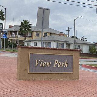
View Park−Windsor Hills is an unincorporated community in Los Angeles County, California. The View Park neighborhood is the community surrounding Angeles Vista Boulevard and the Windsor Hills neighborhood is on the southern end to the north of Slauson Avenue.

Buena Park is a city in northern Orange County, California, United States. As of the 2020 census its population was 84,034. It is the location of several tourist attractions, including Knott's Berry Farm. It is about 12 miles (20 km) northwest of downtown Santa Ana, the county seat, and is within the Los Angeles metropolitan area.

The Richmond District is a neighborhood in the northwest corner of San Francisco, California, developed initially in the late 19th century. It is sometimes confused with the city of Richmond, which is 20 miles (32 km) northeast of San Francisco.

West Hills is a suburban / residential community in the western San Fernando Valley region of the City of Los Angeles, California. The percentage of residents aged 35 and older is among the highest in Los Angeles County.
North Hills, known previously as Sepulveda, is a neighborhood in the San Fernando Valley region of Los Angeles, California.
West Los Angeles is an area within the city of Los Angeles, California, United States. The residential and commercial neighborhood is divided by the Interstate 405 freeway, and each side is sometimes treated as a distinct neighborhood, mapped differently by different sources. Each lies within the larger Westside region of Los Angeles County.

Hastings Ranch is a neighborhood of Pasadena, California which lies in northeast Pasadena. It is principally accessed by Sierra Madre Boulevard, Michillinda Avenue, Hastings Ranch Blvd., and Riviera Drive. Hastings Ranch is also identified by large shopping areas at its southernmost end and by a shopping center at the corner of Sierra Madre and Michillinda. Hastings Ranch is divided by Sierra Madre Blvd, north of the blvd is Upper Hastings Ranch and south is Lower Hastings Ranch. To the north of the Ranch is the San Gabriel Mountains and Mount Wilson.

The Harbor Gateway is a 5.14-square-mile residential and industrial area (13.3 km2) in the Los Angeles Harbor Region, in the southern part of the city. The neighborhood is narrow and long, running along a north-south axis. Its unusual shape has given it the alternative name of "the Shoestring Strip". The northern limit of the neighborhood is Imperial Highway, a city street just north of I-105.

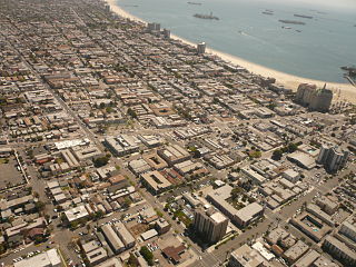
Belmont Heights is a district in the south-east portion of the city of Long Beach, California, United States, bordering the Pacific Ocean and the more commercial community of Belmont Shore. The district commemorates the old City of Belmont Heights, which was incorporated in 1908 and annexed to Long Beach in 1909. Belmont Heights' borders are Ocean Boulevard and Livingston Drive to the south, Redondo Avenue on the west, 7th Street to the North, and Nieto Avenue to the east. The area is mostly residential, but also has an active business district, the strip of Broadway east of Redondo Avenue.

California's 44th congressional district is a congressional district in the U.S. state of California. The district is centered in South Los Angeles and the Los Angeles Harbor Region. It is currently represented by Democrat Nanette Barragán. The 44th district was created as a result of the redistricting cycle after the 1980 census.
The western border of Santa Monica, California, is the 3-mile (4.8 km) stretch of Santa Monica Bay. On its other sides, the city is bordered by various districts of Los Angeles: the northwestern border is Pacific Palisades, the eastern border is Brentwood north of Wilshire Boulevard and West Los Angeles south of Wilshire, the northeastern border is generally San Vicente Boulevard up to the Riviera Country Club, the southwestern border is Venice Beach and the southern border is with West Los Angeles and Mar Vista.

West Long Beach is a working-class neighborhood in Long Beach, California.
Bixby Knolls is a neighborhood in Long Beach, California, named after the Bixby family.

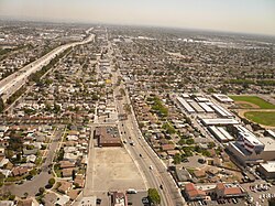
Garfield Avenue/Cherry Avenue is a major north-south street in Los Angeles County, California, US.