Paramount, California

Last updated

Paramount, California
LA County Incorporated Areas Paramount highlighted.svg
Location of Paramount in Los Angeles County, California
Usa edcp relief location map.png
Red pog.svg
Paramount, California
Location in the United States
Coordinates: 33°54′0″N118°10′0″W / 33.90000°N 118.16667°W / 33.90000; -118.16667
Country Flag of the United States.svg United States
State Flag of California.svg  California
County Los Angeles
Incorporated January 30, 1957 [1]
Government
   Mayor Velma Cuellar Stallings
   Vice Mayor Isabel Aguayio
   City council Brenda Olmos [2]
Laurie Guillen
Peggy Lemons
   City Manager John Moreno
Area
[3]
  Total4.84 sq mi (12.54 km2)
  Land4.73 sq mi (12.25 km2)
  Water0.11 sq mi (0.29 km2)  2.28%
Elevation
69 ft (21 m)
Population
 (2010)
  Total54,098
  Estimate 
(2019) [4]
53,955
  Density11,406.98/sq mi (4,404.16/km2)
Time zone UTC−8 (Pacific)
  Summer (DST) UTC−7 (PDT)
ZIP code
90723 [5]
Area code 562 [6]
FIPS code 06-55618
GNIS feature ID 1652771
Website www.paramountcity.com

Paramount is a city in Los Angeles County, California, United States. According to the 2010 census, the city had a total population of 54,098, down from 55,266 at the 2000 census. Paramount is part of the Greater Los Angeles Area and is bordered by Compton and Lynwood to the west, South Gate and Downey to the north, Bellflower to the east and south, and Long Beach to the south.

Contents

Geography

According to the United States Census Bureau, Paramount has a total area of 4.8 square miles (12 km2), of which 4.7 square miles (12 km2) is land and 0.1 square miles (0.26 km2) (2.28%) is water.

History

Manuel Dominguez, a signer of the Californian Constitution and owner of Rancho San Pedro, which covered most of modern-day Paramount. Manuel Dominguez of California.jpg
Manuel Domínguez, a signer of the Californian Constitution and owner of Rancho San Pedro, which covered most of modern-day Paramount.
School building in Paramount (then Clearwater) c. 1899 Clearwater (later Paramont) School (CHS-2163).jpg
School building in Paramount (then Clearwater) c. 1899

While the Paramount economy was based largely on the hay and dairy industries, the high cost of land led to their local demise. The last Paramount dairy closed in 1977. [7]

Demographics

Historical population
CensusPop.Note
1960 27,249
1970 34,73427.5%
1980 36,4074.8%
1990 47,66930.9%
2000 55,26615.9%
2010 54,098−2.1%
2019 (est.)53,955 [4] −0.3%
U.S. Decennial Census [8]

2010

At the 2010 census Paramount had a population of 54,098. The population density was 11,177.1 inhabitants per square mile (4,315.5/km2). The racial makeup of Paramount was 22,988 (42.5%) White (5.6% Non-Hispanic White), 6,334 (11.7%) African American, 440 (0.8%) Native American, 1,629 (3.0%) Asian, 419 (0.8%) Pacific Islander, 20,023 (37.0%) from other races, and 2,265 (4.2%) from two or more races. Hispanic or Latino of any race were 42,547 persons (78.6%). [9]

The census reported that 53,788 people (99.4% of the population) lived in households, 27 (0%) lived in non-institutionalized group quarters, and 283 (0.5%) were institutionalized.

There were 13,881 households, 7,999 (57.6%) had children under the age of 18 living in them, 6,919 (49.8%) were opposite-sex married couples living together, 3,104 (22.4%) had a female householder with no husband present, 1,328 (9.6%) had a male householder with no wife present. There were 1,153 (8.3%) unmarried opposite-sex partnerships, and 105 (0.8%) same-sex married couples or partnerships. 1,904 households (13.7%) were one person and 558 (4.0%) had someone living alone who was 65 or older. The average household size was 3.87. There were 11,351 families (81.8% of households); the average family size was 4.22.

The age distribution was 17,630 people (32.6%) under the age of 18, 6,360 people (11.8%) aged 18 to 24, 16,271 people (30.1%) aged 25 to 44, 10,421 people (19.3%) aged 45 to 64, and 3,416 people (6.3%) who were 65 or older. The median age was 28.6 years. For every 100 females, there were 94.7 males. For every 100 females age 18 and over, there were 91.9 males.

There were 14,571 housing units at an average density of 3,010.5 per square mile, of the occupied units 6,024 (43.4%) were owner-occupied and 7,857 (56.6%) were rented. The homeowner vacancy rate was 1.8%; the rental vacancy rate was 4.8%. 23,759 people (43.9% of the population) lived in owner-occupied housing units and 30,029 people (55.5%) lived in rental housing units.

According to the 2010 United States Census, Paramount had a median household income of $44,934, with 22.1% of the population living below the federal poverty line. [10]

2000

At the 2000 census there were 55,266 people in 13,972 households, including 11,331 families, in the city. The population density was 11,678.3 inhabitants per square mile (4,509.0/km2). There were 14,591 housing units at an average density of 3,083.2 per square mile (1,190.4/km2). The racial makeup of the city was 34.70% White, 13.59% African American, 1.06% Native American, 3.35% Asian, 0.84% Pacific Islander, 41.69% from other races, and 4.78% from two or more races. Hispanic or Latino of any race were 72.28%. [11]

Of the 13,972 households 55.1% had children under the age of 18 living with them, 51.3% were married couples living together, 21.7% had a female householder with no husband present, and 18.9% were non-families. 14.6% of households were one person and 4.6% were one person aged 65 or older. The average household size was 3.93 and the average family size was 4.31.

The age distribution was 36.9% under the age of 18, 12.0% from 18 to 24, 31.9% from 25 to 44, 14.0% from 45 to 64, and 5.2% 65 or older. The median age was 26 years. For every 100 females, there were 96.3 males. For every 100 females age 18 and over, there were 93.3 males.

The median household income was $36,749 and the median family income was $37,276. Males had a median income of $27,730 versus $22,472 for females. The per capita income for the city was $11,487. About 19.1% of families and 21.9% of the population were below the poverty line, including 27.5% of those under age 18 and 10.5% of those age 65 or over.

According to the 2000 census, Mexican (60.1%) and Filipino (1.5%) were the most common ancestries in the city. Mexico (80.9%) and Guatemala (4.0%) were the most common foreign places of birth. [12]

Government and infrastructure

Public services

The Los Angeles County Sheriff's Department operates the Lakewood Station in Lakewood, serving Paramount. [13] The department operates the Paramount Substation within Paramount. [14]

The Los Angeles County Department of Health Services operates the South Health Center in Watts, Los Angeles, serving Paramount. [15]

The United States Postal Service Paramount Beach Post Office is located at 7200 Somerset Boulevard. [16]

State and federal representation

In the California State Legislature, Paramount is in the 33rd Senate District , represented by Democrat Lena Gonzalez, and in the 62nd Assembly District , represented by Democrat Anthony Rendon. [17]

In the United States House of Representatives, Paramount is in California's 40th congressional district , represented by Republican Young Kim. [18]

Culture

Paramount has a large community of Mexicans originally from the state of Sinaloa [19] [20] [21] reflected in the many restaurants selling Mexican food "estilo sinaloense" meaning "Sinaloan style." [22] [23] [24] The city has been described as a "second Sinaloa." [25] [26] [27]

Transportation

The Century Freeway (Interstate 105) passes east–west through the northern portion of Paramount, the Long Beach Freeway (Interstate 710) follows north–south along the city's western border, and the Artesia Freeway (State Route 91) runs east–west less than a one-half-mile from the southern Paramount city limits.

Paramount is served by bus service from Los Angeles County Metropolitan Transportation Authority (MTA) and Long Beach Transit. The city also operates Easy Rider Shuttle , a fixed-route local bus.

Education

The Paramount Unified School District includes schools in Paramount, as well as a few in surrounding cities.

The schools located within Paramount are Paramount High School-senior and west campus,Alondra, Lincoln, Wirtz, Jefferson, Mokler, Zamboni, Los Cerritos, Gaines, Jackson, Hollydale, Tanner, Roosevelt, and Paramount Park. Schools that are run by the Paramount Unified School District, but are located in Lakewood include Buena Vista Continuation High School, Odyssey STEM Academy, and Lakewood School. Collins school is also run by PUSD but is located in Long Beach.

Our Lady of the Rosary Private Catholic School is one of several private schools located in Paramount. [28]

Renovations to the high school started at the end of 2007-08 school year. It was a four-phased endeavor that would improve the athletics field, development of a field house, expansion of the gymnasium and finally improvement to the west campus. [29]

Libraries

The County of Los Angeles Public Library operates the Paramount Library. [30]

Sites and attractions

A Zamboni ice resurfacer lays down a layer of clean water, which will freeze to form a smooth ice surface. Zamboni ice resurfacer.jpg
A Zamboni ice resurfacer lays down a layer of clean water, which will freeze to form a smooth ice surface.

The Paramount Hay Tree is a California State Historical Landmark. It is a still standing mature camphor tree remembered for its importance to the hay trading marketplace of the towns of Hynes and Clearwater, which later incorporated as Paramount. The hay traders met under the tree each working day to discuss the price of hay. Their numbers were quoted by the New York mercantile markets as the global hay standard.

Paramount is also home of the Zamboni Company. Frank Joseph Zamboni Jr. is the inventor of the ice resurfacing machine. Zamboni & Co. began and is still headquartered in Paramount. Zamboni manufactures and sells the machines worldwide. Since 1939 the Zamboni family has also operated Iceland, an ice skating rink with improvements patented by Frank Zamboni.

The city also gives its name to a packaging firm called Paramount Global, which was founded here in 1976. [31]

Sister city

Paramount has one sister city:

Related Research Articles

<span class="mw-page-title-main">Artesia, California</span> City in California, United States

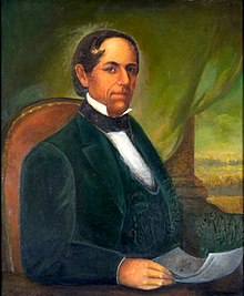
Artesia is a city in southeast Los Angeles County, California. Artesia was incorporated on May 29, 1959, and is one of Los Angeles County's Gateway Cities. The city has a 2010 census population of 16,522. Artesia is surrounded on the west, south, and east sides by Cerritos, with Norwalk to the north. Artesia is the home of the East West Ice Palace, an ice rink which is co-owned by Michelle Kwan. It was also the childhood home of former First Lady Pat Nixon, who lived there from 1914 to 1931, though the property on which she grew up is now part of neighboring Cerritos.

<span class="mw-page-title-main">Bellflower, California</span> City in California, United States

Bellflower is a city located in southeast Los Angeles County, California, in the Los Angeles metropolitan area. It was founded in 1906 and incorporated on September 3, 1957. As of the 2020 census, the city had a total population of 79,190, up from 76,616 at the 2010 census. This made it the 65th most densely populated city in the United States, of cities over 50,000 residents.

<span class="mw-page-title-main">Cudahy, California</span> City in California, United States

Cudahy is a city located in southeastern Los Angeles County, California, United States. In area, Cudahy is the second smallest city in Los Angeles County after Hawaiian Gardens but with one of the highest population densities of any incorporated city in the United States. It is part of the Gateway Cities region and had a population of 23,805 as of the 2010 U.S. Census.

<span class="mw-page-title-main">East Rancho Dominguez, California</span> Unincorporated community in California, United States

East Rancho Dominguez, also known as East Compton, is an unincorporated community and census-designated place (CDP) located in southern Los Angeles County, California. The population was 15,135 at the 2010 census, up from 9,286 at the 2000 census. East Rancho Dominguez is an accepted city name according to the USPS, and shares the 90221 ZIP Code with Compton.

<span class="mw-page-title-main">East Pasadena, California</span> Unincorporated community in California, United States

East Pasadena is an unincorporated community in Los Angeles County, California, United States. The population was 6,021 at the 2020 census, down from 6,144 at the 2010 census. For statistical purposes, the United States Census Bureau has defined East Pasadena as a census-designated place (CDP).

<span class="mw-page-title-main">Hawaiian Gardens, California</span> City in California, United States

Hawaiian Gardens is a city in Los Angeles County, California, United States. It is the smallest city in the county in area and was incorporated on April 9, 1964. The population was 14,149 at the 2020 census, down slightly from 14,254 at the 2010 census.

<span class="mw-page-title-main">Lennox, California</span> Census-designated place in California, United States

Lennox is a census-designated place (CDP) in the South Bay region of Los Angeles County, California, United States. The population was 22,753 at the 2010 census, down from 22,950 at the 2000 census.

<span class="mw-page-title-main">Lomita, California</span> City in California, United States

Lomita is a city in Los Angeles County, California, United States. The population was 20,921 at the 2020 census, up slightly from 20,256 at the 2010 census.

<span class="mw-page-title-main">Pico Rivera, California</span> City in California, United States

Pico Rivera is a city located in southeastern Los Angeles County, California. The city is situated approximately 11 miles (18 km) southeast of downtown Los Angeles, on the eastern edge of the Los Angeles basin, and on the southern edge of the area known as the San Gabriel Valley. As of the 2020 United States census, the city has a population of 62,088. Pico Rivera is bordered by Montebello to the west, Downey to the south, Santa Fe Springs to the southeast, and Whittier to the east. Northrop Grumman's Advanced Systems Division developed the B-2 Spirit bomber here.

<span class="mw-page-title-main">South El Monte, California</span> City in California, United States

South El Monte is a city in the San Gabriel Valley, in Los Angeles County, California, United States. At the 2010 census, the city had a population of 20,116, down from 21,144 at the 2000 census.

<span class="mw-page-title-main">South San Gabriel, California</span> Census-designated place in California, United States

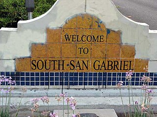
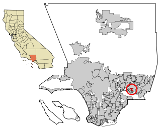
South San Gabriel is a census-designated place (CDP) in Los Angeles County, California, United States. The population was 8,070 at the 2010 census, up from 7,595 at the 2000 census.

<span class="mw-page-title-main">Valinda, California</span> Census-designated place in California, United States

Valinda is a census-designated place (CDP) in the San Gabriel Valley, in Los Angeles County, California, in the United States. At the 2010 census, the population was 22,822, up from 21,776 at the 2000 census.

<span class="mw-page-title-main">West Athens, California</span> Unincorporated community in California, United States

West Athens is a census-designated place (CDP) in Los Angeles County, California. The population was 9,393 at the 2020 census. It is an unincorporated community within the 2nd Supervisorial District of Los Angeles County. West Athens is served by the Los Angeles County Sheriff's Department, operating out of the South Los Angeles Station. The approximate boundaries for West Athens are: 87th Street to the north, Vermont Avenue to the east, El Segundo Boulevard to the south, and approximately Western Avenue to Van Ness Avenue to the west. West Athens is predominantly residential, with commercial uses along its main corridors. Los Angeles Southwest Community College lies within the West Athens neighborhood and city limits.

<span class="mw-page-title-main">West Carson, California</span> Unincorporated community in California, United States

West Carson is an unincorporated community in the South Bay region of Los Angeles County, California. The population was 22,870 at the 2020 census. For statistical purposes, the United States Census Bureau has defined West Carson as a census-designated place (CDP).

<span class="mw-page-title-main">West Rancho Dominguez, California</span> Unincorporated community in California, United States

West Rancho Dominguez, formerly known as West Compton and also known as East Gardena, is an unincorporated census-designated place (CDP) located in southern Los Angeles County, California. Per the 2020 census, the population was 24,347. The community lies to the west of the city of Compton. The ZIP Codes encompassing the CDP area are 90220 & 90248.

<span class="mw-page-title-main">West Whittier-Los Nietos, California</span> Census-designated place in California, United States

West Whittier-Los Nietos is a census-designated place (CDP) in Los Angeles County, California, near the San Gabriel River and the San Gabriel River (I-605) Freeway. The population was 25,540 at the 2010 census, up from 25,129 at the 2000 census. The census area consists of separate unincorporated communities of Los Nietos and West Whittier.

<span class="mw-page-title-main">Rolling Hills Estates, California</span> City in California, United States

Rolling Hills Estates is a city in Los Angeles County, California, United States. On the northern side of the Palos Verdes Peninsula, facing Torrance, Rolling Hills Estates is mostly residential. Incorporated in 1957, Rolling Hills Estates has many horse paths. The population was 8,067 at the 2010 census, up from 7,676 at the 2000 census. In 2018, the population rose to 8,141, and the 2020 census counted 8,280 residents.

<span class="mw-page-title-main">Lakewood, Washington</span> City in Washington, United States

Lakewood is a city in Pierce County, Washington, United States. The population was 63,612 at the 2020 census.

<span class="mw-page-title-main">Rossmoor, California</span> Census-designated place in California, United States

Rossmoor is a planned census-designated place located in Orange County, California. As of the 2020 census, the CDP had a total population of 10,625 up from the 2010 census population of 10,244. The gated Leisure World retirement community in the city of Seal Beach is to the south of Rossmoor, Los Alamitos is to the east and north, and Long Beach is to the west. The community of Rossmoor has two shopping centers within its boundaries, but only one—the Rossmoor Village Square, is now within the political boundaries of Rossmoor. A larger shopping center, the Rossmoor Business Center, was annexed, despite many protests, by the City of Seal Beach in 1967. The Center has been remodeled several times and was renamed the Shops at Rossmoor in the early 2000s.

<span class="mw-page-title-main">Lakewood, California</span> City in California, United States

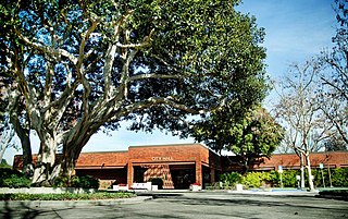
Lakewood is a city in Los Angeles County, California, United States. The population was 82,496 at the 2020 census. It is bordered by Long Beach on the west, northwest and south, Bellflower on the north, Cerritos on the northeast, Cypress on the east, and Hawaiian Gardens on the southeast. Major thoroughfares include Lakewood, Bellflower, and Del Amo Boulevards and Carson and South Streets. The San Gabriel River Freeway (I-605) runs through the city's eastern regions.

References

  1. "California Cities by Incorporation Date". California Association of Local Agency Formation Commissions. Archived from the original (Word) on October 17, 2013. Retrieved August 25, 2014.
  2. "Paramount City Council". Archived from the original on August 29, 2013. Retrieved March 31, 2009.
  3. "2019 U.S. Gazetteer Files". United States Census Bureau. Retrieved July 1, 2020.
  4. 1 2 "Population and Housing Unit Estimates". United States Census Bureau. May 24, 2020. Retrieved May 27, 2020.
  5. "USPS – ZIP Code Lookup – Find a ZIP+ 4 Code By City Results" . Retrieved January 18, 2007.
  6. "Number Administration System – NPA and City/Town Search Results". Archived from the original on February 24, 2012. Retrieved January 18, 2007.
  7. "City Profile/History | Paramount, CA". www.paramountcity.com.
  8. "Census of Population and Housing". Census.gov. Retrieved June 4, 2015.
  9. "2010 Census Interactive Population Search: CA – Paramount city". U.S. Census Bureau. Archived from the original on July 15, 2014. Retrieved July 12, 2014.
  10. "Paramount (city) QuickFacts from the US Census Bureau". Archived from the original on November 15, 2013. Retrieved November 26, 2013.
  11. "U.S. Census website". United States Census Bureau . Retrieved January 31, 2008.
  12. "Paramount Profile - Mapping L.A. - Los Angeles Times". Los Angeles Times.
  13. "Lakewood Station Archived December 30, 2009, at the Wayback Machine ." Los Angeles County Sheriff's Department. Retrieved on January 21, 2010.
  14. "Paramount Sub Station Archived July 20, 2006, at the Wayback Machine ." Los Angeles County Sheriff's Department. Retrieved on January 21, 2010.
  15. "South Health Center." Los Angeles County Department of Health Services. Retrieved on March 18, 2010.
  16. "Post Office Location – PARAMOUNT Archived July 18, 2012, at archive.today ." United States Postal Service . Retrieved on December 6, 2008.
  17. "Statewide Database". Regents of the University of California. Archived from the original on February 1, 2015. Retrieved April 6, 2015.
  18. "California's 40th Congressional District - Representatives & District Map". Civic Impulse, LLC.
  19. "Recuerdan al "compa Chalino"" . Retrieved February 29, 2016.
  20. "La tambora sinaloense retumba en las calles de California". El Debate.
  21. "¿Qué dicen los sinaloenses de L.A. sobre el veredicto a 'El Chapo'?". La Opinión.
  22. Esparza, Bill (May 4, 2016). "El Sinaloense #2 Proves That Sequels Aren't Always Worse than the Original". LAmag - Culture, Food, Fashion, News & Los Angeles.
  23. "Antojitos por Metro: Mi Lindo Sinaloa y sus camarones estilo Choix". April 21, 2017.
  24. "Mariscos sinaloenses en el sur de California". La Opinión.
  25. "Sam Quiñones:Sing Now, Die Later". LA Weekly. July 29, 1998.
  26. "Paramount". Imaginerealty.com.
  27. "Paramount Movers".
  28. "Paramount Schools | Paramount, CA". www.paramountcity.com. Retrieved March 2, 2023.
  29. District, Paramount Unified School (June 13, 2008). "Paramount High School Improvement Project". ceqanet.opr.ca.gov.
  30. Megan Garvey (November 13, 2002). "U.S. Rules Have Little Impact in L.A. County". Los Angeles Times . Retrieved January 26, 2009.
  31. "ViacomCBS is becoming Paramount Global, already the name of a packaging company". February 16, 2022.
  32. "Sister Cities meet". paramountjournal.org. April 25, 2019.